
The Best System Is Probably Layered
Why No Single Redistricting Model Should Govern Everything

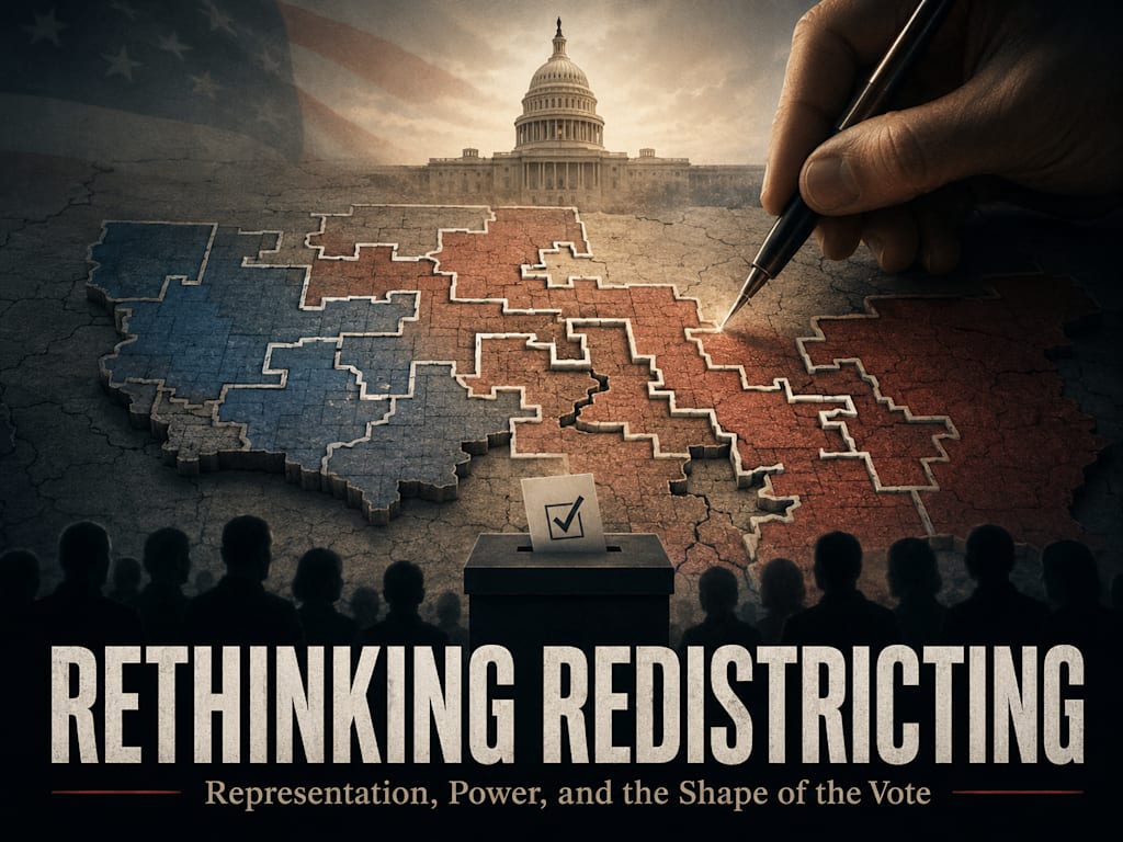
The Failure Begins With a False Choice
The redistricting debate is often presented as if the only real choice is between a fair geographic map and an unfair geographic map. One side draws lines. The other side challenges the lines. Courts, commissions, parties, activists, analysts, and voters then argue over compactness, contiguity, partisan advantage, racial balance, community preservation, competitiveness, and legal compliance. Those arguments matter, but they still leave the deeper assumption untouched. They assume representation must begin with land, and that the only real reform is drawing the land more fairly.
That assumption is too small. Representation is not one thing. A representative may need to speak for a place, a population, an economy, a culture, a class interest, a value system, a party affiliation, a governing philosophy, or a randomly selected cross-section of citizens. Those are not identical. A city council member should know the streets. A county commissioner should understand land, roads, towns, and local production. A state representative should understand regional infrastructure and state-level law. A federal representative should understand war, debt, constitutional limits, speech, privacy, immigration, federal power, and national direction. Different offices represent different realities.
That is why the best system is probably layered. One districting model should not be forced to govern everything. Geography should matter where government manages place. Values should matter where government governs principle. Randomness may matter where the highest goal is preventing manipulation. Voter choice should matter where representation depends on consent. Communities of interest should matter wherever real shared life exists. A mature system would not ask one map to carry all of that.
Local Government Should Remain Place-Based
Local government should be the most geographic because local government manages place. A city council member, county commissioner, school board member, utility board member, sheriff, zoning official, or local representative must understand concrete conditions. Roads, bridges, potholes, water systems, school routes, police response, business owners, factories, farms, churches, neighborhoods, municipal boundaries, and local culture are not abstract policy categories. They are the daily realities of local government.
At this level, representation should preserve coherent places. Districts should respect neighborhoods, towns, counties, school zones, infrastructure systems, municipal boundaries, business corridors, and local economies. A representative should be able to know the area, meet the people, understand the employers, see the road failures, hear from the schools, and answer for what government does on the ground. A purely ideological district would be weak here because shared values cannot replace local knowledge.
This does not mean local voters should ignore values. Values still matter in policing, schools, zoning, taxation, development, public safety, parental authority, religious liberty, homelessness policy, business regulation, and public spending. But local representation begins with place because the office itself acts on place. The closer government gets to physical services, the more geography must dominate.
State Government Needs a Mixed Standard
State government sits between place and principle. It governs highways, schools, water, courts, policing rules, taxes, public universities, land use, energy, housing frameworks, regional development, county relationships, and state agencies. Those are tied to geography. A mountain county, farming valley, port city, border region, dense urban center, industrial corridor, and suburban growth area may face different state-level realities. A state representative should understand those regional differences.
But state government also governs moral, legal, and ideological questions. It decides issues involving parental rights, religious liberty, abortion law, gun law, education content, public health authority, agency power, speech rules, criminal justice, election law, and the relationship between citizen and state. These questions are not only about roads and counties. They are about governing philosophy. A voter’s values matter.
For that reason, state systems may need the most careful balance. Compact geographic districts should probably remain the baseline. Communities of interest should receive serious protection. Rural, urban, suburban, industrial, religious, working-class, and municipal communities should not be casually split. But state systems might also benefit from one chamber or one portion of representation that accounts for broader values. A state legislature could use geography in one body and value-based or ranked-preference constituencies in another. That would let place and principle both be heard.
Federal Representation Can Justify More Innovation
Federal representation is where value-based reform becomes most defensible. A member of Congress votes on national debt, war, foreign policy, immigration, federal agencies, speech, privacy, taxation, national regulation, constitutional limits, spending, intelligence powers, and the proper reach of federal government. These questions are not primarily about one road, one school zone, or one county bridge. They are questions of national direction and governing principle.
Geography still matters federally. States have industries, ports, farms, energy regions, military bases, universities, disaster risks, and transportation needs. A federal representative should not be ignorant of place. But geography alone is often a weak proxy for federal values. Two neighbors may share roads and disagree completely about war, speech, agencies, family, immigration, debt, and constitutional power. Two voters far apart may share a deeper governing philosophy than two voters on the same street.
That is why federal representation could experiment with value-based districts, voter-selected districts, ranked-preference district assignment, party-affinity sorting, multi-axis value districts, or hybrid systems. The point is not to erase geography. The point is to stop pretending geography alone can represent national principles. Federal government often governs what citizens believe government is allowed to be. That demands more than a map.
Compact Districts Still Matter
The layered model does not reject compact geographic districts. It places them where they are strongest. Compact districts are valuable because they reduce obvious manipulation, preserve recognizable places, protect municipalities and counties where possible, and make districts easier for citizens to understand. A compact rural district, urban district, suburban district, or industrial district can give a real community a coherent voice.
Compactness also helps expose bad maps. Long corridors, strange hooks, city fragments, rural attachments, and unnatural shapes may reveal that voters are being arranged for political advantage. A regular shape is not automatically fair, and an irregular shape is not automatically corrupt, but compactness remains an important safeguard. It forces mapmakers to begin with place before strategy.
The weakness is that compactness cannot represent everything. A compact district may still leave ideological minorities without a meaningful voice. It may preserve place while failing to represent values. That is why compact districts should be foundational for local government and important for state government, but not treated as the entire theory of representation.
Epicenter Districts Solve a Specific Urban-Rural Abuse
The epicenter model also belongs in a layered system because it addresses a specific abuse: the urban-spoke district. Instead of slicing a city into narrow tips that extend into surrounding rural areas, the epicenter model begins with the dense urban core and expands outward until each district reaches the required population. It treats the city as a city first, then allows suburbs and rural regions to be divided by geography, culture, and local coherence.
This protects both urban and rural representation. The city is not treated as a reservoir of voters to be exported into surrounding districts. Rural areas are not treated as land to be diluted by urban attachments. Suburbs are not treated as filler. Each zone is represented according to its own reality: urban core, urban ring, suburban belt, exurban area, and rural region.
The epicenter model is not universal. It fits best where a major city dominates the surrounding region and where spoke-style manipulation is tempting. It can become too mechanical if it ignores neighborhoods, natural boundaries, and local culture. But used carefully, it gives mapmakers a more honest method for dense population centers. It is one tool in the layered system, not the whole system.
Voter-Selected Districts Add Consent
Voter-selected districts introduce a different principle: citizens should have a role in choosing the constituency that represents them. Instead of being assigned entirely by residence, voters could select or rank districts that reflect their values, party affinity, governing philosophy, or issue priorities. Equal population caps would keep each district balanced. Wait-lists would prevent full districts from being flooded. Registration windows would preserve stability.
This model is powerful because it moves representation closer to consent. A voter is no longer merely placed inside a district and told to choose among candidates within that container. The voter helps form the container. That changes the moral structure. The district grows from voters choosing association rather than from politicians drawing boundaries around them.
The weakness is that voter-selected districts can reduce geographic coherence and create opportunities for strategic sorting. That is why caps, wait-lists, ranked preferences, stable labels, privacy protections, and public assignment rules are essential. Voter-selected districts make the most sense for higher offices or value-based chambers, not for local offices that govern physical place.
Ranked Preferences Make Choice More Honest
Ranked-preference district assignment is the strongest practical form of voter-selected representation. Voters do not have to choose one label and hope it fits perfectly. They can rank several constituencies in order. If the first choice is full, the system moves to the next available choice. This allows voters to express layered political identity.
A voter might rank Constitutionalist, Libertarian, Localist, and Nonaligned. Another might rank Labor, Anti-War, Progressive, and Nonaligned. Another might rank Religious Conservative, Populist, Constitutionalist, and Localist. These rankings show more than party registration or residence. They reveal the voter’s order of representational priorities.
Ranked assignment also reduces forced classification. The state does not need to decide what a voter “really” is. The voter declares preference. The system manages equal caps, overflow, wait-lists, and election administration. That preserves agency while maintaining structure. In a layered system, ranked assignment could be one of the main tools for value-based representation.
Named Districts Provide Clarity
Named ideological districts make the purpose of a constituency visible. A district called Constitutionalist, Libertarian, Progressive, Labor, Localist, Anti-War, Religious Conservative, Populist, or Nonaligned tells voters something important. The district’s identity is not hidden behind a number or a geographic boundary. Voters can decide whether that constituency fits them. Candidates can be judged according to the district’s stated purpose.
This clarity is useful because ordinary maps often hide political effects. A geographic district may be drawn to produce a partisan outcome while claiming neutrality. A named district admits its representational purpose. That is more honest, but also more dangerous if labels become propaganda. Names can attract, repel, flatter, stigmatize, or manipulate.
The safeguard is stable, descriptive labeling. Labels should describe real political communities, not campaign slogans. They should have public definitions. They should not be changed mid-cycle. A Nonaligned District should exist for voters who reject the available labels. Named districts can improve clarity, but only if language is restrained by rules.
Numbered Spectrums Offer Simplicity
Numbered ideological spectrums offer a simpler alternative to named districts. Lower numbers could represent leftward views. Higher numbers could represent rightward views. Middle numbers could represent moderate, mixed, or nonaligned voters. The advantage is administrative simplicity. Numbers may reduce fights over loaded labels.
A numbered system could be useful as a transitional model. It would let voters choose or rank a place on a broad spectrum without requiring a detailed political compass or a long list of ideological categories. It would also make caps and overflow easier to understand. Voters could rank adjacent districts if their first choice is full.
The weakness is oversimplification. Politics is not one line. A voter can be anti-war and conservative, religious and labor-oriented, progressive and civil-libertarian, localist and economically populist, or institution-skeptical without fitting neatly into left or right. Numbered spectrums are clear, but incomplete. They may work as a starting point, but a mature system should see more than one dimension.
Multi-Axis Districts Capture Real Complexity
Multi-axis value districts recognize that voters are shaped by several dimensions: centralized versus local power, liberty versus authority, war versus anti-war, globalism versus localism, market orientation versus labor orientation, progressive versus traditional moral order, institutional trust versus skepticism, and secure class position versus lived constraint. A voter’s real governing philosophy often emerges from the combination of these axes.
This model is more accurate than party labels or simple left-right numbering. It can represent cross-pressured voters who are invisible in normal politics. It can identify real constituencies such as labor-populists, localist constitutionalists, anti-war voters, religious conservatives, libertarian civil-liberties voters, progressive institutionalists, and nonaligned skeptics. It treats voters as layered citizens rather than single-axis data points.
The weakness is complexity and category power. Whoever defines the axes can shape representation. That is why voter choice must remain central. Multi-axis categories should guide and inform, not become mandatory state classification. Public definitions, stable categories, ranked preferences, equal caps, and privacy rules are essential. Multi-axis districts are powerful because they are precise. They are dangerous for the same reason if captured.
Political Compass Tools Should Guide, Not Govern
A political compass or values assessment can help voters understand which districts may fit them. It can reveal patterns that party labels hide. It can show a voter that they are localist, anti-war, constitutionalist, libertarian, progressive, labor-oriented, religious conservative, institution-skeptical, or nonaligned. That can be useful in a system with value-based constituencies.
But mandatory political testing would be dangerous. The test becomes the new map. Questions can be loaded. Scores can be weighted secretly. Categories can be manipulated. The state can build ideological profiles of citizens. A system designed to improve representation can become a classification machine.
The safe rule is clear: a political compass may guide, but it should not govern. Voters may use it voluntarily. The questions and scoring should be public. The data should be private. Final district choice should remain with the voter through ranked preference. The government should administer representation, not decide citizens’ beliefs for them.
Party-Affiliation Sorting Is a Bridge, Not a Destination
Party-affiliation sorting is the easiest starting point because party registration and primary participation already exist. Democrats could fill left-aligned districts. Republicans could fill right-aligned districts. Minor-party voters could rank aligned options. Independents could choose nonaligned or other constituencies. Equal caps would keep districts balanced.
This model could reduce geographic gerrymandering quickly because voters are grouped by declared political affiliation rather than by manipulated lines. It is easier to explain than multi-axis districts and less invasive than mandatory testing. As a transitional reform, it has practical value.
But party labels are too crude to be the final answer. A Republican may be libertarian, constitutionalist, populist, religious conservative, business-oriented, nationalist, or anti-war. A Democrat may be progressive, labor-oriented, anti-war, institutionalist, environmentalist, or civil-liberties focused. Independents are not automatically moderate. Party can be a starting signal, but citizens need escape routes through ranked preferences and value-based options.
Random Lottery Districts Provide an Anti-Manipulation Check
Random lottery districts remove mapmaker control by assigning voters to districts through chance. This is the maximum procedural-equality model. No one draws lines. No one cracks cities. No one packs opponents. No one attaches rural areas to urban tips. The district is a random sample rather than a designed container.
The strength is obvious. Random assignment makes geographic gerrymandering nearly impossible. It treats voters equally at the point of assignment. It can create districts that resemble the broader population and force candidates to appeal more broadly. It may be useful for oversight bodies, citizens’ assemblies, anti-corruption panels, or limited forms of representation.
The weakness is equally clear. Random districts are weak at representing real places and weak at representing coherent values. They are fair in process but thin in community. They should not replace local geographic districts. In a layered system, randomness is best used as a check against manipulation, not as the entire representative structure.
Communities of Interest Bind the Models Together
Communities of interest should not be a vague phrase used to defend whatever map or category was already desired. A real community of interest is a shared life government has reason to hear. It may be rural, urban, suburban, working-class, religious, industrial, agricultural, cultural, geographic, economic, ideological, or moral. The key is that it must be real, explainable, and relevant to the office.
This concept binds the whole layered model together. Compact districts preserve geographic communities of interest. Epicenter districts preserve urban and rural communities from spoke-style distortion. Value-based districts preserve non-geographic communities of interest. Ranked preferences allow voters to identify their own communities. Hybrid chambers let different types of communities receive different channels of representation.
A serious system should require evidence for claimed communities. Municipal boundaries, school zones, transportation routes, industries, churches, public testimony, cultural institutions, farms, factories, business corridors, and shared policy concerns can all show that a community is real. The phrase should protect representation, not conceal manipulation.
Anti-Abuse Rules Are the Price of Reform
Every layer needs guardrails. Geographic districts need compactness rules, anti-corridor rules, municipal preservation, and public justification for splits. Epicenter districts need objective centers and consistent expansion rules. Voter-selected districts need equal caps, wait-lists, and registration windows. Ranked assignment needs public overflow rules. Named districts need stable labels. Multi-axis districts need transparent categories. Political compass tools need voluntary use and privacy. Party-affiliation sorting needs escape routes. Lottery districts need auditable randomness. Hybrid systems need clearly separated functions.
This is not bureaucracy for its own sake. It is the price of honest reform. If the old system was abused through maps, the new system can be abused through categories, tests, algorithms, timing, caps, wait-lists, labels, or randomization. The new gerrymander must be named before it appears.
The standard is not whether abuse is impossible. No political system can promise that. The standard is whether abuse is harder, more visible, easier to challenge, and less capable of controlling the entire structure. A good layered system gives manipulation fewer hiding places.
Competitive Districts Are Not the Goal
A layered system also rejects the assumption that competitive districts are inherently more representative. A close race may be healthy if it emerges from real disagreement inside a coherent community. But a 50.01 percent victory does not prove representation. It may simply mean the district is divided almost exactly in half. The winner legally represents everyone while nearly half the district may have no meaningful voice.
A lopsided district can be manipulated, but it can also be honest. A rural district may overwhelmingly choose a rural representative. An urban district may overwhelmingly choose an urban representative. A labor district, constitutionalist district, religious conservative district, progressive district, or anti-war district may strongly prefer one kind of candidate because the constituency is coherent. That is not automatically unfair.
The better standard is coherence plus accountability. A district should represent a real community, and the representative should be removable if they fail that community. Competition is useful when it improves accountability. It is harmful when it is manufactured by breaking real communities into permanent conflict.
The Final Structure Should Match the Human Reality
The layered system begins with a simple observation: citizens are not one-dimensional. They live in places. They work in economies. They belong to families, churches, neighborhoods, towns, industries, cultures, and moral communities. They hold values about power, liberty, war, debt, speech, privacy, labor, family, faith, immigration, markets, and government authority. They also deserve protection from manipulation by those who control political containers.
A system that represents only geography misses values. A system that represents only ideology misses place. A system that uses only randomness misses community. A system that uses only party labels misses complexity. A system that uses only political tests risks state classification. A system that pursues only competitive districts may mistake conflict for representation. The human reality is layered, so the representative structure should be layered too.
This does not require every model to be adopted everywhere. It requires matching the method to the office. Local offices should represent place. State offices should balance place and principle. Federal offices can justify more value-based innovation. Randomness can serve as an anti-manipulation check. Communities of interest should guide all of it. Anti-abuse rules should restrain the control points.
A Practical Layered Framework
The clearest framework would look something like this. Local offices remain geographic, compact, and tied to municipalities, neighborhoods, schools, infrastructure, business corridors, and local culture. State legislative districts remain mostly geographic but give stronger protection to rural, urban, suburban, industrial, working-class, religious, and regional communities of interest. One state chamber or a portion of representation could experiment with value-based or ranked-preference constituencies if the public chooses.
Federal representation could include compact geographic districts where regional advocacy matters, but also value-based or voter-selected constituencies where national principles matter more. These constituencies would use ranked preferences, equal caps, wait-lists, stable labels, privacy protections, and transparent rules. Political compass tools could be voluntary guides. Party affiliation could serve as a starting bridge. Random lottery systems could be used for oversight bodies, citizen panels, or limited anti-manipulation structures.
This framework does not force one answer. It assigns each answer to the place where it is strongest. That is the point. A mature representative system should use different tools for different forms of representation.
The Goal Is Real Voice
The goal of representation is not merely equal numbers on a map. Equal population matters, but it is not enough. The goal is not merely compact shapes. Compactness matters, but it is not enough. The goal is not merely close elections. Competition can matter, but it is not enough. The goal is not merely voter choice, ideology, party affiliation, or random equality. Each matters in the right context, but none is the whole of representation.
The goal is real voice. A rural community should have a representative who understands rural life. A city should not be sliced into political fragments. A working-class region should not be diluted into invisibility. A religious community should not be treated as if conscience is politically irrelevant. A constitutionalist, libertarian, progressive, labor, anti-war, localist, populist, or nonaligned voter should have a meaningful path to representation when the office governs values. A voter should not be used as raw material for someone else’s district design.
A layered system serves that goal better than a single-method system because it admits that different voices need different channels. It does not pretend one shape, one label, one test, one lottery, one party, or one chamber can represent everything.
Representation Should Match What Is Being Represented
The final principle is straightforward: representation should match what is being represented. If the office governs roads, bridges, potholes, zoning, schools, water systems, factories, farms, business owners, neighborhoods, and municipalities, the district should be geographic. If the office governs war, debt, constitutional limits, speech, privacy, immigration, federal agencies, national regulation, and the use of federal power, the district may need to reflect values. If the office is meant to prevent capture or audit power, random selection or assignment may be useful. If voters are forming value constituencies, consent and ranked preference should matter.
This principle cuts through the false choice. Geography is not always enough. Ideology is not always enough. Randomness is not always enough. Party is not always enough. Competition is not always representation. The office determines the proper method because the function determines what must be represented.
The best system is probably layered because the people are layered. They live somewhere, believe something, work under conditions, belong to communities, and deserve protection from manipulation. A representative system that sees only one of those dimensions will eventually distort the others.
Beyond the Map
The redistricting debate should not end with better maps. Better maps matter, but the deeper question is whether the people are actually represented. A map can be legal and still dilute a community. A district can be compact and still silence a value minority. A district can be competitive and still represent no coherent people. A random sample can be fair and still thin. A party district can be simple and still crude. A political test can be precise and still dangerous. Every model has a cost.
The best answer is not to worship one method. The best answer is to build a system that assigns each method to its proper use, then restrains every point where power can corrupt it. Compact geography for place. Epicenter logic for urban density. Communities of interest for shared life. Voter-selected districts for consent. Ranked preferences for nuance. Caps and wait-lists for stability. Named or numbered districts for clarity. Multi-axis categories for complexity. Voluntary political tools for guidance. Party sorting as a bridge. Lottery mechanisms for anti-manipulation. Hybrid chambers for balance.
That is the full argument beyond the map. Representation should not begin and end with lines drawn around voters. It should begin with the real question government exists to answer: who is being spoken for, by whom, and on what basis? Until that question is asked honestly, redistricting will remain a fight over containers. A layered system would move the argument closer to the people those containers are supposed to serve.
About the Creator
Peter Thwing - Host of the FST Podcast
Peter unites intellect, wisdom, curiosity, and empathy —
Writing at the crossroads of faith, philosophy, and freedom —
Confronting confusion with clarity —
Guiding readers toward courage, conviction, and renewal —
With love, grace, and truth.
Enjoyed the story? Support the Creator.
Subscribe for free to receive all their stories in your feed.
Comments
There are no comments for this story
Be the first to respond and start the conversation.