
The Real North Pole: 5 Mythical Ancient Islands That Might Actually Exist
5 Mythical Ancient Islands That Might Actually Exist
There are many stories of places that have been deemed mythological only for it later to be discovered that there is much more to these myths than was first thought. Vitra Manand, also variously known as Great Ireland or White Man's Land, is one such place. Amongst the most significant and influential of ancient Norse texts are The Saga of Eric the Red and The Saga of the Greenlanders. These sagas allude to the island of Vitra Manand, described as being six days sailing west of Ireland or alternatively somewhere near Vinland, the name once given to the coastal area of eastern North America. In The Saga of Eric the Red, the native people of Vitra Manand were described as always being dressed in white and that they, quote, "uttered loud cries, bore long poles, and wore fringes." Another source mentions albinism in the population with, quote, "hair and skin as white as snow." Jedis Mercader, the flist geographer and cartographer who created one of the first world maps, also mentioned a similar land in a 1577 letter to John Dee, the English academic and occultist. In the letter to Dee, Mercader mentions that in the 14th century a group of eight men had come to Norway from a distant land, claiming to have been part of an expedition sent by the legendary King Arthur of Britain and that they were, in fact, his fifth-generation descendants. The true location of the legendary Vitra Manand is a subject of scholarly debate, with several theories proposing locations along the Eastern Seaboard of North America. Carl Christian Raen suggests the Chesapeake Bay area, referencing legends of white men with iron instruments. However, historian Farley Moat offers a more detailed theory, placing the land on Newfoundland's western shore. According to Moat, European settlers from the Northern British Isles, referred to as Alans, reached Iceland, Greenland, and North America before the Vikings. These Albans, thought to be the original Neolithic inhabitants of Britain, were displaced by the Celts and pushed to Europe's northwestern fringes. Moat asserts they were skilled walrus ivory hunters, which led them to discover and settle in Newfoundland due to its suitable land for farming and rich walrus population. Moat argues that the Albans' presence in Newfoundland predates the Vikings by centuries and that their settlements along the southwest coast influenced Viking exploration. The Vikings knew this area as Vitra Manand, and Moat speculates that voyages by figures like Leif Ericson were attempts to raid this land, which either failed or resulted in hostile encounters with the natives. The Albans are believed to have maintained connections to Europe into the early Middle Ages, but these links were severed by the 14th century as European pirates forced their migration inland, where they assimilated with other populations. Moat's theory is a fascinating possibility, placing the Albans and Vitra Manand at the heart of an untold chapter of pre-Columbian transatlantic contact and settlement in the New World.
Isle of the Demons
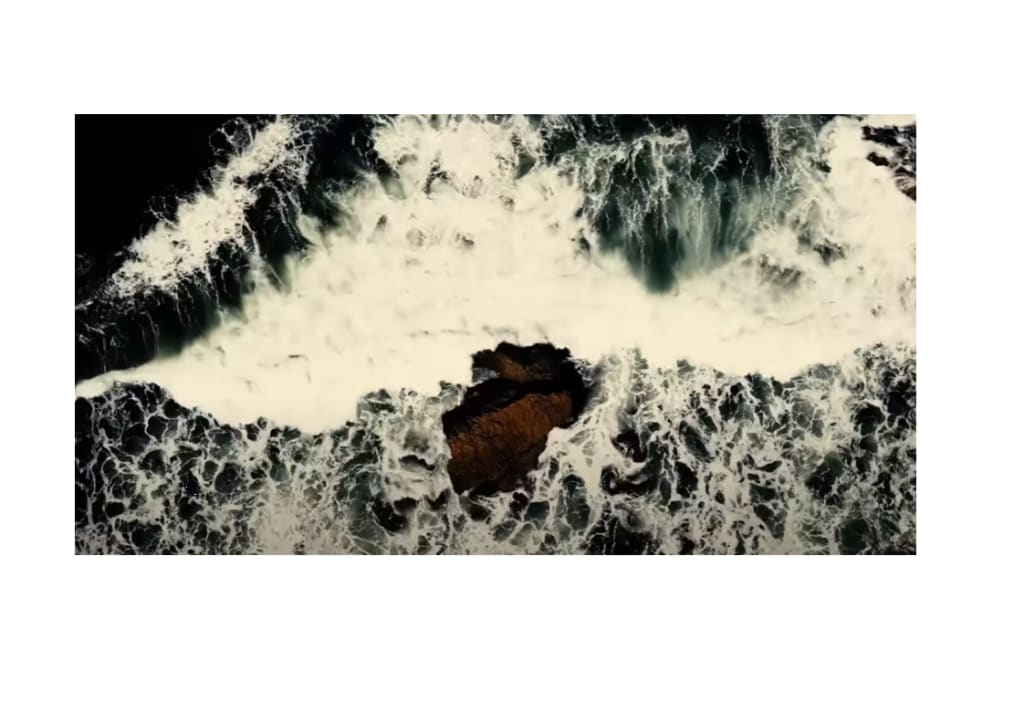
The ominously named Isle of the Demons appears on a number of maps from the 16th and 17th centuries, but it remained unexplored for many years because of the widely held belief that evil spirits inhabited it. According to accounts, the Isle of the Demons was lush and beautiful, yet uninhabited due to vicious wild beasts and spirits that would attack passing ships and visitors. It was said that the spirits spoke in tongues and haunted visitors and passersby, conjuring up terrifying hallucinations. One early map from 1508 features an inscription next to the island that states, quote, "demons assaulted ships near these islands, which were avoided but not without peril." The Isle of the Demons is also featured on such prominent maps as those produced by Gastaldi, Christopher Columbus, and Marco Polo, lending support and credibility to theories of the island's existence, if not its sinister inhabitants. In the mid-16th century, while en route to Quebec, a French ship stopped at the Isle of the Demons to maroon a French noblewoman and a young man with whom she'd been having an affair as punishment for their behavior. It was assumed that the demons would take care of them. The woman, Marguerite de la Roque, fell pregnant and gave birth on the island, living there with her lover for many years. Here, they built a small shelter and hunted wild game, but were routinely tormented at night by countless inhuman screams. The baby died, likely of malnutrition, as did the man and Marguerite's maidservant. Marguerite herself was ultimately rescued by fishermen after two years alone, living to tell her tale and contributing to the Isle of the Demon's morbid reputation. By the mid-17th century, the Isle of the Demons was no longer included on maps. Its actual location remained speculative, though it is generally placed in Newfoundland or one of the many islands located across the Strait of St. Lawrence. Carpoon Island is often considered its modern counterpart. Alternatively, some theorize that Marguerite and her companions were abandoned at Harrington Harbour in the Gulf of St. Lawrence, where Marguerite is said to have taken refuge in a rocky cave now named after her.
Rupes Negra
The Black Rock was a fabled monolith believed to reside at the Magnetic North Pole, originating from the lost manuscript Inventio Fortunata. This myth was chronicled by a Franciscan monk from Oxford in the 14th century and presented to the King of England in 1360. The content was later summarized by Jacobus Noan, whose account influenced flist geographer Jedis Mercader. In a 1577 letter, Mercader described Rupes Negra as follows, quote, "In the midst of four countries is a whirlpool; the water rushes around and descends into the earth just as if one were pouring it through a filter funnel. Right under the pole, there lies a bare rock in the midst of the sea, and it is all of magnetic stone." Rupes Negra was described as being 33 miles in diameter and was included in maps from the 16th and 17th centuries. It was theorized to explain why compasses point north, because, according to the myth, this large black rock was magnetic in nature. Rupes Negra was described as stretching far into the sky, quote, "as high as the clouds," and being easy to identify due to its black and glistening composition. Mercader placed it at the center of his 16th-century map of the North Pole, the first of its kind. The biblical imagery conjured up by Mercer's account of Rupes Negra, including a country populated by 4-foot-tall pygmies, prompted many explorers, geographers, and cartographers to seek it out. They followed their compass needles to the top of the world, hoping to lay eyes on the largest magnetic mass on the planet. Subsequent discoveries revealed Mercader's tendency to embellish or borrow from other works, yet the myth of Rupes Negra as true north endured. Although no colossal black rock exists at the Magnetic North Pole, the pole itself is real, migrating due to the Earth's molten outer core's dynamics. This fluid core of iron and nickel moves from the inner core's heat and the planet's rotation, creating electric currents and consequently magnetic fields. These fields are subject to the molten metal's irregular flow, resulting in magnetic pole shifts of approximately 6 to 9 miles annually. Historical records and geological evidence placed the Magnetic North Pole near Melville Island in the Arctic Ocean during the early 1600s, when Mercader's map ignited widespread fascination with Rupes Negra.
Antilia
Legend has it that in the 8th century, seven Christian bishops fleeing the Muslim conquest of Spain packed their livestock and followers on ships and set sail in a westerly direction. Eventually, the seven bishops and their ships reached a mysterious land that would become known as Antilia, where they decided to settle. Each founded a separate settlement, thus giving the island its alternative name, the Isle of Seven Cities. While this may be mere legend, the land of Antilia has been referred to in writings from as early as 1367, describing a gigantic statue that had been built on its shore to deter unwanted visitors. One account describes how, in the early 15th century, a Portuguese ship was forced by dangerous weather to land on the island. There, the crew found settlers with whom they went to church; however, they could not shake the feeling that they were being plotted against and hurried back to their ship. Hastily, they returned to Portugal, discovering that a third of their collected sand samples from Antilia's beach was gold. This discovery may have fueled the later Spanish legends of the Seven Cities of Gold. The writings of various other explorers, particularly those seeking wealth, describe equally unusual encounters on Antilia. Antilia is first clearly depicted in a 1424 chart, then in various naval logs created over the rest of the 15th century, after which it gradually began to disappear from records as fewer and fewer references to Antilia were made. The prevailing belief became that the land was a fictitious one, drawing comparisons with the utopian tales of Atlantis and the Isles of the Blessed as referred to in ancient Greek poetry and other writings. While it was once considered a phantom island, theories have suggested that the real Antilia may have been under our noses the whole time. The consistency of its recorded size and depiction on maps has led scholars to speculate. Some suggest that Antilia's representation aligns with the Americas, supporting theories of pre-Columbian transoceanic contact.
Avalon
The mythical island of Avalon is a pivotal location in Arthurian legend, as the enchanted place where the sword Excalibur was forged and where King Arthur was taken to recover after being severely wounded at the Battle of Camlann. Avalon is synonymous with Arthurian mythology, often associated with mystical practices and figures such as the sorceress Morgan, who is sometimes depicted as its ruler. Geoffrey of Monmouth, who later became the Bishop of St. Asaph, referred to Avalon as the Isle of Fruit Trees, indicating a place abundant with such trees, a concept which could have Welsh, Cornish, or Breton origins relating to the word for apple tree in those languages. This ties into wider Celtic and Gaelic legends of otherworldly islands abundant with apples, suggesting a common mythological theme of islands of paradise among the ancient Britons. The leading candidate for the real island on which Avalon was based is the town of Glastonbury, which is located in the English county of Somerset and is famous for its many apple orchards. While Glastonbury is not an island, it was once surrounded by marshlands and does occupy high ground, which may have given it the appearance of being an island at one time. Glastonbury Abbey also has powerful Arthurian associations, lending further weight to this theory. The connection between Avalon and Glastonbury first arose from medieval traditions, particularly from the claims made by monks in the 12th century who sought to benefit from the burgeoning popularity of Arthurian legends. They announced the discovery of Arthur's remains at Glastonbury in 1190, declaring it to be Avalon. This link was solidified by the purported discovery of Arthur's tomb, which led to a stream of pilgrims visiting the site, though many experts now believe that the monks fabricated the inscription and the tomb. Despite this, Glastonbury and Avalon have become inseparable in the collective imagination, with Glastonbury even now being referred to as the ancient Isle of Avalon.
About the Creator
Enjoyed the story? Support the Creator.
Subscribe for free to receive all their stories in your feed. You could also pledge your support or give them a one-off tip, letting them know you appreciate their work.
Keep reading
More stories from Vitalii Petrov and writers in History and other communities.
Five Unsolved Mysteries of Ancient China that are being glossed over
Perhaps the most mysterious legacy of past civilizations on Earth is rightfully considered to be the pyramids, which can be found in different parts of the world. In one of my videos, I already told you about many questions that the pyramids of Egypt pose to specialists, but at least as many questions are raised by the pyramids built in China. While the Egyptian pyramids are more or less accessible for research, the Chinese ones remain closed to the general public to this day.
By Vitalii Petrov2 days ago in History
This is how you ATTACK with Rome! | Roman Siege Towers
Roman siege towers stand as a testament to the engineering genius and military might of ancient Rome. These formidable structures, designed to breach the walls of enemy fortifications, played a crucial role in the expansion and consolidation of Roman power. Understanding the origins, construction, and tactical use of Roman siege towers provides a fascinating glimpse into the strategic innovations that enabled Rome to dominate the ancient world.
By Marveline Merab3 days ago in History
Prophet Muhammad
Story apostle Muhammad Once upon a time, in the bustling city of Mecca, there lived a man named Muhammad. He wasn't just any man, though—people knew him for his kindness, honesty, and wisdom. Muhammad grew up with his uncle after losing his parents at a young age, and even as a child, he showed a deep sense of compassion for others.
By Hari Deviyana4 days ago in History


Comments
There are no comments for this story
Be the first to respond and start the conversation.