
The Lawless Islands of the Rio Grande
Sane Saturday Edition

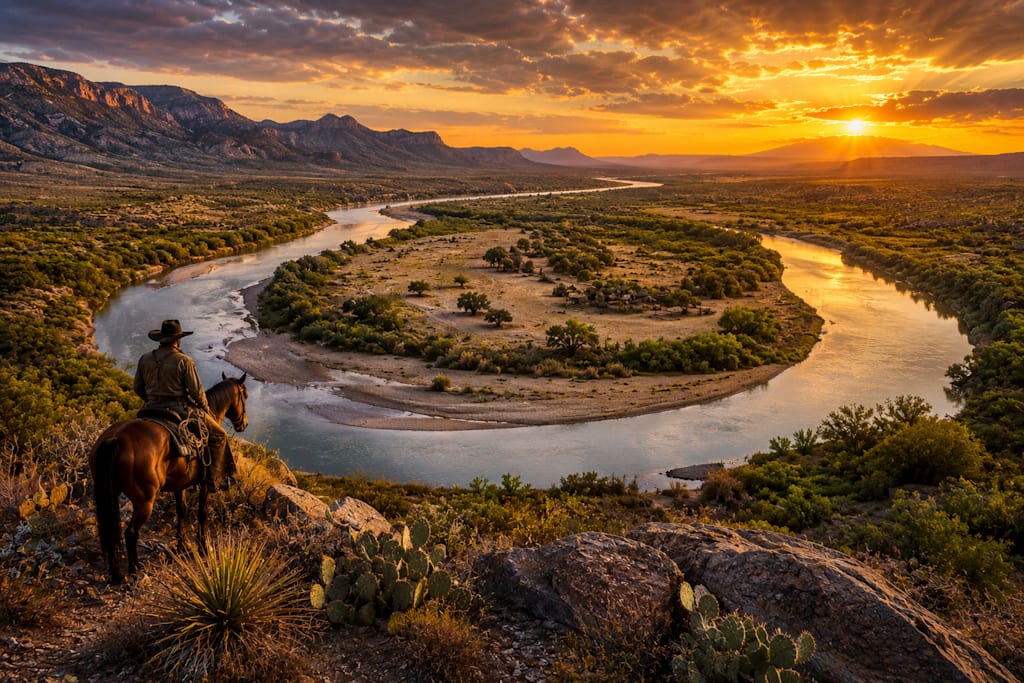
Somewhere along the Texas-Mexico border in the late nineteenth century, imagine a cattle rustler riding hard toward the Rio Grande. Behind him are angry ranchers and perhaps a lawman or two. Ahead lies Mexico and, with it, the possibility of escape. If he can get himself and the stolen cattle across the international boundary, an ordinary pursuit suddenly becomes considerably more complicated. He reaches the river, only to face one problem: exactly where is the border?
There is an abandoned river channel behind him. Another channel twists through the landscape ahead. Between them sits a strange crescent of land created when the river changed course. The rustler may know exactly where he is. The lawman chasing him might not. And somewhere in a government office, an increasingly frustrated official is about to discover that arresting criminals along the Rio Grande occasionally requires knowledge of geography, hydrology, and international diplomacy.
Welcome to one of the strangest problems in the history of the American border. For generations, the United States and Mexico faced an unusual question: how do you maintain an international boundary when the boundary itself refuses to stay put?
The Treaty of Guadalupe Hidalgo ended the Mexican-American War in 1848 and established much of the modern boundary between the two nations. Along Texas, the Rio Grande became the dividing line. On a map, this seemed straightforward. On the ground, nature had other ideas. The lower Rio Grande was, and remains, a living river. Floods carved new channels. Sandbars appeared and disappeared. Great horseshoe bends slowly migrated across the floodplain. Occasionally the river simply abandoned one path and created another. When that happened, pieces of land could suddenly find themselves on what appeared to be the wrong side of the international boundary. These peculiar geographic features became known as bancos.
Imagine a river making an enormous horseshoe-shaped bend. Over time, erosion narrows the neck of the horseshoe until a flood punches directly through it. The river happily adopts the shortcut. The old bend becomes a crescent-shaped body of water or gradually dries out. But what happened to the international border? That depended upon exactly how the river had changed. Under principles eventually applied to the boundary, slow changes caused by erosion could move the border along with the river, while sudden changes known as avulsion could leave the legal boundary in the old channel. To surveyors, lawyers, and diplomats, the distinction mattered enormously. To smugglers, it presented an opportunity.
By the late nineteenth century, officials were already complaining that bancos made enforcement extraordinarily difficult. An American diplomatic report from 1888 described how cutoffs along the river could create parcels ranging from dozens to hundreds of acres in remarkably short periods. Establishing whether suspects captured around these areas had actually been standing inside American territory could become maddeningly difficult.
Imagine being the customs officer responsible for explaining that in court. “Where did you arrest the defendant?” “Texas.” “Are you certain?” “Well...” That hesitation could be everything a smuggler needed. And there were plenty of smugglers.
The Texas-Mexico border following the Civil War was a complicated and often violent place. Ranching dominated huge stretches of South Texas, and cattle represented walking fortunes. They were also remarkably easy to move. Cattle rustlers discovered that an international river made an excellent getaway route. Stolen Texas livestock could be driven south into Mexico. Stolen Mexican cattle could travel north. Once animals crossed the boundary, recovering them might require cooperation between authorities who operated under different laws and answered to different governments. The border did not cause cattle rustling, but it could make it considerably easier.
Now add a river that periodically rearranged the border itself. Suddenly geography became an accomplice. A thief didn't necessarily need to manufacture an island or dig a new river channel; nature was already doing the work for free. Flood after flood produced bancos, cutoffs, and isolated parcels where determining jurisdiction could require consulting survey markers and treaty language rather than simply looking at the water.
Eventually, the problem became too large to ignore. The United States and Mexico established joint mechanisms to manage boundary disputes, and in 1889, the International Boundary Commission was created. Surveyors and engineers faced the unenviable task of turning a restless river into something resembling a dependable international line. But the Rio Grande wasn't finished causing trouble. One of the strangest examples appeared near El Paso at the end of the nineteenth century. It became known as Cordova Island.
Despite the name, Cordova Island wasn't really an island. The story began with another enormous bend in the Rio Grande. Flooding posed a persistent problem, so in 1899, American and Mexican engineers cooperated in cutting a straighter channel through the bend. From an engineering perspective, the solution made sense. From a political perspective, things became wonderfully strange.
The new channel redirected the river, but the international boundary remained in the old riverbed. The result was a roughly 385-acre piece of Mexican territory lying north of the new Rio Grande channel and surrounded on several sides by the United States. Mexico had acquired what amounted to a geographical pocket inside El Paso. There were boundary markers, fences, legal technicalities; and, inevitably, there were people who looked at this peculiar arrangement and thought: we can probably make money here.
By the era of Prohibition, Cordova Island had developed an unsavory reputation. Alcohol was illegal across the United States, but Mexico remained outside American prohibition laws. Smugglers moved liquor across the border while authorities struggled to control the flow. Cordova Island's peculiar geography made it particularly troublesome. A person could move between jurisdictions across remarkably short distances, and law enforcement officials had to remain constantly aware of which side of an invisible international line they occupied. One establishment operating near the boundary became appropriately known as the Hole in the Wall, offering drinking and gambling tantalizingly close to American territory. One can only imagine the frustration of American officers watching activities occur within sight while knowing that international jurisdiction prevented them from simply strolling across the line and making arrests.
The cattle rustlers had largely given way to a new generation of smugglers. The merchandise had changed, but the geography had not. Eventually Mexico erected fencing around Cordova Island, and decades of engineering projects dramatically altered the border around El Paso. But elsewhere along the Rio Grande, the banco problem remained.
The two countries eventually negotiated agreements specifically designed to deal with these troublesome pieces of territory. Under the Banco Convention of 1905, numerous cutoffs could be formally transferred between the United States and Mexico, simplifying a boundary that nature had made unnecessarily complicated. Over the following decades, hundreds of bancos were eliminated from the international puzzle. Tens of thousands of acres changed jurisdiction, surveyors installed markers, engineers straightened channels, and diplomats signed agreements. Gradually, the border became less dependent upon whatever mood the Rio Grande happened to be in that particular year.
Yet the history of the bancos reveals something fascinating about borders themselves. We tend to imagine national boundaries as permanent. A line appears on a map; one side is one country, the other is another. Simple. Except maps are abstractions. Rivers flood, mountains erode, coastlines shift, and occasionally nature rearranges the landscape without consulting the diplomats who drew lines across it.
Along the Rio Grande, that reality created opportunities for some of the most resourceful characters of the American frontier. Cattle thieves exploited it. Smugglers exploited it. Saloon owners exploited it. Lawmen cursed it. Surveyors measured it. Diplomats spent decades trying to make sense of it. And somewhere along the border, more than one accused smuggler undoubtedly benefited from the wonderfully inconvenient question: "What country was he actually standing in?"
Today, the Rio Grande remains one of the most politically significant rivers in North America. Modern engineering, treaties, and international cooperation have made its boundary considerably easier to manage than it was during the nineteenth century. But hidden beneath that modern border lies an older landscape. A landscape of abandoned channels and vanished bends, of stolen cattle disappearing across the river, of customs officers chasing smugglers through geographical loopholes, of Mexican territory sitting unexpectedly north of the Rio Grande, and of tiny pieces of land whose nationality could change because the river decided to take a shortcut.
For generations, lawmen tried to catch the rustlers. Customs officers tried to catch the smugglers. Diplomats tried to settle the disputes. Eventually, the United States and Mexico discovered that the most troublesome character along the entire border wasn't carrying a six-shooter or a bottle of contraband whiskey. It was the river...
About the Creator
The Iron Lighthouse
Where folklore meets freeway. A guide to the strange heart of the American backroads...
Enjoyed the story? Support the Creator.
Subscribe for free to receive all their stories in your feed.
Comments
There are no comments for this story
Be the first to respond and start the conversation.