
Mantigue Island as a Coupled Coastal–Forest Tourism Landscape
A comprehensive field-based assessment of visitor experience, spatial use, environmental sensitivity, and site management

Field visit: 13 June 2026 | Revised: 2 November 2026
Company team-building trip: 12–14 June 2026
© 2026 Mingae Gaces Samontina, Author’s text and photographs. All rights reserved.
Abstract
This study examines Mantigue Island, Camiguin, as a compact coastal–forest tourism landscape. It draws on a field visit conducted on 13 June 2026, systematic visual review of 30 original photographs, field notes, and targeted documentary sources on geography and biodiversity. Rather than comparing Mantigue with another island, the study evaluates Mantigue on its own terms: its spatial sequence from landing beach to open sand, shaded woodland, shelters, narrow shoreline paths, and shallow marine edge; the ways visitors use these areas; and the management implications of combining recreation with a sensitive coral-island environment. The photographic record documents active boat landing areas, concentrated beach use, interior walking routes, shade-dependent rest spaces, exposed roots, driftwood, reef-edge access, and quieter wooded zones. The evidence supports a management approach centered on measured visitor capacity, clear zoning, shoreline and vegetation monitoring, safe separation of boats and swimmers, transparent visitor information, and protection of the wooded interior as both habitat and visitor infrastructure. Because the study did not include ecological sampling, interviews, water-quality testing, or formal visitor counts, its conclusions are interpretive and management-oriented rather than a biological condition assessment.
Keywords
Mantigue Island; Camiguin; coastal tourism; visitor management; beach forest; coral island; photographic field assessment; sustainable tourism
1. Introduction
Mantigue Island is frequently encountered as a scenic excursion destination, yet its significance is not limited to white sand and clear water. It is a small coral island whose visitor experience depends on the close physical relationship among the beach, shallow marine environment, wooded interior, access routes, and modest visitor facilities. These elements form one connected tourism landscape. Decisions affecting a landing area, shelter, shoreline path, or stand of trees can therefore influence visitor comfort, safety, visual quality, and environmental condition at the same time.
The purpose of this research is to produce a comprehensive, site-specific assessment of Mantigue Island using firsthand field material and a transparent review of documentary evidence. The paper deliberately avoids a comparative-island design. Its central question is: How do Mantigue Island’s physical setting, visitor-use patterns, and tourism infrastructure interact, and what management measures are appropriate for protecting the island while maintaining a meaningful visitor experience?
2. Objectives and Research Questions
Describe the island’s observable coastal interior and nearshore characteristics.
Interpret how visitors move through and use the arrival zone, open beach, shoreline paths, woodland, shelters, and water-access areas.
Identify visible management strengths, pressures, and safety considerations without treating photographs as ecological measurements.
Develop practical recommendations for visitor management, conservation monitoring, site information, and future research.
The study addresses three research questions: (1) What landscape features structure the visitor experience? (2) What pressures or management needs are visible in the field record? (3) What evidence should be collected before changing visitor volume, facilities, or access arrangements?
3. Study Area and Geographic Setting
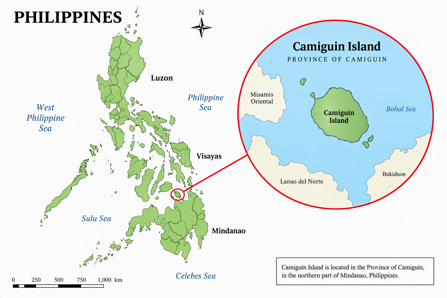
Mantigue Island lies off the eastern coast of Camiguin in the southern Philippines. The Key Biodiversity Areas factsheet describes it as a small, flat coral island of approximately 3 hectares, with beach-type forest dominated by ipil (Intsia bijuga) and bitaog (Calophyllum inophyllum), and an extensive sandy-coralline tidal flat exposed at low tide. The wider Camiguin site is recognized as a confirmed Key Biodiversity Area (Key Biodiversity Areas, 2018).
4. Research Design and Methods
4.1 Evidence base
The study integrates: (a) field notes from 13 June 2026; (b) 30 original photographs taken during the visit; and (c) selected documentary sources concerning Mantigue’s location, physical character, and biodiversity context. The photographs were treated as geovisual field evidence. They were reviewed for shoreline form, vegetation, exposed roots, beach width, visitor concentration, boats, pathways, shelters, water access, and relationships among these features.
4.2 Photographic interpretation protocol
Each photograph was captioned only according to visible content. Captions avoid unsupported direction labels such as “front,” “rear,” or “side” unless the image itself establishes orientation. They also avoid claiming ecological health, reef condition, water quality, crowding thresholds, or official facility functions that cannot be verified from the image alone. Where a structure appears to be an observation or lifeguard platform, the wording remains qualified.
4.3 Analytical framework
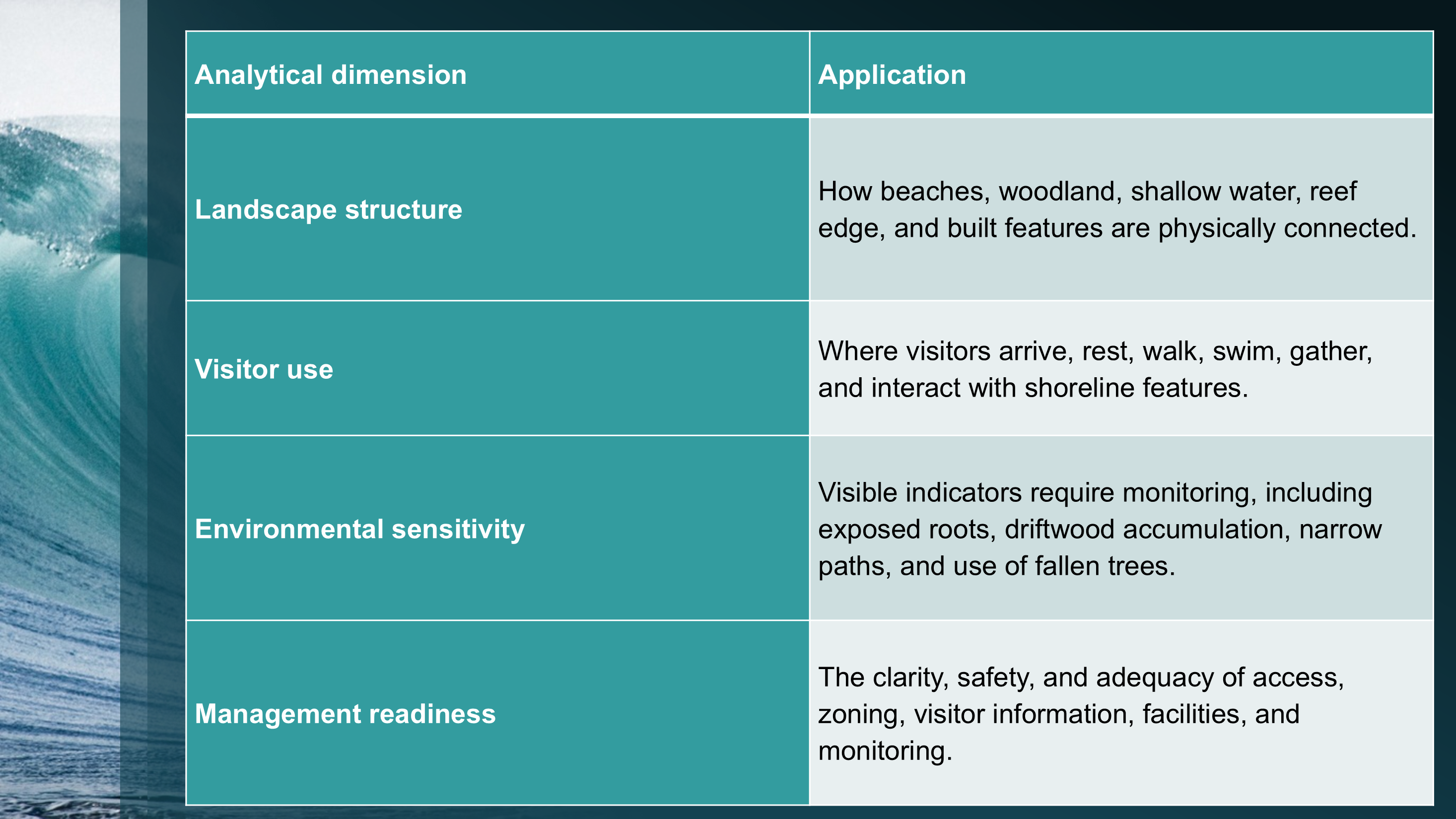
5. Field Findings
5.1 Arrival, boat access, and the open beach
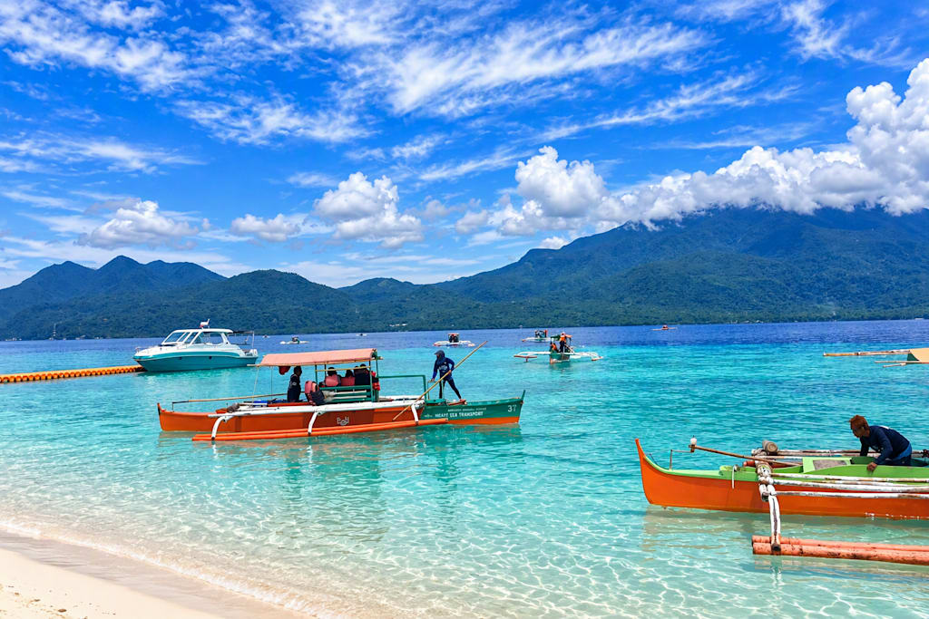
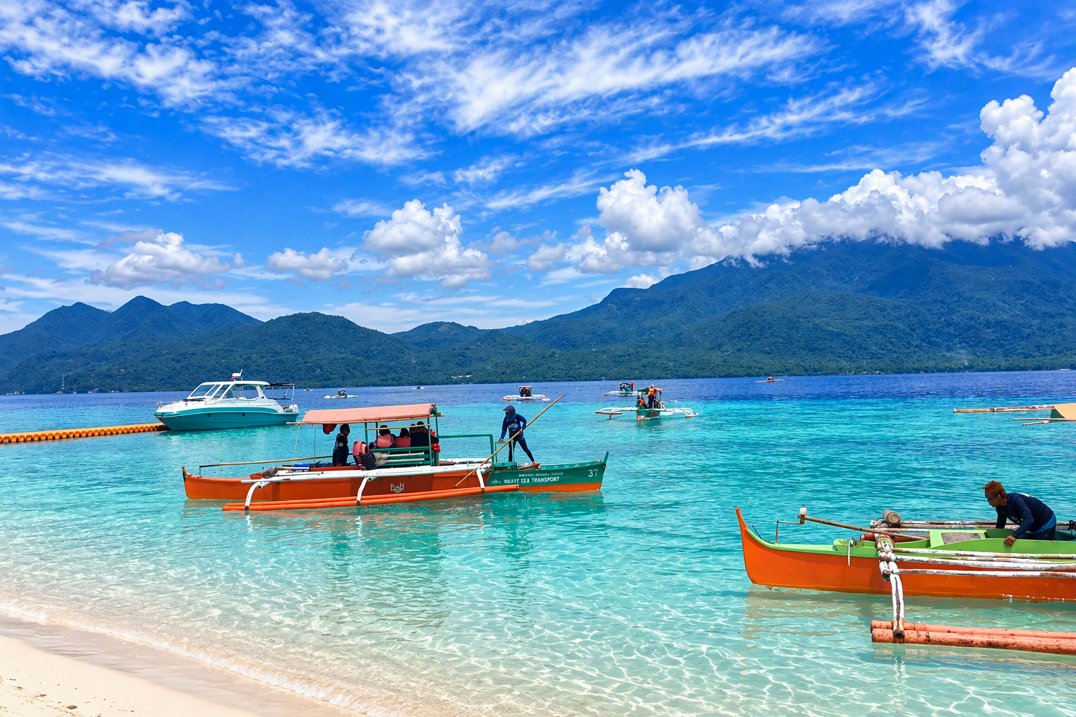
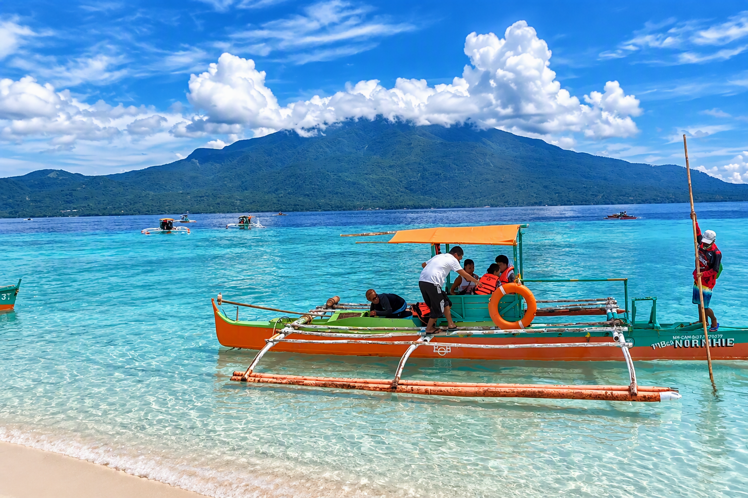
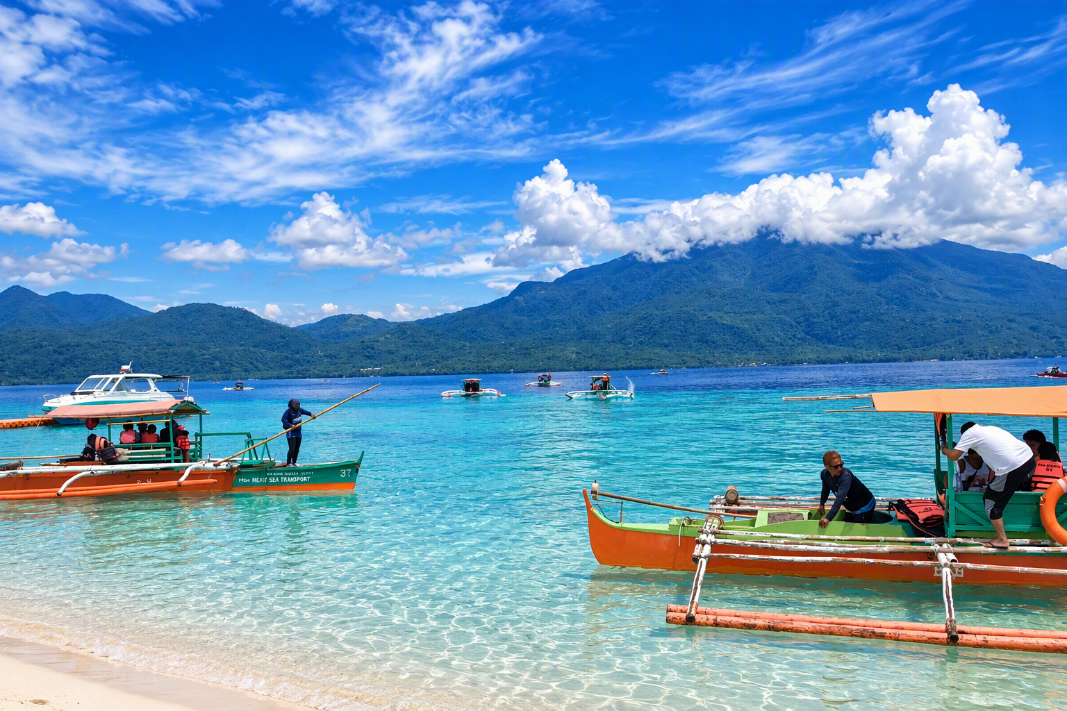
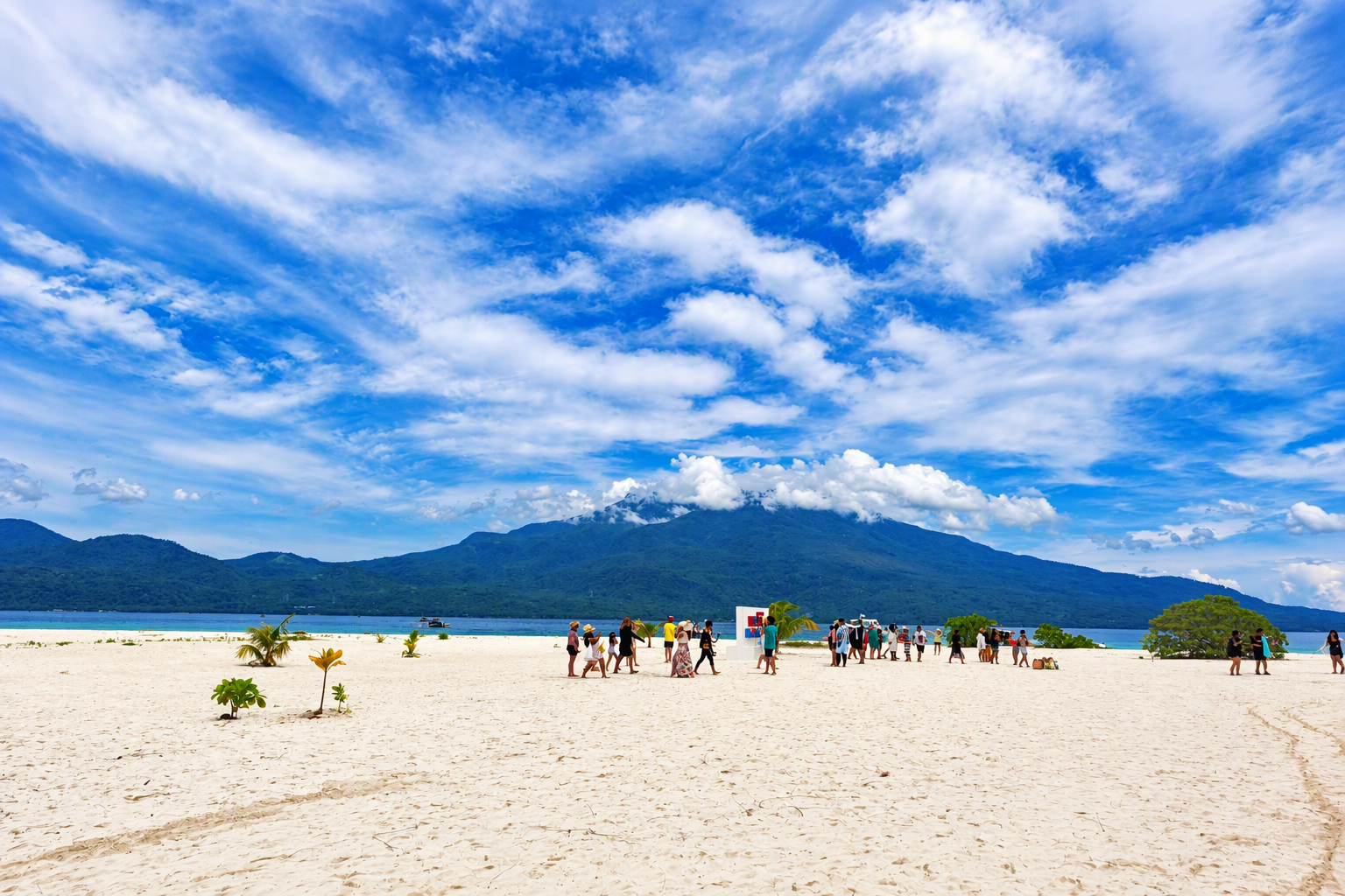
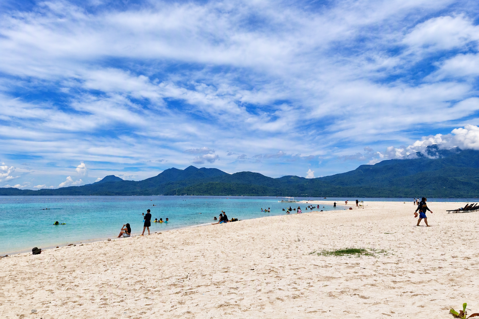
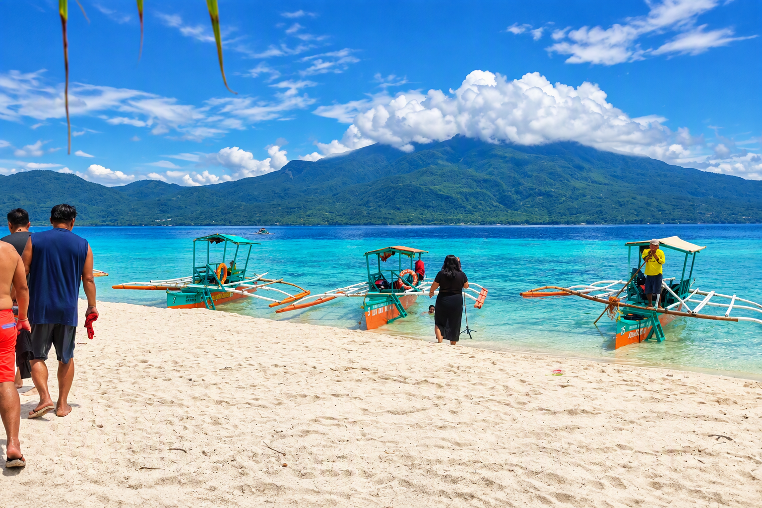
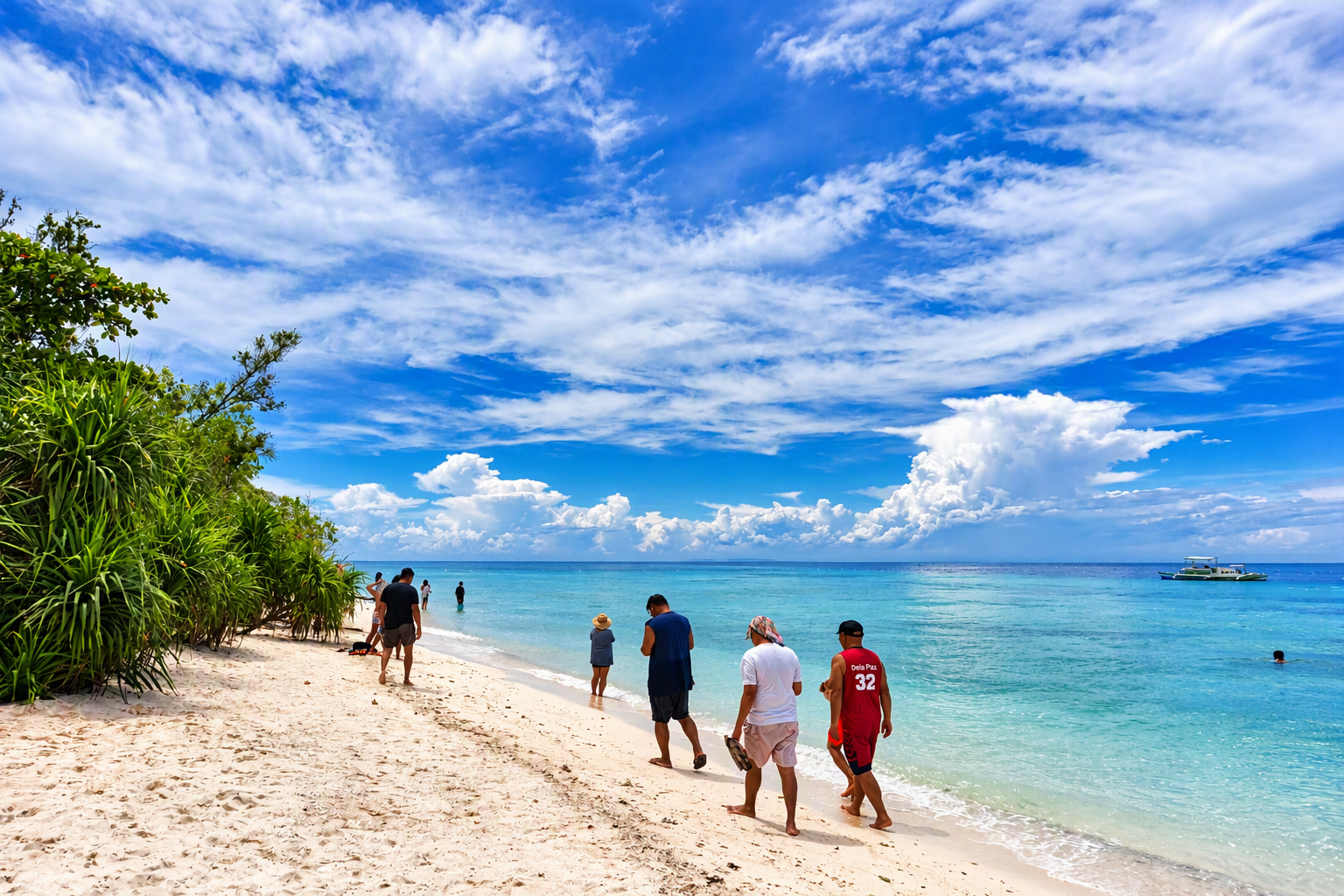
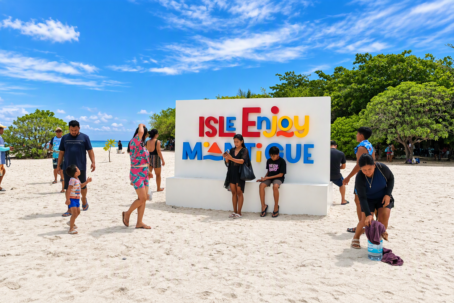
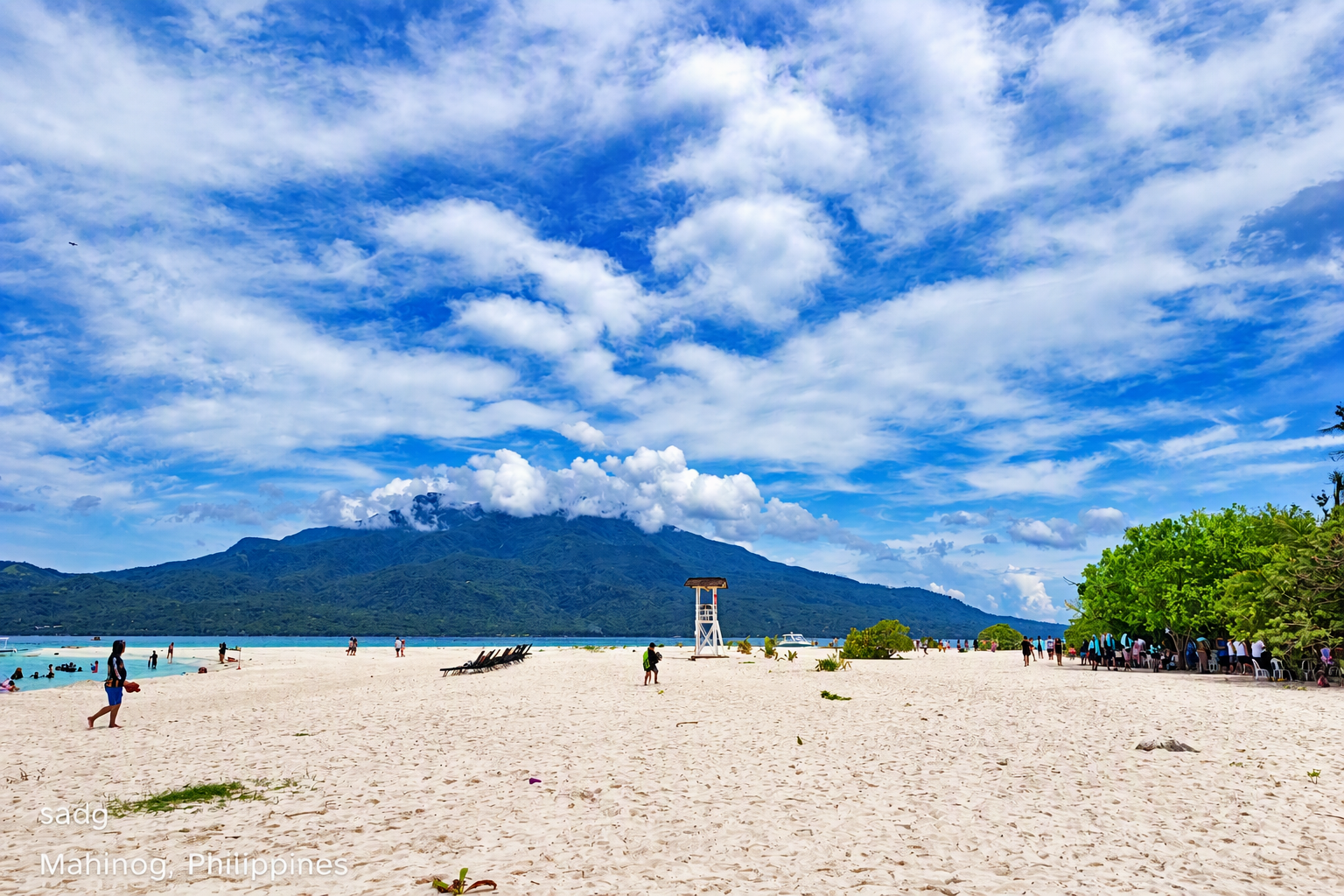
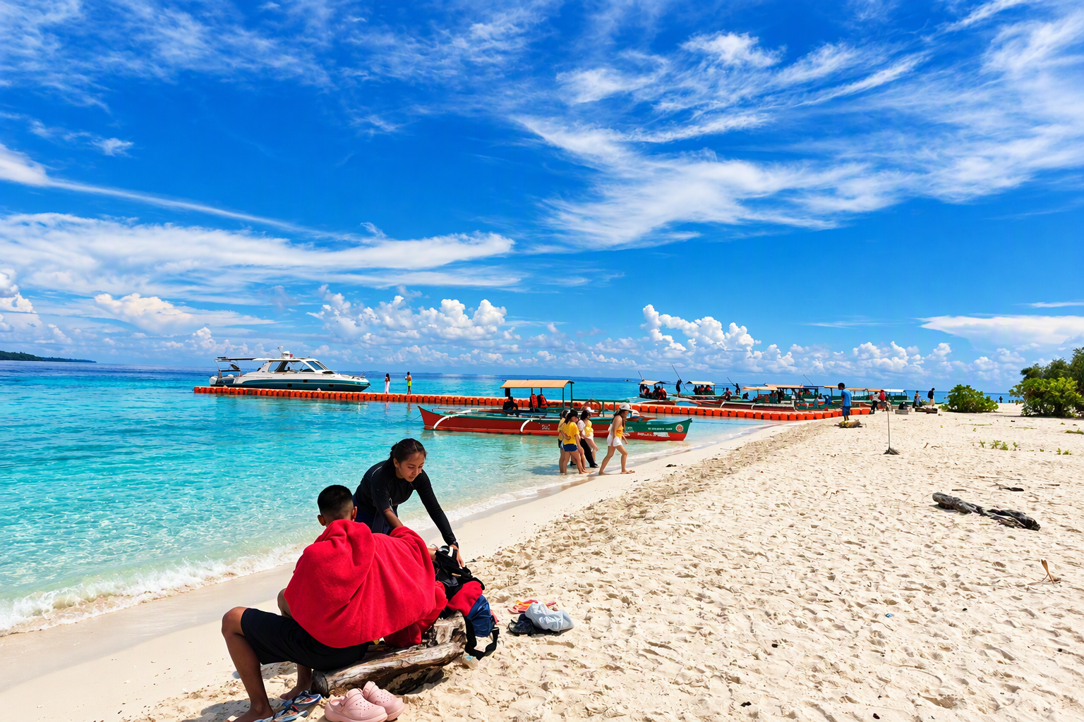
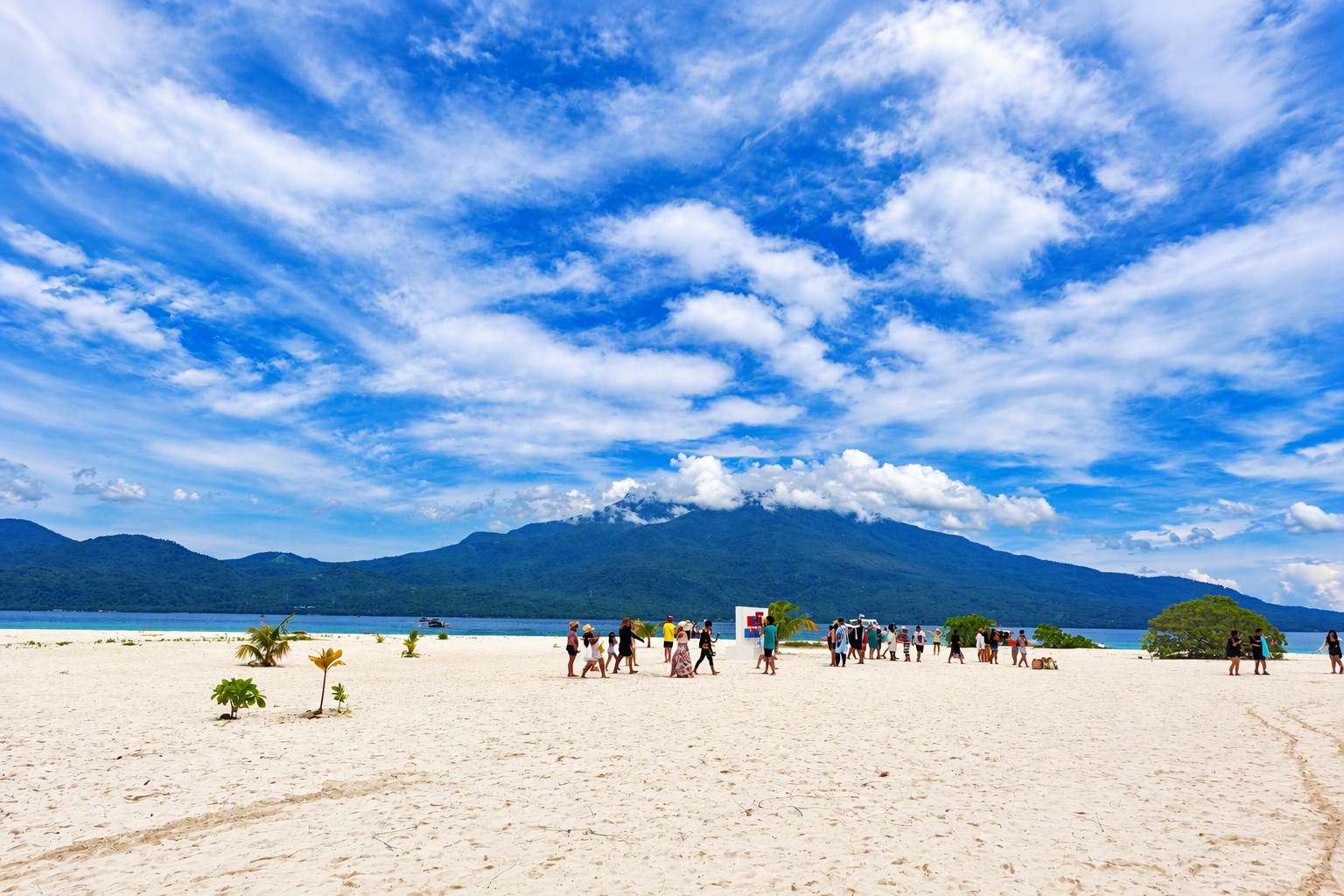
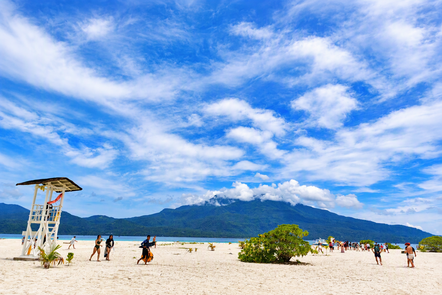
The landing environment is a working tourism space rather than an untouched beach. Outrigger boats operate close to the shoreline, visitors move between vessels and sand, and the mountain mass of Camiguin remains a strong visual reference across the water. This area concentrates several functions: arrival, departure, orientation, waiting, photography, and water access. The mixture creates a need for clear movement corridors and separation between boat operations and swimming areas.
5.2 Beach form and visitor distribution
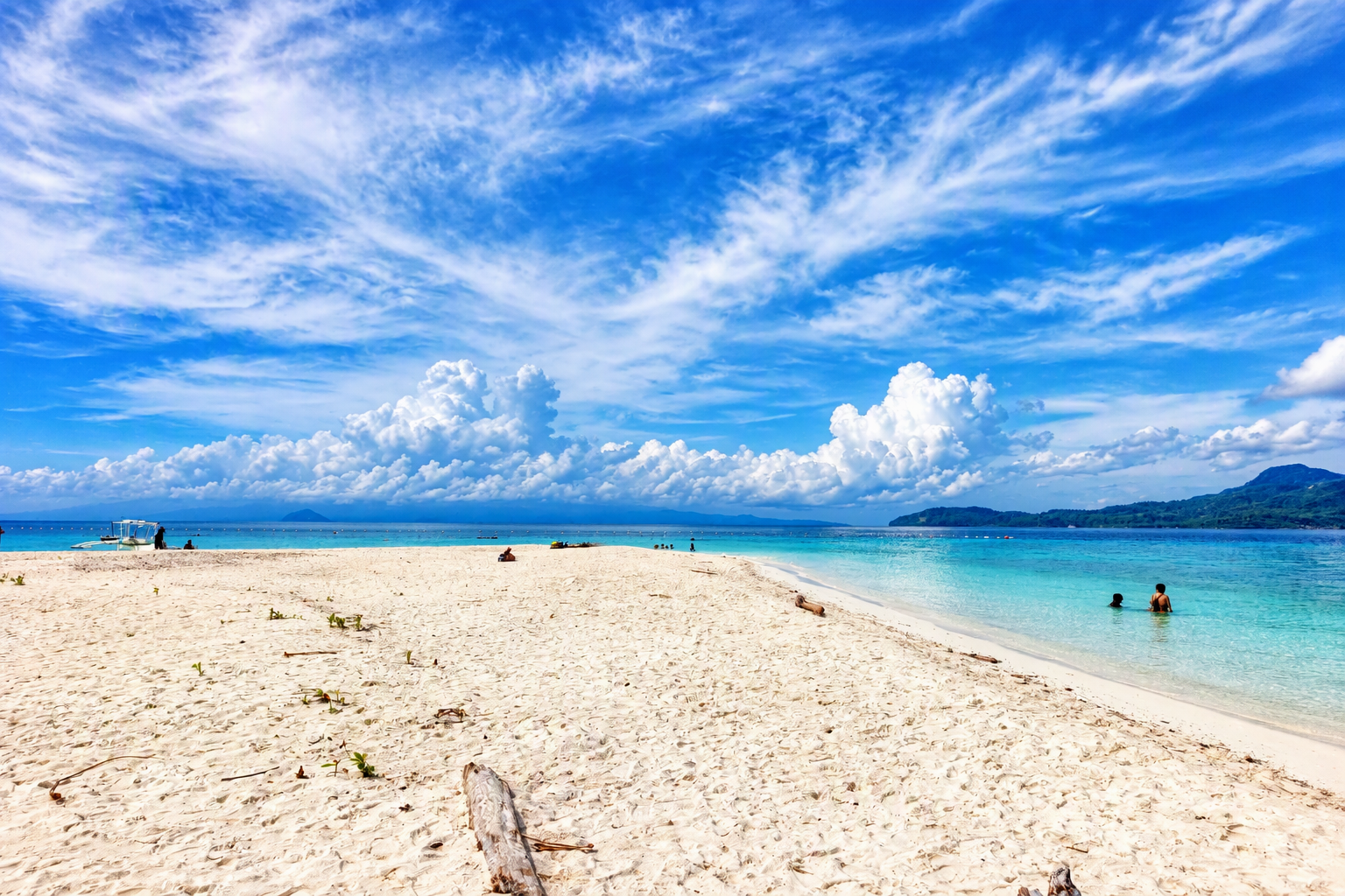
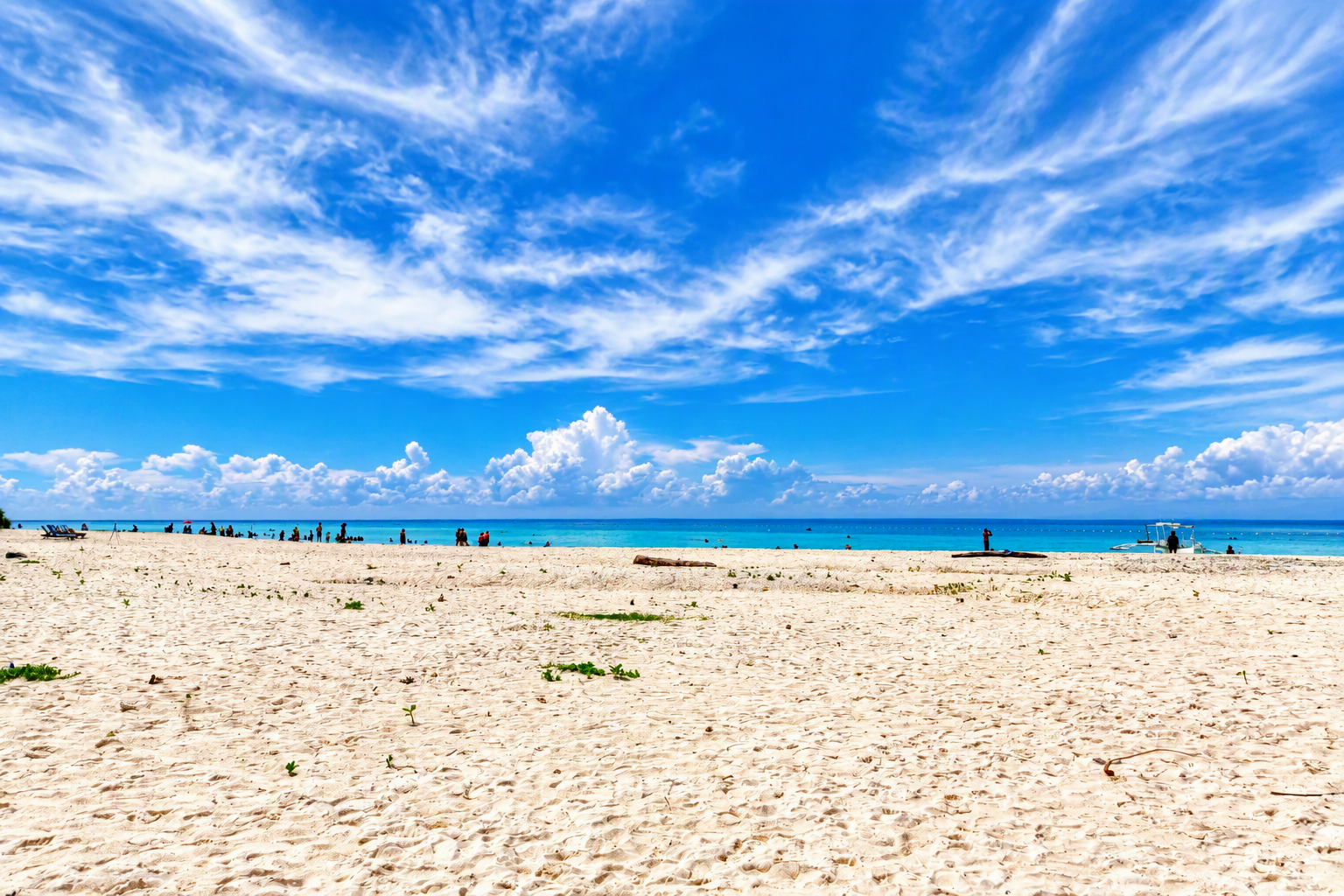
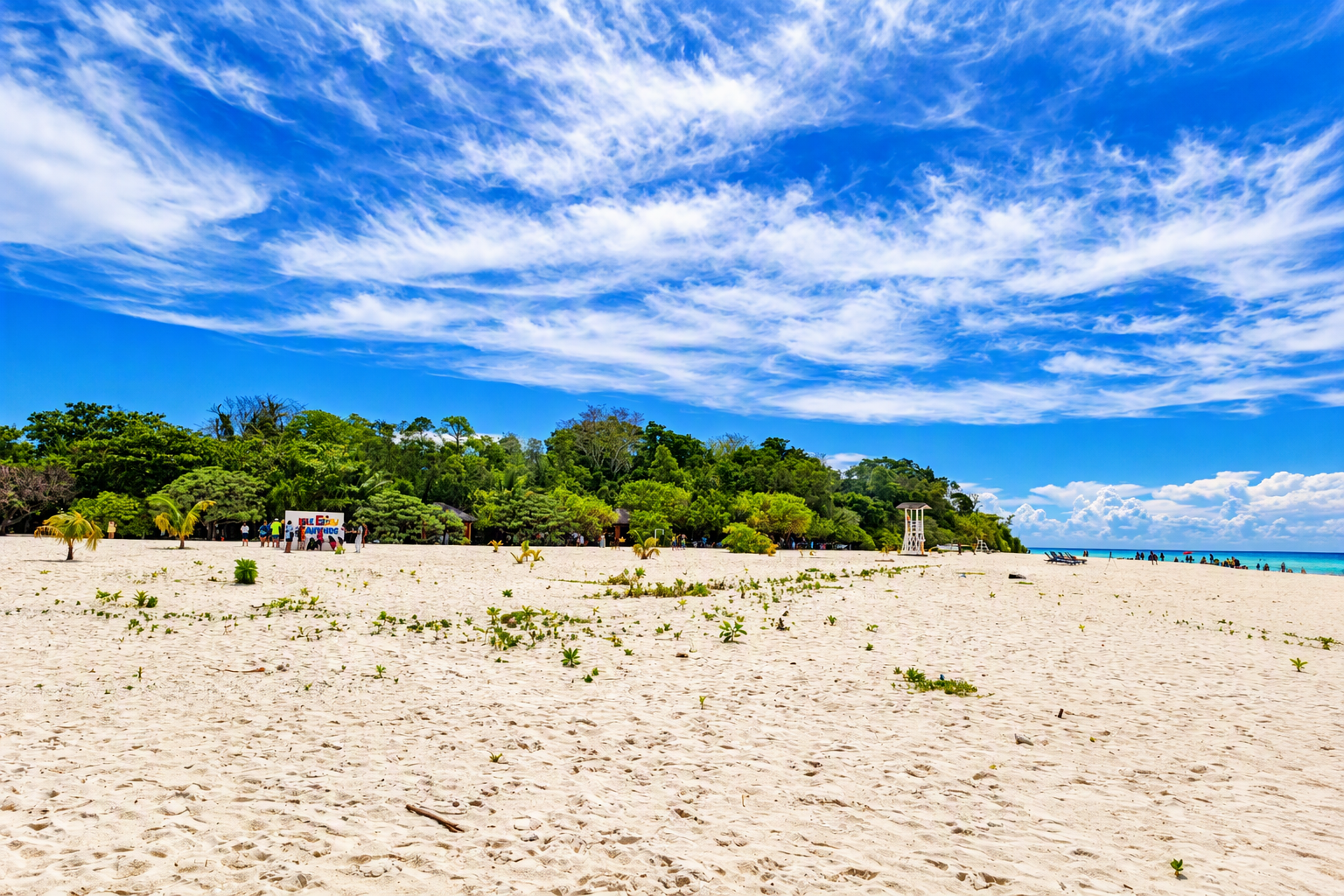
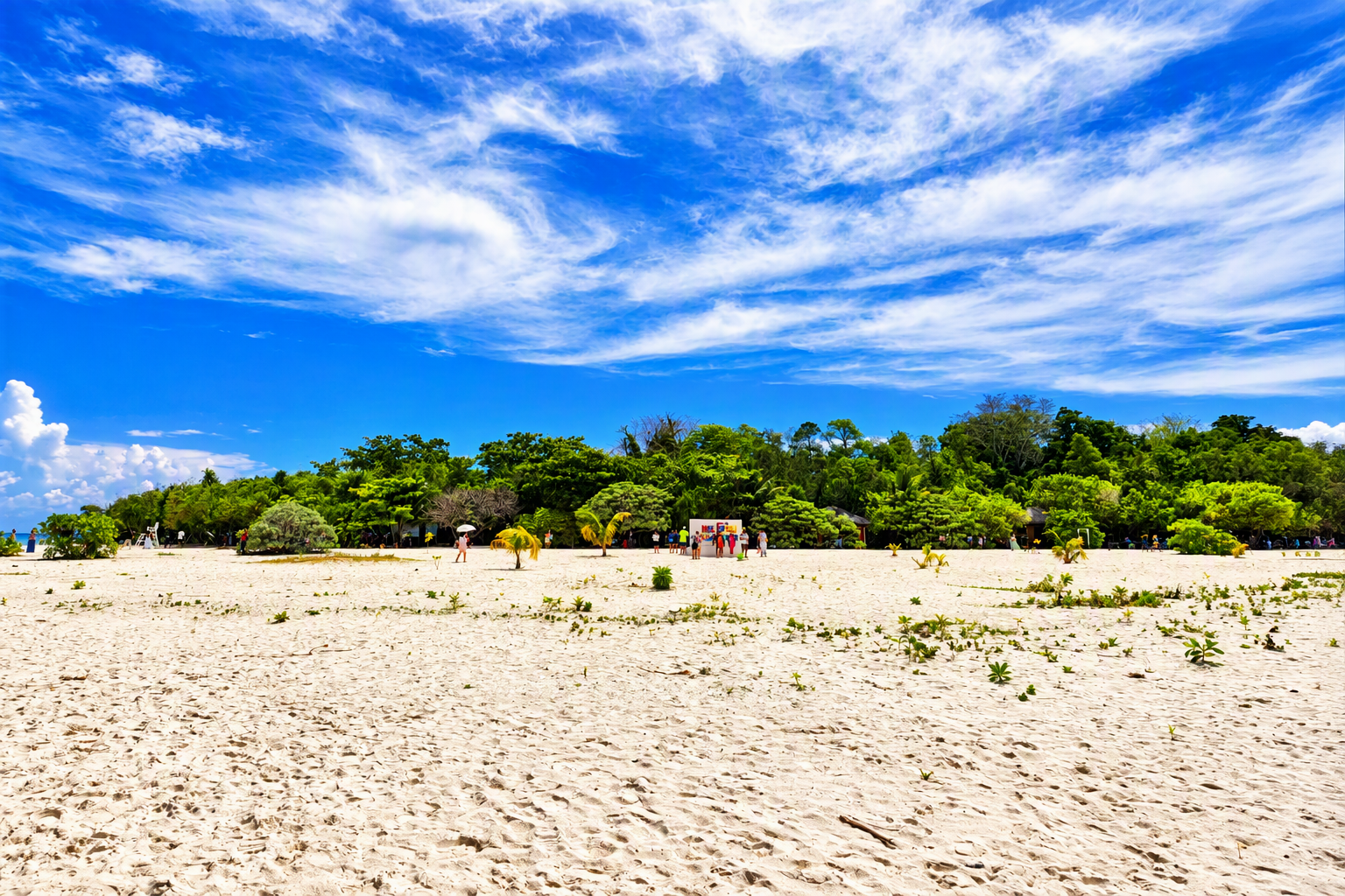
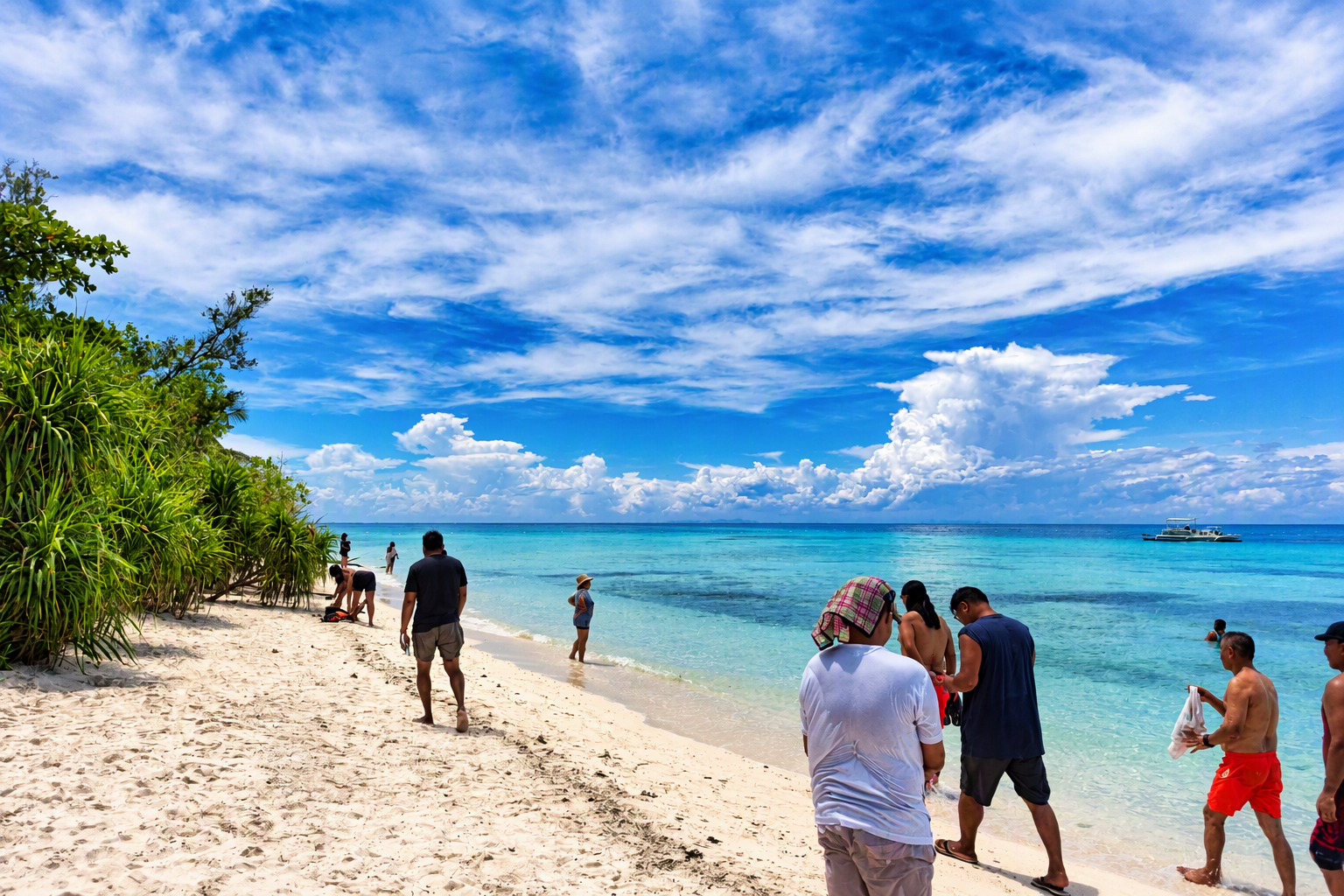
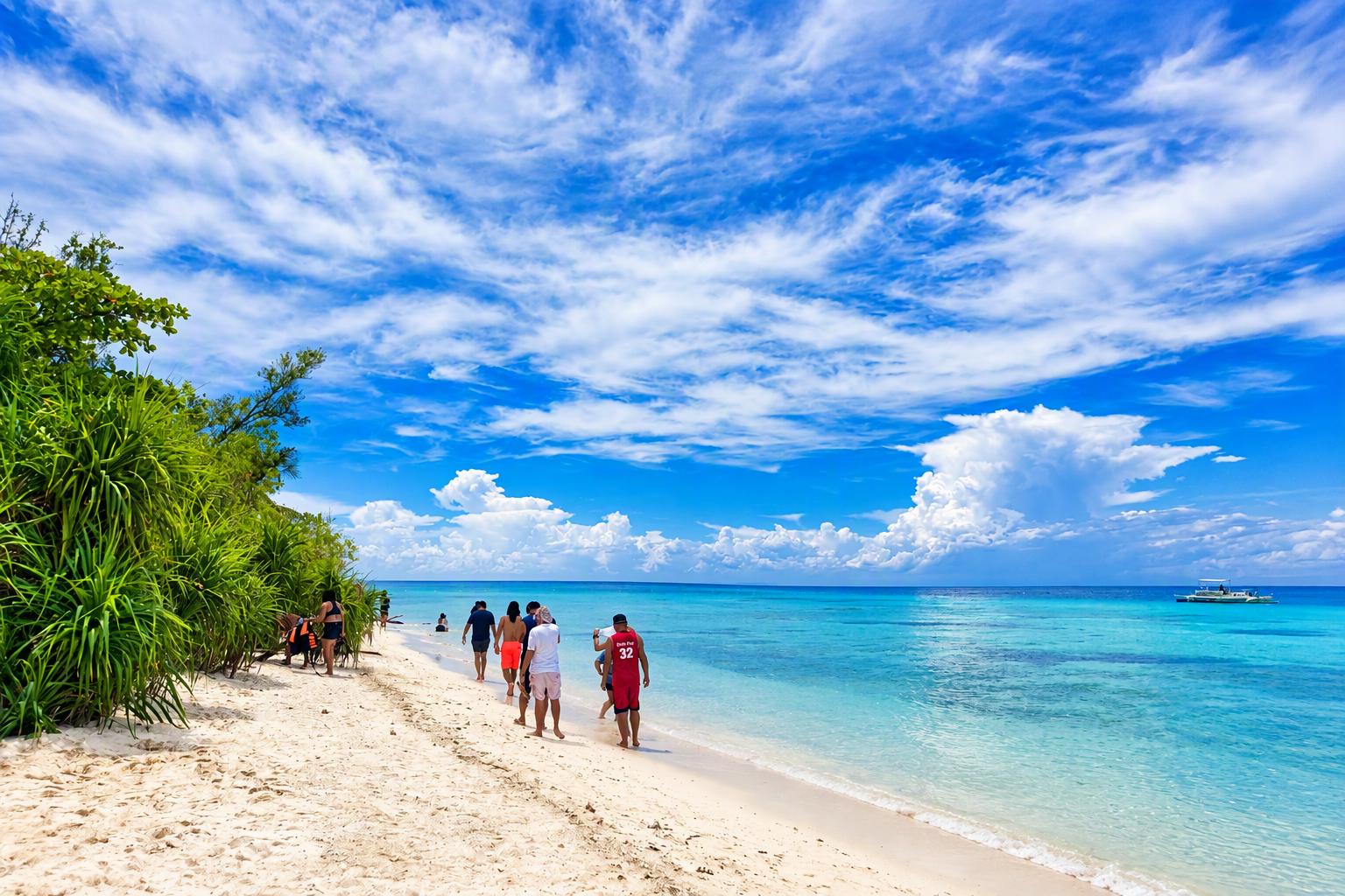
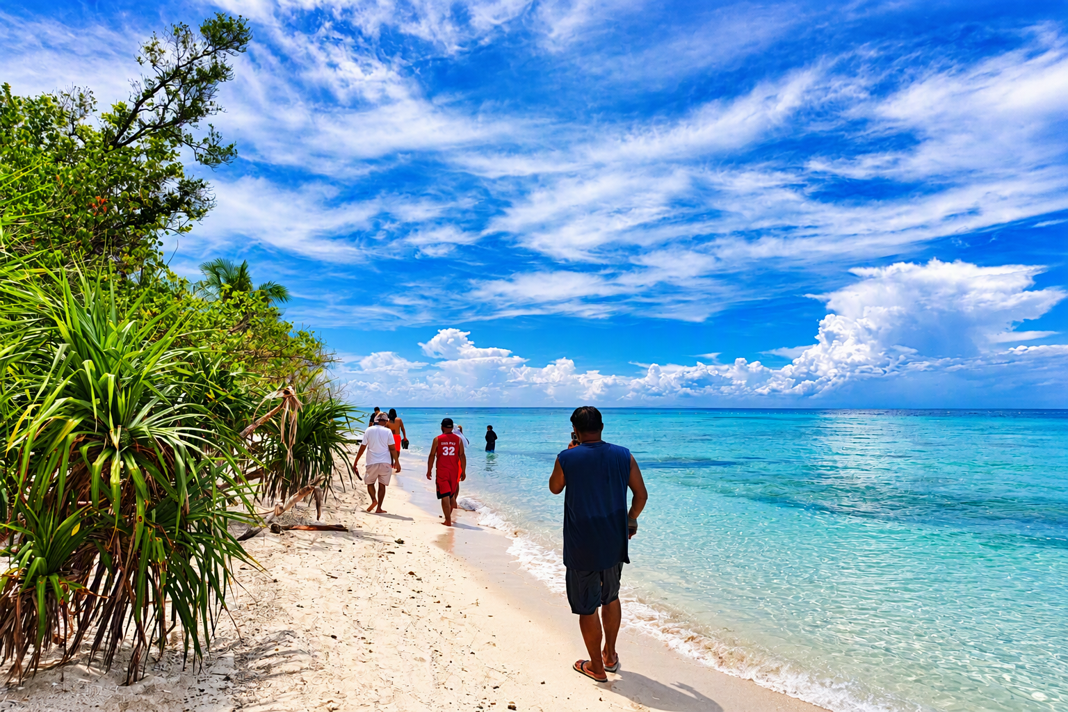
The photographs show substantial variation in beach width and use. Some frames record broad, open sand with dispersed visitors; others show narrow wet-sand routes where people walk close to the water because vegetation limits the landward path. This variation means that capacity should not be estimated from total island area alone. The usable area changes by location, tide, boat activity, shade, and the need to protect vegetation.
5.3 Coastal vegetation, shade, and interior circulation
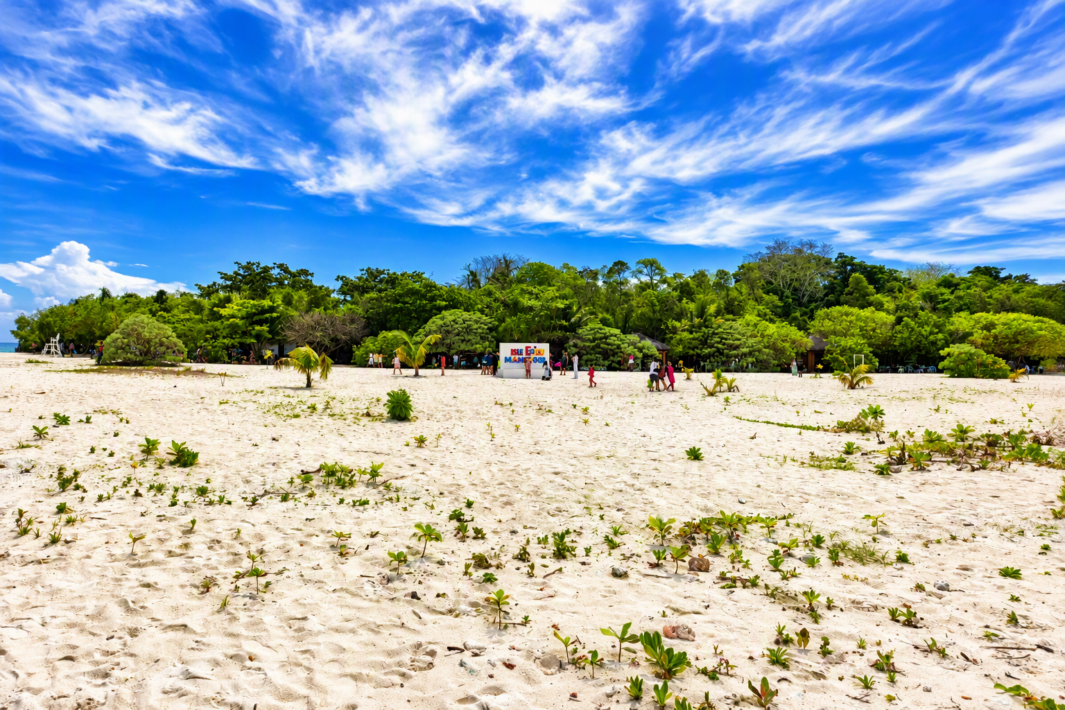
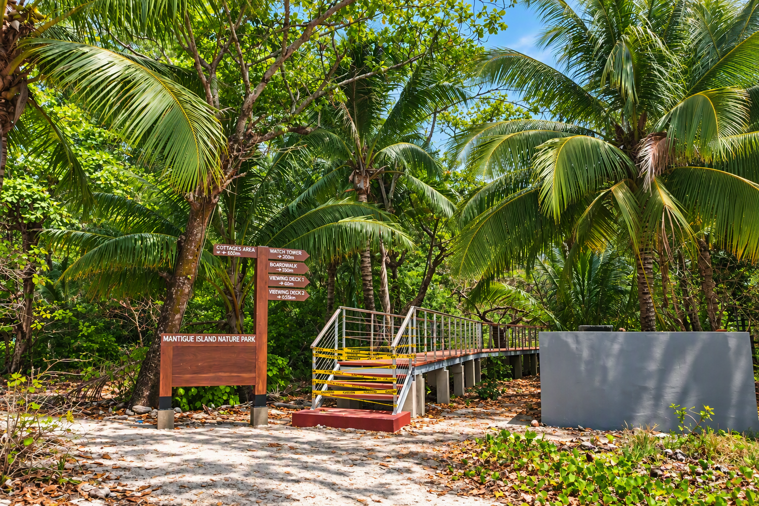
The wooded interior is a defining part of the site. Sandy paths pass through dense vegetation, and small shelters are positioned beneath tree cover. Shade extends the time visitors can remain comfortably on the island and reduces pressure to build large artificial structures. At the same time, concentrated foot movement can widen paths, compact surface material, and disturb root zones if circulation is not guided.
5.4 Shoreline sensitivity and informal recreation
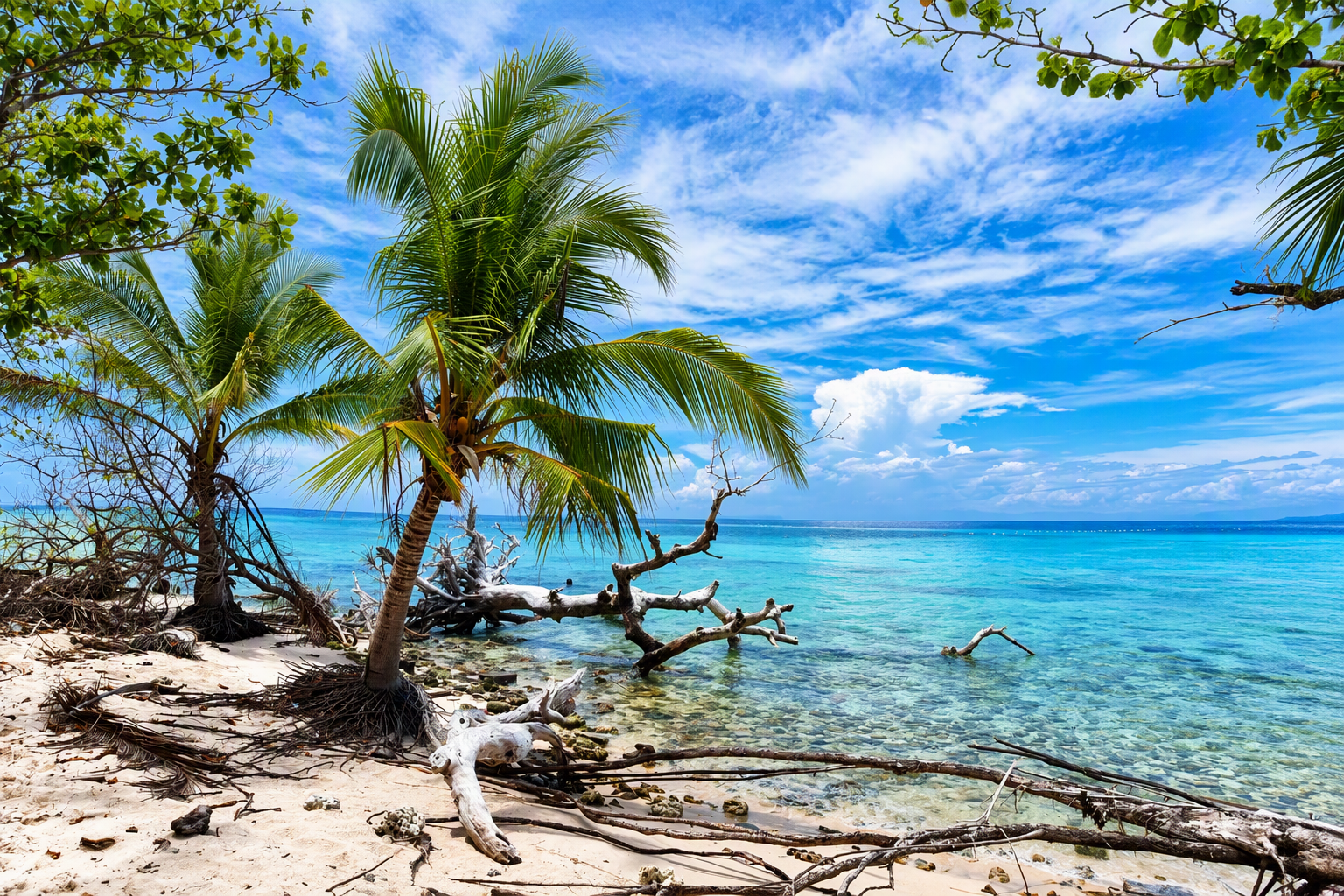
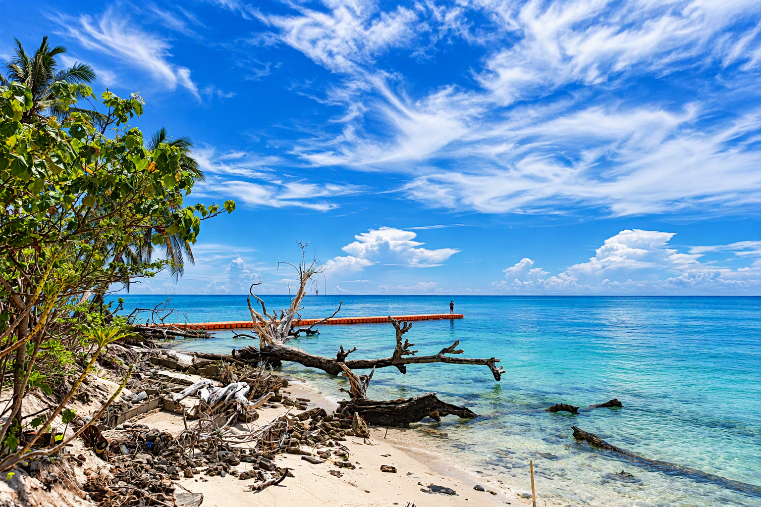
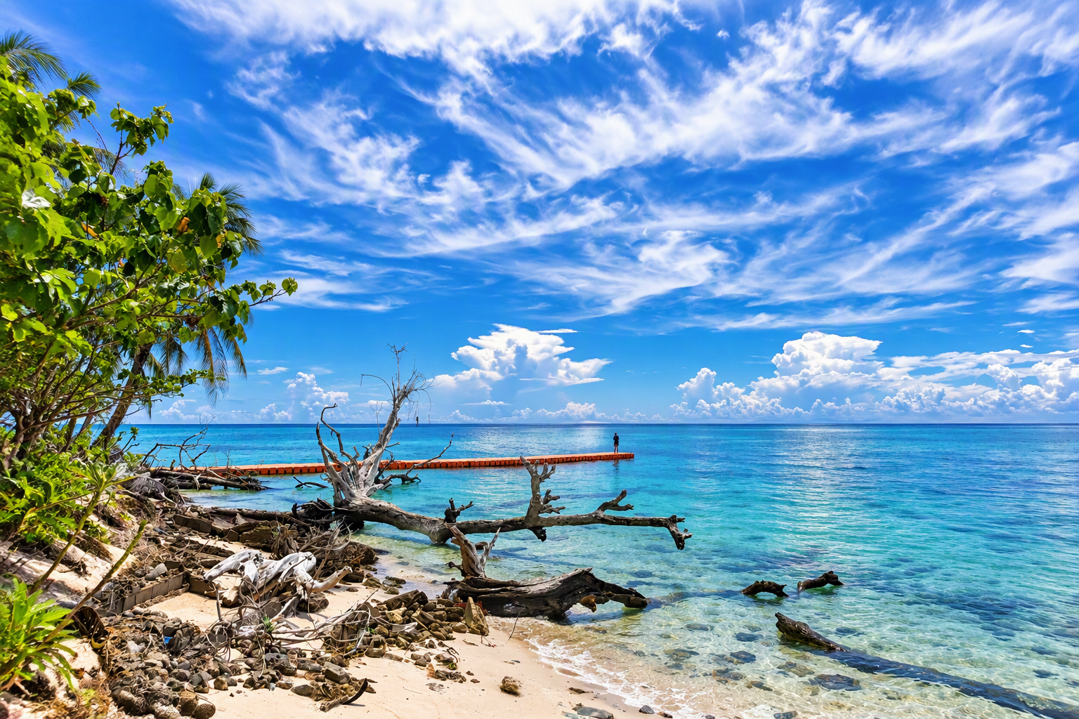
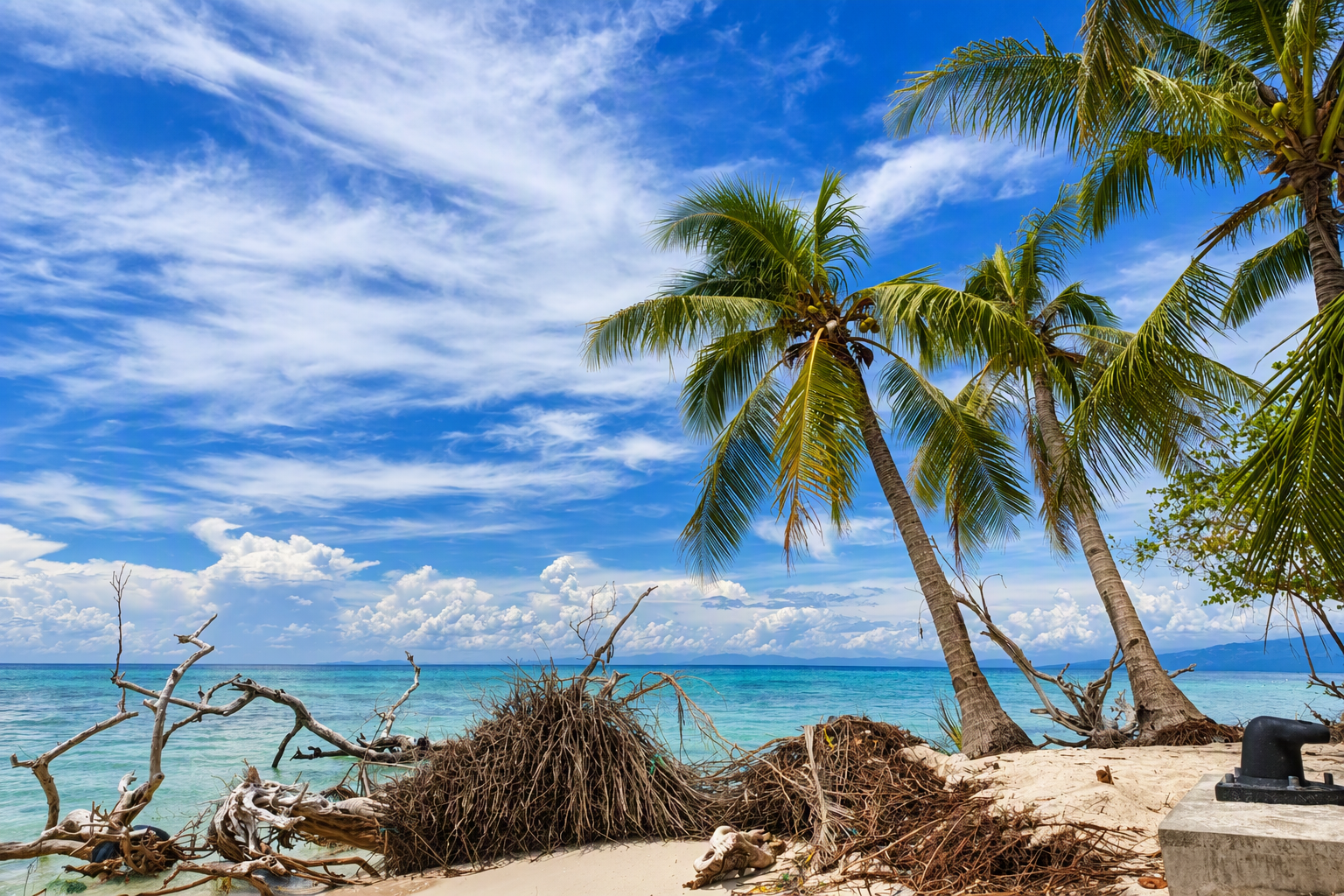
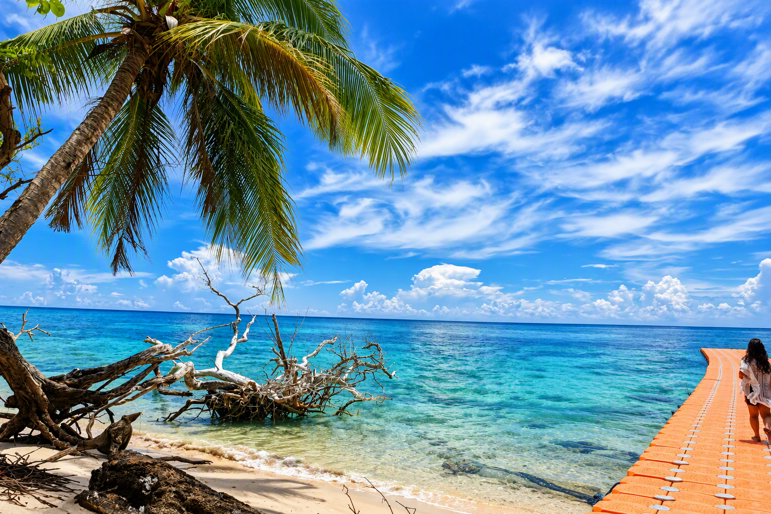
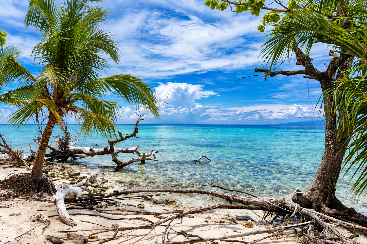
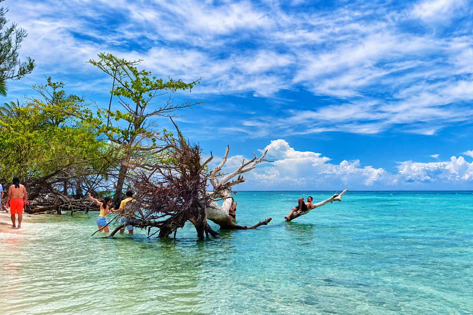
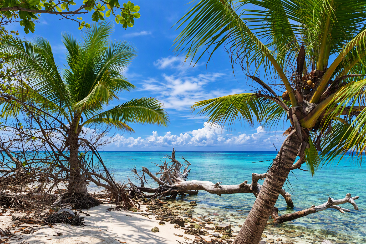
Several images show exposed roots, fallen trunks, driftwood, or mature trees directly at the water’s edge. These are visually striking features, but they can also indicate a dynamic shoreline subject to wave action, sediment movement, and localized erosion. A fallen tree used as an informal recreation point illustrates how visitors’ behavior can concentrate around vulnerable natural features. The image does not establish the cause or rate of shoreline change, but it identifies a priority location for repeated monitoring.
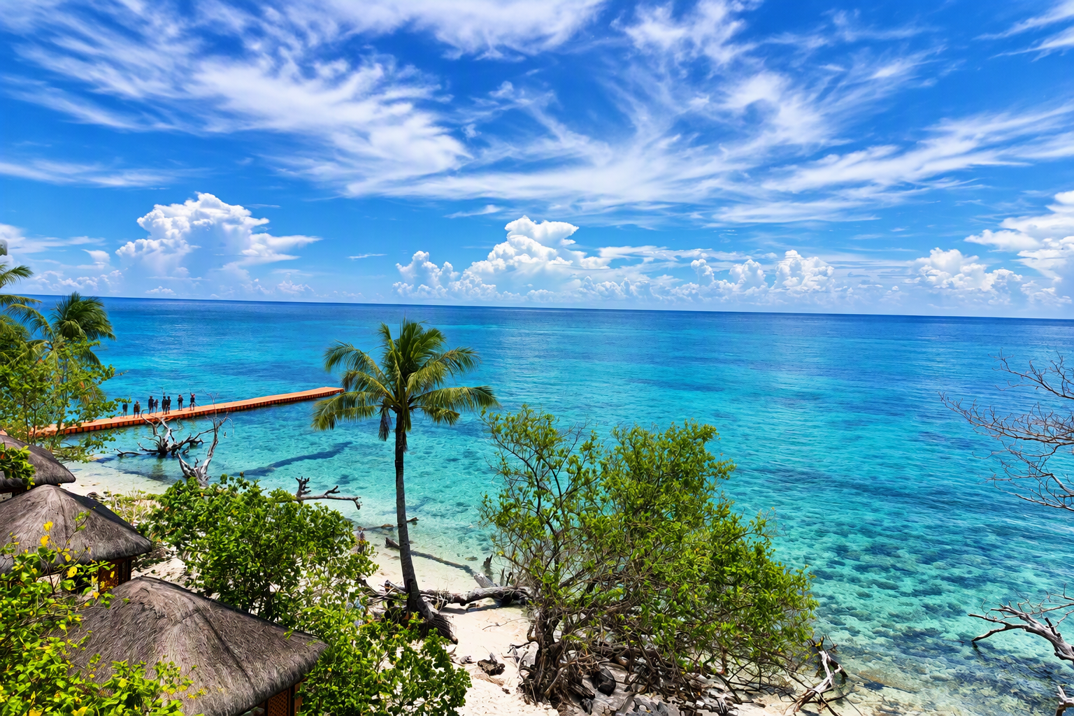
5.5 Reef-edge viewing and access structures
Elevated and shoreline-access views reveal clear shallow water, darker submerged patches, a visitor walkway, shelter roofs, and an orange access structure beside the reef edge. These features connect terrestrial circulation with marine recreation. Their management should consider slip and fall hazards, safe loading, emergency access, anchoring practices, and potential contact with shallow habitats.
6. Integrated Discussion
6.1 A coupled coastal–forest visitor system
Mantigue should be managed as one coupled system rather than as separate beach, forest, and marine attractions. The arrival area channels visitors onto the beach; the beach distributes them toward swimming zones and walking routes; woodland supplies shade and rest; paths link shelters and shoreline segments; and shallow water supports recreation and boat access. Congestion or damage in one component can transfer pressure to another.
6.2 Visitor capacity must be measured, not inferred visually
Open space in a photograph is not evidence of unused capacity. A defensible capacity study would require time-stamped visitor and boat counts, tidal conditions, mapped usable areas, waste and sanitation limits, emergency-response requirements, path condition, shoreline change, and indicators of marine and vegetation condition. Until this data exists, management should avoid using visual openness as justification for increasing throughput.
6.3 Vegetation as ecological and visitor infrastructure
Trees and understorey vegetation are not merely scenic background. They provide shade, define routes, support the island’s beach-forest character, and reduce demand for extensive built cover. Protecting root zones, preventing uncontrolled path multiplication, and monitoring edge trees should therefore be treated as visitor-experience measures as well as conservation measures.
6.4 Safety and functional zoning
Boat landing, swimming, snorkeling, resting, and shoreline walking can overlap spatially. Functional zoning does not require heavy construction. Visible markers, staff guidance, mapped routes, and designated landing windows can reduce conflicts while preserving the natural appearance of the island. Any zoning plan should be tested under different tides and visitor volumes.
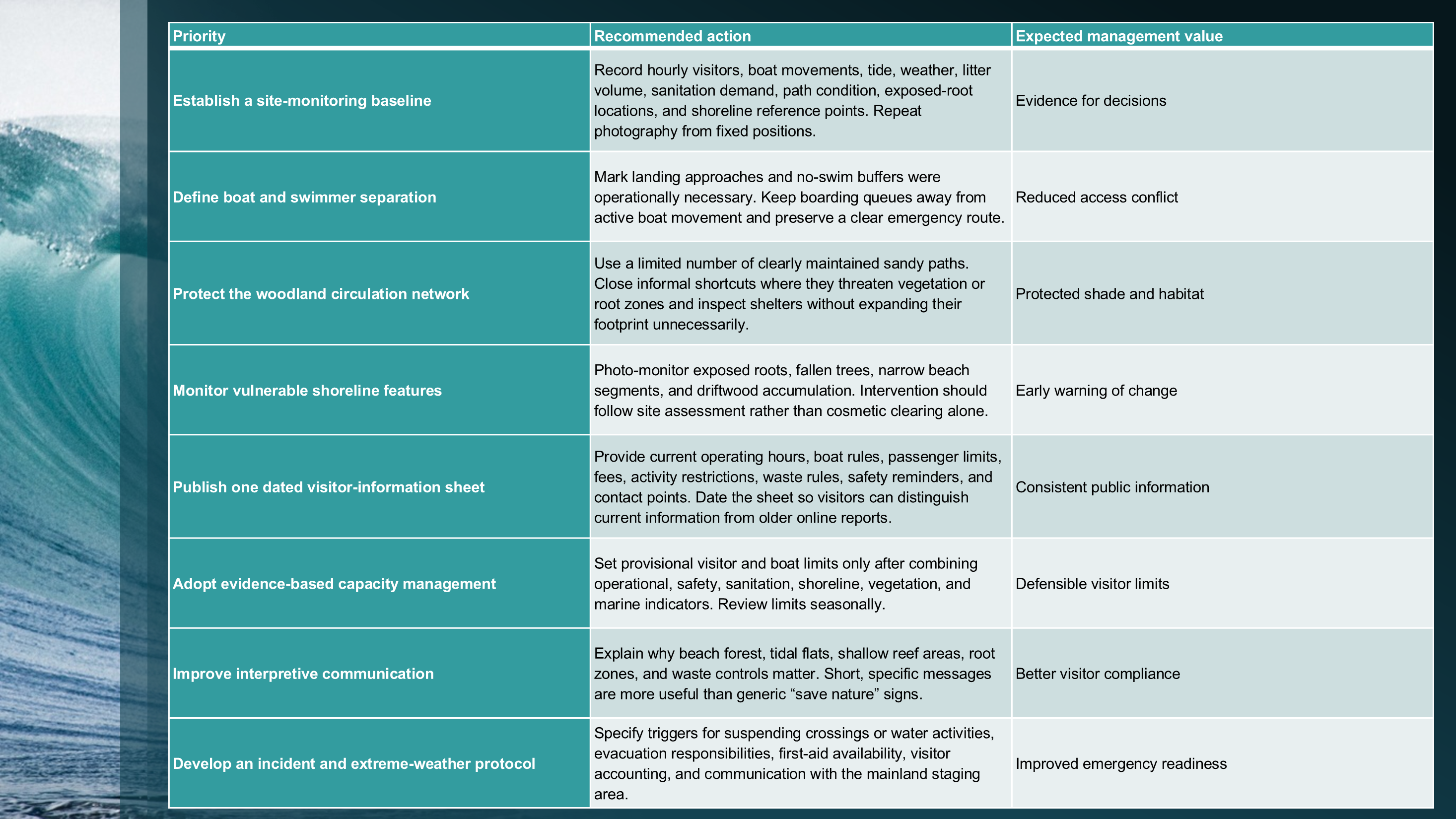
7. Management Recommendations
8. Proposed Future Research Program
Phase 1: Spatial baseline
Map shoreline, paths, shelters, landing areas, swimming zones, sensitive roots, and fixed photo points using GPS and repeatable coordinates.
Phase 2: Visitor-use survey
Undertake hourly counts, movement observations, short visitor questionnaires, queue-time measurement, and boat-turnover recording across weekdays, weekends, and peak periods.
Phase 3: Environmental monitoring
Partner with qualified specialists for beach-profile surveys, vegetation plots, water-quality testing, litter audits, and marine habitat assessment.
Phase 4: Management evaluation
Test zoning and information measures, then compare safety incidents, congestion, path condition, visitor understanding, and operational performance before and after implementation.
9. Limitations
The field visit represents one date and does not establish seasonal conditions.
Photographs provide visible evidence but cannot determine water quality, reef health, biodiversity abundance, erosion rate, or official carrying capacity.
No structured interviews were conducted with residents, boat operators, site personnel, tourism officials, or visitors.
No GPS track, tide log, visitor census, beach-profile survey, or underwater assessment was completed.
Online visitor information can change and should not be treated as an official tariff or permanent operating rule.
10. Conclusion
Mantigue Island’s tourism value is produced by the close relationship among its coral-sand shoreline, shallow marine setting, wooded interior, shade, walking routes, modest shelters, and views toward Camiguin. The 13 June 2026 photographic record shows a landscape that is both attractive and operationally active. Boats, swimmers, walkers, rest areas, vegetation, and vulnerable shoreline features occupy a compact space. The appropriate management response is neither unrestricted expansion nor purely visual preservation. It is measured, site-specific management based on visitor counts, functional zoning, shoreline and vegetation monitoring, transparent rules, and qualified environmental assessment. Protecting the wooded interior and sensitive water–land edge is fundamental to preserving both ecological character and visitor experience.
References
BirdLife International. (2001/2018). Camiguin Island site factsheet. BirdLife DataZone. https://datazone.birdlife.org/site/factsheet/9790-camiguin-island
Key Biodiversity Areas. (2018). Camiguin Island (Site 9790): Site factsheet. https://www.keybiodiversityareas.org/en/site/factsheet/9790
Samontina, D. G., Jr. (2026, June 13). Mantigue Island field notes and photographic record [Unpublished primary field material].
Atlas Pilipinas. (2026). Mantigue Island: Geography, conservation and tourism in Camiguin. https://philippines123.com/wiki/Mantigue
Appendix A. Additional Photographic Field Record
The following photographs supplement the main analysis. Captions describe only visible content and do not imply ecological measurement, official orientation, or verified facility function.
Videos
About the Creator
Domingo Añasco-Gaces Samontina, Jr.
.Professional Member of the Mechatronics and Robotics Society of the Philippines
.Certified Documented Information Controller with TUV Rheinland Qualifications
.Master of Science in Engineering (on-going) with Professional Teacher Certificate
Enjoyed the story? Support the Creator.
Subscribe for free to receive all their stories in your feed.
Comments
There are no comments for this story
Be the first to respond and start the conversation.