culture
Get the authentic cultural experience on your next foreign jaunt. Wander like a local; here, there, and everywhere.
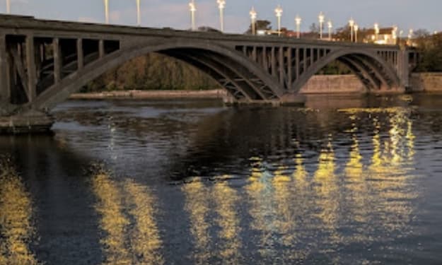
An Optical Illusion On The Wall
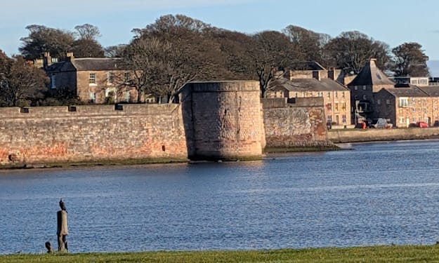
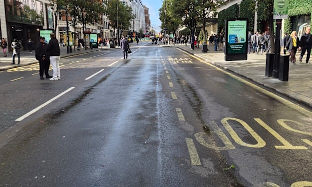
The same shot today Introduction This is a very short post because I intended to walk the Berwick Walls to the round tower in the main picture, and I got there, walked around it, took some pictures, and then made my way back.
By Mike Singleton 💜 Mikeydred 3 days ago in Wander
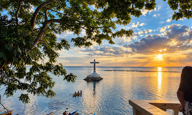
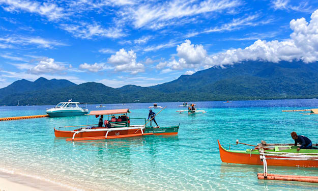
Beyond the Sunken Cross: Volcanic Heritage, Collective Memory, Coastal Landscape, and Sustainable Tourism at the Sunken Cemetery in Camiguin Island, Catarman, Northern Mindanao, Philippines
Author: Mingae Gaces Samontina Field visit: 13 June 2026, approximately 4:00 p.m. Publication date: 4 November 2026 Research type: Qualitative field-based heritage and tourism case study
By Domingo Añasco-Gaces Samontina, Jr.3 days ago in Wander
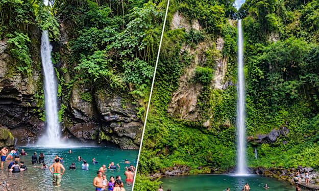
TWO FACES OF CAMIGUIN’S LIVING WATERS
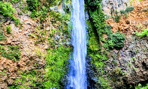
Abstract This comparative article examines Katibawasan Falls and Tuasan Falls in Camiguin Island through a blend of firsthand travel documentation and published visitor-oriented sources. The field context is the author’s company team-building trip with consultant colleagues from 12 to 14 June 2026. The group visited Katibawasan first and Tuasan the following day. Rather than treating the two waterfalls as interchangeable attractions, the article compares their setting, visible morphology, accessibility and visitor experience. Published sources consistently characterize Katibawasan as a tall, narrow single-drop waterfall near Mambajao, while Tuasan is described as a lower, broader cascade in Catarman. The comparison suggests that their tourism value lies precisely in this contrast: Katibawasan offers vertical drama and comparatively developed access, whereas Tuasan offers a broader, rockier cascade and a different sense of encounter with moving water. These conclusions are interpretive and site-specific, not measurements made by the author.
By Domingo Añasco-Gaces Samontina, Jr.7 days ago in Wander
Integrating Landscape Character, Informal Recreation, and Environmental Stewardship
Abstract This article presents a bounded, photographic field study of a coconut-lined river landscape in Jasaan, Misamis Oriental, visited by the author and fellow consultants on 18 October 2026. Using direct observation and nine photographs, the study examines visible landscape character, informal recreational use, and practical stewardship needs. The images show a clear rural waterscape formed by mature coconut palms, dense riparian vegetation, exposed stones, shallow river sections, and human access points. These features create strong scenic and recreational value, but the visit did not include water-quality testing, biodiversity sampling, land-tenure verification, hazard assessment, or interviews with residents. Accordingly, the article does not claim ecological condition, legal swimming suitability, or formal tourism status. It argues instead that the site’s value lies in the interaction of agriculture, flowing water, vegetation, and low-intensity human use. Any future promotion should therefore begin with locally led assessment, visitor-safety controls, waste prevention, respect for land ownership, and protection of river corridors. The study demonstrates how careful visual documentation can provide an initial evidence base for place interpretation while clearly separating observation from claims requiring technical verification.
By Domingo Añasco-Gaces Samontina, Jr.9 days ago in Wander
Where the Water Remembers: Returning to Sagpulon Falls Eight Months Later
Some places impress us immediately. Others become meaningful only after we return. For me, Sagpulon Falls became both. I first visited the waterfall on February 17, 2026, together with colleagues. It was Chinese New Year, and because we had no work that day, the holiday gave us an opportunity to leave our usual routine behind and explore another corner of Misamis Oriental.
By Domingo Añasco-Gaces Samontina, Jr.10 days ago in Wander
Where The Day Meets the Bay
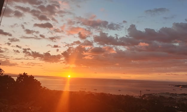
Abstract This visual research article examines a personal photographic record of sunsets observed across Tagoloan and Cagayan de Oro in Misamis Oriental. The collection was assembled during the author’s first year in the province after arriving on 13 December 2025 for an assignment as a Consultant Document Controller on a major infrastructure project. Using repeated, place-based observation and visual description, the article considers how sunset changes the perception of six environments: Paco Beach in Barangay Gracia, Poblacion in Tagoloan, the Mindanao Container Terminal area, Puerto, the Cagayan de Oro Coastal Road, and Malaiba in Barangay Casinglot. The images reveal a recurring relationship among sky, water, industry, settlement, and movement. Rather than presenting a controlled atmospheric-science study, the work is framed as reflective visual inquiry: a documented encounter with place, supported by geographic and coastal context. The central finding is that sunset is not merely a scenic background. It becomes a daily lens through which working landscapes, shorelines, roads, and communities can be seen as one connected regional environment.
By Domingo Añasco-Gaces Samontina, Jr.13 days ago in Wander