
The Evolution of Remote Sensing: From Satellites to Drones & Beyond
Discover the fascinating evolution of remote sensing technology, from the early days of satellites to the modern use of drones and beyond. Learn how this field has advanced over the years and the endless possibilities it holds for the future. Don't miss out on this insightful journey through the history and future of remote sensing
The landscape of remote sensing has undergone a remarkable transformation in recent times. It is no longer just about capturing grand, blurry aerial photographs. Today, a sophisticated suite of technologies – from high-orbiting satellites to nimble drones – paints a detailed picture of our planet, empowering various industries and government sectors across the globe with unparalleled precision. In fact, a recent report by GeoMarketing suggests that the global market for remote sensing data and services is projected to reach a phenomenal $18.6 billion by 2025, reflecting the ever-increasing demand for geospatial insights across diverse applications.
Let us delve into how remote sensing has become indispensable tool!
Transforming Industries with Remote
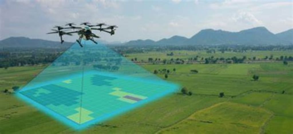
Managing vast agricultural landscapes with pinpoint accuracy is not a far-fetched dream anymore, thanks to remote sensing data. Captured via multispectral satellites, this data provides a detailed map, revealing all the nutrient deficiencies and irrigation inefficiencies. This empowers farmers to further optimize the way they use their resources – leading to healthier crops, reduced waste, and ultimately a more secure global food supply.
The constant fight for a sustainable future demands proactive environmental monitoring, and remote sensing has become the ultimate weapon in this initiative. For instance, satellites equipped with geospatial mapping technology can track deforestation trends, allowing for targeted action against illegal logging and the conservation of precious rainforests. Hyperspectral imaging helps identify early signs of water pollution, enabling swift intervention. Drones equipped with thermal cameras map wildfires in real-time, guiding firefighters and saving lives. These are just a few examples of how remote sensing has been empowering us to become better stewards of our planet.
Building Smarter Cities with Geospatial Data
The days of reactive urban planning are long gone now, thanks to some powerful tools under remote sensing. For example, LiDAR technology provides highly accurate 3D models of cities, thus enabling more proactive infrastructure development as well as disaster preparedness. Satellite data, another key component of geospatial mapping, helps monitor urban sprawl, enabling accurate design of sustainable infrastructure projects and facilitating effective resource management. This means that we can have more resilient, efficient, and livable cities for all – thanks to these geospatial technologies.
Discovering Earth's Treasures with Precision
Efficient exploration of natural resources is a crucial operation, and remote sensing plays a vital role by guiding this discovery with pinpoint accuracy. Geospatial mapping from satellites identifies geological
features and potential mineral deposits, enabling targeted exploration efforts while also minimizing the environmental impact, when compared to traditional methods. Additionally, advanced radar technology can map oil and gas reserves hidden beneath the Earth's surface, with such a targeted approach as this helping optimize resource discovery along with reducing environmental disruption.
Securing Our Borders & Infrastructure
National security and border management are paramount for any nation in this age of increasing conflicts. High-resolution satellite imagery, a cornerstone of geospatial mapping, provides a constant vigil, enabling effective monitoring of the borders along with detecting any unauthorized activities. Drones are also transforming infrastructure inspection by integrating seamlessly with these technologies. Critical pipelines and power grids can now be thoroughly examined – thanks to remote sensing tools – enabling proactive maintenance and identifying potential security vulnerabilities. These benefits are poised to create a safer and more secure environment for all!
The Future Outlook
While remote sensing has evolved by leaps and bounds recently, its evolution is far from over. The future lies in our ability to integrate data from a diverse range of sources – satellites, drones, and ground-based sensors – to create a unified and comprehensive geospatial mapping system; with advanced AI-powered analytics bound to reveal even deeper insights from this vast data pool.
However, this data integration presents a challenge: ensuring the quality and usability of information collected from various sources. For instance, while drones have significantly impacted remote sensing as a flexible, relatively low-cost, and easy-to-operate tool obtaining data from unprecedented geographies, significant errors may emerge in the collected data without knowledge of remote sensing fundamentals.
This is where Magnasoft shines. With over 25 years of experience, we develop cutting-edge solutions that bridge the gap between data collection and actionable insights. We foster collaboration within the industry to establish best practices across remote sensing. By harnessing the ever-evolving potential of these geospatial technologies, we can ensure a future that is not only sustainable but also thrives on a deeper understanding of our planet!
About the Creator
Enjoyed the story? Support the Creator.
Subscribe for free to receive all their stories in your feed. You could also pledge your support or give them a one-off tip, letting them know you appreciate their work.
Keep reading
More stories from writers in Education and other communities.


Comments
There are no comments for this story
Be the first to respond and start the conversation.