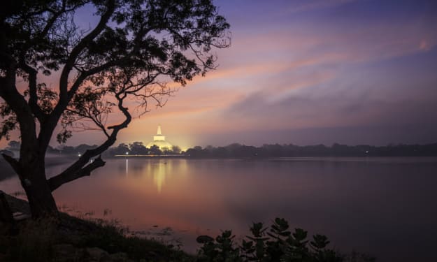
In Sri Lanka's Dolosbage Mountain Range, Kabaragala is the mountain's highest summit. This is situated where the districts of Kagalle and Kandy meet. The summit rises 1506 meters above sea level. Similar to the Horton Plains, it has an almost level topography. Moreover, a massive fallout akin to the Word End. It is situated in Sri Lanka's Sabaragamuwa Province. The mountain range is known as Kabaragala, according to the locals, because of its speckled iguana-like appearance. On one side of the mountain, when you reach the peak, a steep slope may be seen on the opposite side. You may ascend the mountain farther to view a number of interesting locations. The natural forest and grasslands at the top of the hill contributed to the splendor of the mountains. A windbreak that produces an endless stream of winds is also present. The natural environment may be explored quite well here.
Starting from Maryville Junction, the trek will go. The concrete road leading to the mountain and a Kovil are your first two encounters. You will then arrive to a tea estate. Your path will now get shorter and you'll be traveling along a short footpath. But it is easy to recognize. You will then enter a tiny pine tree forest. You may reach the first viewing point after an hour of walking. It truly is fantastic. You may view beautiful images of the area.
Most travelers complete their trek at the vista point. But in order to reach the peak, you should go on. The Horton Plains' surface is remarkably similar to the landscape. Mana trees and vegetation like the Sahara may be seen. The steep descent to the bottom is comparable to the end of the world.
You can reach the Kabaragala Mountains' top after over two hours of climbing. The panorama from the peak is really breathtaking. You'll definitely be astounded!

Historical information and village beliefs
According to the locals, the mountain range known as "Kabaragala Kanda" in the "Dolosba Range," which is adjacent to the location known as "Kinihira," dates back to the time of RAVANA. The name Kabaragala, which refers to a spotted iguana, is thought by the locals to refer to the mountain range. Others think that Gautama Buddha arrived here before ascending Sri Pada Kanda and departed in response to a spotted iguana's screaming. There is a settlement there named Tolabowala Pathana Janapadaya, and the locals think that this is where King Rawana planted the Tolebo plant in order to wed Princess Sita. Two enormous torch beams on either side of Mount Kabaragala and on the side of Kinihira known as Raksha Gala Kanda, which swelled to seven torches and lit in one location in the center of the mountain, were among the notable occurrences that occurred there on the night of Kemmura. It may be canceled. The witnesses to the tragedy still reside in the same village. And the old people claimed that this hill had formerly been the site of incredible constructions of all kinds. Examples are the tunnel and the well-constructed pond at the top of the hill. The development of tea cultivation to the summit of this hill appears to have been destroyed over time during the British administration.

Biodiversity
Biodiversity experiments haven't been done yet, although there are a lot of indigenous species of plants and animals that may be seen. Evergreen vegetation, bushes, and woodlands can be found there. A system of plain grasslands is also present. Various varieties of plants that have been trimmed (shortened plants) as a result of the high winds that are prevalent. A large diversity of birds, reptiles, amphibians, mammals, and insects make up the flora. For instance, hawks, lizards of all kinds, geckos, pythons, frogs, rabbits, pigs, deer, parrots, monkeys, parrots, butterflies, and lizards. In addition, the mountains are full with water features that help the local fauna survive.

What you can observe to the Kabaragala?
You can see Sri Pada Mountain, Peacock Hills, Kothmale Area, Dolosbage Area, Pusellawa, and Kothmale Reservior. You may also see a lot of undiscovered mountains and towns. This picturesque image is excellent for a photographer. The greatest time of day to take in your surroundings is in the morning. The mist will typically blanket the entire region. The clouds tucked behind the mountains are another well-known sight in Kabaragala. If you're fortunate, you can undoubtedly see this lovely image.
Camping
Kabaragala is an excellent location for camping as well. A large number of local visitors go there to have an adventurous experience. The mountain's summit has considerable room for camping. You may find woods everywhere. The time around the holidays is quite hectic. Many locals stay here overnight. The evening is crisp and windy. In the dark, you can see the lights of the nearby locations. It appears to be extremely picturesque as well.

Weather
The region has yearly rainfall of about 3000mm. Consider the months of May through September to be the rainy season. There is a lot of rainfall in the area thanks to the South-West monsoon. The ideal time to visit Kabaragala is between January and April because of the lower rainfall during that period.
At the summit of the hills, the yearly temperature hovers about 18C. The nights are quite chilly and foggy. The area's coldest months are December and January. Therefore, you should consider the weather before going on a hike or camping trip.

How to get To Kabaragala
You must first travel to Nawalapitiya town if you intend to climb this hill. Bus service from Kandy to Nawalapitiya is very plentiful. From Kandy to Nawalapitiya, a rail ride is also an option.
The quickest method to travel to you from Colombo is to take a Colombo-Hatton bus, get out at Ginigathhena, and then take a bus to Nawalapitiya.
Travelers from Colombo can board the Badulla railway and go straight to Nawalapitiya.
Both the Nawalapitiya Ginigathhena road and the Nawalapitiya Dolosbage route may be used to reach Kabaragala. When riding a Nawalapitiya Dolosbage bus, you will be able to exit at the mountain's entrance by hearing the Kabaragala climbing intersection. From there, you must hike up the hill while navigating tea plantations and the Phineas forest. It will be simpler for you to ask someone in the hamlet for directions, if at all feasible.
In the midst of the ascent, one could see the Raxagala (Kinihira Kanda). In the Dolosbage range, Raxagala is the second-highest mountain at 1.438 meters (4,718 feet).
It is impossible to describe the wonder at the mountain's summit. You may view the Kotmale Reservoir, Monarakanda and Pussellawa regions, the areas around Ambuluwawa, the southwest portions of the central hills up to Sri Pada, and other locations when you reach the top of this Kabaragala, which is frequently shrouded in fog.
Things to Consider Before the Hike
- Kabaragala is a busy place during the holidays. So, start your hike, considering this fact.
- People have destroyed the location with rubbish, polythene, and plastics. So, don’t pollute the place and please bring back everything you are carrying.
- Rainy days are rich with leeches. So, please bring leach protection during the rainy season.
- Mobile signals are available on the hills.
- The large rocks on the edges are superb for photography. But you should be careful when taking selfies there.
- Be deeply concerned when you are lighting a fire in the dry season.
- The hike is not hard and anyone can climb to the top of the hills.
- There is no water source in the Kabaragala Mountain Range. So, please carry enough water.
Google Map:
https://goo.gl/maps/bi1wauYBiw5jPp4w9
Watch Video:
About the Creator
Zeloan
I'm a Traveller, Blogger, and Content Creator. Visit Sri Lanka, and you can see the most beautiful places in the world and the remarkable hospitality here


Comments
There are no comments for this story
Be the first to respond and start the conversation.