
The Secret of Old Maps and the Mystery of Their Monsters
Why sea monsters appeared on old maps not as childish fantasy, but as warnings, symbols of danger, and traces of a less certain world.
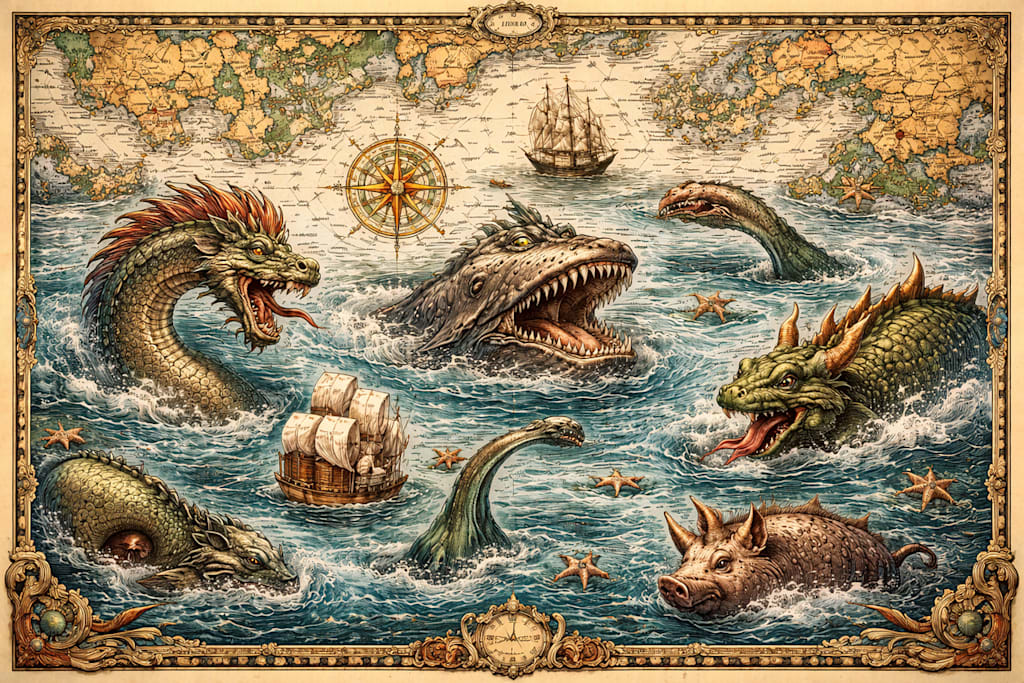
Old maps are striking not only for their coastlines and elegant lettering. They also show whales with dragon teeth, serpents with almost human faces, horned beasts, and ships sailing beside enormous jaws. To a modern viewer, this seems strange: a map is supposed to explain the world, not frighten people with fables. But for people in the fifteenth, sixteenth, and seventeenth centuries, there was no contradiction here. A map was not just a navigational tool. It also told a story about the world: what was already known, what should be feared, and where certainty came to an end. Sea monsters appeared there not because cartographers were naive, but as an honest sign that the sea was not yet fully understood and that it contained real dangers.
To understand why, it helps to remember what the sea represented at the time.
When the sea was a territory of the unknown
On land, the cartographer’s work was easier. There were cities, roads, monasteries, borders, and travelers’ reports. At sea, everything was different. Vast spaces remained poorly explored, the depths were barely understood, and sailors’ accounts easily slipped from observation into legend. If someone saw a whale, a walrus, a narwhal, or a large school of strange fish, the retelling quickly changed. One person added size, another added ferocity, a third added drama. After several retellings, the animal became a monster. And then that monster found its way into a chronicle, a book, or directly onto a map. That is why a sea monster on an old map is not always pure invention. Very often, it stood behind a real sighting, distorted by fear, distance, and imagination. A dragon might hide a whale, a horned creature might conceal a narwhal, and a giant serpent might come from something that had truly been seen but never fully understood.
On old maps, an image was rarely just decoration. It almost always conveyed something. A sea monster could mean dangerous waters, the bad reputation of a certain region, or a general warning: beyond this point begins a place where human beings should not feel too confident. Such creatures were especially common in areas that remained uncertain to Europeans for a long time: the northern seas, the waters around Iceland, and the Atlantic. These seas inspired fear even without fantasy — cold, storms, fog, and underwater rocks were enough. In other words, the monster on a map was not only a product of imagination, but also a sign of danger.
The map as a luxury object
There was another reason as well. In the sixteenth and seventeenth centuries, many maps were bought not by sailors, but by wealthy people for studies, libraries, and reception rooms. They wanted to see not just lines of coast, but something beautiful, rare, and impressive. Sea monsters made a map more expensive, more dramatic, and more memorable. It became not only a geographical document, but also a work of art. At the same time, real sailors usually used very different maps — plain and practical ones. Navigational charts, especially portolan charts, were utilitarian: they marked coasts, ports, shoals, and directions. Extra decoration was unnecessary there. A sailor needed accuracy, not fantasy. So the result is clear: monsters usually lived not on maps made for sailing, but on maps made for an educated public.
The most famous map with monsters
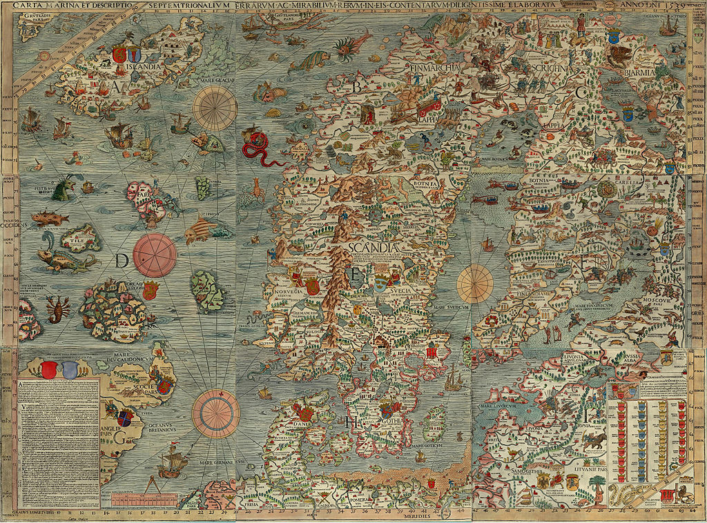
The most famous example is Carta Marina, created in 1539 by the Swedish churchman and cartographer Olaus Magnus. He worked on it in Rome from 1527 to 1539. It is one of the most famous maps of the northern seas, and it is especially full of monsters. But Olaus Magnus was not simply decorating the map with frightening creatures. He explained in detail what they were, and he seems to have believed in their existence himself. For him, they were part of the real world of the North — harsh, dangerous, and full of wonders. On his map, one can see:
• Leviathan — the enormous biblical monster. Magnus wrote that it reached about 100 meters in length. On the map, only its head rises from the water.
• The sea serpent off the coast of Bergen — according to Magnus, this creature was about 60 meters long and up to 6 meters thick. He believed that such monsters hid in underwater caves off the Norwegian coast.
• The deceptive whale — a legendary whale that sailors mistook for an island. According to the stories, people landed on it, lit fires, and then it dived, dragging them to the bottom.
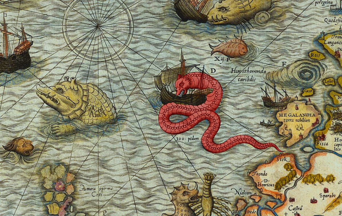
• The sea pig — a bizarre being that people claimed to have seen in the North Sea in 1537. In the image, it really does look like a pig that somehow ended up in the water.
• The ziphius — a sea monster that Magnus described as a dangerous predator feeding on seals.
For Olaus Magnus, the map was not only about geography. It was meant to show that the North was a place where nature was stronger than man, and where the sea was full of danger and mystery.
Ortelius and the monsters of Iceland
Another famous cartographer was Abraham Ortelius, the Dutch scholar who in 1570 created the first modern-style atlas, Theatrum Orbis Terrarum (“Theatre of the World”). His map of Iceland is also full of monsters.
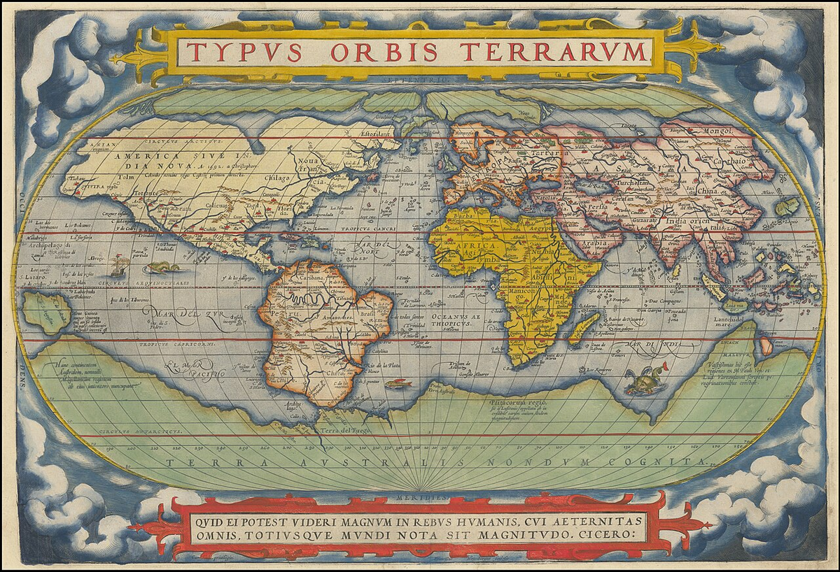
Many of them he borrowed from Olaus Magnus and from old Icelandic traditions. But something else matters even more: he clearly understood that such images attracted attention and made the map a desirable object. On Ortelius’s map, one can encounter all kinds of sea creatures: good and evil whales, strange beasts with tusks, and animals that look like a mixture of seal, walrus, and dragon. All of this made the map not just useful, but memorable. That is exactly why monsters survived so long on maps: they frightened, warned, and decorated at the same time.
Why people believed in sea monsters at all
To understand this, we need to remember that in the Middle Ages and the Renaissance, the boundary between science, observation, and legend was not as rigid as it is today. Since antiquity, there had been a popular idea going back to Pliny the Elder: that every land animal had its counterpart in the sea. If there was a lion on land, then there had to be a sea lion in the water. If there was a bull, then there must be a sea bull. If there was a horse, then there must also be a sea horse. Today this seems naive, but at the time such a scheme was taken quite seriously. The ocean seemed like a mirror of the land, only darker, less understandable, and more dangerous. That is why the appearance of sea pigs, sea dogs, sea lions, and other strange beings on maps did not look absurd. It was an attempt to fit the unknown into a familiar picture of the world.
Real fear stood behind the monsters
It is important to remember that people of the past truly feared the ocean, and with good reason. The sea meant storms, cold, fog, loss of course, underwater rocks, and death without a trace. It was immense, unpredictable, and far less controllable than land. When a cartographer drew a sea monster, he was expressing not only fantasy, but also a very real fear of the elements. For a person in the sixteenth century, a monster on a map was almost as understandable a warning as a sign for icebergs, reefs, or dangerous currents is for us today. It was the language of the age: where we are uncertain, we draw danger in visible form.
Why they still fascinate us
Sea monsters on old maps still make such a strong impression because they bring together several things at once: fear, curiosity, art, and the attempt to explain the world. They remind us that serious knowledge once spoke not only through numbers and lines, but also through images. Where we now place coordinates and depths, people of the past drew a monster. Not because they were less intelligent, but because the world for them truly remained less clear, less measured, and far more frightening. In that sense, the sea monsters on old maps are not a mistake of old science, but a very honest trace of a time when blank spaces on the map disturbed the imagination more than any unknown part of the world does today.
About the Creator
Enjoyed the story? Support the Creator.
Subscribe for free to receive all their stories in your feed.
Comments
There are no comments for this story
Be the first to respond and start the conversation.