
Echoes on the Ridges: Britain’s Best Hillfort Walks
Good walks for hilltops

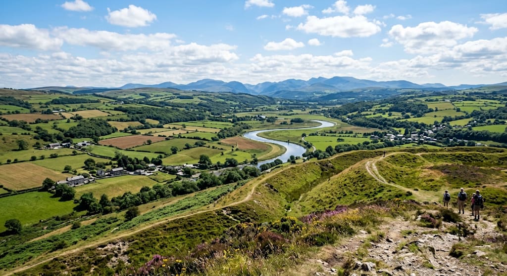
Long before castles dominated the skyline, Britain’s ancient inhabitants built monumental earthworks high on windswept ridges. These Iron Age hillforts were vibrant hubs of trade, community, and strategy, offering sweeping views across the surrounding country. Today, their massive ramparts, deep ditches, and atmospheric ruins provide some of the finest walking routes in Great Britain.
Whether you are looking for a gentle family stroll around grassy chalk banks or a challenging mountain scramble up ancient stone ruins, here is a detailed guide to twelve of Britain’s best hillfort walks—featuring highlights across England, Wales, and Scotland, what to look for on the horizon, how long each journey takes on average, and links to explore these sites further.
England
1. Maiden Castle, Dorset
One of the largest and most complex Iron Age earthworks in Europe, Maiden Castle covers an area equivalent to roughly fifty football pitches.
Average Walk Time: 1 to 1.5 hours (approx. 2 miles / 3.2 km).
The Walk: A gentle circular route takes you around the triple ramparts and deep grassy ditches. Walking along the massive chalk banks gives you an incredible sense of scale, leaving you marvelled at the sheer physical effort required to dig them out by hand thousands of years ago.
The Best Views: From the highest western ramparts, you get uninterrupted 360-degree views across the rolling green Dorset Downs, the historic rooftops of nearby Dorchester, and, on a crisp clear day, distant glints of the English Channel along the Jurassic Coast over Weymouth and Portland.
2. British Camp, Malvern Hills, Worcestershire
Perched atop Herefordshire Beacon, British Camp’s distinctive terraced earthworks give the Malvern Hills one of their most recognisable contours.
Average Walk Time: 1.5 to 2.5 hours (approx. 3 to 4.5 miles / 5 to 7 km depending on the loop).
The Walk: The climb from the Malvern Ridge path up to the central citadel delivers a short, energetic ascent over ancient terraces. You can extend the trek north or south along the ridge line to combine history with a proper hill-walk.
The Best Views: Being a narrow, elevated ridge, the summit offers panoramic vistas. To the east, you look down over the flat expanse of the Severn Valley towards the Cotswolds; to the west, you gaze across rolling Herefordshire countryside toward the black-tinged skyline of the Welsh Black Mountains and Hay Bluff.
3. Caer Caradoc, Shropshire
Standing proudly above the Stretton Valley, Caer Caradoc is a dramatic, rocky hillfort steeped in legend—often associated with the Celtic king Caratacus's last stand against the Romans.
Average Walk Time: 2 to 3 hours (approx. 3.5 to 4.5 miles / 5.5 to 7 km).
The Walk: A steep, exhilarating climb leads up from Church Stretton or All Stretton, tackling grassy slopes and craggy outcrops before reaching the summit ramparts.
The Best Views: The high ridge gives spectacular, soaring vistas down the Stretton Valley, looking directly across to the Long Mynd, the Wrekin to the northeast, and out towards the distant Welsh mountains.
4. Cissbury Ring, West Sussex
Situated in the South Downs National Park, Cissbury Ring is the second-largest hillfort in England. Beyond its Iron Age earthworks, it conceals Neolithic flint mines beneath its turf.
Average Walk Time: 1.5 to 2 hours (approx. 3.5 miles / 5.5 km).
The Walk: A steady, gradual climb along the crest of the South Downs leads you into the fort's vast, hollow interior, where wild ponies often graze among the chalk grassland wildflowers.
The Best Views: On a crisp day, the elevated ramparts afford magnificent coastal views stretching from the Isle of Wight in the west past Brighton and towards Beachy Head in the east, framed by endless green chalk downland.
5. Yeavering Bell, Northumberland
Tucked into the northern edge of the Cheviot Hills, Yeavering Bell (the "Hill of the Goats") features an impressive collapsed stone wall enclosing twin summits.
Average Walk Time: 2.5 to 3.5 hours (approx. 4.5 miles / 7.2 km).
The Walk: A scenic trek through heather-clad moorland and open pastures in the Glen Valley brings you up to a high plateau littered with the sunken stone footings of dozens of ancient roundhouses.
The Best Views: You are treated to wild, dramatic scenes across the Cheviot range, looking out over the Scottish Border region and down into the Glendale valley, where Anglo-Saxon kings once held court.
Wales
6. Tre’r Ceiri, Llŷn Peninsula
Perched high on one of the granite peaks of Yr Eifl, Tre’r Ceiri ("Town of the Giants") is widely regarded as one of the best-preserved Iron Age stone forts in North-Western Europe.
Average Walk Time: 2.5 to 4 hours (approx. 4 miles / 6.5 km).
The Walk: The path up the rugged, boulder-strewn hillside demands sturdy boots and a steady stride. Upon reaching the top, you find stone ramparts standing over three metres high and can wander through the maze-like remains of over 100 roundhouse foundations.
The Best Views: The coastal views here are breathtaking. You get a direct sightline over the turquoise waters of Caernarvon Bay, the entire sweep of the Llŷn Peninsula, and across the Menai Strait to the island of Anglesey.
7. Foel Fenlli, Clwydian Range
Standing at the southern end of the Clwydian Range, Foel Fenlli is a heather-capped hillfort with deep defensive ditches and a rich archaeological history.
Average Walk Time: 1.5 to 2.5 hours (approx. 2.5 to 3.5 miles / 4 to 5.5 km).
The Walk: Starting from the top of the Bwlch Penbarras pass, a steep heathland trail leads up to the ancient ramparts, weaving around deep ditches and grassy banks.
The Best Views: The summit provides stunning views taking in the Vale of Clwyd, Moel Famau to the north, and vast expanses across Denbighshire toward the mountains of Snowdonia (Eryri).
8. Moel Famau & Penycloddiau, Clwydian Range
The Clwydian Range boasts an extraordinary chain of hillforts linked together by the famous Offa’s Dyke Path, featured on the Heather and Hillforts project.
Average Walk Time: 3 to 4.5 hours for a dedicated circuit around Penycloddiau (approx. 6 to 7.5 miles / 10 to 12 km).
The Walk: Penycloddiau is one of the largest hillforts in Wales. Following the high heather ridge route provides continuous undulating walking along well-maintained trails with significant history underfoot.
The Best Views: Standing on the northern ramparts gives you dual landscapes: to the west, the lush Vale of Clwyd backed by the peaks of Snowdonia (Eryri); to the east, the flat, patchwork landscape of the Cheshire Plain.
9. Castell Dinas Brân, Llangollen
Rising dramatically on a conical hill above the Dee Valley, Castell Dinas Brân sits within the earthen banks of an earlier Iron Age fort, crowned by the evocative ruins of a 13th-century stone castle.
Average Walk Time: 1 to 1.5 hours (approx. 2 miles / 3.2 km).
The Walk: The zigzag path leading up from the historic canal town of Llangollen is short but very steep, giving your legs a workout before bringing you directly onto the summit plateau.
The Best Views: The high point commands iconic views over the dramatic limestone escarpment of Eglwyseg Mountain, the winding River Dee below, and the historic Thomas Telford aqueduct in the distance.
Scotland
10. Eildon Hill North, Scottish Borders
Dominating the skyline near Melrose, the three volcanic peaks of the Eildon Hills have drawn people for millennia. Eildon Hill North was once the vast regional capital of the Selgovae tribe.
Average Walk Time: 3 to 4 hours if completing all three peaks, or 2 hours for just the North Hill (approx. 3 to 6 miles / 5 to 9.5 km).
The Walk: Starting from Melrose Abbey, the path climbs up through shaded woodland before breaking out onto open heathland. Near the top of the northern hill, you can still trace the platforms cut into the hillside where over 300 timber roundhouses once stood.
The Best Views: You get unmatched vantage points over the winding River Tweed, the town of Melrose, and a panoramic sweep of the Scottish Borders reaching all the way to the Cheviot Hills on the English border.
11. Traprain Law, East Lothian
Rising sharply from the flat agricultural plains of East Lothian, Traprain Law is a striking volcanic crag that served as a major power centre for the Votadini tribe—and famously yielded a massive buried hoard of late Roman silver.
Average Walk Time: 1 to 1.5 hours (approx. 2.5 miles / 4 km).
The Walk: A short, crisp circuit leads up the rocky flanks to the grassy summit ridge. It’s an ideal walk for spotting native Exmoor ponies that graze the hill to manage the habitat.
The Best Views: The summit offers sweeping sea views out across the Firth of Forth, taking in the distinct volcanic island of Bass Rock, North Berwick Law, and miles of fertile East Lothian farmland.
12. Dun da Laimh, Laggan, Scottish Highlands
Located deep in the Highlands near Laggan, Dun da Laimh is a spectacularly situated fort built on a rocky spur high above Speyside.
Average Walk Time: 2 to 3 hours (approx. 4.5 miles / 7.2 km).
The Walk: The approach takes you through quiet forestry trails before breaking out onto a dramatic rocky ridge, where the fort’s massive drystone ramparts—some built up to four metres thick—remain astonishingly intact.
The Best Views: Surrounded by wild, rugged mountain scenery, the view looks down over the confluence of the River Spey and the River Mashie, offering a classic Highland landscape of forest, river, and open glen without the big crowds.
Further Reading & Resources
If you want to dive deeper into British hillforts, explore research directories, or find nearby sites across the UK, check out these excellent external resources:
Hillforts.co.uk: A passionate independent site packed with information, site guides, and an extensive directory of hillfort links across Britain and Ireland.
Atlas of Hillforts of Britain and Ireland: A comprehensive research project mapping over 4,000 hillfort locations across the UK and Ireland.
Clwydian Range & Dee Valley Hillforts: Details on the extraordinary chain of hillforts across North Wales.
Practical Tips for Hillfort Walks
Protect the Heritage: These earthworks and stone walls are protected ancient monuments. Always stick to established paths to avoid eroding delicate banks, ditches, and stone foundations.
Be Prepared for the Elements: Because hillforts were intentionally built in high, exposed locations to spot incoming threats, their summits are almost always windier and cooler than the valley floor. Pack a windproof layer, warm gear, and sturdy, waterproof footwear.
Bring Ordnance Survey Mapping: A detailed OS map (1:25,000 scale) makes a huge difference. It allows you to identify subtle archaeological features—such as ancient gateways, defensive ditches, and hut circles—that might otherwise just look like ordinary bumps in the grass.
About the Creator
Lewis Smith
The Paradigm Glitch Hunter. Account aim is investigative insights into current popular & academic theories, using immersive systemising, to do 1st principles, & nuance pinpointing, structural deconstruction & reconstruction. & fun stories.
Enjoyed the story? Support the Creator.
Subscribe for free to receive all their stories in your feed.
Comments
There are no comments for this story
Be the first to respond and start the conversation.