
Generating accurate floor plans from 3D scans (Pointclouds)
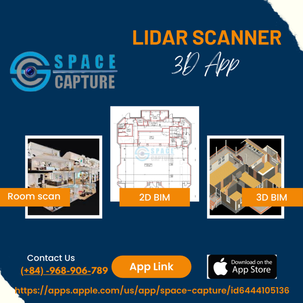
Space Capture

In the era of digital advancements, technology has completely transformed our perception and interaction with the world around us. From smartphones to advanced scanning devices, innovations have made complex tasks more straightforward and accessible. One such advancement is the ability to generate accurate floor plans from 3D scans. With the advent of the 3D scanner iPhone and LiDAR scanner 3D app, creating precise floor plans has become easier.
In this blog, you will get to explore how these technologies have transformed the process of capturing and converting physical spaces into accurate digital representations.
The Rise of 3D Scanner iPhone Apps
Gone are the days when expensive and bulky equipment was required to create 3D scans of spaces. Thanks to the advent of the 3D scanner iPhone app, people now have the ability to capture intricate 3D models of their environment using a compatible device. Leveraging the advanced camera features and computational prowess of iPhones, these applications can obtain depth information and produce precise 3D representations. Offering convenience and portability, these apps have become a popular option for capturing floor plans while on the move.
LiDAR Scanner 3D Apps: A New Dimension of Accuracy
The incorporation of LiDAR technology in the latest iPhone models has significantly elevated the level of precision and accuracy in 3D scanning. With LiDAR, an acronym for Light Detection and Ranging, laser beams are employed to measure distances and generate intricate depth maps.
This advanced technology ensures that the resulting 3D scans are highly detailed and accurate. A LiDAR scanner 3D app leverages this technology to capture highly accurate measurements of spaces, resulting in more precise floor plans. The ability to capture fine details and intricate measurements makes LiDAR scanner 3D apps invaluable for architects, interior designers, and surveyor.
Capturing the Space: Point Clouds
To initiate the capture of space, one can utilize either a 3D scanner iPhone app or a LiDAR scanner 3D app. The process involves maneuvering the device throughout the desired area. While the app scans the surroundings, it gathers data points that compose a point cloud. This point cloud consists of millions of individual points arranged within a three-dimensional coordinate system. Each point represents a specific location in the space and contains information about its position and depth.
Converting Point Clouds to Accurate Floor Plans
Once the point cloud is captured, the next step is to convert it into an accurate floor plan. Advanced software applications, often provided alongside scanning apps to process the point cloud data and generate precise floor plans. The result is a detailed and accurate digital representation of the floor plan.
Benefits and Applications
Generating accurate floor plans from 3D scans offers numerous benefits and applications across various industries. Architects and interior designers can use these digital representations to visualize design concepts, plan layouts, and assess spatial relationships.
Facilities management teams can utilize these floor plans to streamline maintenance, space utilization, and renovations. The accuracy and precision of these digital floor plans empower professionals to make informed decisions, saving time, effort, and resources.
The utilization of 3D scanner iPhone apps and LiDAR technology streamlines the process of capturing floor plans, saving time and reducing costs. Traditional methods of manually measuring spaces are labor-intensive and prone to human error. With the aid of these innovative tools, measurements can be captured quickly and accurately, leading to increased efficiency in various industries.
Final Words
The era of 3D scanning has opened up new possibilities for generating accurate floor plans. With the aid of 3D scanner iPhone apps and the integration of LiDAR technology, capturing detailed and precise scans has become more accessible and efficient. Whether you are in engineering, architecture, or interior design industry, these tools empower you to showcase spaces and make informed decisions. Embrace the power of 3D scanning and unlock a world of endless possibilities in creating accurate floor plans.
By harnessing the capabilities of the 3D scanner iPhone app and LiDAR technology, the process of generating accurate floor plans has been revolutionized, making it more convenient, precise, and accessible than ever before.
About the Creator
Space Capture
Space capture application offers tools to capture and 3D scans of spaces, rooms with your LiDAR (iPad and/or iPhone). And then, the data will be converted into 2D plans and 3D BIM models.
Enjoyed the story? Support the Creator.
Subscribe for free to receive all their stories in your feed. You could also pledge your support or give them a one-off tip, letting them know you appreciate their work.
Keep reading
More stories from writers in 01 and other communities.
The Art of Work: Valuing Time in the Age of AI
Artificial intelligence isn't going away. You might be excited about that. You might be anxious. Whatever you're feeling, though, AI has become a permanent fixture in our society. As long as there's profit to be made, advancements in AI will shape the next wave of technology.
By Addison Horner10 days ago in 01
Investing in EV Charging Infrastructure: Key Business Models to Consider
Introduction With the rapid growth of the electric vehicle (EV) market, the demand for a robust EV charging infrastructure has surged, creating lucrative opportunities for investors and businesses alike. As governments worldwide enact policies to encourage EV adoption and consumers increasingly lean towards sustainable transportation options, investing in EV charging infrastructure has become not just prudent but essential. This blog explores several EV business models that investors can adopt to tap into this expanding market, ensuring both economic gains and environmental benefits. Whether you’re an established player in the energy sector or a new entrant considering diversification, understanding these EV business models will help align your investments with the ongoing green revolution in transportation.
By Glasier Inc.4 days ago in 01


Comments
There are no comments for this story
Be the first to respond and start the conversation.