
The Knot in Asia and the Mountain in the Text
The Pamir is where five mountain ranges meet. Kunlun is a name Chinese writers built from rivers, old books, and a question Sima Qian refused to answer.
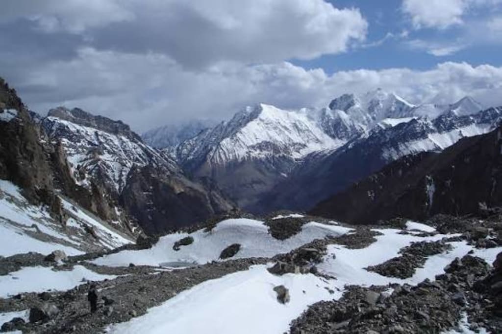
Heading west from Zhengzhou, past Luoyang and Sanmenxia, the terrain begins to rise. Further west, the Qinling stands across the way, its ridges above 2,000 meters stretching for more than 400 kilometers. West of the Qinling lies the Longshan; west of the Longshan, the Qilian; and west of the Qilian, the northern foothills of the Kunlun Mountains at the edge of the Tarim Basin. The elevation profile along this route does not rise evenly. It has a steep step at the Qinling and another at the Qilian. By the Pamir Plateau, average elevation shoots above 4,000 meters.
The ancients had no altimeters, but they had eyes. On the North China Plain the Yellow River flows slowly and carries a heavy sediment load; near Tongguan it suddenly narrows and quickens, because ahead lies the boundary between the Qinling and the Loess Plateau. A river coming from the west grows in force; its source must lie higher. The reasoning is not complicated: small mountains give small rivers, great mountains give great rivers. The Yellow River was the greatest river they knew, so its source should have a great mountain.
No one had seen this mountain. It was placed to the northwest, beyond the reach of Huaxia power, where the Yellow River rises. The ancients gave it a name: Kunlun.
I
The Pamir Plateau lies in southwestern Xinjiang, where Tajikistan, Afghanistan, Pakistan, and China meet. The Tianshan stretches in from the north, the Kunlun from the east, the Karakoram from the southeast, the Hindu Kush from the west, and the Himalaya from the south. Five world-class mountain ranges meet and twist together in this area. Kongur Tagh rises more than 7,700 meters; Muztagh Ata more than 7,500. Between the two mountains runs the Kangxiwar River. The Panj cuts down through the plateau, and the Wakhan Corridor extends toward China like a long, narrow finger.
Geology calls this the “Pamir tectonic knot.” The Indian plate has been colliding northward with the Eurasian plate for more than fifty million years, and this pile of mountains is the result. There is more than one mountain knot in the world. There is another in northwestern Iran, where several ranges meet on the Armenian Highlands, but it is much smaller and the ranges involved are of a lower order. The Pamir gathers ranges of the Tianshan, Kunlun, Karakoram, and Himalaya class. To call it rare is to state a geological fact.
But when the ancients named Kunlun, they did not know the Pamir. They had not even traversed the Tarim Basin.
II
The word “Kunlun” was written 昆侖 in the Han dynasty. Its Old Chinese pronunciation is reconstructed as *kˤun-rˤun. The two syllables share the same rhyme but have different initials, making it a typical rhyming disyllabic bound word. Linguists have argued that it derives from the single-syllable root 昆 (kun) through progressive reduplication. In Old Chinese, 昆 had the sense of “great”: 鲲 (kun) is a great fish; the Zhuangzi, “Xiaoyao You,” says, “The greatness of the kun, who knows how many thousand li it is”; 鶤 (kun) is a great bird, mentioned in the Huainanzi, “Lanming”; 睔 (guan) means large-eyed; the Shuowen, “Mu Radical,” says directly, “睔, large-eyed”; and 昆 means elder brother; the Book of Songs, “Ge Lei,” Mao commentary says, “昆, elder brother.”
The Erya, “Shiqiu” (“Explaining Mounds”), classifies mounds by tiers: “One tier makes a dun mound; two tiers make a tao mound; two tiers with a pointed top make a rong mound; three tiers make a Kunlun mound.” A mound of three tiers was called a Kunlun mound. Here “Kunlun” was not yet a proper name; it was an adjective describing a tall, tiered mound. Only later did it become the name of a specific great mountain.
Another school holds that “Kunlun” derives from hunlun or hunlun, meaning “undifferentiated, chaotic.” The two views differ in emphasis, but both point to the same conclusion: the word grew from within Chinese and is not a transcription of Sumerian, Akkadian, or Tibetan. Su Xuelin compared Kunlun to the Sumerian Khursag Kurkura; Ling Chunsheng to the Akkadian ziggurat; Cheng Faren explained it with Tibetan kara (“black”); Lin Meicun compared it to Tocharian klyom (“sacred”). These comparisons share a common problem: they establish no clear rules of phonological correspondence. Some arbitrarily divide syllables; some invoke “a mere sound shift”; some compare modern Cantonese directly with Sumerian. By the standards of historical comparative linguistics, these amount only to sound comparisons by resemblance.
The original meaning of “Kunlun” is “great.” Kunlun Mountain means “great mountain.” When the Han Chinese named the imagined great mountain at the source of the Yellow River, they used a word from their own language meaning “great.”
III
This reasoning, “the source of a great river must have a great mountain,” was not unique to the Chinese.
Aristotle writes in the Meteorology that the greatest rivers come from the greatest mountains. Observing that the Dnieper and the Don flow from north to south into the Black Sea, he inferred that beyond the far north of Scythia stood the Rhipaean Mountains. Today we know that those rivers rise in the Valdai Hills, whose highest point is less than 350 meters.
The Indian Puranas say that at the center of the earth stands Mount Meru; the Ganges falls from heaven onto its summit and divides into four great rivers flowing in four directions. Seeing the Indus flow southwest and the Ganges southeast, Indians inferred that Mount Meru lay beyond the snow mountains north of India. That location roughly corresponds to the two mountain knots of Mount Kailash and the Pamir, where the sources of the Ganges and the Indus are distributed.
Genesis says that a river flows out of Eden and divides into four branches, two of which are the Tigris and the Euphrates. Seeing both rivers flow from north to southeast, the people of Mesopotamia inferred that the “holy mountain of God” lay in the northern highlands upstream of the two rivers. That location is the Armenian Highlands, where both rivers have their sources.
Kunlun, the Rhipaean Mountains, Mount Meru, and the holy mountain of Eden are products of the same reasoning in different geographical experiences. A great river comes from afar; its source must have a great mountain. No one has seen this mountain, so it can be magnified without limit.
IV
In the fourth year of the Yuanshou era, Zhang Qian returned from his second mission to the Western Regions and reported on Khotan. In the southern mountains of Khotan there was a river, and the river held much jade. Emperor Wu consulted ancient maps and documents and named the southern mountains of Khotan Kunlun. The Records of the Grand Historian, “Dayuan Liezhuan,” states it clearly: “And when the Han envoys exhausted the source of the Yellow River, the source came from Yutian; its mountains have much jade, which they collected and brought back. The Son of Heaven consulted ancient maps and documents and named the mountain from which the river issues Kunlun.”
In the same chapter, Sima Qian raised a doubt: “Now, after Zhang Qian’s mission to Daxia, they exhausted the source of the Yellow River. Where did they see the Kunlun spoken of in the Basic Annals?” The Basic Annals of Yu says Kunlun is “more than 2,500 li high, where the sun and moon hide from each other and thereby give light.” The Han envoys reached the river source but did not see such a mountain. Sima Qian’s point was that the southern mountains of Khotan did not match the Kunlun described in the ancient texts.
But the idea that “the Yellow River issues from Kunlun” was too deeply rooted. Emperor Wu’s naming was a textual annexation: the ancient texts said the river issued from Kunlun; Khotan had a river source and jade; so Kunlun was placed there. Thereafter, each time the Central Plains dynasty pushed further northwest, Kunlun was retroactively identified with whatever new river source was discovered. The Book of Han, “Treatise on Geography,” records Kunlun outside the frontier at Linqiang County in Jincheng Commandery, around present-day Qinghai Lake, where the Huangshui rises and where a shrine to Mount Kunlun was established. In the Yuan dynasty, Dushi was sent to investigate the river source, reached the Xingxiu Sea, and retroactively identified Amne Machin as Kunlun. During the Kangxi reign of the Qing, another expedition explored the river source and included the Bayan Har Mountains within the Kunlun range.
Kunlun’s location kept moving, but the name did not. Because “Kunlun” no longer needed to be found; it had become a cultural coordinate.
V
What elevated Kunlun to the position of “ancestor of all mountains” was geomancy. Fengshui masters divided China’s mountain ranges into three great dragon veins: the northern trunk running north of the Yellow River, the central trunk between the Yellow River and the Yangtze, and the southern trunk south of the Yangtze. All three trunks originate in Kunlun. Kunlun is the total source of the dragon veins, the “ancestor of all mountains.”
This doctrine gradually took shape after the Song dynasty and by the Ming and Qing had become a basic framework of fengshui. It piled observations of mountain trends, imaginings about dynastic fortune, and awe of the northwestern highlands onto the name Kunlun. Kunlun changed from the imagined great mountain of the Basic Annals of Yu, “more than 2,500 li high,” into the “mountain of the river source” in Han and Tang geographical works, and then into the “ancestor of the dragon veins” in the fengshui system. It became ever more sacred and ever more detached from geography on the ground.
The Classic of Waterways says Kunlun is the “center of the earth”; the Classic of Mountains and Seas says it is the “lower capital of the Emperor.” None of these descriptions can be verified on the ground, but they agree with one another and constitute a self-consistent textual world. In this world, Kunlun does not need to be found; it only needs to be believed.
VI
On the Pamir Plateau there is a pass called Khunjerab, more than 4,700 meters above sea level, closed by heavy snow from October to April. The Panj flows west through the Wakhan Corridor, and in places the river is only a dozen or so meters wide. The terminus of the Muztagh Ata glacier lies at about 4,200 meters; the meltwater flows into Karakul Lake, and the lake water flows down and eventually enters the Tarim River.
These are geographical facts. The Pamir is a knot where several super-ranges of Asia converge; its scale is rare, and to call it the “ancestor of all mountains” in a geographical sense has geological support.
But when Emperor Wu named Kunlun, he did not know the Pamir. He consulted ancient maps and documents, looked at the southern mountains of Khotan, and thought of the source of the Yellow River. When Sima Qian said, “Where did they see the Kunlun spoken of in the Basic Annals?”, what he doubted was the mismatch between text and ground, not the existence of the Pamir.
The Pamir was later called Congling. The Great Tang Records on the Western Regions says: “Congling lies in the middle of Jambudvipa, adjoining the snow mountains to the south and reaching the Hot Sea to the north.” Xuanzang passed through here. But Xuanzang did not equate Congling with Kunlun. To call the Pamir “Kunlun” is for later ages to backfill a cultural symbol with geographical knowledge.
Retrospective identification has meaning: it shows us that the ancients’ direction of reasoning was roughly right. There is a great mountain knot in the northwest, and great rivers come from the highlands. But retrospective identification is not origin. Kunlun’s starting point was not the Pamir; it was the people on the North China Plain who looked west at the Yellow River and imagined.
A mountain is a mountain. The Pamir is a geological knot; Kunlun is a textual knot. That the two knots were tied together is a later affair.
The last character of Sima Qian’s sentence is hu 乎. He wrote a question, not an exclamation.
About the Creator
Jin
Writer of reamstories
https://reamstories.com/jin
Enjoyed the story? Support the Creator.
Subscribe for free to receive all their stories in your feed. You could also become a paid subscriber, letting them know you appreciate their work.
Comments
There are no comments for this story
Be the first to respond and start the conversation.