
Integrating Landscape Character, Informal Recreation, and Environmental Stewardship
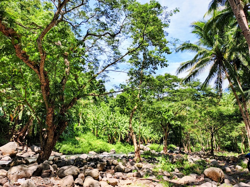
A Photographic Case Study of a Coconut-Lined River Corridor in Jasaan, Misamis Oriental

Abstract
This article presents a bounded, photographic field study of a coconut-lined river landscape in Jasaan, Misamis Oriental, visited by the author and fellow consultants on 18 October 2026. Using direct observation and nine photographs, the study examines visible landscape character, informal recreational use, and practical stewardship needs. The images show a clear rural waterscape formed by mature coconut palms, dense riparian vegetation, exposed stones, shallow river sections, and human access points. These features create strong scenic and recreational value, but the visit did not include water-quality testing, biodiversity sampling, land-tenure verification, hazard assessment, or interviews with residents. Accordingly, the article does not claim ecological condition, legal swimming suitability, or formal tourism status. It argues instead that the site’s value lies in the interaction of agriculture, flowing water, vegetation, and low-intensity human use. Any future promotion should therefore begin with locally led assessment, visitor-safety controls, waste prevention, respect for land ownership, and protection of river corridors. The study demonstrates how careful visual documentation can provide an initial evidence base for place interpretation while clearly separating observation from claims requiring technical verification.
Keywords: Jasaan; Misamis Oriental; coconut landscape; river corridor; rural tourism; photographic observation; environmental stewardship
Research scope. This is an exploratory visual case study, not an ecological survey, water-safety certification, or tourism feasibility study.
1. Introduction
Not every meaningful landscape announces itself through formal gates, mapped trails, or established tourism infrastructure. Some places become memorable through a quieter convergence of ordinary elements: cultivated trees, moving water, shade, stone, and a brief pause in the rhythm of travel. The coconut-and-river landscape encountered in Jasaan, Misamis Oriental, offered such a setting during a stop made by the author and fellow consultants on 18 October 2026.
The purpose of this article is to transform that brief visit into a disciplined account. Rather than treating the photographs as proof of conditions that were not measured, the study uses them as records of visible features at a particular moment. It asks three questions: What landscape characteristics are evident? How does the setting support low-intensity recreation and place appreciation? What safeguards should precede any wider promotion or future site development?
These questions matter because nature-based visitation can create appreciation and local value while also introducing pressure on waterways, vegetation, access routes, and surrounding communities. UN Tourism frames nature-positive tourism around biodiversity safeguards, pollution reduction, responsible resource use, and restoration. Its rural-tourism guidance likewise emphasizes community participation, environmental responsibility, and visitor management. These principles provide a suitable interpretive frame for a small, visually appealing rural site whose formal status has not been established.
2. Study Area and Context
The documented site is described by the author as a coconut-and-river landscape in Jasaan, Misamis Oriental. The available material does not provide geographic coordinates, a barangay name, land-ownership information, a formal attraction name, or an official management designation. For that reason, this article deliberately avoids assigning boundaries or presenting the site as an established public destination. Jasaan is known more broadly for nature-oriented places, including waterfalls, islands, beaches, and spring resorts, but those references establish municipal tourism context only; they do not identify the photographed location.
3. Methodology
The study employed a qualitative, site-based visual observation method. The primary dataset consisted of nine photographs taken during the 18 October 2026 visit and the author’s written account that colleagues stopped at the landscape and observed a river used for swimming. Each photograph was reviewed for recurring physical features, including vegetation structure, water visibility, riverbed material, shade, access, and evidence of human presence.
Analysis followed three stages: (1) descriptive inventory of visible elements; (2) thematic grouping into landscape character, recreation, and stewardship; and (3) comparison with selected guidance on sustainable rural tourism, coconut-based landscapes, and river-corridor protection. No image was used to infer water quality, water depth, biodiversity status, legal ownership, or year-round conditions.
The method is intentionally modest. Photographs capture selected viewpoints and one visit only. Seasonal variation, rainfall, upstream activity, river flow, sanitation, and visitor volume were not measured. The findings should therefore guide questions for further assessment rather than substitute for technical studies.
4. Photographic Results
4.1 Landscape Character
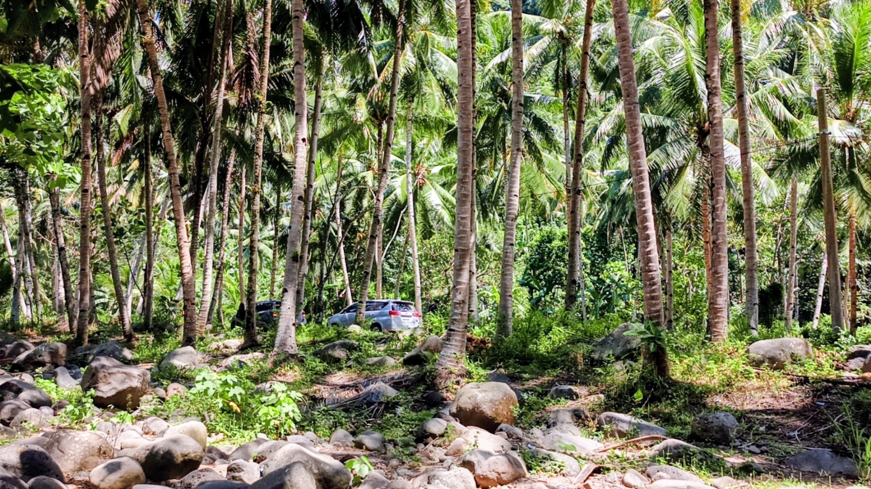
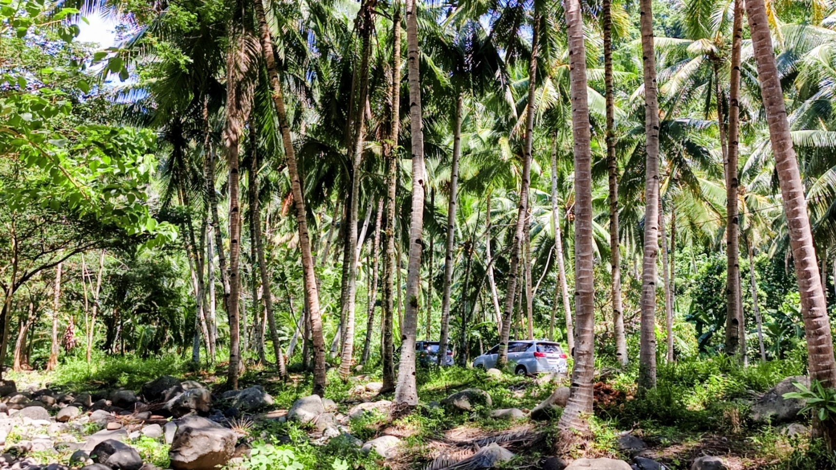
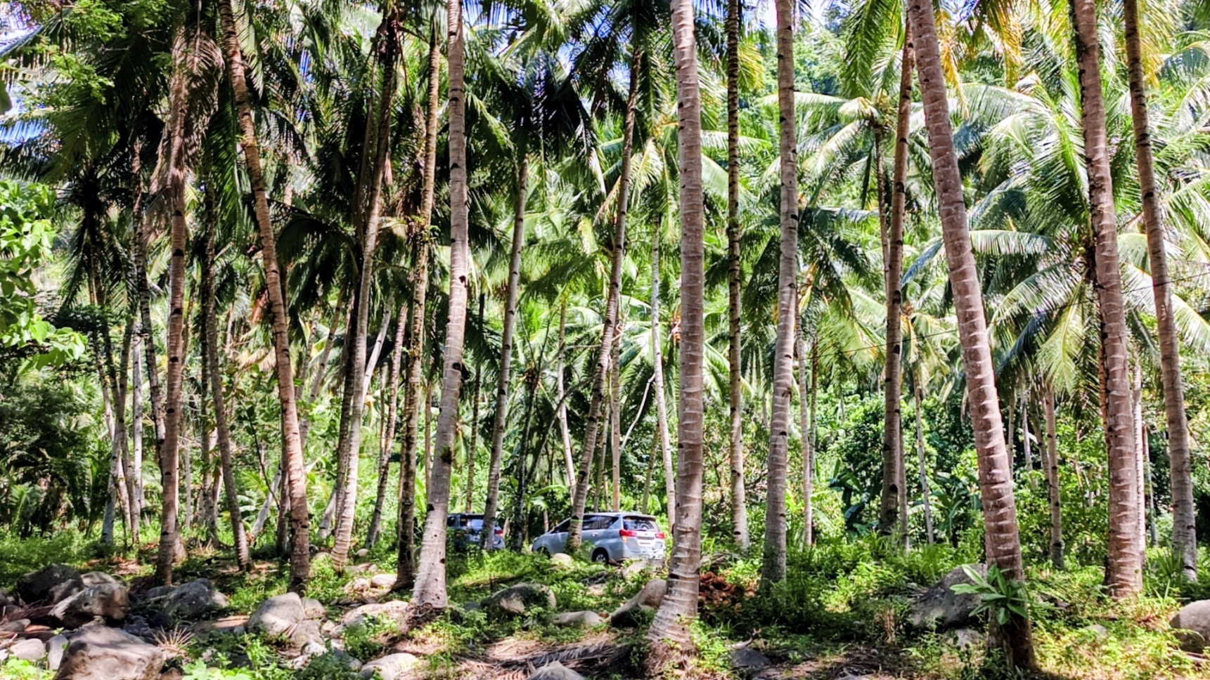
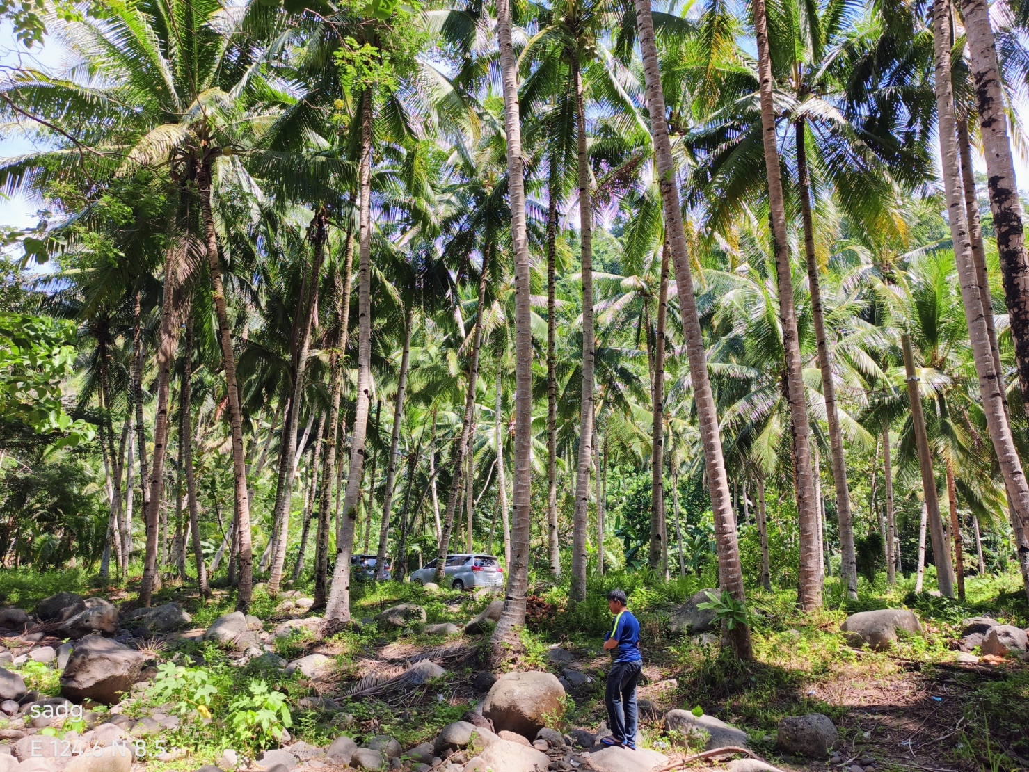
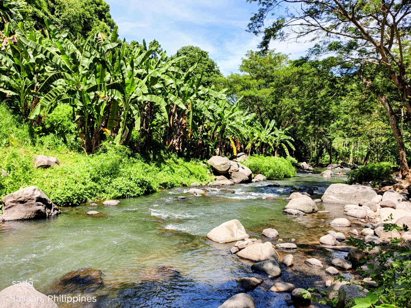
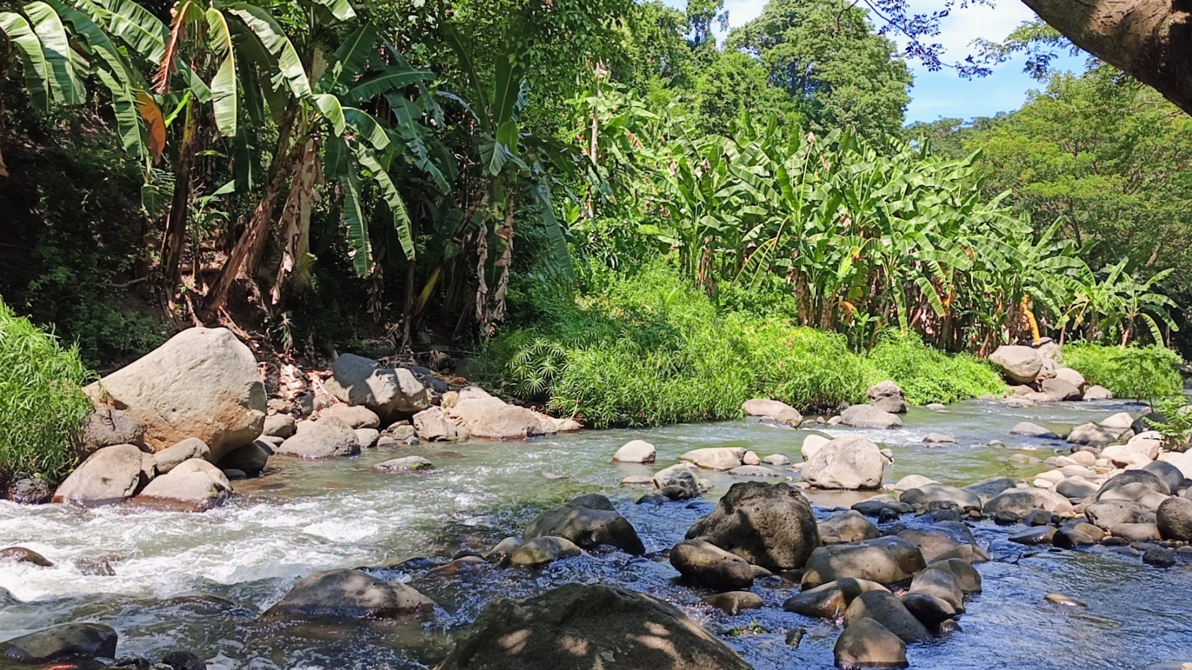
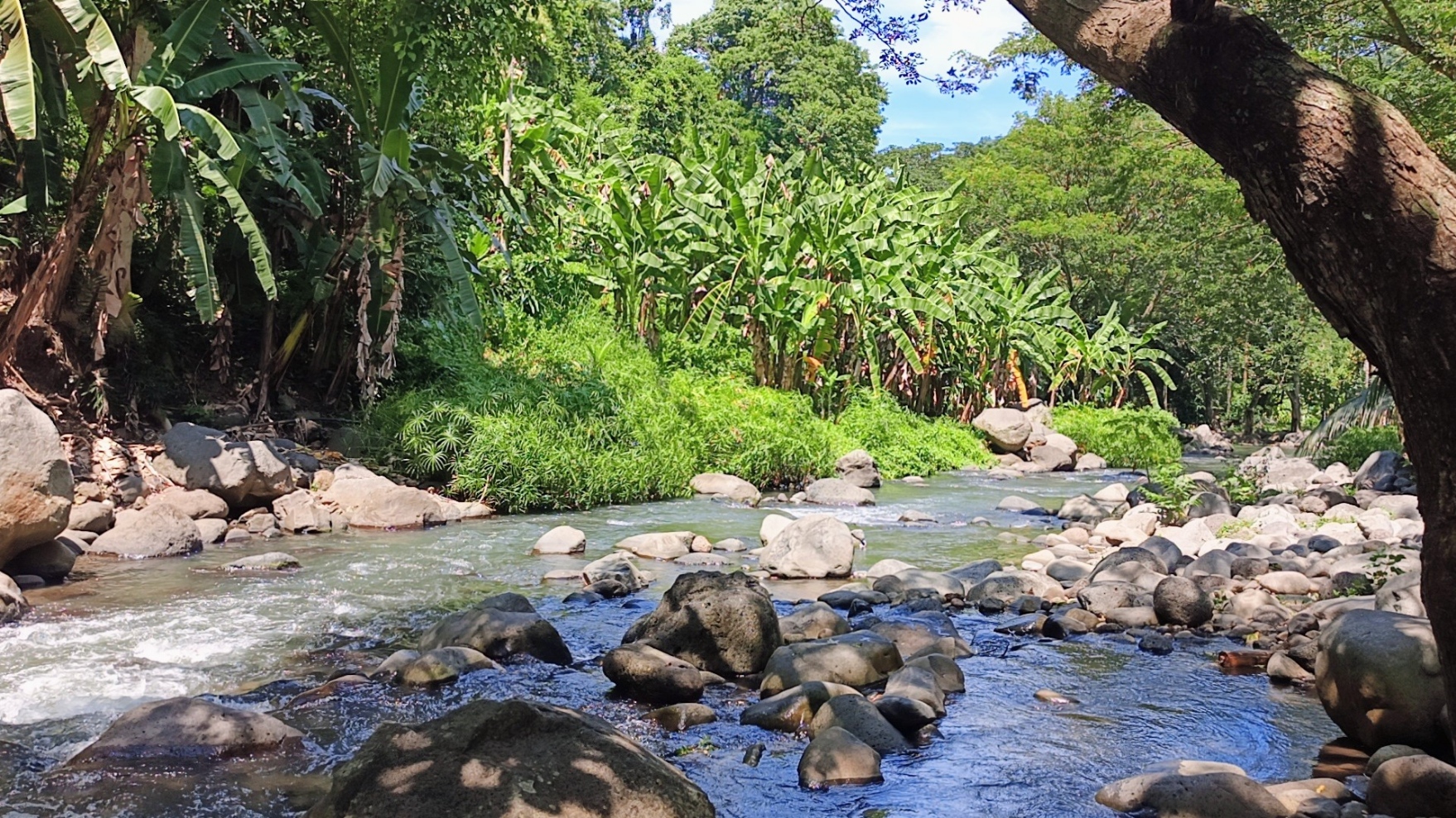
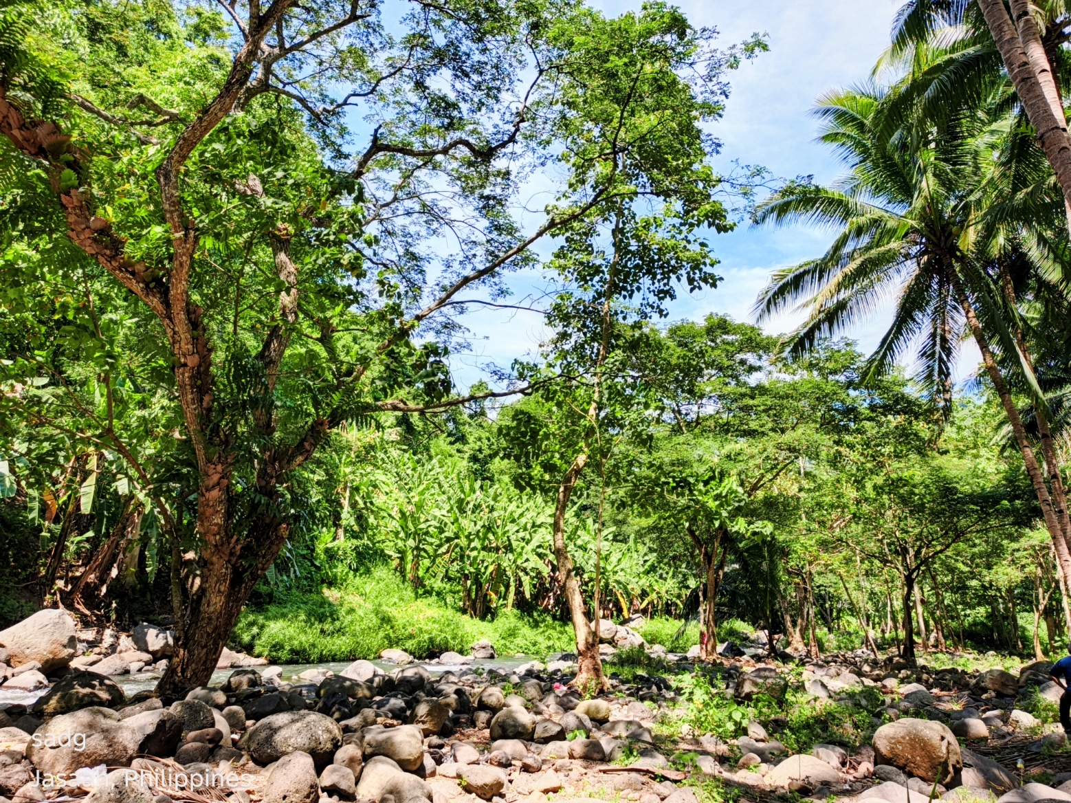
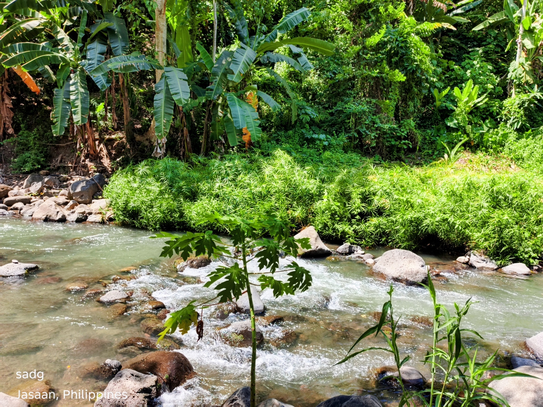
Across the image set, the most consistent visual pattern is the close relationship between mature coconut palms and the river corridor. Tall, slender trunks create vertical rhythm above a lower layer of shrubs, grasses, and bank vegetation. The watercourse introduces contrast through reflective surfaces, exposed stones, and changes in channel width. Together, these elements form a recognizable rural landscape rather than a single isolated attraction.
4.2 Water and Access
Several photographs show shallow-looking segments, visible stones, and bank areas from which visitors can approach the water. These visual cues may explain the site’s appeal for informal stopping and recreation. However, apparent shallowness in a photograph cannot confirm safe depth, current speed, cleanliness, or conditions after rainfall. Access should therefore be interpreted as visible rather than formally assessed.
4.3 Human Presence and Scale
A person visible in one photograph provides a useful sense of scale within the coconut grove. The setting appears relatively undeveloped in the photographed frames, with no clearly visible built visitor facilities, formal signage, barriers, or designated paths. This low-intensity character contributes to the site’s visual appeal, but it also means that visitor behavior, emergency access, waste handling, and property permissions would require attention before active promotion.
5. Review of Related Literature and Policy
5.1 Nature-Positive Rural Tourism
UN Tourism’s nature-positive framework calls for tourism to protect and restore nature, reduce pollution, integrate biodiversity safeguards, and avoid unsustainable resource use. Related rural-tourism discussions emphasize community ownership, traditional knowledge, environmental responsibility, and visitor management. Applied to the Jasaan landscape, these principles suggest that scenic appreciation should not begin with marketing alone. It should begin with community consent, site rules, baseline environmental information, and limits appropriate to local conditions.
5.2 Coconut-Based Landscapes
The Food and Agriculture Organization identifies coconut as one of the Philippines’ most important crops and has supported climate-resilient coconut-based farming systems with the Philippine Coconut Authority. This national context helps explain why coconut landscapes are both productive and culturally familiar. The photographed palms should therefore be understood not merely as scenery, but as part of a working land-use pattern whose owners, farmers, and maintenance practices must be respected in any tourism discussion.
5.3 River-Corridor Stewardship
DENR Administrative Order No. 2021-07 provides guidelines for legal easements along rivers, lakes, creeks, esteros, seas, and other wetlands, with public-use and environmental-protection objectives. The order is relevant as a policy reference, but this study did not survey boundaries or determine which easement provisions apply to the photographed land. Any future facility, access path, or structure would require site-specific verification by the responsible landowners, local government, and competent agencies.
6. Discussion
6.1 Value as a Cultural Landscape
The site’s strongest attribute is the visual integration of cultivated coconut palms with a living watercourse. The landscape illustrates how agricultural and natural features can share the same field of view and create a distinct sense of place. This identity could support environmental interpretation, photography, quiet recreation, or locally guided visits if the community considers such uses appropriate.
6.2 Opportunity Without Overstatement
The photographs support a claim of scenic quality, not a claim of ecological health or visitor readiness. Describing the location as a “hidden paradise,” “pristine,” or “safe for swimming” would go beyond the available evidence. A more credible approach is to present the site as a visually compelling rural waterscape that merits careful assessment and protection.
6.3 Risks of Unmanaged Visibility
Publicity can increase foot traffic faster than a small site can absorb it. Likely management concerns include litter, bank trampling, unauthorized entry, unsafe swimming, parking conflicts, and disturbance to agricultural activity. These are planning considerations, not observed impacts from the single visit. Raising them early helps prevent scenic appreciation from becoming a source of degradation.
6.4 Documentation as a First Step
The nine photographs create a useful baseline of viewpoints and visible conditions on 18 October 2026. Repeated photography from the same locations, paired with rainfall notes, water observations, visitor counts, and community feedback, could turn this initial narrative into a stronger longitudinal record.
7. Recommendations
Priority: 1
Action: Confirm identity and authority
Purpose: Record coordinates, barangay jurisdiction, land ownership, access rights, and the responsible local offices before publishing directions or inviting visitors.
Priority: 2
Action: Establish a baseline
Purpose: Undertake water-quality testing, flow and depth checks, bank-condition mapping, waste assessment, and basic biodiversity observation through qualified personnel.
Priority: 3
Action: Prioritize community consent
Purpose: Consult landowners, residents, farmers, barangay officials, and the municipal tourism and environment offices on acceptable uses, visitor limits, and benefit-sharing.
Priority: 4
Action: Adopt low-impact access
Purpose: If visitation is permitted, favor marked entry points, simple safety signage, waste carry-in/carry-out rules, and no-build or minimal-build solutions until technical assessments are complete.
Priority: 5
Action: Communicate responsibly
Purpose: Use accurate language such as “photographically documented rural waterscape.” Avoid declaring the water safe, the place public, or the ecosystem pristine without verification.
Priority: 6
Action: Monitor change
Purpose: Repeat photographs at fixed viewpoints and maintain a short monitoring log covering rainfall, visible litter, bank disturbance, visitor activity, and maintenance action.
8. Conclusion
The coconut-and-river landscape documented in Jasaan, Misamis Oriental, is powerful precisely because its visual character is uncomplicated. Coconut palms, moving water, stones, shade, and human scale combine to create a place that invites attention without requiring exaggerated claims. The photographs establish scenic and interpretive value during one visit on 18 October 2026; they do not establish ecological quality, legal access, or swimming safety. A professional account must preserve that distinction. With community-led assessment, responsible communication, river-corridor protection, and low-impact management, the landscape may serve as a meaningful example of how everyday rural environments can be appreciated without being consumed by visibility.
References
Department of Environment and Natural Resources. (2021). DENR Administrative Order No. 2021-07: Guidelines on the establishment of legal easements along the seas, rivers, lakes, esteros, and creeks. Source
Food and Agriculture Organization of the United Nations. (2022). Technical support in developing climate resilient coconut-based farming systems: TCP/PHI/3708. Source
Samontina, M. G. (2026). Field photographs and observation notes from a coconut-and-river landscape in Jasaan, Misamis Oriental [Unpublished field documentation].
UN Tourism. (2024). Nature positive travel and tourism. Source
UN Tourism. (2025, August 1). How tourism can conserve nature and strengthen rural resilience. Source
Author’s Note and Copyright
This article is based on the author’s field visit and original photographic documentation. It is written as an exploratory research-style article for educational and publication purposes. Site descriptions are limited to what is visible in the photographs and recorded in the author’s notes. © 2026 Mingae Gaces Samontina. All rights reserved. Photographs by the author unless otherwise credited.
About the Creator
Domingo Añasco-Gaces Samontina, Jr.
.Professional Member of the Mechatronics and Robotics Society of the Philippines
.Certified Documented Information Controller with TUV Rheinland Qualifications
.Master of Science in Engineering (on-going) with Professional Teacher Certificate
Enjoyed the story? Support the Creator.
Subscribe for free to receive all their stories in your feed.
Comments
There are no comments for this story
Be the first to respond and start the conversation.