
Destination Oregon
The Coastal Region: Astoria to Brookings

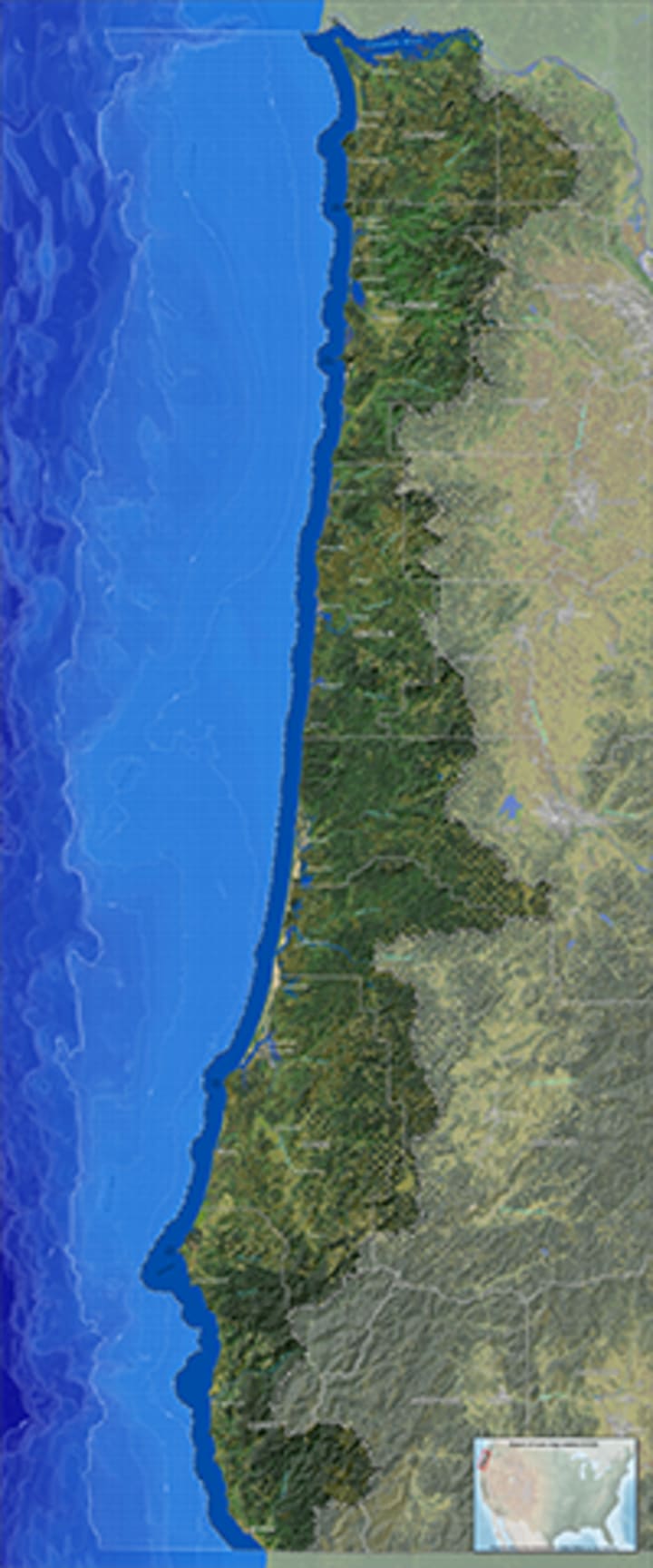
Located in the northwest corner of the country, Oregon is one of the states of the Pacific Northwest. Washington borders Oregon on the north, California and Nevada on the south, and Idaho on the east. To the west is the powerful and prepossessing Pacific Ocean. A variety of landscapes can be found within the borders of Oregon, including coastlines, beaches, deserts, rainforests, mountains, valleys, rivers, and lakes. Families and individuals alike can picnic, camp, or just hang out for the day in the many federal, state, county, and city parks scattered throughout the state. Join me on the must-see journey through Oregon. Within the eight distinct regions of Oregon, I'll highlight the hot spots everyone is talking about, as well as some of the lesser-known must-sees that the locals were willing to share.
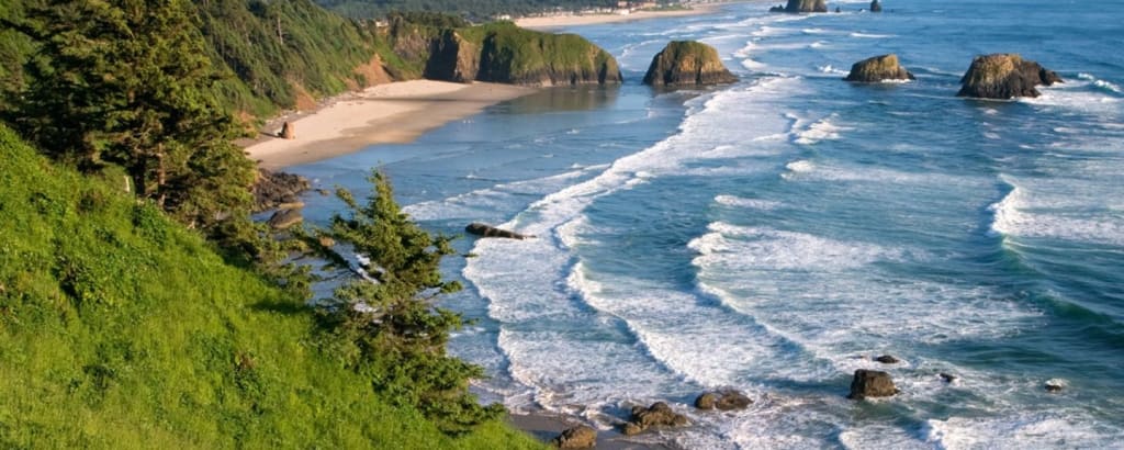
The Coastal Region
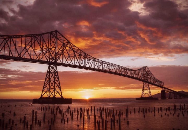
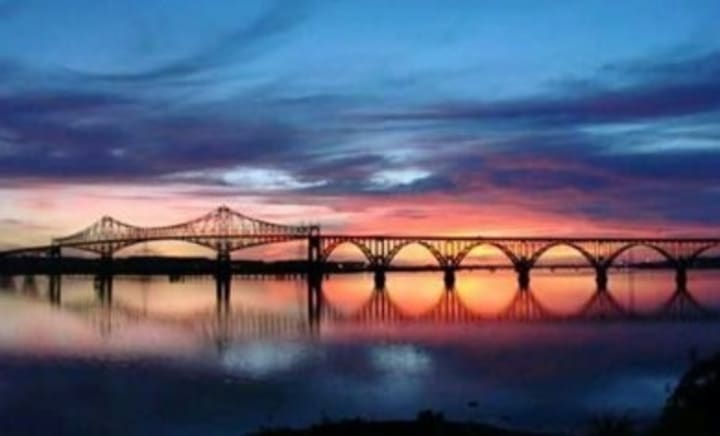
The coastal region was my introduction to Oregon, and I fell in love. As we crossed the famed Astoria-Megler Bridge from Point Ellice, Washington into Astoria, Oregon, I could not help but be awestruck. The bridge is fourteen miles away from the mouth of the Columbia River at the Pacific Ocean and was originally built as an answer to inefficacious ferry service on the river. The bridge spans a little over four miles across the Columbia River and rises to an incredible two hundred feet at its peak. Massive barges, sailboats, yachts, and cruise liners pass beneath the Astoria-Megler Bridge, and approximately 9,000 vehicles cross the truss bridge daily.
Land on the Oregon side of the Astoria-Megler Bridge and you find yourself deep in movie backdrop history. Astoria, Oregon has played host to Hollywood many times and has been the location where movies such as The Goonies, Free Willy, Short Circuit, and Kindergarten Cop were filmed.
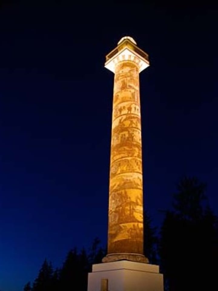
Coxcomb Hill, at 600 feet high, is topped by an observation deck at the top of a 125-foot-tall Astoria Column. Approximately seven feet wide and 525 feet long, a spiral sgraffito frieze adorns the exterior of the structure. Electus D. Litchfield and Attilio Pusterla painted the mural, which depicts 14 significant early Oregonian events as well as 18 scenes from the region's history, including Captain Gray's discovery of the Columbia River in 1792 as well as the Lewis and Clark expedition. The frieze starts with the pristine forest and concludes with the arrival of the vital railway in Astoria. The view from the observation deck is breathtaking so you may want to give yourself some extra time should you decide to visit the Astoria Column.
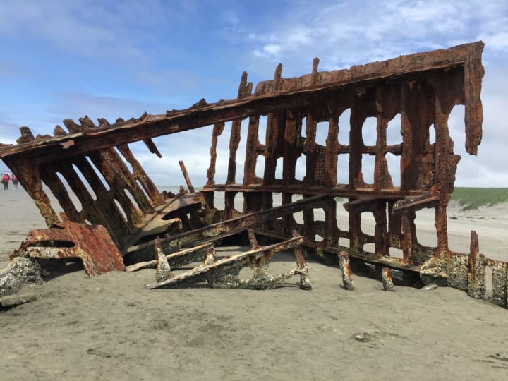
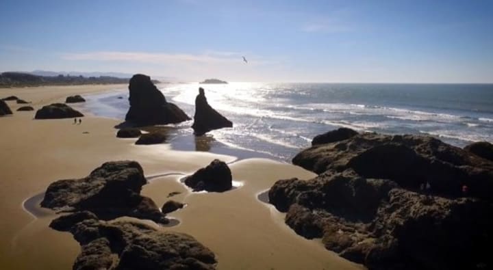
Cross the New Youngs Bay Bridge south on Highway 101 and you will find yourself in Warrenton. Fort Stevens State Park is amazing for camping with 485 campsites. Exploring is a must around Fort Stevens and taking the time to find the wreck of the Peter Iredale is of the essence. The ship ran aground in October 1906 before it could reach its intended destination, the Columbia River. The remains of the four-masted sailing vessel can be approached at low tide for amazing photographic opportunities.
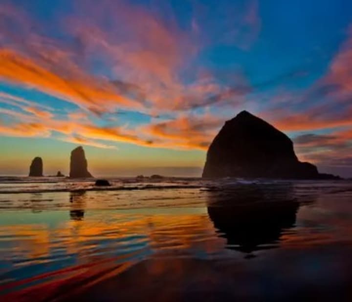
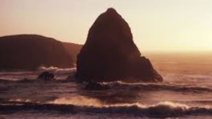
In the 1840s, a naval canon from a wrecked ship washed up on the coast of Oregon. Thus Canon Beach was born, named the best overall beach in Oregon. There, you will find the famous Haystack Rock. The rock is glorious against the sunset backdrop and is worth the trip just for the potential pictures! Haystack Rock and Canon Beach have been the location for such blockbuster films as The Goonies, Point Break, and Twilight.
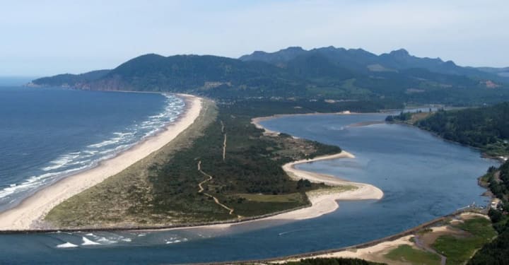
Just off of Highway 101 in the tiny little town of Nehalem is nestled the Nehalem Bay State Park. The park sits on 900 acres of land that was transferred to the State of Oregon from Tillamook County in the 1930s. The park sat stagnant until a flurry of activity in the 1940s and 1950s when thousands upon thousands of European beach grass, shore pine, and Scotch broom that were meant to strengthen and stabilize the dunes were planted. After over two decades of hard work, the plants had taken root and fulfilled their intended purpose. Nehalem Bay State Park opened to the public in 1972. Hiking, biking, and equestrian trails weave throughout the park and an airstrip invites pilots to drop in and camp for the evening. In addition to the RV and tent sites, there is also an equestrian camp, airstrip camp, hiker/biker campsites, and yurts available. Once inside the campground, the beach is easily accessible by way of a small hike over the dunes that separate Nehalem Bay State Park from the Pacific Ocean. The wildlife includes bears, elk, deer, and mountain lions and will often graze inside the campground offering opportunity to watch them in a close-up setting.
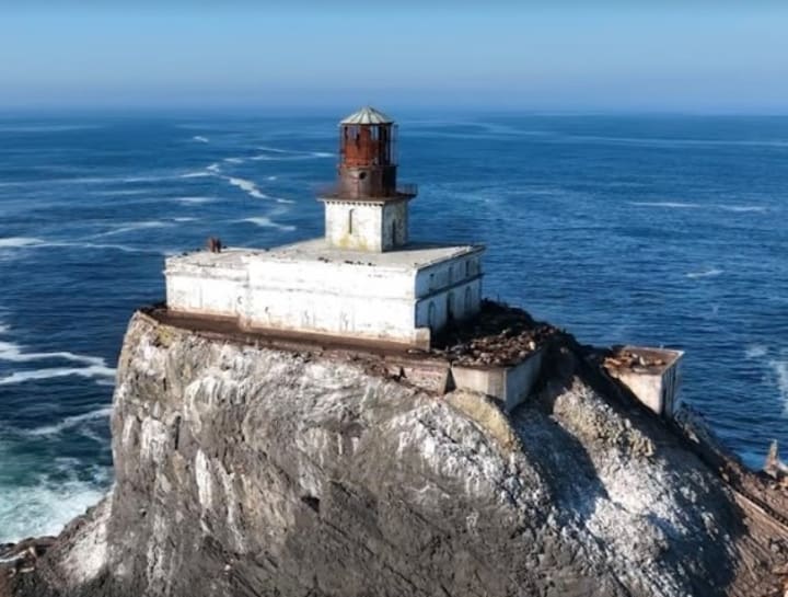
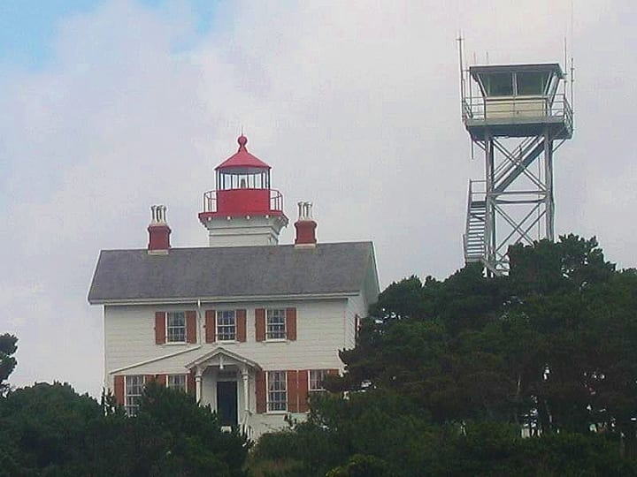
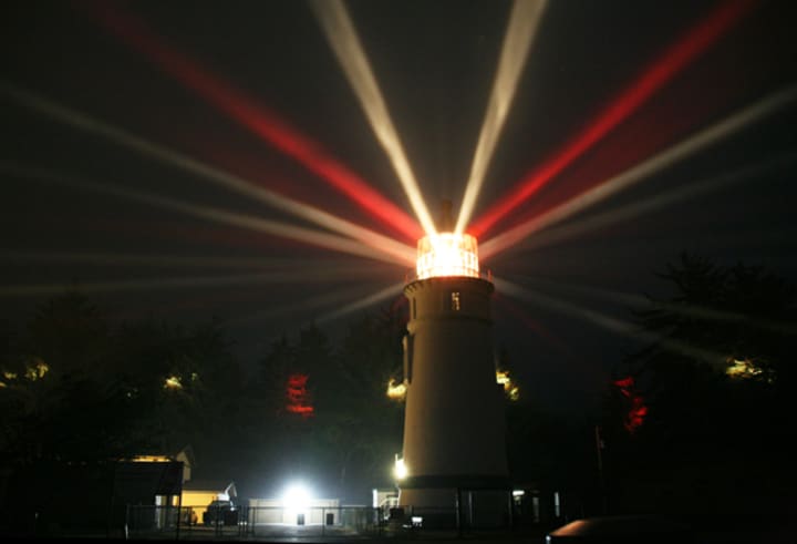
Arguably the most imposing structure on coast is the Tillamook Rock Lighthouse. The travel to and from the lighthouse was trecherous and it took an astounding 500 days to complete the construction. When she was officially lit and in service January 21, 1881, she was inhabited by four keepers. Through years of the relentless battering by massive waves, the lens was shattered, the base of the lighthouse eroded, and she was decommissioned in 1957. Terrible Tilly, as she is referred to by the locals, sold to private owners in 1980. The only means to safely reach Tillamook Rock Lighthouse is by helicopter, though even the owners are not permitted to visit during certain times of the year when sea birds are nesting on the rock. Though no access to the lighthouse is availble, it is eaily viewed from Ecola State Park.
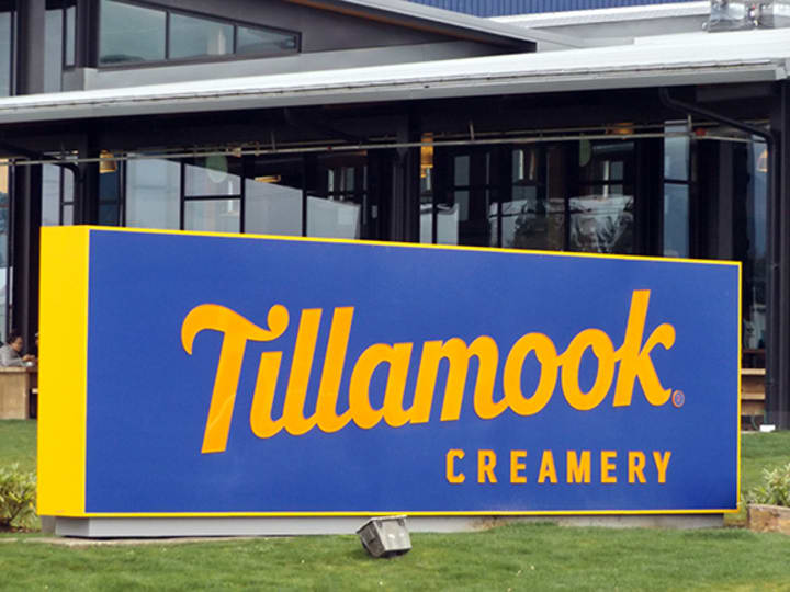
Tillamook is THE place to be if you are a fan of cheese, ice cream, butter, and sour cream. Tillamook Creamery offers self-guided tours of the factory and it's completely free! During the tour, you will learn about the cheese-making process as well as the packaging and shipping operations of the creamery. The tour ends in the sample room, where you may feel free to sample any or all of the cheeses on display. After filling yourself with THE. BEST. CHEESE. EVER., head on over to the ice cream shop and taste a variety of flavors of the frozen confection, also manufactured right at the creamery. When you have finished with the cheese and ice cream, venture across the parking lot to visit the livestock. Though Tillamook Creamery operates over one hundred farms throughout Oregon, many cows are kept on-site at the creamery. A quick drive north on 101 from the Tillamook Creamery brings you to the Tillamook Country Smoker where you can find the best beef jerky on the planet!
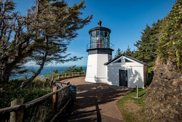
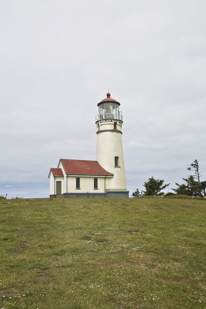
At only 38 feet high, the Cape Meares Lighthouse is the shortest of the eleven that exist on the Oregon Coast. Don't let its height fool you though, as there was no need to build higher as she sits atop a 200-foot cliff. Signaling sailors since New Year's Day, 1890, the kerosene-driven illumination offered by the Cape Meares Lighthouse can be seen from over 21 miles away!
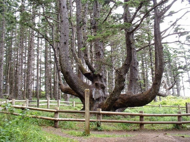
Just a short walk from the parking lot of the Cape Meares Lighthouse is an oddity known as the Octopus Tree. The giant Sitka spruce is over 50 feet at its base and instead of one trunk, there protrudes from its massive base many individual trunks, bringing an eerie octopus-looking visual to the landscape. Many have wondered just how nature could have sculpted the tree in such a way and have been astonished to find that the Sitka spruce was trained into a cage-like form by the Tillamook Indian Tribe. Though it is unknown exactly why the Tillamook Tribe trained the tree in that manner, it was common practice among tribes in North America to bend trees as a way to mark trails and territory.
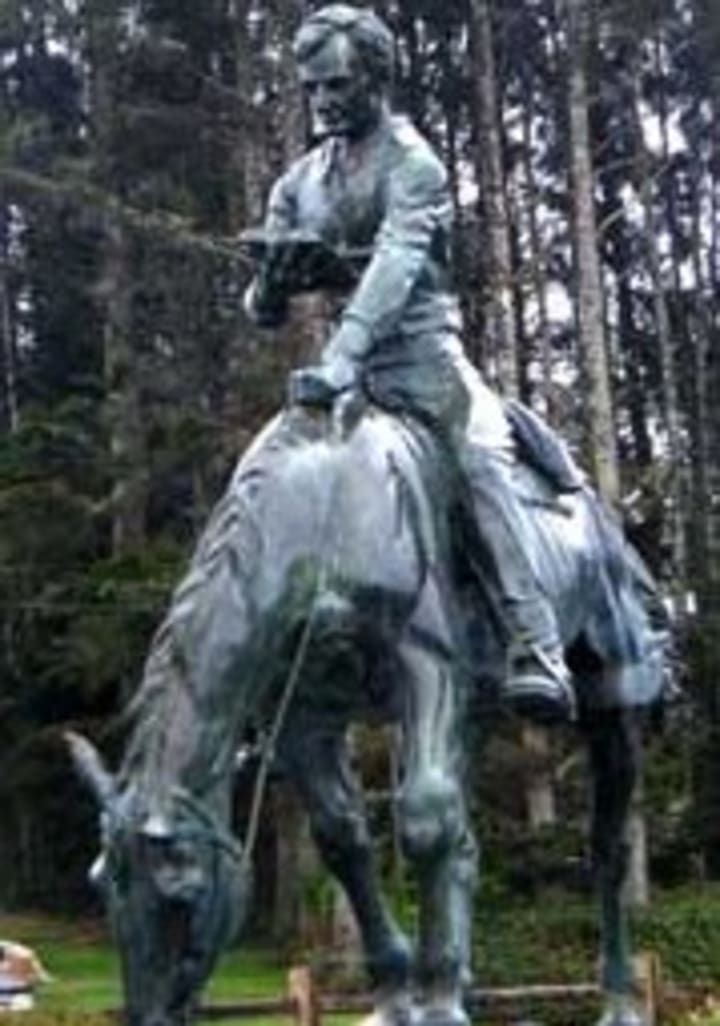
Lincoln City is home to a 15-foot-tall statue of Abraham Lincoln on a horse and reading a book. A group of five small coastal cities united in the 1950s and became Lincoln City, so named in honor of Honest Abe's offer of the governorship in 1849. Although Lincoln often visited what is now known as Lincoln City, traveling between the five cities on horseback, engrossed in a book, he turned down the offer, choosing instead to return to his law practice.
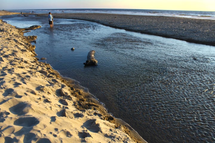
Also in Lincoln City can be found the shortest river in the world. Stand on the bridge that spans the river and take in all 120 feet of its majesty. The river sits between Devil's Lake and the Pacific Ocean, making it even shorter with the change of the tide, dropping to an astounding 58 feet in length!
Depoe Bay claims the honor of the smallest harbor in the world. At just six acres, its naturally occurring harbor has earned its title as the whale-watching capital of the world! As well as the resident grey whales at Depoe Bay, large whale migrations happen on the coast of Oregon during the months of June through September. With boat tours offered every 30 minutes, you can get an up-close and personal look at the whales and sea lions!
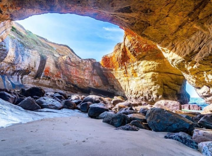
Visit the Devil Punchbowl at low tide, and you will find a massive roofless cave with plenty of tidepools to explore. At high tide, the best time to visit, the Pacific Ocean displays its power and slams into the hollowed-out mixture of sandstone and siltstone sending waves into the air above. If you decide to add Devil's Punchbowl to your list of must-sees, be sure to check tide tables to ensure you are not exploring at the bottom of the bowl when high tide comes in. The results could be deadly. If you can divert your eyes from the beauty of the Devil's Punchbowl, the Pacific Ocean beyond is a surfer's dream, evidenced by the sheer amount of surfers that can be found in the water at all times of the year.
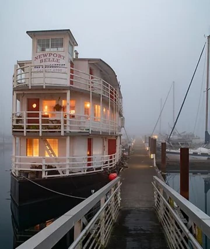
The Newport Belle Bed and Breakfast is one of a kind. It is a 97-foot-long stern-wheeler riverboat that is permanently moored at the South Beach Marina. Meet the local wildlife with a resident seal lovingly named Bob, and Harriet, the blue heron. The Newport Belle is a labor of love and it shows in every detail of the riverboat. If you are lucky enough to find an open date for a reservation, book now!
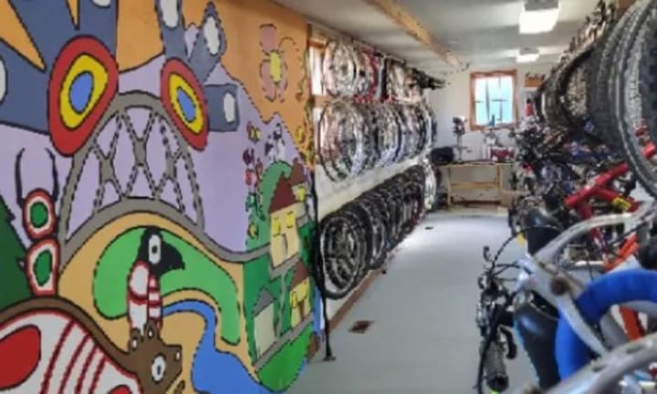
Green Bikes Co-op, located in Waldport, is a unique bicycle shop. While they offer the normal wares, repair, and rentals, what makes them unique is their fleet of 100 bicycles that are free of charge to use. Green Bikes Co-op also offers the use of their tools to the community free of charge. The Co-op is run solely from the efforts of volunteers. That's where volunteer Chuck Lott found the parts that he needed to make, of all things, telescopes! Utilizing rims, cables, and various other parts and pieces, Chuck uses a sudiball-type design to complete his telescopes.
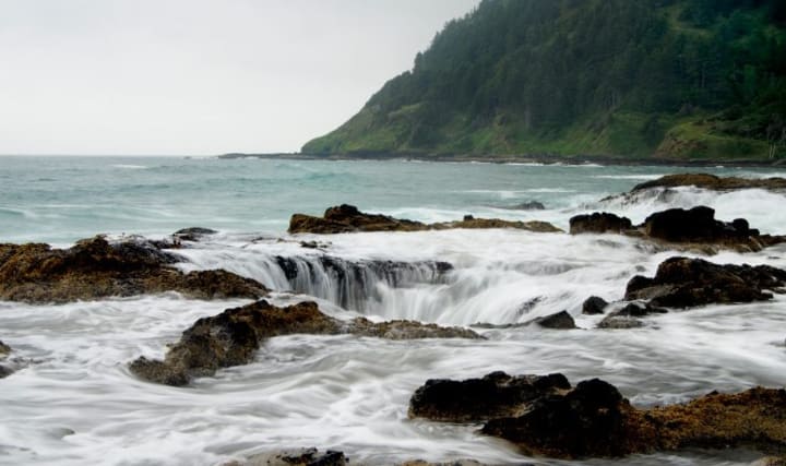
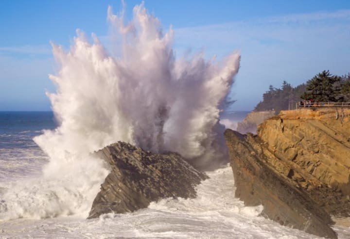
Thor's Well is another of the coastal region's natural formations that is well worth the trip to see in person. Years of the mighty and unrelenting Pacific Ocean slamming into the rocky coast has created a cave-like area in the rock that appears to "drain the sea". The collapsed sea cave is only an estimated twenty feet deep, but the amount of water that seems to shoot angrily from deep within Thor's Well is something that only seeing will allow your mind to believe. For the most thrilling showing of Thor's Well, arrive about an hour before high tide. See the empty well at low tide and watch as it begins to fill with the cold water of the mighty Pacific. As the high tide continues, the well seems to explode as water splashes higher and higher into the air. Bring your camera!
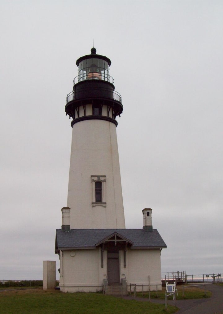
Yauqina Head Lighthouse is the tallest on the Oregon coast at 93 feet tall. Made in Paris, France in 1868, the lighthouse was shipped to Oregon and sprang to life August 20, 1873. The light is visible up to 19 nautical miles and was automated in 1966. The lighthouse and grounds that surround it have been the location for several movies including The Ring, Nancy Drew Mysteries, and Hysterical. The lighthouse is open for tours but space is limited and on a first come first served basis.
The Yaquina Bay Lighthouse was built in 1871 and decommissioned in 1874. The lighthouse is the only one in Oregon with living quarters attached and is the oldest structure in Newport and the oldest wooden structure still standing. The lighthouse was restored and placed back into service December 7, 1996 and is currently under the supervision of Oregon Parks and Recreation Department. The Yaquina Bay Lighthouse is not currently open to the public.
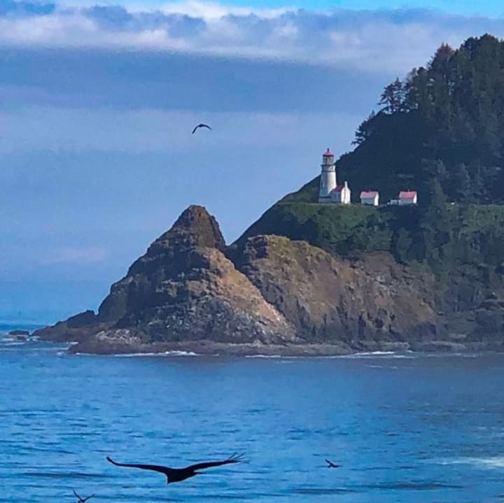
Heceta Head Lighthouse was built in a Queen Anne style and the light can be seen for 21 nautical miles, making this lighthouse the strongest light on the Oregon coast. The light itself is maintained by the Oregon State Parks and has a Bed and Breakfast that was transformed from the assistant lighthouse keeper's quarters that is owned and operated by the United States Forest Service. Tours are available, and I urge you to call ahead to ensure tours are taking place when you plan to be there.
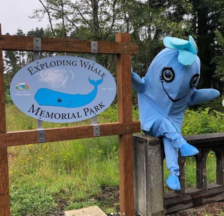
In what is truly a one-of-a-kind destination, Exploding Whale Park is a must-see for all the right reasons! When a grey whale washed up on the shore in Florence, it was decided that the only way to rid the beach of the decomposing mass of flesh was total destruction of the whale by means of dynamite! While officials from Lane County Highway Divison buried dynamite on the landward side of the massive whale with the hopes that the blast would direct the remains into the ocean, onlookers gathered to watch the destruction of the whale. In what the original news reporter from 1970 called the "blast that blasted blubber beyond all believable bounds", the beach, the spectators, and vehicles were pounded with whale blubber. Stop by for a view of the Suislaw River Bridge with your toes in the sand and the memory of the incredible exploding whale fresh in your mind.
Cleft of the Rock Lighthouse is truly unique. It is privately built and owned by a lighthouse hisorian and former keeper of the Tillamook Rock Lighthouse, James A. Gibbs. James added the tower to his own home and converted his home into a private museum. The United States Coast Guard recognized Cleft of the Rock Lighthouse as an official navigational marker in 1979. Though the tower and grounds are closed to the public, the lighthouse is visible from mile marker 166 on Highway 101, just south of Yachats.
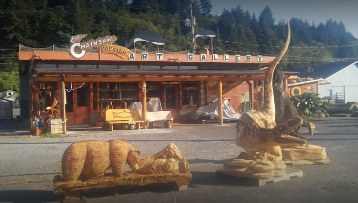
Every year thousands of people gather on Father's Day for the annual Oregon Divisional Chainsaw Carving Championship. Massive logs are trucked into Reedsport for the competition and throughout the weekend you may bear witness to the extraordinary talents of chainsaw artists from all over the world. From totem poles to Donald Trump, eagles to bears, and mind-bending fantasy scenes, the artists leave you wondering how in the world they make their art look so easy. Stop by Ellie's Chainsaw Art Gallery anytime to see the variety of wood carvings offered for sale year-round. You can often find an artist on site and hard at work! Make sure to take a walk through town and see the carvings on display throughout the city.
Just south of Reedsport on Highway 101 is a true gem. Winchester Bay is full of hiking, biking, and all things dunes! Several RV parks hold the flocks of ATVers that visit Winchester Bay and utilize the dunes. A marina holds boats of all shapes and sizes and the wildlife is incredible! Sea lions love the marina and can often be found sunbathing on the docks and swimming in the bay. Shopping, lodging, and food can all be found in tiny little Winchester Bay. The shops and restaurants are locally owned and staffed, a fact that comes through in the quality of service and product you can expect when you enter the doors. There is a ton to see in such a tiny place and your camera will need a break by the time you leave the area!
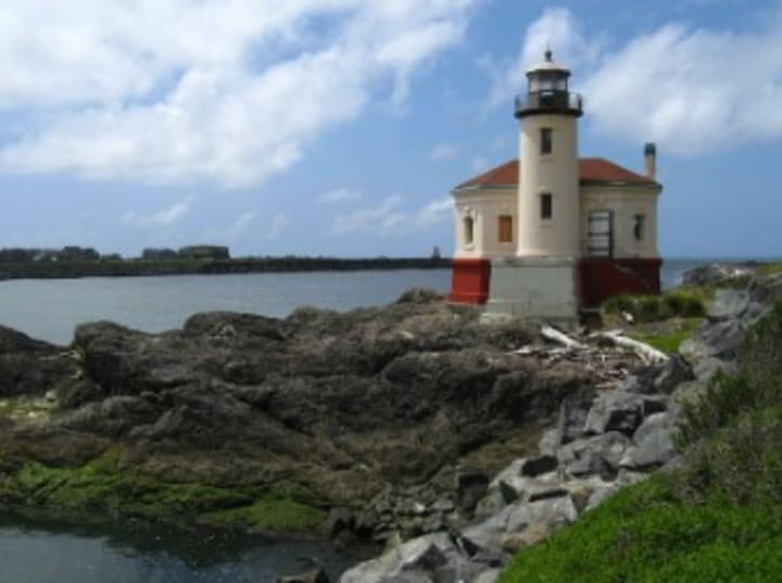
The Umpqua River Lighthouse is a personal favorite. Built during the same time and using the same plans as the Heceta Head Lighthouse the two are almost identical. Construction was started in 1892 and was lit for the first time in 1894. Though originally built on the Umpqua River, the flooding and shifting sands would prove too much for the structure and it collapsed. The Umpqua River Lighthouse sits atop one hundred feet of mountain and has a visibility of 21 nautical miles. The lighthouse is easy to reach and can be easily photographed day or night. Tours are offered and are seasonal, so check ahead of time to ensure a successful trip!
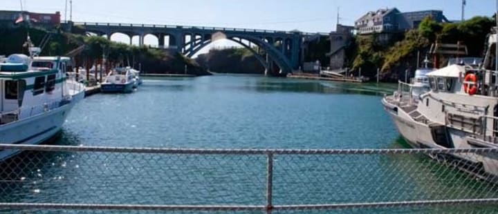
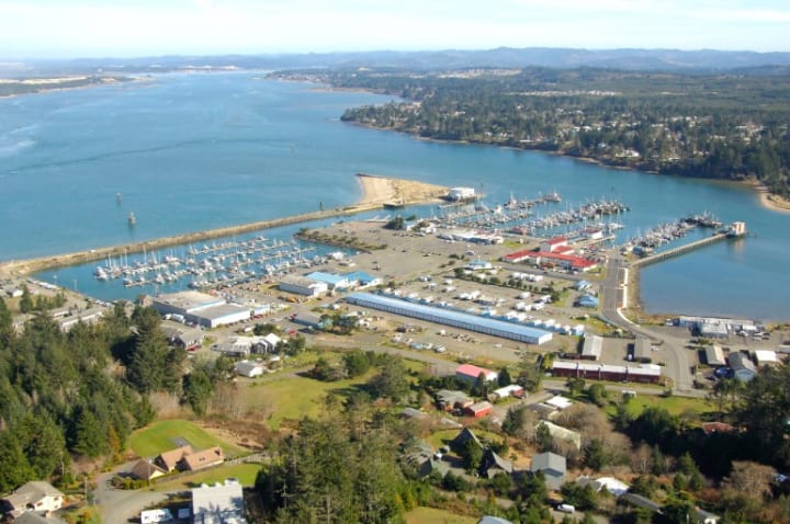
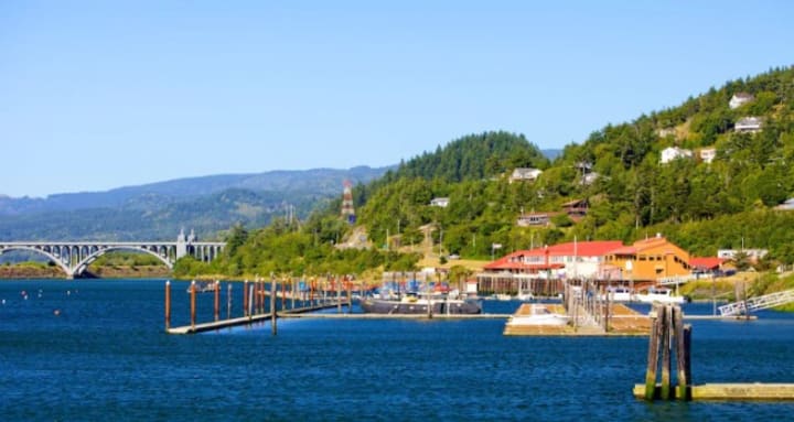
Another of the bridges that made my list is the Conde B. McCullough Memorial Bridge. The bridge was a major forward step as the cantilever bridge spans the Coos Bay and replaced the ferry service that was once the only way across the bay. Though originally named the North Bend Bridge, the name was changed in honor of Conde B. McCullough, the man responsible for this bridge and ten others on the coast of Oregon. The view from the bridge is amazing and affords a bird's eye view of the North Bend airport.
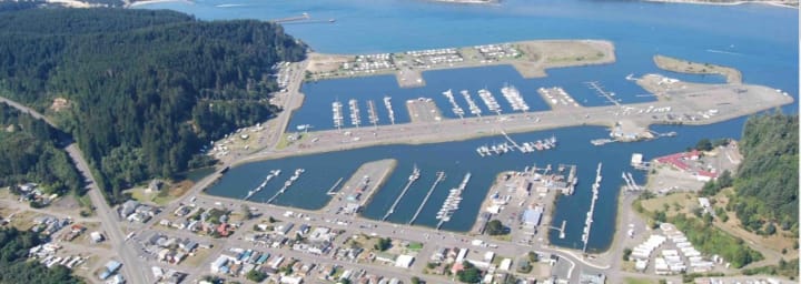
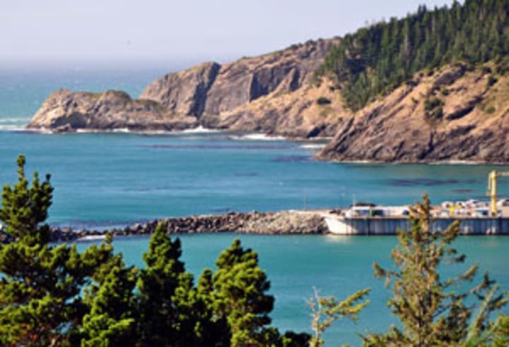
Just past the Conde B. McCullough Memorial Bridge is the gateway to paradise. A quick turn onto Highway 540 (Newmark Avenue) and you will quickly find yourself lost in the view. Follow the highway all the way to Charleston, a tiny fishing village that's off the beaten path, but well worth the drive. Once across the drawbridge, a right turn will take you to the marina. There is an RV park, a marina for the boats, shops, and restaurants, and the marina plays host to the United States Coast Guard. Watching the Coast Guard in action is a sight to behold as they take on the wind, cold rain, freezing water, and massive waves on the Pacific Ocean.
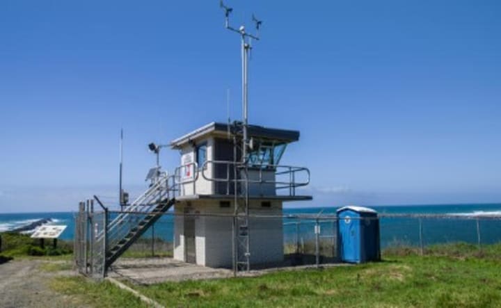
Before you leave Charleston and continue on Highway 540, visit the Coos Head Lookout Tower. The view from the top of the mountain affords a view of the ocean that spans for miles on a clear day. The tower is situated above the North Jetty and offers a view of Bastendorff Beach that is unmatched.
Leaving the Coos Head Lookout Tower will bring you to the next stop on Highway 540, Bastendorff Beach. Walk on the beach, play in the water, hop in the Jeep and do some four-wheeling on the marked trails, or just sit and watch the waves roll in.

Sunset Bay State Park cannot be captured in a single picture. The beautiful sands of the beach, the deep blue of the water, and the towering cliffs that surround it make for an experience that you must see in person to truly appreciate. Dip your feet into the ocean, hike one of the many trails that weave throughout the park, picnic on the beach, and play a round of golf. Bring your RV or a tent or rent one of the yurts so you can visit for a few days and soak up all that the park has to offer!
Situated between Sunset Bay Sate Park and Shore Acres State Park, Cape Arago Lighthouse has been a beacon in the night for sailors since 1866. Though orignally just a 25 foot octagonal tower, the current Cape Arago Lighthouse towers 44 feet into the air and was fully automated before it was decommisioned January 1, 2006. Though the lighthouse is closed to the public for tours, it can be easily seen from Bastendorff Beach, Shore Acres State Park, and Sunset Bay State Park.
Continue south on OR-540 (Cape Arago Highway) to Shore Acres State Park to experience the beautiful garden and the view from atop the towering cliffs that rise from the Pacific Ocean. Shore Acres is the perfect place to witness seasonal whale migration. December through January and then again in February through May, an estimated 20,000 whale head from their summer feeding ground at the Bering Sea to their winter hangout in Baja, Mexico. If you love the waves, Shore Acres is THE perfect spot to witness their power and beauty as they slam against the face of the cliffs shooting water far into the air in a spectacular display! Visit between Thanksgiving and Christmas for an amazing tour with 325,000 LED Christmas lights displayed throughout the garden.
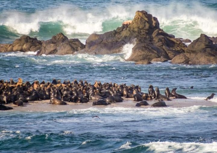
Simpson's Reef is so much fun for marine animal lovers! Northern Elephant Seals, Harbor Seals, Northern Sea Lions, and California Sea Lions use Simpson's Reef as a stopping-off place to rest, nurse their pups, or just relax. Even with the waves crashing around you, the seal and sea lion bark is loud and they aren't shy about making their presence known! Be sure to bring your video camera for this one!
The next and final stop on the Cape Arago Highway detour is Cape Arago State Park. A trailhead for hiking, bathrooms, picnic areas and the most mind-bending view are all offered at the end of Cape Arago Highway. A lookout area offers a birds-eye view of migrating whales, local wildlife that includes bears and deer, marine life, and massive cargo ships and fishing boats that pass by. One can actually see the curvature of the earth from this vantage point! To the far right of the parking lot are the trails that lead to the sand and water below, tidepools, and a hike that will test your body. If you stay to the right on the trails, you will arrive at the backside of the mountain. Thousands of sea lions can be found there eating, sleeping, and playing. Though you CAN get close to the sea lions, you DEFINITELY should keep your distance. The massive animals can grow to eight feet long and weigh 800 pounds!
The Coquille River Lighthouse was constructed in 1895 as a means to guide sailors between the harbor and the ever-shifting sandbars into the Coquille River. Originally equipped with a Fresnel light of the fourth order and a fog-signal changes would have to be made fairly quickly to ensure the safety of the passing vessels. While the light was visible for about 12 nautical miles, the fog-signal was a Daboll trumpet, which failed to carry across the roar of the Pacific. The trumpet was replaced with a more traditional fog horn in 1910, much to the dismay and over the objection of Bandon residents. Now owned and operated by Oregon State Parks there are tours available. Make sure to call ahead to ensure the operating days and times, as the tours are seasonal.
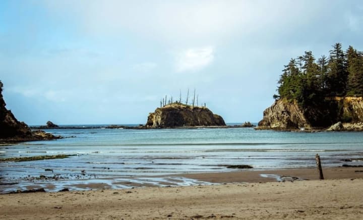
Make sure to read the legend of Face Rock before navigating to the stunning Bandon, Oregon. Learn about how each of the nine sea stacks got its name and then take your time and behold their beauty. Visit at low tide to explore the tide pools by way of the maintained trails. Sunset is prime for the most stunning pictures! While visiting Face Rock Scenic Viewpoint, leave yourself extra time to visit the small shops and restaurants in Old Town Bandon.
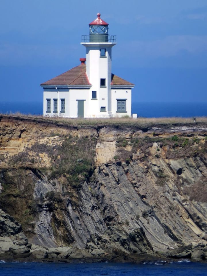
The Cape Blanco Lighthouse holds several unique honors. December 20, 1870, Cape Blanco Lighthouse became operational. That makes it the oldest continually operating light in Oregon history. The position of Cape Blanco Lighthouse makes it the most westerly, and with a focal plane at 256 feet above the Pacfic Ocean, it is also the highest of the Oregon lighthouses. Making it even more special is Cape Blanco Lighthouse saw its first woman keeper in Oregon history when Mabel E. Bretherton accepted the position in 1903. There are tours available, so be sure to call ahead for the proper times and prices of the tour, as they vary throughout the year.
Port Orford is the westernmost town in the contiguous United States. It also holds the honor of being the oldest coastal township. Hiking, biking, fishing, boating, and sightseeing are the order of the day in Port Orford. Another unique fact about Port Orford is that there isn't an ocean bar to cross to arrive at the port. Since the port is situated on the open ocean, the possibility for morrage is limited to very specific tidal and weather conditions. As a result, Port Orford is the only dolly dock on the west coast. Two bright yellow cranes hoist vessels from the water, where the boat is then moved to a dolly, where it is stored until ready to be launched once again. Be sure to visit Prehistoric Gardens, where 23 life-sized dinosaurs lurk in the luscious Oregon rainforest!
Fishing, crabbing, clamming, hiking, biking, golf, beachcombing, and beach treasure hunts can be found in Gold Beach. From the Isaac Lee Patterson Memorial Bridge that crosses the mouth of the Rogue River to Kissing Rock, take your time with this location. Visit the wreck of the Mary D. Hume, a steamer that sank in the Rogue River soon after she was retired. Make your reservation for a ride with Jerry's Rogue Jets for boat trips on the Rogue River. Join them for the daily mail route where mail is delivered to households for 32 miles along the river. Jerry's offers a two-hour bay and several other scenic routes, including the 104-mile whitewater tour!
Whaleshead Beach is among the most stunning and rugged along the Oregon coast. Whaleshead Rock is a sea stack that rises from the Pacific and is shaped like, you guessed it, a whale's head! When the tide rises and the waves slam against the sea stack, it gives the illusion that the whale's head is spewing water from its blowhole.
One of the biggest groves of coastal redwoods in the United States exists in Brookings, the last town in Oregon before you reach the border of California. The redwoods are best seen from the Riverview Nature Trail and the U.S. Forest Service Redwood Loop and if you have never been in the presence of a robust redwood, please take the time to do so. You would be hard-pressed to find anyone disappointed in their visit. Just 15 miles east of Brookings is the sight of the only mainland bombing from the Japanese during World War II. September 9, 1942, Japanese Imperial Navy pilot, Nobuo Fujita, flew his floatplane over Brookings with two incendiary bombs. The location of the second bomb is still unknown, but one hit Wheeler Ridge on Mount Emily. The intent of the attack was to start massive forst fires that would force the United States to direct funds and manpower to saving life and limb of the citizens of Oregon. In true Oregon fashion, the rain wouldn't let up. A small fire was the result which was quickly spotted from the firewatch tower and extinguished just as fast as it started. If that isn't enough history for you, in 1962, a campaign was started to invite Nobuo Fujita to the city as an honored guest at the famed Azalea Festival. Though there was plenty of opposition to extending an invitation to a person whose sole claim to fame was being the only Japaense Imperial Navy pilot to attack on the continiguous United States, an invitation was extended. Once Fujita was sure that he would be free from prosecution for any war crime, he decided to accept the invitation. While in Brookings Fujita presented the city with a 400 year old sword that was a priceless family heirloom. Though the sword flew with him on every mission, including the Brookings bombing, he brought it to Brookings on that occasion to engage in sepuku should the reception in the coastal city be hostile. The katana is on display at the Chetco County Public Library and can be visited from 10am-7pm daily.
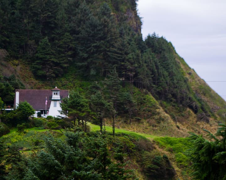
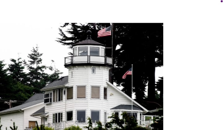
The Cady family of Brookings love lighthouses. So much so, in fact, that they built one of their very own onto their home. The Fresnel lens blasts light 12 nautical miles into the Pacific, warning sailors of potential pril since the United States Coast Guard recognized it as a nautical beacon in 1999. Pelican Bay Lighthouse is privately owned and operated and is situated on private property, so no tours. The lighthouse can be eaily seen and photographed from the Brookings harbor just below it.
Please be sure to call ahead to ensure your visit to the Oregon coast is pleasant and successful. Many places throughout the Oregon coast operate on a seasonal schedule, and Covid is still affecting the hours of operation and accessibility.
About the Creator
Phoenixx Fyre Dean
Phoenixx lives on the Oregon coast with her husband and children.
Author of Lexi and Blaze: Impetus, The Bloody Truth and Daddy's Brat. All three are available on Amazon in paperback format and Kindle in e-book format.
Keep reading
More stories from Phoenixx Fyre Dean and writers in Wander and other communities.
Reality RV
It's everyone's dream to sell everything you own and travel this beautiful country in an RV. No clocks or time constraints. Nowhere in particular that you need to be. If you don't like the neighborhood, you can break camp and find another one. I'm never been without a roof over my head and food in my stomach while my family and I explore the highways and byways of America, seeing sights some will never see. The bright blue of a cloudless Colorado sky. The ocean off the coast of Oregon. The field in Pennsylvania where United flight 93 crashed on that fateful September day. The swamps of southern Georgia and the masterpiece that is Mount Rushmore. Nothing is out of reach.
By Phoenixx Fyre Dean5 years ago in Wander
Was I a Model in Japan?
During my time in Nagoya I worked and lived at the strangely famous hostel and café Nagonoya. With its chequered floors and florescent lighting it felt quite dated, but I think that was supposed to be part of the charm. The dorms were always fully booked on weekends with domestic tourists and there was always a buzz in the downstairs café. Camera crews were constantly in and out of the place interviewing the Japanese staff members who worked the café. I think it had something to do with the egg sandwiches. At least that was what was on most of the merchandise, except for that one dishcloth with the owner’s face on it. Was I being employed by a local celebrity?
By Susanna Kiernan19 days ago in Wander
Tulip Mania
Who would have thought you could visit a Tulip Farm in the U.K.? I've been growing tulips in my London garden for a while now and know how much they cheer me up as I head into my London garden or look through the window. They add a wonderful splash of colour, especially when the weather is blah blah outside.
By Tabby London4 days ago in Wander


Comments
There are no comments for this story
Be the first to respond and start the conversation.