
Beyond the Sunken Cross: Volcanic Heritage, Collective Memory, Coastal Landscape, and Sustainable Tourism at the Sunken Cemetery in Camiguin Island, Catarman, Northern Mindanao, Philippines
Where memory meets the sea

Author: Mingae Gaces Samontina
Field visit: 13 June 2026, approximately 4:00 p.m.
Publication date: 4 November 2026
Research type: Qualitative field-based heritage and tourism case study
© 2026 Mingae Gaces Samontina Field photographs and original narrative reserved to the author.
Abstract
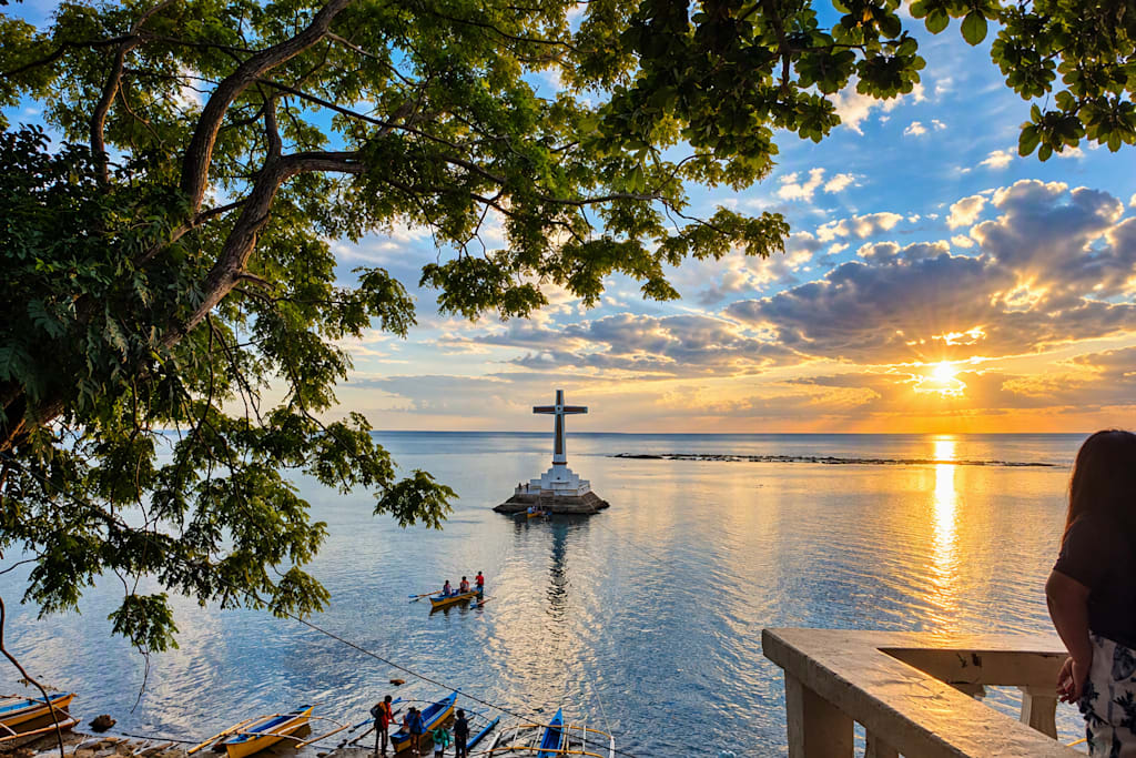
This article examines the Sunken Cemetery in Catarman, Camiguin as a cultural landscape where volcanic history, memorial meaning, coastal ecology, and tourism intersect. The study combines the author’s direct observations and five field photographs from 13 June 2026 with documentary evidence from the Provincial Government of Camiguin, the Philippine Institute of Volcanology and Seismology (PHIVOLCS), cartographic sources, and current destination literature. The field record documents a low-tide, late-afternoon view from shore, the prominent offshore cross, small boats near the monument, exposed intertidal surfaces, tree-framed sightlines, and souvenir activity along the roadside. The analysis argues that the site should be interpreted not merely as a scenic stop but as a memorial seascape requiring historically cautious narration, respectful visitation, and evidence-based conservation. Because this was a non-intrusive observational visit and no underwater survey, archival verification, interviews, tide record, or conservation assessment was undertaken, conclusions about submerged remains and ecological conditions remain provisional and source-dependent.
Keywords: Camiguin; Sunken Cemetery; Catarman; volcanic heritage; memorial landscape; geotourism; cultural tourism; field observation
1. Introduction
On the western coast of Camiguin, a large concrete cross stands offshore as the visible marker of a burial ground associated with the nineteenth-century transformation of old Catarman. The Provincial Government of Camiguin identifies the Sunken Cemetery as a Catarman attraction formed in the 1870s when Mount Vulcan erupted and the cemetery, capital, and old town of Catarman sank; the same official page describes the cross as a commemorative marker. This government account supports the site’s combined identity as volcanic heritage and memorial place, while also showing why its history should be presented with care rather than reduced to a photo opportunity (Provincial Government of Camiguin, n.d.).
The author visited the site with colleagues during a company team-building trip to Camiguin from 12 to 14 June 2026. The observation occurred on 13 June at approximately 4:00 p.m., after a visit to Tuasan Falls. The roadside signage made the attraction easy to locate. The group observed the offshore cross from a distance and did not travel by boat to the monument. Sea level appeared low, with sections of the nearshore zone exposed. Souvenir stalls were present around the visitor area. These statements are treated as primary field notes, not as proof of broader historical, environmental, or visitor-management conditions.
The central research question is: How does the Sunken Cemetery function simultaneously as a memorial, a volcanic cultural landscape, and a tourism site, and what evidence is needed to interpret it responsibly?
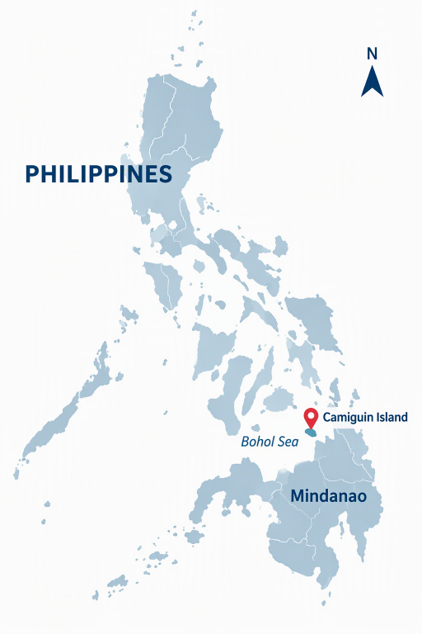
Map basis: Camiguin Island coordinates are reported as approximately 9.16667° N, 124.71667° E by Apple Maps. Wikimedia Commons also provides a Philippines locator map for Camiguin under CC BY-SA 4.0. The locator graphic is schematic and not to scale. A future edition should replace it with a GIS-produced map based on authoritative geospatial data.
2. Study Area and Context
Camiguin is an island province in Northern Mindanao. The Sunken Cemetery is situated in Catarman along the Camiguin Circumferential Road. The field photographs show the memorial cross offshore from a tree-lined coastal viewing area, with small boats in the water and a broad western seascape. Public map services place Camiguin in the Bohol Sea, north of mainland Mindanao (Apple Maps, 2026; Google Maps, 2026).
The site belongs to a wider volcanic heritage landscape. PHIVOLCS’ 2026 commemoration of the 1951 Hibok-Hibok eruption states that the event caused loss of life, displaced thousands, and altered parts of the island’s landscape; it also explains that the disaster contributed to the establishment of the Commission on Volcanology in 1952, the institutional predecessor of PHIVOLCS. Although the 1951 eruption is distinct from the nineteenth-century event associated with the Sunken Cemetery, the official account demonstrates the continuing importance of volcanic risk, public memory, and science-based preparedness in Camiguin (PHIVOLCS, 2026).
3. Methodology
3.1 Research design
The study uses a qualitative, descriptive case-study design. It integrates: (1) direct field observation; (2) visual analysis of five author-owned photographs; and (3) documentary review of official government, volcanological, cartographic, and tourism sources available up to 4 November 2026.
3.2 Field observation protocol
Observation took place from the public shoreline/viewing area. The visit was non-intrusive: no excavation, underwater inspection, water sampling, drone survey, GPS track, interview, visitor count, or structural assessment was conducted. Observations were recorded retrospectively from the author’s notes and photographs.
3.3 Visual analysis
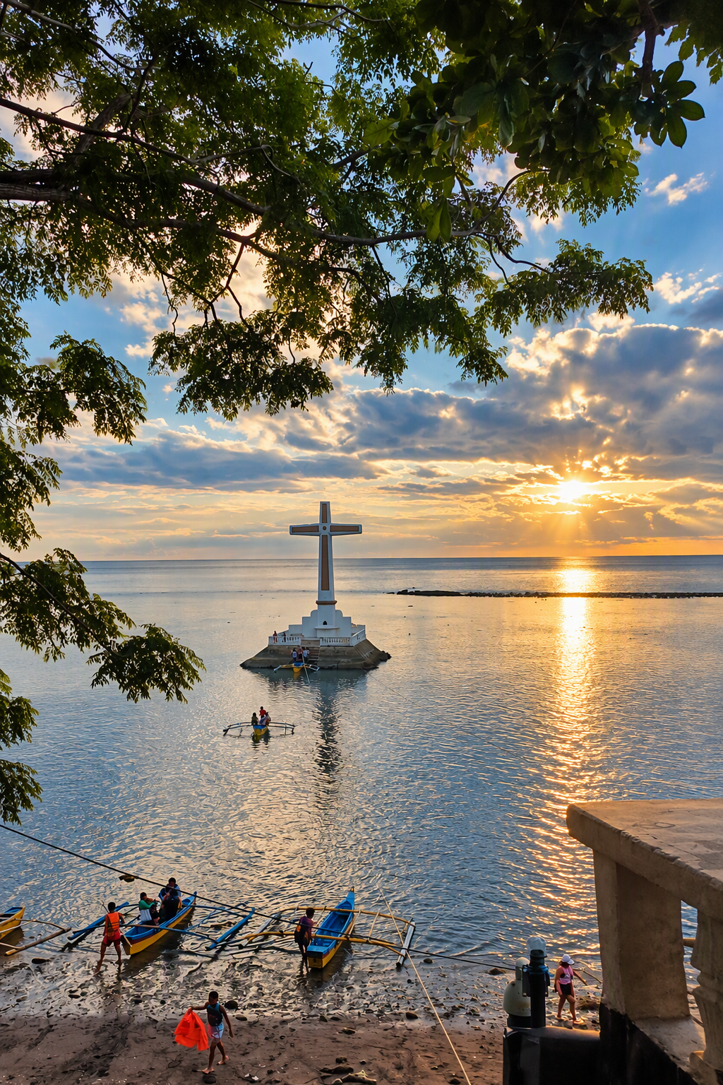
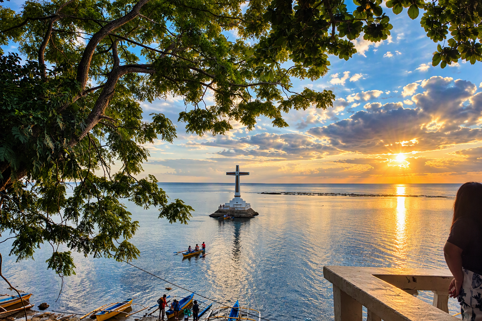
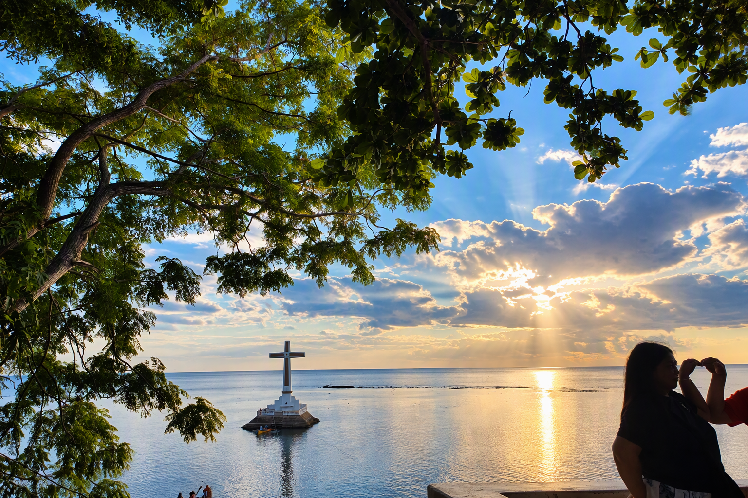
Each photograph was reviewed for observable features only: viewpoint, cross placement, sea level appearance, boats, shoreline exposure, vegetation framing, lighting, and visitor-support activity. Interpretations about meaning are identified as analysis rather than visual fact.
3.4 Limitations and research ethics
The study is limited by a single late-afternoon observation, an onshore viewpoint, and the absence of interviews or instrumental measurements. Tide state was not verified against an official tide table. The photographs do not establish the condition, depth, or extent of submerged graves or coral communities. As a cemetery and memorial landscape, the site should be approached with dignity, minimal disturbance, and sensitivity to local community values.
4. Review of Related Literature and Documentary Evidence
4.1 Historical and commemorative interpretation
The Provincial Government of Camiguin states that the Sunken Cemetery was formed in the 1870s when Mount Vulcan erupted, causing the cemetery, capital, and old town of Catarman to sink. This is the strongest accessible local-government description identified. Some travel sources provide more specific narratives, dates, depths, and causal mechanisms, but these details should not be treated as settled without corroborating archival or geological records. Accordingly, this article retains the official province’s broader formulation and flags the exact event chronology for further verification.
4.2 Volcanic memory and risk awareness
PHIVOLCS’ 2026 press release on the 1951 Hibok-Hibok eruption frames volcanic commemoration as both remembrance and public preparedness. It reports that the 1951 eruption led to many deaths, displacement of thousands, and landscape alteration, and that its aftermath led to the creation of the Commission on Volcanology through Republic Act No. 766 in 1952. This institutional history provides a contemporary risk-awareness context for interpreting Camiguin’s older volcanic heritage sites (PHIVOLCS, 2026).
4.3 Tourism and place interpretation
The official Camiguin tourism page presents the Sunken Cemetery alongside Tuasan Falls, the Walkway to the Old Volcano, and the Gui-ob Church Ruins, placing the site within an island-wide itinerary of natural and historical attractions. This pairing is significant: visitors encounter waterfalls, volcanic landforms, ruins, memorials, and marine scenery within a compact route. However, tourism promotion should distinguish between scenic appeal and evidentiary claims about underwater remains, casualties, ecological transformation, and heritage status.
4.4 Evidence quality in current literature
The open-web literature reviewed for this study is dominated by destination guides, mapping platforms, and tourism pages rather than peer-reviewed site-specific studies. Current guides commonly describe an underwater cemetery, coral growth, snorkeling, boat access, and sunset viewing. These sources are useful for identifying themes and potential field questions, but they require verification through municipal records, National Museum documentation, PHIVOLCS or geological studies, hydrographic data, and marine ecological surveys. This evidence gap is itself a finding: strong public recognition is not equivalent to a complete scholarly record.
5. Findings from the 13 June 2026 Field Record
5.1 Accessibility and arrival
The author’s notes describe the place as easy to find because of visible roadside signage reading “Welcome To Sunken Cemetery – Experience Serenity Beneath the Sea.” The attraction was reached after Tuasan Falls, showing how the circumferential road connects multiple tourism stops. The presence of souvenir stalls indicates a commercial visitor interface, but no systematic inventory of vendors, products, prices, or livelihoods was made.
5.2 Coastal view and memorial focus
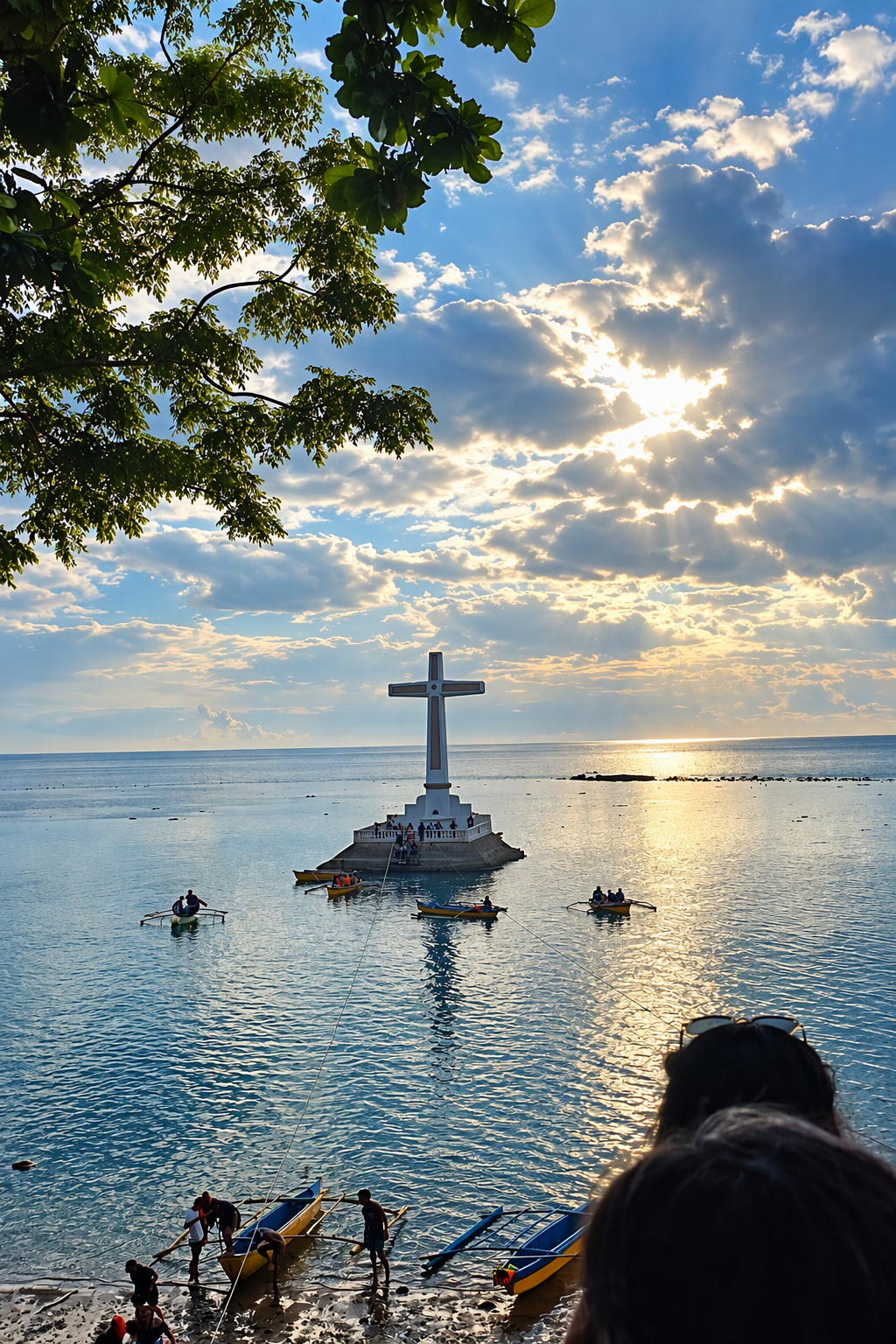
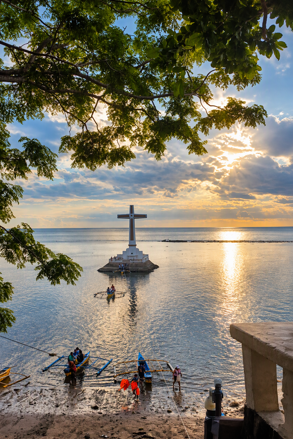
Across all five images, the offshore cross is the dominant built feature. The repeated use of distant, tree-framed viewpoints emphasizes the relationship between monument, shoreline, and open water. Small boats positioned near the monument indicate water access, but the photographs alone do not establish whether the boats were carrying visitors, guides, or operators.
5.3 Apparent low water and exposed nearshore surfaces
The field notes record a very low sea level, and the images show exposed or shallow-looking nearshore surfaces. Because no tide gauge, official tide prediction, or timestamped geospatial record was collected, the condition should be described as “apparent low tide during the visit,” not as a measured tidal minimum.
5.4 Late-afternoon visual character
Warm late-afternoon light, elongated reflections, silhouettes, and a low sun create a strong contemplative visual setting. This supports the site’s popularity as a viewing and photography location, yet the memorial function should remain central in interpretation.
6. Photographic Documentation
7. Discussion
7.1 A memorial seascape, not only a landmark
The visual power of the cross comes from its isolation in the sea, but its significance depends on the burial-ground narrative and the community history it represents. Responsible interpretation should therefore place remembrance before spectacle. Signage, guide scripts, publications, and social-media captions should distinguish verified history from local tradition and tourism shorthand.
7.2 Volcanic heritage and resilience
The Sunken Cemetery gives visible form to landscape change. When interpreted alongside PHIVOLCS’ account of the 1951 Hibok-Hibok disaster and the development of Philippine volcano monitoring, the site can support public understanding of how communities remember and adapt to volcanic hazards. The lesson is not that every volcanic event is the same, but that Camiguin’s identity is inseparable from repeated encounters with dynamic earth processes.
7.3 Tourism, livelihoods, and conservation
Souvenir activity and boat presence suggest links between heritage visitation and local livelihood. Yet unmanaged access can create risks to dignity, submerged cultural material, marine habitats, and visitor safety. A stronger evidence base is needed before recommending carrying-capacity limits, zoning, underwater routes, or conservation interventions. The most defensible immediate principle is low-impact, respectful visitation guided by current local rules.
7.4 Interpretation priorities
A robust site-interpretation program should present a verified historical timeline; identify the exact volcanic process supported by geological evidence; explain what is known and unknown about submerged remains; document how the cross was built and maintained; include community voices; and state site rules clearly. These elements would transform the visit from passive viewing into historically and environmentally informed engagement.
8. Conclusion
The 13 June 2026 visit documents the Sunken Cemetery as a visually compelling coastal memorial on Camiguin’s circumferential route. The offshore cross, apparent low tide, warm late-afternoon light, nearby boats, tree-framed viewpoints, and souvenir activity together reveal a site where memory, scenery, mobility, and local tourism meet. Official sources support the broad account that volcanic activity in the 1870s submerged the cemetery and parts of old Catarman, while current PHIVOLCS material situates Camiguin within a continuing national history of volcanic risk and preparedness. The strongest conclusion is therefore interpretive rather than archaeological: the Sunken Cemetery should be communicated as a culturally sensitive memorial landscape whose history and environmental condition require careful verification. Future research should combine archival records, oral histories, GIS mapping, tide data, underwater documentation, structural assessment, and marine ecological study.
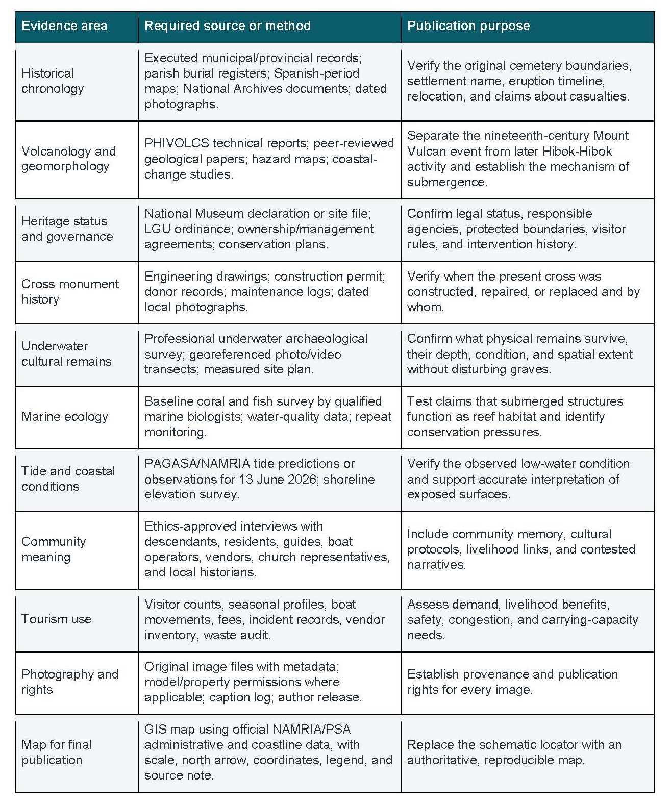
9. Research Gaps and Evidence Priorities
10. Future Research Agenda
1. Obtain written confirmation from the Municipality of Catarman, the Provincial Government of Camiguin, and the National Museum regarding the site’s official historical narrative, legal status, and governing rules.
2. Request PHIVOLCS or a qualified geologist to review the article’s description of the nineteenth-century event and the relationship between Mount Vulcan and Hibok-Hibok.
3. Commission a NAMRIA- or GIS-based location map and a separate site map showing the shore viewpoint, cross, known submerged features, and protected boundaries.
4. Conduct oral-history interviews using informed consent and identify whether descendants or community custodians prefer specific terminology for the burial site.
5. Undertake non-contact underwater documentation only with the required permissions and qualified heritage and marine specialists.
6. Validate the 13 June 2026 tide condition using an official tide source and preserve original photo metadata in the research archive.
References
Apple Maps. (2026). Camiguin Island, Mahinog, Camiguin, Philippines. https://maps.apple.com/place?place-id=I7C3C30D77575A7AE
Google Maps. (2026). Camiguin, Philippines. https://www.google.com/maps/search/Camiguin%2C%20Northern%20Mindanao%2C%20Philippines
Philippine Institute of Volcanology and Seismology. (2026, July 22). From Hibok-Hibok to PHIVOLCS: Commemorating the 1951 eruption. https://www.phivolcs.dost.gov.ph/press-release-from-hibok-hibok-to-phivolcs-commemorating-the-1951-eruption/
Provincial Government of Camiguin. (n.d.). Where to go: Sunken Cemetery. https://camiguin.gov.ph/where-to-go/
Wikimedia Commons. (2020). Ph locator camiguin.svg [Map]. CC BY-SA 4.0. https://commons.wikimedia.org/wiki/File:Ph_locator_camiguin.svg
Author and Copyright Statement
Mingae Gaces Samontina is the author of the field narrative, analysis, and original photographs reproduced in this article. Copyright © 2026 Mingae Gaces Samontina. External facts, maps, and institutional materials remain subject to their respective source terms and licenses. Publication in a journal, company platform, or commercial outlet may require additional permissions and independent editorial review.
Editorial note: This article distinguishes firsthand observation from externally sourced claims. Archival, geological, legal, ecological, and underwater questions that remain unresolved are identified in Section 9 as priorities for future research.
About the Creator
Domingo Añasco-Gaces Samontina, Jr.
.Professional Member of the Mechatronics and Robotics Society of the Philippines
.Certified Documented Information Controller with TUV Rheinland Qualifications
.Master of Science in Engineering (on-going) with Professional Teacher Certificate
Enjoyed the story? Support the Creator.
Subscribe for free to receive all their stories in your feed.
Comments
There are no comments for this story
Be the first to respond and start the conversation.