
3 Short Hikes in Chester, Vermont
High School Trail, Lost Mine Trail, and Butternut Hill Trail
I have lived in the small town of Chester, Vermont on and off for 20 years now. I have enjoyed walking on the trails within the town limits for a good share of those years. At first there was only one trail my family and I went on, the trail behind the local high school. But about 10 years ago or so the town made a new trail called the Lost Mine Trail, so we started hiking there as well. Then, about 3 years ago, another new trail was made, called Butternut Hill Trail, which we also checked out and now enjoy.
All three trails are worth exploring!
High School Trail
The trail behind the high school is actually several trails that are all connected. One way to get on the trail system is right by the school building...
but you can also enter in the upper field above the track...
Over the years they have expanded the trails closer to the school and take classes out on them for multiple reasons. I like to go with my nieces and nephews since it is a perfect trail for kids. There's even a frog pond not too far away...
Most of the trails are wide, with plenty of room for a group hike...

One of the attractions of this trail is the glacial boulder, which you can climb if you dare...


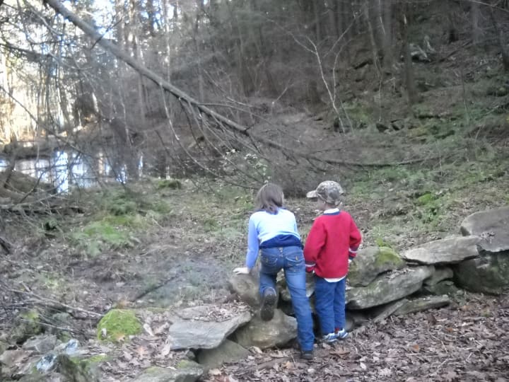
There are also the Lower Loop and Upper Loop trails further on, which go uphill, and have cool rocks to play in...

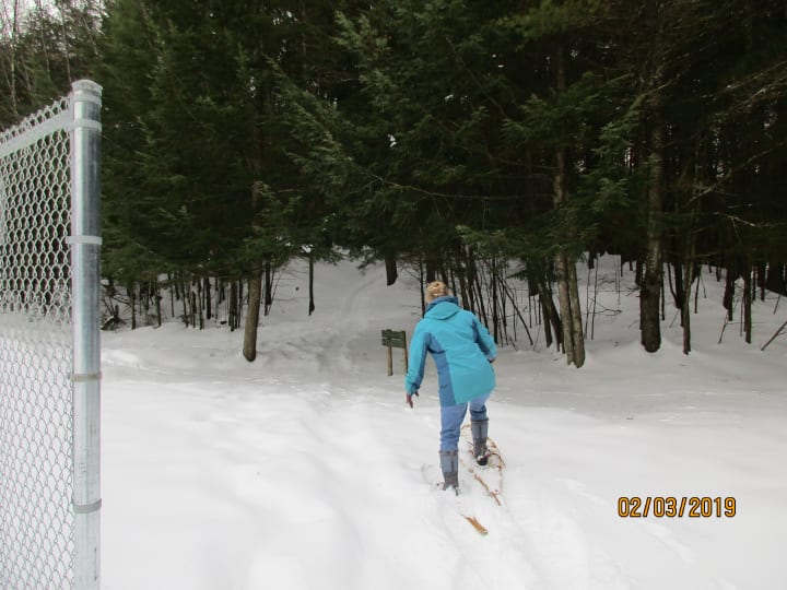
It is a great place to come all times of the year, even Winter when you can snowshoe!

And when it rains, mist rises from the ground, and you can find some orange salamanders/newts...


Lost Mine Trail
We discovered the Lost Mine Trail about 10 years ago, and have been hiking it ever since. It is named after the old talc mine where Chesterite rocks were discovered. It is located down Reservoir road headed west out of town. Passed the town reservoir and up the road there is a small turnoff where you can park.

It has a sign with information on the Lost Mine Trail...

It is a loop trail that is about 2.2 miles long, and takes about an hour and a half on average to complete.
We usually start right by the parking place, look for the small sign with the hikers on it back on the road about 30 feet...

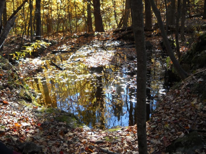
It continues up into the woods and leads to what remains of the old mine, which is now basically just a big hole in the ground full of water...
Red markers on the trees mark the trail, some easier to see than others…
During the summer, you can find some interesting mushrooms along the trail…

The trail leads up to the top of the hill, but has no view. However, when you start on the way down, you get a peak at Mount Ascutney…

Continuing down the other side, you eventually come to a spot where you can see a small brook down below that contains a small waterfall…

You then begin to climb again and end up at the dirt road at which you began, completing the loop!
Butternut Hill Trail
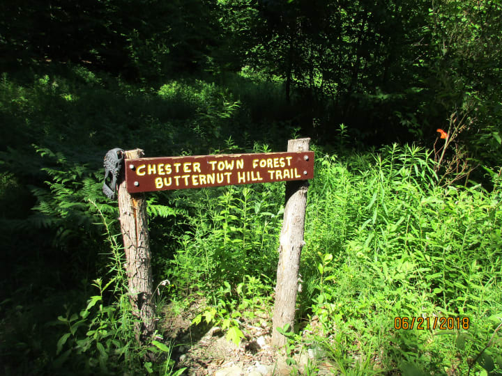
The Butternut Hill trail is the newest addition to the Chester trails network, and the hardest of the three. It can also be a loop trail since there are two ways to begin, but you have to walk on the road in order to do so. This trail is also located on Reservoir road, but instead of turning right down the road to the reservoir, you keep going.

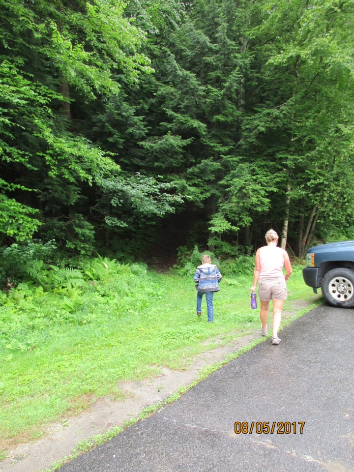
The first way to enter the trail is down the VAST snowmobile trail on the right side of the road…

You have to walk down the VAST trail for several minutes before you find the sign that says Lost Mine Trail on the left. When my niece and I went on it right before it officially opened there was no sign, so we guessed where to go…luckily we were right! There were some trail markers after a break in the stonewall that helped…

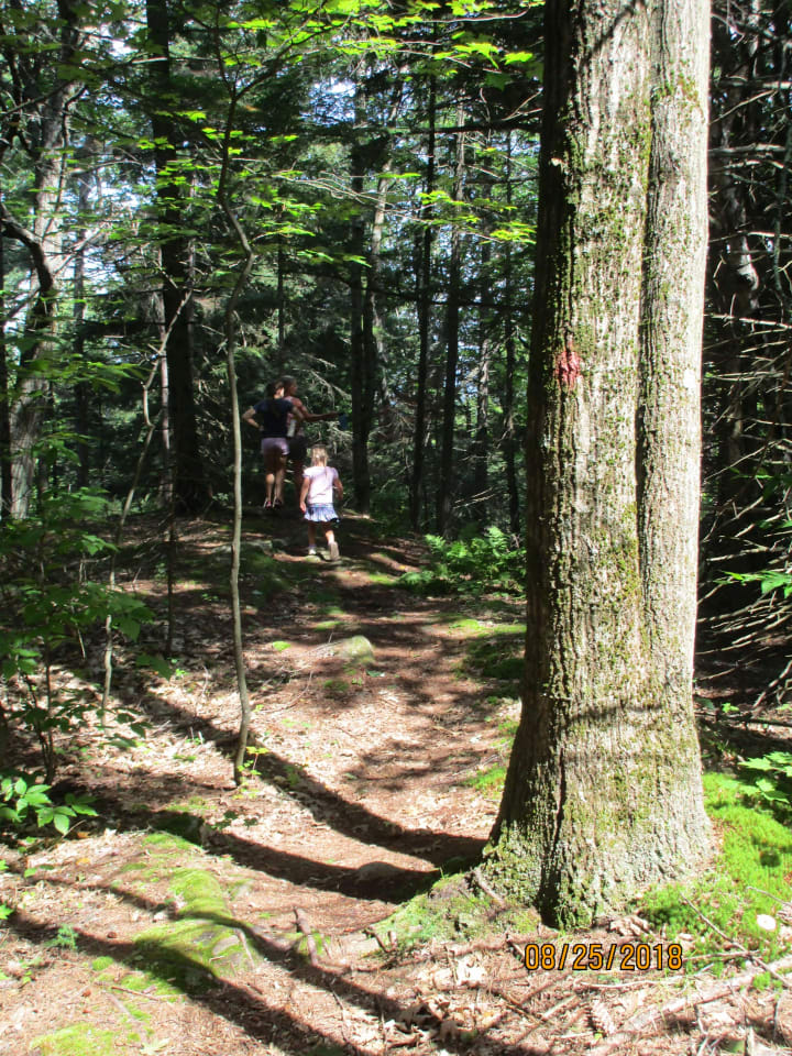
The trail is mostly narrow, but does open up in places, and goes up and down hills…

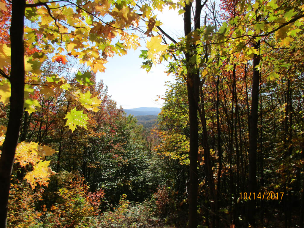
It has two spots to view nearby mountains. The first place offers a smaller window, and looks gorgeous in the Fall with all the pretty leaves…

The second view opens up onto rocks where you can see out towards Magic mountain, a nearby ski resort...

There are even two plastic Adirondack chairs to sit and enjoy the view…

Headed back down the other side, there is a cool rock that almost looks marbleized…

And some vines that climb up the trees…

After hiking down a somewhat steep hill, you reach the road, where the other entrance lies…
You then have to walk back on the road to where you parked. Or you can start here and go in the opposite direction, or just go to the top and back. If you do the whole loop, it's 1.9 miles long and takes a good 1.5 to 2 hours to complete with time to enjoy the view!
About the Creator
Keep reading
More stories from Rachael Spafford and writers in Wander and other communities.
Telluride
Nestled in a remote valley of the jagged San Juan Mountains in Colorado, Telluride draws visitors from around the world with its blend of old Western charm, vibrant contemporary culture, and breathtaking scenery. Originally a mining town, Telluride boomed in the late 19th century with the discovery of gold, silver, and, you guessed it, Tellurium. It was in Telluride that Butch Cassidy and his gang robbed one of their first banks. Telluride played a huge role in the creation of the Labor Movement with its mining worker strikes in the early 1900’s. And it became one of the first towns in the world to have commercial alternating current electricity thanks to Nikola Tesla and George Westinghouse.
By Jody Holmanabout 20 hours ago in Wander


Comments
There are no comments for this story
Be the first to respond and start the conversation.