
Exploring the Benefits of a Digital Twin City for Citizens
What are the Challenges of Digital Twin Technology?

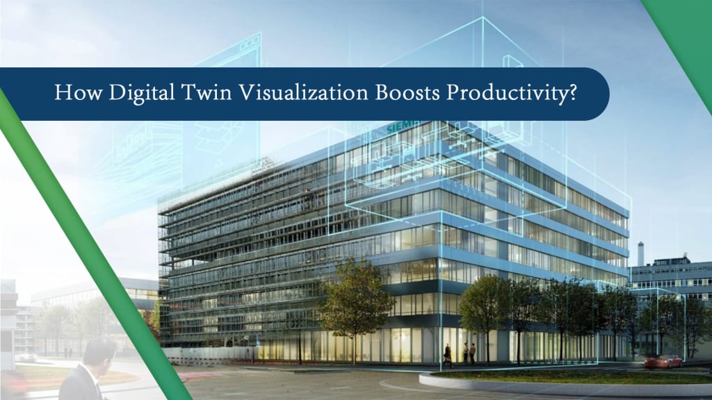
By 2050, the present 4.2 billion urban dwellers will grow by 2.5 billion, predicts the World Economic Forum. Due to this rise, cities and their supporting ecosystems must meet the need for housing and infrastructure while simultaneously addressing issues of quality of life, economic development, safety and security, and resilience.
Assets are becoming more and more susceptible to factors associated to climate change, such as drought, seismic activity, and strong storms.
Cities look for solutions that will enable them to lessen the ongoing strain on their current infrastructure and to lessen, respond to, and recover from the acute shocks of earthquakes, floods, and other catastrophic occurrences.
What is the main purpose behind development smart cities?
- Solution for Infrastructural Development: Each city data owner must make accurate and pertinent infrastructure information available to all appropriate departments, the city ecosystem, and frequently to people in order to address these real concerns.
It is crucial to have faith in the accuracy and completeness of the data used to support civic infrastructure and services. By taking into account the impacts of persistent stress on t must also be used to guide decision-making.
Further, it's critical to have access to reliable data that can be utilized to respond to and recover from acute shocks like those brought on by weather-related incidents.
How Technologies come into play for Holistic Infrastructure Asset?
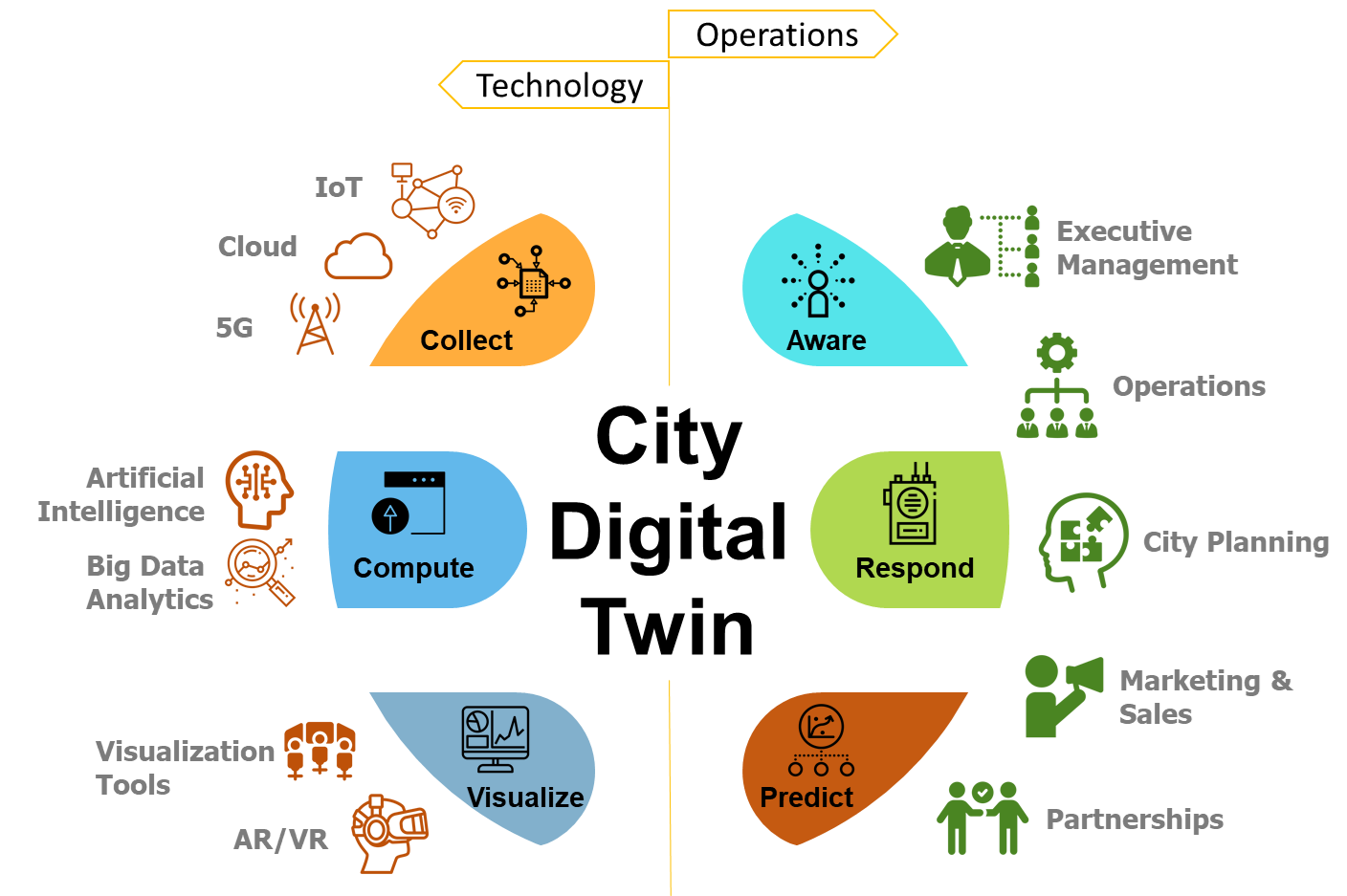
The city's infrastructure, population, and buildings are all advancing digitally. Cities offer a variety of new and improved services to people with the use of new technologies, such as Industry 4.0, the Industrial Internet of Things (IoT), sensors, RFIDs, smart phones, and cloud services. Digital twins, a digital representation of a physical asset, process, or system as well as the technical data that enables us to understand and model their performance, are at the centre of this digital revolution in many industries.
Asset-centric enterprises can combine their information, engineering, and operational technologies with the help of digital twins for immersive visualization and analytics visibility.
Digital twins offer an immersive and comprehensive perspective of infrastructure assets above and below ground. This is made feasible by convergence of 3D/4D visualization, mixed reality, reality modeling and geotechnical engineering.
Thought of an Industry Specialist – Vice President, Digital Cities, Bentley:
According to Robert Mankowski, Vice President of Digital Cities at Bentley Systems, the potential of a digital twin is in its ability to enable decision makers draw fresh insights and inform smarter decisions, giving a holistic visualization of infrastructure asset information and performance.
What are the Benefits of Digital Smart Cities System?
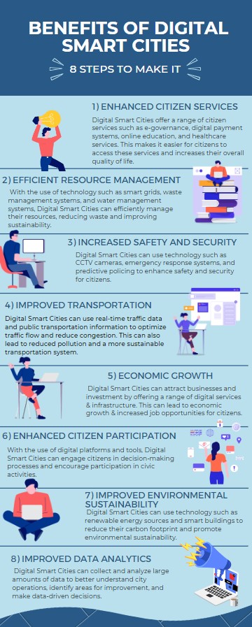
- Assembling knowledge to enhance city infrastructure:
Numerous towns have created digital footprints utilizing reality modeling, but they are frequently nothing more than eye-catching 3D representations.
This is due to the fact that various departments utilize various systems to manage data related to their unique architecture and operations. There are numerous formats in which the data is available, including CAD, BIM, and GIS, engineering models, spreadsheets, databases, documents, real-time and archived IoT data streams, pictures, and point clouds.
The data is tough to get and ensures that you have the appropriate information at the appropriate moment as it is always changing. You may easily access semantically rich models and be sure they are true and current by building an open, connected data environment (CDE).
By prolonging the life of assets and equipment and making reliable information accessible whenever and wherever it is required to support local infrastructure and services, city stakeholders can maximize operating budgets.
- Enhanced cooperation across diverse ecosystem of city stakeholders:
A collaborative approach to information benefits all stakeholders, including city departments, the city ecology, and citizens. Within and between cities, infrastructure for transportation is constructed, run, and maintained, including rail, highways, bridges, and tunnels.
So, it stands to reason that these groups would gain from efficient cooperation. To improve decision-making that results in the support of each group's goals, city operations, planning, and economic development, as well as emergency services and utility operators, must work together and share information with transportation authorities.
Hence, infrastructure owners may be confident that they have the most recent knowledge of the state of the environment before projects start by taking a comprehensive approach to consuming and sharing information.
Further, having the most accurate information enables stakeholders to be more proactive when communicating transportation and utility projects to the public and planning for interruptions, assisting the public in avoiding project area.
Additionally, by communicating the city's goal for improving infrastructure and mobility, this information helps the city better fulfil its promise of increased transparency.
- Increased accessibility and security in public areas:
With the use of digital twins, space can be used more effectively, which enhances building planning and design as well as safety, productivity, and profitability.
Additionally, they enable users to simulate and analyze foot traffic on or in infrastructure assets, such as stadiums, shopping center's, airports, and rail and metro stations.
Engineers and designers can precisely evaluate designs, operational plans, and business strategies using digital twins to improve foot traffic, way finding, crowd control, safety, and security.
- Better project visualization and urban planning:
Urban planners visualize projects spanning entire cities down to the street level utilizing a combination of terrain models, reality meshes, and semantic 3D city models by streaming large-scale digital twins online. Urban planners can now create designs with a higher level of detail.
Owners of buildings have a special influence on how cities develop digitally. Urban planners can combine intelligent models with individual buildings to create a citywide digital twin, which will enhance the intelligence of the city data.
To ensure that what is built improves the quality of life of the occupants, using digital twins to involve developers and building owners throughout planning helps to influence the new or refurbished space through incentives and zoning.
- Building resilient infrastructure by anticipating & recovering from shocks:
Flooding and significant infrastructure damage are brought on by extreme hydrometeorological occurrences, fast urbanization, and poor drainage substructures, which also have an adverse effect on public safety and the economy.
Urban planners must employ flood resilience technologies to fully control flood risks and quickly recover from any interruptions brought on by the event in order to prevent flood hazards and lessen the effects of a heavy downpour. The digital twinning allows for the transmission of precise and trustworthy risk and analytical data to organizations involved in flood mitigation, response, recovery, and preparation.
Additionally, they assist resilience teams in making better decisions by utilizing actionable data to predict early warnings and encourage response, so enhancing public safety and minimizing damage to infrastructure. The technologies reduce interruptions to the minimum extent possible, prevent further mitigation expenses, and speed up response times.
The scenario data can also be used by utilities to design mitigation plans, such as cost-benefit analyses of alterations to utility systems to avert system problems in the future.
- Engaging public, creating a feedback loop:
City planners can use digital twins to communicate plans in a thorough, appealing, and persuasive manner as well as to quickly gain support for projects. This information is provided to communities in order to improve their safety and prevent traffic congestion near project sites.
It also helps inhabitants understand how these plans will affect their daily lives. With the aid of digital twin technology, city planners can offer a quick, simple, and visually appealing approach to interactively discuss, promote, and share municipal initiatives in order to win over residents and draw in investors.
This sharing entails providing digital experiences (mixed reality and wearables), as well as crowd sourcing and visualization, using platforms including the web, smart phones, touch screens, and digital billboards.
- Adopting open data for development through reliable city and infrastructure data:
Open data ecosystems are a primary focus of many cities' digital city ambitions. Many collaborate with academic institutions, researchers, and other developers to provide citizens with apps and services through an open data effort.
How digital twin has impacted the industry?
Real-life Examples in USA:
- Boston Commons Downtown Park: Urban planners in Boston utilized ArcGIS Urban to explore several possibilities, such as building footprint, height, and location, and achieve their goals, reducing the amount of shadows thrown on the park.
- City of New York's Vision Zero: This dashboard, created by New York City for its Vision Zero program, displays important pedestrian safety indicators using data from sources and IoT sensors, including traffic sensors integrated into a geospatial context, intelligent cameras, and pedestrian traffic tracking. With the aid of predictive analytics and real-time traffic collision monitoring, public safety agencies can better regulate traffic flow and increase pedestrian safety.
- The City of Oshkosh, Wisconsin: Finding commercial and investment opportunities in Oshkosh, Wisconsin created a strategy Imagine Oshkosh to promote economic activity and secure investment possibilities in the wake of firms departing the city centre. The Envision Oshkosh strategy was developed, assessed, and communicated using ArcGIS tools including Business Analyst and CityEngine.
Thank you so much your such support and reading my articles. Please stay tuned for - my upcoming article i am going to cover about digital twin capabilities Or how BIM integrated digital twinning promotes growth and performance of construction companies.
About the Creator
Damanpreet Karr
Hi there, I'm Damanpreet Karr, a content creator with 10 years of experience. I'm a passionate content writer and creator with a knack for crafting compelling stories that engage and inspire. Industries- Architectural & Education etc.
Enjoyed the story? Support the Creator.
Subscribe for free to receive all their stories in your feed.
Comments
There are no comments for this story
Be the first to respond and start the conversation.