
The invisible barrier keeping two world
Separate world

In between two of the islands of Indonesia,
there’s an ancient line that is both real and not real.
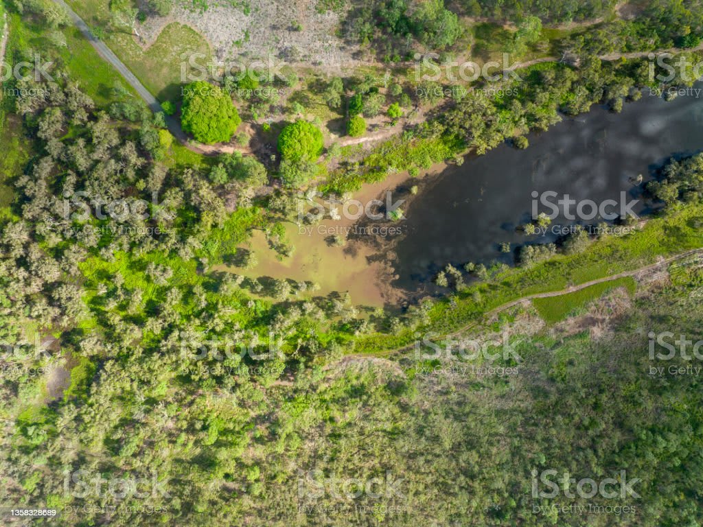
You can’t see it, but it’s there all the same. If you stood on the coast of Bali and looked east to the shores of Lombok, you’d be staring right at the line’s narrowest point: a 32 km stretch of water that seems pretty unassuming.
This invisible barrier weaves its way through the entire Malay Archipelago, the largest collection of islands on the planet.
See, on the western side, the animal life is characteristic of Asia, featuring rhinos, elephants, tigers, and woodpeckers, to name a few.
But cross the line, and things suddenly change. You won't find those same species on the eastern side. Instead, the islands have a different cast of ecological characters, including marsupials, Komodo dragons, cockatoos, and honeyeaters. This is what scientists call a biogeographic boundary, the meeting point of two regions of biodiversity that are highly distinct.
And this particular line, called the Wallace Line, is perhaps the sharpest and most iconic of all.
So how did this invisible line come to be? Why does it shape the distribution of so many species?
How did we figure out the path it takes?
And how can it be both real and imaginary?
The Wallace line was first sketched out in 1859 by a guy named, wait for it, Wallace.
Alfred Russel Wallace to be exact, is a British naturalist who you might have also heard of as the co-discoverer of natural selection.
That concept came to Wallace in a literal fever dream as he lay bedridden with malaria during part of his eight-year trip around the Malay Archipelago.
And while he’d end up being overshadowed by Darwin on that front,
the second-best idea he had on that trip was the existence of the Wallace line.
I mean…...you know, two good ideas in one trip.
This idea helped to forever establish him as the father of biogeography, the study of the distribution of living things.
He had spent his voyage observing and collecting as many species as he could,
hopping from island to island across almost the entire archipelago.
And it was as he moved east from Bali to Lombok that he first noticed something intriguing. Even though the islands were separated only by a narrow strait, the change in animal life wasn’t gradual and subtle, it was sudden and distinct.
Wallace saw the differences in animal life between the two as being even more striking than between England and Japan!
It was birds that initially caught his attention. Certain species that were plentiful on Java and Bali - like the yellow-headed weaver, coppersmith barbet, and the Javanese three-toed woodpecker - Few didn’t exist at all on Lombok. And this abrupt shift extended to mammals and even many insects, too.
Almost as if an invisible barrier was separating two different worlds. But why? And how?
The biogeographic line that he drew, which others would tweak in later years, didn't just reflect the proximity of the islands. Some islands on opposing sides of the line are closer to each other than many islands on the same side are to one another.
So Wallace realized that other, more mysterious forces must be in play. Like, say, geology.
He recognized that the geological past shapes the biological present. And, because the distribution of living species today partly reflects ancient geological events, he saw biogeography as a way to uncover epic chapters of the planet’s history that might otherwise have been unknowable.
These concepts are easy to take for granted today - we talk about them
all the time here on Eons - but they were still fairly new ideas in Wallace’s day. And by taking this perspective, he concluded that the western islands must have once all been connected to each other, and the Asian mainland. While today they are surrounded by shallow seas, this is only the result of a geologically recent rise in sea levels.
How else could the big animals of that side, like tigers and rhinos and tapirs,
have ended up on the islands? Because they’re now separated by expanses of water that are way too wide for those species to cross.
He had a similar thought about how the islands east of Java and Borneo
had formed - at least some of them were the remnants of a former Australian continent.
Wallace had a hunch that, throughout all of that change, deeper waters with strong currents between the two regions must have prevented many species from crossing from continent to continent when sea levels were lower.
And this is still preventing many species from crossing today when sea levels are higher and the continents are fragmented into neighboring groups of islands.
Even many flying bird and insect species obey the line, ones that aren't capable of crossing those stretches of open ocean.
Wallace had pulled together many pieces of the puzzle, but he and other scientists at the time were missing one key idea to complete the picture… Plate tectonics.
The surface of the planet is not static, of course, it’s dynamic. It’s made up of
individual large sections or plates that move and collide over vast stretches of geologic time.
It’s yet another concept that’s easy for us to take for granted, but which is a relatively recent addition to our understanding of the world.
Plate tectonics only became widely accepted in the late 1960s – more than half a century after Wallace’s death.
And also, around the time when I was this which means, I'm…...I'm as old as plate tectonics…We now know that plate tectonics shapes our planet in many ways, including forming and deforming continents, raising island chains, and building mountain ranges.
And studies have shown the Malay Archipelago to be one of the most complex tectonic regions in the world, a meeting point of multiple plates all jostling for space.
And this is responsible for not only the area’s many volcanoes and frequent seismic activity but also the peculiar contrasts of its animal life.
Because by the 1980s, scientists were able to say with confidence that the Wallace line is, at its core, a result of plate tectonics.
Wallace had correctly identified that two former continuous land masses had existed on either side of this line in the deep past.
Today, we know them as the paleo continents of Sunda in the west and Sahul in the east, both of which existed during the ice ages when more water was locked up in ice and sea levels were lower.
Wallace didn't know it, but while they’re pretty close now, the two partly-sunken continents used to be much, much further apart.
The Sahul continent of the eastern side of the line, encompassed Australia, Tasmania, New Guinea, and the Aru islands.
And it only approached the Asian Sunda continental shelf in the west around 20
to 25 million years ago in the late Oligocene or early Miocene epoch.
This was a result of the Australian plate slowly drifting north over tens of millions of years after breaking away from Antarctica in the south, bringing its distinctive community of birds, reptiles, and marsupials with it.
So even though the species of each side are neighbors now, they’d been evolving separately for eons, their two worlds only colliding fairly recently in evolutionary terms.
And in between them, immediately east of the line, a complex force of plate tectonics
created a chain of new islands in an area of the archipelago that’s now called Wallacea.
These oceanic islands differ from the continental islands that flank them in that they were never connected to either of the greater land masses.
They were ecological blank slates waiting to be filled in with whatever creatures could make it there.
And those ended up being mostly species from the Australian side, seeing as the Wallace line acted as a barrier to Asian species moving east.
Take, for instance, the Komodo dragon,
a giant monitor lizard that today lives on a handful of islands in eastern Indonesia.
Their fossils first appear in mainland Australia more than 3 million years ago in the Pliocene epoch, only reaching their current Indonesian island homes in the Wallacea region around 1 million years ago.
And even now, the deep waters with strong currents that weave between the two regions, including the strait between Lombok and Bali, still limit the dispersal of many species across the line, keeping the differences in their evolutionary history so strikingly visible.
This is what created the stark contrast bisecting the jungle of islands that Wallace first sketched out in 1859, and that still fascinates biogeographers today.
Wallace’s invisible line may not be real in a physical sense, but it shows just how loudly ancient geological events can echo through time, and how they shape the diversity and distribution of life in strange and contrasting ways.
And while Darwin might get virtually all the credit as the guy who figured out how species came to be, Wallace is still recognized as a pioneer in figuring out how species came to be where they are.
About the Creator
Keep reading
More stories from Muokelo Charles and writers in Earth and other communities.
Most terrifying planets
T-r-e-s-2b is a planet where night never finishes and it's not your standard Knight with stars sparkling in the lovely Skie. Here it's black as night and searing High Tres 2B is a gas monster approximately one and a half times more huge than Jupiter and its surface retains light better compared to charcoal it could likewise have a weak dim red sparkle as a result of it's consuming air which is essentially as hot as new magma exquisite in the star arrangement of 55 malignant growth, there are five planets four of which are gas goliaths like Jupiter and Saturn however the fifth one or rather the first since it's nearest to the star is different in a most terrible manner. 55 Cancrie is so near its Sun that a portion of the planet's surface is a strict Sea of liquid magma the other half is an everlasting Haziness since it never sees the sun the planet is constantly gone to its star on one side and between the singing and the dull there's a Twilight Zone is a meager portion of miserable nothingness hd189377 B Well I won't say that again is the just exoplanet in the circle of its star and right away, it looks very lovely blue and white twirls making up wondrous examples on a superficial level yet these Wonderful varieties come from hard silicate particles in the planet's air which implies it downpours glass here,, however the most terrible is that breezes arrived at the speed of 5400 miles each hour or nearly Mach 7.
By Muokelo Charlesabout a year ago in Earth
A Few Significant Realities About the Moon
Presentation: The moon, Earth's just regular satellite, has captivated humankind for centuries. Its ethereal sparkle in the night sky has motivated endless fantasies, legends, and logical requests. As our nearest vast neighbor, the moon holds a conspicuous spot in human culture and logical investigation. In this paper, we will dive into a portion of the fundamental realities about the moon, investigating its structure, stages, impact on The planet, and importance in space investigation.
By Md Anas Khan7 days ago in Earth


Comments
There are no comments for this story
Be the first to respond and start the conversation.