
Mariscal Canyon, The Path Less Traveled
The Third Day of Camping in Big Bend National Park
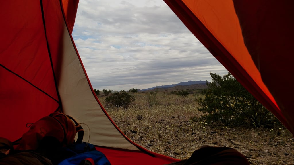
At 6:30a, coyotes howled not far from our tent. There was a pack of them, all howling together, yipping here and there. They kept it up until almost 7 and Ian and I decided to wait a few minutes before moving around and getting out. The air outside was cold, the sun still behind Mariscal Mountain, and we quickly bundled up and began cooking our breakfast.
Breakfast consisted of oatmeal and tea, a little bit of dried fruit and some jumping jacks to get warmed up. I set up the camera to film the sunrise over the mountain as we ate. We checked the maps, talked about the plan for the hike and began packing our daypacks. We packed lunches, snacks, and a few liters of water each. Once we were packed and breakfast cleaned up, everything stowed in the car and bear box, we slung our backpacks over our shoulders and followed the road about a mile to the trailhead.

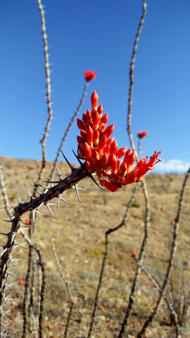
At the trailhead, we saw a pack of wild horses in the brush by the river. We spent a few minutes watching them before turning north and heading into the brush, ourselves. The beginning of the trail was thick with bushes and wildflowers. Long, spindly branches reached out in every direction and we found ourselves ducking and stepping over plants. Even though the area around our tend was far from barren, it was strange to have walked such a short distance only to find ourselves in a thicket that blocked our view past the next bend in the trail.
It wasn’t long before the trail gained in elevation. The climb was easy, but it brought us out of the brush and into the full light of the sun. After a moment to reflect on how far we had already walked (and to spy Ian’s car on a hill in the distance). We continued on.
Even though it isn’t a particularly difficult hike—3.5 miles one way—Mariscal Trail is one of the least-traveled trails in the park, being in such a remote location. For many of the backcountry trails, the way is marked with cairns. As we climbed the hills approaching the mountain the trail would disappear entirely. We would stop, hold our hands up to block the glare of the sun and look around until, some fifty feet away, we spotted the next cairn. The trail continued like this up most of the mountain until, suddenly, we were walking alongside the edge of the canyon.
We picked our way carefully off the trail to the very edge and peered over, the Rio Grande winding through the rock some 1300 feet below.

It took us another half our or so to find a spot flat enough to sit down and have lunch. We made some rice and beans, gulped down water and lounged in the hot sun. Once we finished eating, we packed our cooking supplies, reapplied sunscreen and headed back down the way we came. The route back to the campsite took far less time. Heading downhill helped. It was hot out in the mid-afternoon sun and there was no shade at camp. So we hopped into the car and took the drive around the north side of Mariscal Mountain to visit the abandoned quicksilver mine on the eastern face.

We spent a few minutes poking around more the abandoned houses at the base of the mountain, then hiked up the trail to the mine itself. The shafts have been sealed, but there were more houses and a few other buildings. After an hour or so we climbed back into the car and headed back to camp to make dinner. With the sun quickly dropping on the horizon, the air cooling off, we cooked our dinners on top of the bear box, watching a small herd of cattle move south in the distance, towards the river.
We sat on some rocks overlooking our tent and watched the sun set on the horizon. There are more cliffs along the horizon, the furthest point we can see. The sun shone through a gap, tiny from where we sit, but big enough we can see the light poking through it. It’s hard to judge distances when things are so wide open. It seems like the Chisos Mountains are just as huge from where we sit at our campsite as they were from the water cache along the outer loop trail. It’s easy to imagine the cliffs along the western horizon to be the far boundary of the park. But they aren’t. There’s still another 30 miles past the point of the gap to the western border of the National Park.
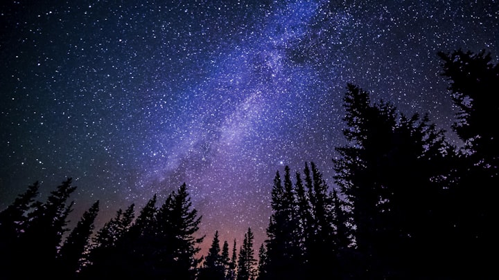
When the sun went down, we turned to find the very nearly full moon just above Mariscal Mountain. It cast an eerie white glow across the landscape, shadows somehow losing their sense of depth. A faint haze hung in the air above us, the afternoon’s humidity sapped away from the ground by the cold, dry night air.
We climbed into the tent tired, but excited about the next day. We would be leaving our campsite at Tally 2 and heading to the southeast corner of the park for two days on the Marufo Vega Trail.
About the Creator
Keep reading
More stories from Adam Lupiani and writers in Wander and other communities.
Was I a Model in Japan?
During my time in Nagoya I worked and lived at the strangely famous hostel and café Nagonoya. With its chequered floors and florescent lighting it felt quite dated, but I think that was supposed to be part of the charm. The dorms were always fully booked on weekends with domestic tourists and there was always a buzz in the downstairs café. Camera crews were constantly in and out of the place interviewing the Japanese staff members who worked the café. I think it had something to do with the egg sandwiches. At least that was what was on most of the merchandise, except for that one dishcloth with the owner’s face on it. Was I being employed by a local celebrity?
By Susanna Kiernan5 days ago in Wander
AN OASIS IN THE SUGARCANE (1)
A WEEKEND IN PARADISE AHEAD Once in a while, even an author needed a break from his job, so Jean had no problem with convincing me to go on this trip. He worked for a huge web design company who created the webpages for some hotels and tourist attractions in Mauritius. They usually tested the facilities before they created the internet presence.
By Krishan Mubashar4 days ago in Wander
First Starlight of Summer
Your whole being is constituted by yearning. You miss the stars but have never seen a fully-realized night sky sparkle to life before your eyes. You write things, funny but short but profound, emulating the archaic cosmos that turns by its own unknowable calculus emulating love in all its celestial glory turning in that same cryptic way, but fully know neither and hardly know both, and it feels disingenuous, so you write about writers. It feels vaguely masturbatory, but it’s funny but short but profound and it impresses the people around you enough, so you run with it forever until you can’t anymore.
By Steven Christopher McKnight3 days ago in Fiction


Comments
There are no comments for this story
Be the first to respond and start the conversation.