

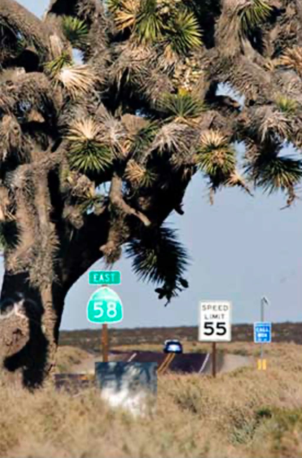
California 58
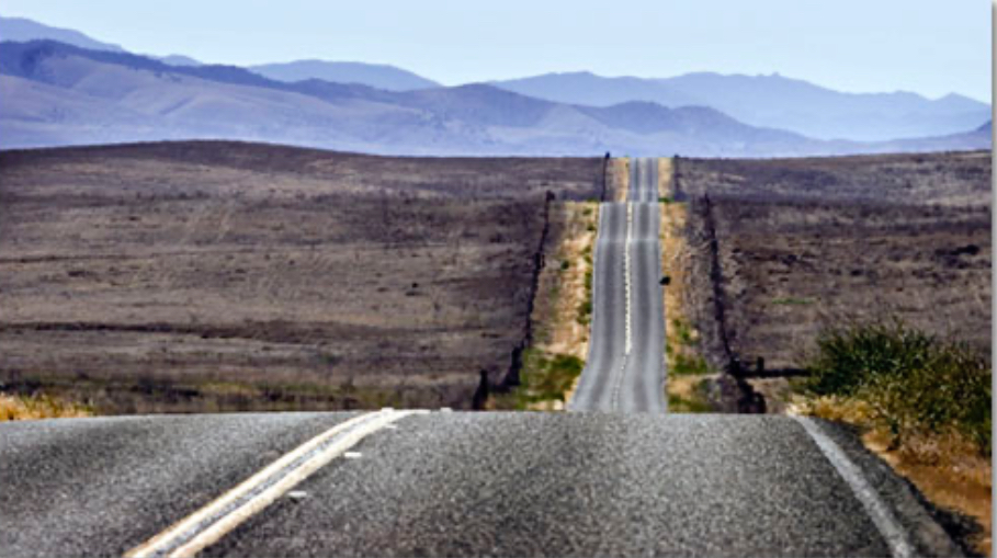
A desert Highway in California.
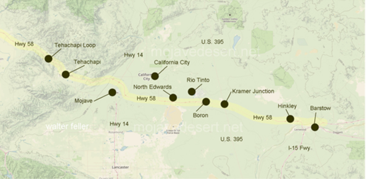
California State Route 58, also known as the Blue Star Memorial Highway, is a 238-mile scenic drive that crosses California's diverse landscapes. It starts in Barstow, San Bernardino County, and ends in Santa Margarita, San Luis Obispo County, near the coast. The route traverses the Coast Ranges, the Mojave Desert, the southern San Joaquin Valley, the Tehachapi Mountains, and the southern Sierra Nevada, but for this article I’m starting in Tehachapi and traveling through the Mohave desert to Barstow, which is the direction I go to get to Quartzsite, Arizona and Tucson beyond there every year for the last 30 years.
MommyDaddy, are we there yet?”
Common enough questions from the kids, as it is long, hot, quiet, boring ( for kids).State Highway 58 gets very little press. But for the adventurous, 58 has its own quirky charms.
QUIRKY HIGHWAY: The quintessential emblem of the Mojave Desert, the Joshua tree, grows along the highway near Kramer Junction. The Joshua Tree is one of the biggest attractions for me on Hwy 58, and the biggest reason I go this way to get to Tucson.
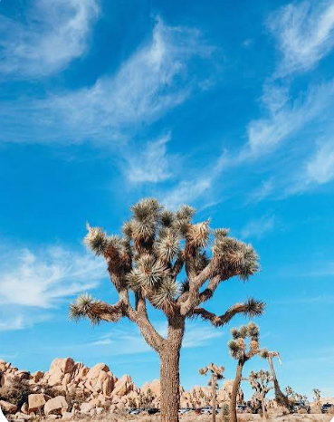
Just off Hwy 58 is the Joshua Tree National Park.
Joshua Tree National Park in California protects a unique desert landscape where the Mojave and Colorado Deserts meet, famous for its namesake Joshua trees, dramatic rock formations, and incredible stargazing. Visitors enjoy hiking, rock climbing, camping, and exploring diverse ecosystems, but should be prepared for extreme temperatures and a lack of services like gas or water inside the park. The park is open year-round, with spring and fall offering the most pleasant weather for daytime activities.
Key features
Landscapes: A mix of Mojave and Colorado Desert ecosystems, featuring Joshua trees, monzogranite rock formations, sand dunes, and dry lakebeds.
Activities: Hiking, rock climbing, camping, 4x4 driving, and stargazing (it's an International Dark Sky Park).
Wildlife: Home to desert bighorn sheep, coyotes, jackrabbits, and many other desert animals.
History: The area has been inhabited for 5,000 years by Indigenous peoples, including the Serrano, Chemehuevi, and Cahuilla.
I live in Northern California, past Sacramento, and travel to Tucson every February for the Tucson Gem Show, where I sell beads. It is the biggest gem show in the world. So I drive south on Hwy 99 until I reach Hwy 58 in Bakersfield, and go east on Hwy 58 To Tehachapi. The only interesting thing in Tehachapi for me is a friend who lives there, and owns a bead store, Karen Lewis (Klew) - the spirited bead. She is a talented and famous polymer clay bead maker.
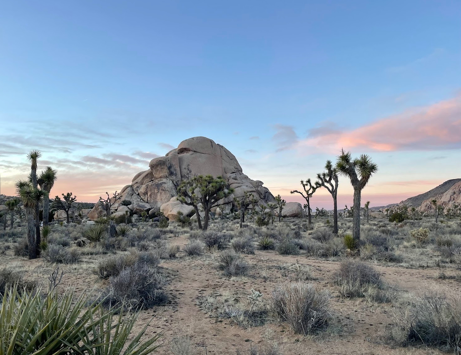
Leaving Tehachapi I travel east over the mountains covered with windmills and immediately enter a forest of Joshua trees. They grow all through the Mohave Desert, past Kramer Junction all the way to Barstow, where Hwy 58 ends, intersecting with interstate 15.
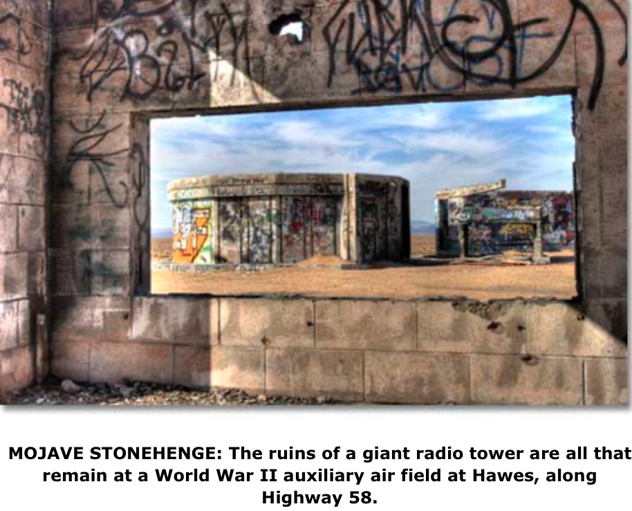
One mile south of the highway and two miles west of Harper Lake Road, a dirt road veers off to the graffiti-covered Hawes Auxiliary Field Tower Site, which I call the “Stonehenge of the Mojave” for its distinctive profile on the horizon.
At Kramer Junction (Highways 58 and 395), the largest solar energy generating station in the world, operated by Florida (Florida? In California?) Light and Power Co., can be seen from both roads. It is closed to the public but it is possible to see the giant mirrors from outside the perimeter fence.
After passing through Kramer Junction, you’ll notice some strange, large structures on the ridge, visible to the south of Boron. This is a space simulation facility run by Phillips Lab with several rocket-engine test stands that create quite a noisy sight when in operation. Leuhman Ridge is known locally as “Rocket Hill.”
The U.S. Borax Mine, on the north side of the road, operates California’s largest open pit mine. It is open for tours with a great visitors center.
Off in the desert are the remains of a jet-engine test site which have a vaguely Aztec-ruins look to them. The book says it’s four miles from the highway to the photogenic ruins on the misnamed "Gebhart" Road. But it is actually less than three -- on Gephart Road -- according to the highway signs. Otherwise the directions are fine. A definite feeling of “desolation in the middle of nowhere” pervades the senses even though the main road is so close. There could be asbestos on the ground, so keep that in mind when visiting.
Highway 58 bypasses the town of Mojave now, but it is worth leaving the main road behind for a few minutes to explore another historic desert town with vintage motels, mining districts and eateries, one of those steps-into-the-past that are fast disappearing from the American landscape. You won’t find a Starbucks here, but you can eat at Denny’s. Founded in 1953, Denny’s is an American institution.
some interesting things to see on this road:
1. Tehachapi: Famous for the Tehachapi Loop, a remarkable engineering feat where the railroad line loops over itself to gain elevation. The area is also known for its wind farms, with hundreds of wind turbines dotting the landscape.
2. Mojave: A small town known for the Mojave Air and Space Port, which includes a large aerospace testing and development facility. This area is significant for its contributions to private spaceflight and aviation research.
3. Edwards Air Force Base: Located near SR 58, this is a major U.S. Air Force base known for its role in testing and developing advanced aircraft. The base has a rich history in aviation and space exploration.
4. Barstow: A key junction where SR 58 meets Interstate 15, Barstow is known for its rich mining history and as a gateway to the Mojave National Preserve. Attractions include the Route 66 Mother Road Museum and the Desert Discovery Center.
5. Calico Ghost Town: Near Barstow, Calico is a former mining town that has been restored as a county park. It's a popular tourist attraction, offering a glimpse into California's mining history.
6. Natural Scenery: The highway offers views of diverse landscapes, including the Sierra Nevada mountains, the Tehachapi Mountains, and vast desert plains. The scenic beauty of the area is a significant attraction in itself. And don’t forget Joshua trees, they don’t grow anywhere else.
These points of interest highlight the cultural, historical, and natural diversity found along SR 58. The route offers a unique cross-section of California's heritage, from its agricultural and industrial roots to its role in the aerospace industry and the preservation of its natural landscapes.
What makes this road so special for me, is that once you leave the town of Tehachapi you are in the desert. Almost no traffic, oh yes, tip - bring your own music, there is no radio reception on this road. Just wide open spaces, Joshua trees, rest stops to pull over and stretch your legs and rock hound for a bit ( one of my wife’s favorite things to do.) The Joshua trees remind me of ancient dinosaurs, tree dinosaurs, which is the second reason I choose this road. You don’t see Joshua trees growing anywhere else.
ok, load your car, stock lots of water, and enjoy the desert road trip.
About the Creator
Guy lynn
I’m interested in history, space travel and the possibilities, Americana,( where I live now), Africa (Southern Africa, where I was born and raised), and I write about things that interest me ( bead history) and I hope will interest you.
Enjoyed the story? Support the Creator.
Subscribe for free to receive all their stories in your feed.
Comments
There are no comments for this story
Be the first to respond and start the conversation.