
Weeks before a major volcano erupted, warning signs appeared.
Prior to the eruption, heat

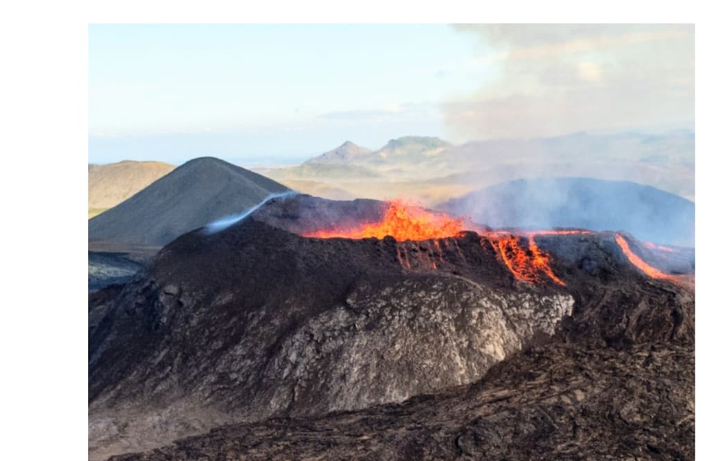
A recent study found that approximately one month prior to its 2022 eruption, the giant Hawaiian volcano Mauna Loa released a detectable heat signature. The same record demonstrates how lava that stopped short of a crucial road might help scientists interpret Venusian volcanoes and intensify warnings on Earth.
Lava close to the road
The Daniel K. Inouye Highway was the direction of the major lava stream during the Hawaii Island eruption in 2022. Dr. Ian T.W. Flynn of the University of Pittsburgh monitored the advancing front's daily movement using satellite imagery.
According to the data, the front traversed almost 80% of its 11-mile route in 48 hours before slowing down as supply declined. Officials may decide to secure roadways, reroute commuters, or keep a closer eye on neighbouring areas as a result of this quick early action.
Prior to the eruption, heat
The surprise was further enhanced by heat records: on October 22, 2022, a little increase in temperature occurred within the volcano's top region. That warm region was distinguished from typical hot ground and foggy sceneries via machine learning.
As magma surged into the volcano's storage system, earthquake activity also rose. Although a single heated patch cannot ensure an eruption, when other signs coincide, it provides monitors with more motivation to investigate.
Why this volcano is unique
Warning signs should not be reproduced carelessly because Mauna Loa operates differently from Kilauea, its active neighbour on Hawaii Island. Before lava reaches the surface, some volcanoes heat older fissures, expand, and release more gas.
According to Flynn, "every volcano has its own personality." Particularly in areas where humans reside close to rapid lava routes, site-by-site records transform that personality into a useful warning.
Calculating the thickness of lava
Satellite height maps revealed that the lava field and vents covered 13.8 square miles after the eruption. By comparing ground heights before and after, scientists were able to determine the amount of fresh rock that had accumulated during each section of the flow.
The entire amount of new rock was around 0.031 cubic miles, with the deepest zones reaching over 66 feet. Forecasts are affected by thickness because deeper lava cools more slowly, retains heat longer, and blocks land more firmly.
Cooling down after a threat
Because heat persisted for months beneath the dark crust, lava did not instantly become harmless when it stopped moving. While thick portions remained heated for almost 21 months, thinner flows dropped to background temperatures in 3 or 4 months.
"It's still dangerous if it's still hot," Flynn stated. Long after the glow fades, fieldwork can become hazardous because to lingering heat that can force hazardous gases from raw rock.
Satellites help expedite decision-making.
During the fast-moving days, commercial fleets provided clearer images, while government satellites provided consistent heat records. Instead of merely viewing a before-and-after shape, researchers were able to quantify altering flow speed because the images were received frequently.
The 2022 lava came within 1.7 miles of the highway, according to a later assessment from the U.S. Geological Survey. While lava cannot be stopped by faster photos, they can lessen confusion while emergency choices regarding roads and crews are still being made.
Heat cameras maintained a trustworthy record.
Orbiting heat cameras had been measuring Mauna Loa's temperature from space during frequent passes well before eruption night. Over several years, the Advanced Spaceborne Thermal Emission and Reflection Radiometer, a heat-mapping device on NASA's Terra satellite, captured surface details and land heat.
Because software was able to compare each image with typical conditions thanks to that record, little variations in temperature did not become noise. Future alerts are less reliant on a single fortunate photo or a clear-weather pass when the archive is better.
Venus's lessons
Venus enters the narrative because its clouds obscure its surface, forcing scientists to utilise orbital measurements to deduce the presence of new lava. During a NASA mapping trip in the 1990s, radar alterations that best suit new lava flows were discovered by a recent study on Venus.
Researchers can determine whether a hot Venus feature is new, fading, or just old rock by using Earth lava cooling rates. Earth laws must be modified prior to use since Venus has different air, pressure, and surface temperatures.
A more promising future
Combining heat, motion, thickness, gas, and ground shaking into site-specific systems will improve forecasts. The new record links subsequent flow speed and cooling to a pre-eruption heat signal for Mauna Loa.
Years of local data at each location are still required for other volcanoes before a pattern can be considered reliable. Even when the statistics appear remarkable, this limit maintains the finding's usefulness without assuming that a single volcano can account for all eruptions worldwide.
A 21-month cooling trail, a little early heat signal, and a road-threatening eruption now make up a more coherent warning scenario. While ambiguity persists, future monitors can use that story to watch sooner, map more quickly, and safeguard people.
About the Creator
Enjoyed the story? Support the Creator.
Subscribe for free to receive all their stories in your feed.
Comments
There are no comments for this story
Be the first to respond and start the conversation.