
LiDAR Market Outlook: Advanced Sensing Technologies and Growth Opportunities
The LiDAR Market is experiencing rapid growth driven by increasing adoption of advanced sensing and mapping technologies across industries.

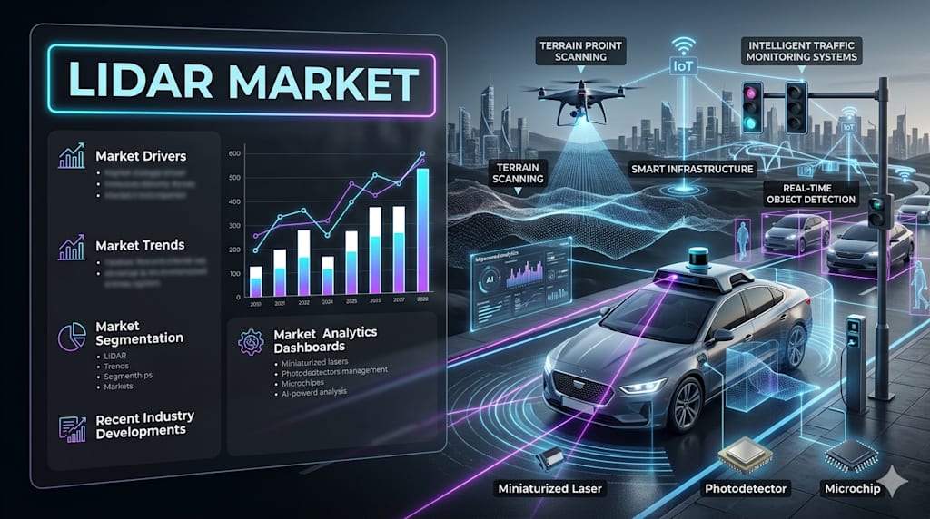
According to IMARC Group's latest research publication, The global LiDAR market size was valued at USD 3.65 Billion in 2025 and is projected to reach USD 14.73 Billion by 2034, exhibiting a CAGR of 16.27% during the forecast period 2026-2034.
How AI is Reshaping the Future of LiDAR Market
- AI-Enhanced Object Detection and Classification: Machine learning algorithms process LiDAR point cloud data in real-time, automatically identifying and classifying objects like pedestrians, vehicles, and obstacles with exceptional accuracy. Deep neural networks analyze millions of data points per second, enabling autonomous systems to make split-second navigation decisions in complex environments.
- Predictive Analytics for Autonomous Navigation: AI systems integrate LiDAR data with GPS, cameras, and radar to predict traffic patterns, pedestrian movements, and potential hazards before they occur. Advanced algorithms process 360-degree environmental scans continuously, optimizing route planning and collision avoidance strategies for autonomous vehicles operating in dynamic urban settings.
- Intelligent Point Cloud Processing and Noise Filtering: Artificial intelligence automatically removes atmospheric interference, vegetation noise, and sensor artifacts from LiDAR scans, delivering cleaner datasets with 40 percent improved accuracy. Machine learning models trained on millions of scans distinguish between meaningful terrain features and irrelevant data points, accelerating mapping workflows significantly.

LiDAR Industry Overview:
The global autonomous vehicles market reached USD 81.0 Billion in 2023, driving unprecedented demand for high-precision LiDAR sensors essential for safe navigation. Self-driving vehicles utilize LiDAR technology alongside cameras and radar to create real-time 360-degree environmental views, detecting obstacles and enabling informed navigation decisions across all driving conditions including complex urban settings and challenging weather scenarios where safety remains paramount for widespread autonomous deployment.
LiDAR Market Trends & Drivers
The explosive growth in autonomous vehicle development and advanced driver assistance systems is fundamentally transforming LiDAR technology adoption across the automotive sector. Light vehicle sales in Canada increased 6.6 percent to 1.64 Million units in 2021, reflecting growing integration of LiDAR-equipped ADAS features in passenger vehicles. Leading automakers are deploying solid-state LiDAR solutions offering enhanced durability, compact designs, and significantly lower costs compared to traditional mechanical systems, enabling mass-market adoption in mid-range and economy vehicles beyond premium segments. Innoviz Technologies accelerated delivery of InnovizTwo LiDAR platforms to Volkswagen Autonomous Mobility, equipping hundreds of ID.
Rapid urbanization and smart city initiatives are creating massive demand for high-resolution 3D mapping and infrastructure monitoring solutions powered by LiDAR technology. The World Bank reported approximately 50 percent of the global population resided in urban areas in 2023, generating urgent needs for efficient transportation systems and traffic management solutions. LiDAR captures detailed information on road networks, traffic patterns, and pedestrian flows, enabling transportation planners to optimize traffic signals, design safer intersections, and plan public transit routes more efficiently.
The expanding adoption of precision agriculture and environmental monitoring applications is driving LiDAR market growth across agricultural and geospatial sectors. The global precision agriculture market is projected to reach USD 20.2 Billion by 2032 as farmers increasingly deploy LiDAR-equipped drones for crop health monitoring, yield prediction, and field mapping optimization. LiDAR technology provides exact measurements of plant spacing, row alignment, and crop maturity, enabling farmers to modify planting densities, reduce crop damage during harvesting, and increase efficiency resulting in higher yields and lower operational costs. Airborne LiDAR systems mounted on aircraft survey vast agricultural lands quickly with exceptional precision, detecting subtle terrain variations affecting drainage patterns and soil conditions invisible to traditional surveying methods.
Leading Companies Operating in the Global LiDAR Industry:
- Faro Technologies Inc.
- Innoviz Technologies Ltd.
- LeddarTech Inc.
- Leica Geosystems AG (Hexagon AB)
- NV5 Global Inc.
- Quanergy Systems Inc.
- RIEGL Laser Measurement Systems GmbH
- Sick AG
- Teledyne Technologies Inc.
- Trimble Inc.
- Valeo
- Velodyne Lidar Inc.
LiDAR Market Report Segmentation:
By Installation Type:
- Airborne
- Terrestrial
Airborne represents the largest segment, as it enables rapid surveying of large terrain areas with exceptional precision and efficiency, ideal for topographic mapping, urban planning, forestry management, and infrastructure inspection.
By Component:
- Laser Scanners
- Navigation Systems
- Global Positioning Systems
- Others
Laser scanners hold the largest share of the industry, as they emit laser beams measuring return time to create highly detailed 3D environmental maps essential for autonomous vehicles, ADAS, topographic mapping, and infrastructure monitoring.
By Application:
- Corridor Mapping
- Engineering
- Environment
- Exploration
- ADAS
- Others
Corridor mapping represents the leading market segment, driven by detailed surveying requirements for linear infrastructure including roads, highways, railways, pipelines, and power lines where high-resolution 3D data supports design, construction, and maintenance.
Regional Insights:
- North America (United States, Canada)
- Asia Pacific (China, Japan, India, South Korea, Australia, Indonesia, Others)
- Europe (Germany, France, United Kingdom, Italy, Spain, Russia, Others)
- Latin America (Brazil, Mexico, Others)
- Middle East and Africa
North America leads the market, accounting for the largest LiDAR market share due to strong regulatory frameworks for autonomous vehicles, established technology providers driving innovation, and widespread adoption across automotive, aerospace, defense, and agriculture industries.
Recent News and Developments in LiDAR Market
- September 2022: Faro Technologies, Inc. announced the acquisition of UK-based GeoSLAM, a leading provider of mobile scanning solutions with proprietary high-productivity simultaneous localization and mapping technology to create 3D models for digital twin applications. The acquisition strengthens Faro's portfolio in GPS-denied environment scanning and expands capabilities in architecture, engineering, construction, and operations and maintenance markets.
- November 2022: Velodyne Lidar, Inc. announced a multi-year agreement to provide LiDAR sensors to GreenValley International for handheld, mobile, and unmanned aerial vehicle 3D mapping solutions including GPS-denied environments. The partnership expands Velodyne's reach in geospatial markets requiring portable, versatile scanning solutions for surveying, mapping, and asset management applications globally.
- 2024: Luminar Technologies released the Iris sensor offering improved range, accuracy, and cost-efficiency for autonomous vehicles, representing a critical advancement in automotive LiDAR technology. The sensor plays a pivotal role in enabling widespread autonomous transportation deployment by delivering high-performance detection capabilities at commercially viable price points, addressing key barriers to mass-market autonomous vehicle adoption.
- 2024: Opsys collaborated with Curiosity Lab and the City of Peachtree Corners to launch ALTOS Gen 2 solid-state LiDAR for smart city applications. The sensor offers high resolution, exceptional reliability, and no moving parts, enhancing urban infrastructure monitoring capabilities for traffic management, safety systems, and environmental monitoring in modern connected city environments.
- May 2025: Innoviz Technologies accelerated delivery of InnovizTwo LiDAR platforms to Volkswagen Autonomous Mobility, equipping hundreds of ID. Buzz AD shuttles with nine LiDAR units each for Level 4 autonomous shuttle operations launching across selected European and U.S. cities in 2026. Mobileye announced integration of Innoviz LiDAR into its Mobileye Drive autonomous platform adopted by Volkswagen Commercial Vehicles, Schaeffler, VDL, Holon, and Verne, with production starting in 2026 and volume production ramping in 2027 driving significant unit volumes.
Note: If you require specific details, data, or insights that are not currently included in the scope of this report, we are happy to accommodate your request. As part of our customization service, we will gather and provide the additional information you need, tailored to your specific requirements. Please let us know your exact needs, and we will ensure the report is updated accordingly to meet your expectations.
About the Creator
Michael Richard
Michael Richard is a Market Research Expert specializing in market intelligence, competitive analysis, and data-driven insights. He helps organizations understand trends and emerging opportunities through in-depth research.
Enjoyed the story? Support the Creator.
Subscribe for free to receive all their stories in your feed.
Comments
There are no comments for this story
Be the first to respond and start the conversation.