courses
Tackle that seemingly endless selection of course offerings; a roundup of helpful resources and sound advice for selecting the best courses and acing them.
Harnessing Data Science for Economic Stability: Analyzing and Forecasting Bangladesh’s Current Crisis
Like many international locations in the developing world, Bangladesh is grappling with a multifaceted monetary disaster characterized by inflation, unemployment, and fiscal instability. The convergence of world financial disruptions, home coverage challenges, and herbal calamities has left the country at a crossroads. However, amid these challenges, the strength of data science provides a beacon of hope, imparting equipment to analyze and forecast financial traits that may want to assist in stabilizing the economy.
By adarsh gowda2 years ago in Education
Understanding White and Black Box Testing in Ethical Hacking
Ethical hacking is when a security expert or ethical hacker purposely breaks into a computer system, network, or application to discover vulnerabilities and weaknesses so that measures can be taken to fix them before malicious actors could exploit them. While black-hat hackers typically aim to steal data or disrupt the system, a white-hat hacker conducts such operations under the full consent of the system owner, hence providing better security.
By anders wisdom2 years ago in Education
Gangadhar Meher University Sambalpur: A lighthouse of higher education in Western Odisha
Gangadhar Meher University Sambalpur: A lighthouse of higher education in Western Odisha Located in Sambalpur, Odisha, Gangadhar Meher University (GMU) is a prominent institution committed to providing quality higher education in the region. Named after the famous Odia poet Gangadhar Meher, the university has a rich history and a strong commitment to academic excellence. Established in 2015, GMU has rapidly emerged as a leading center for learning, research, and all-round development in the state of Odisha.
By Vignesh kumar2 years ago in Education
Elevate Your Career with Microsoft Project Training
In today's fast-paced business environment, project management skills are in high demand across industries. Effective project management ensures that projects are completed on time, within budget, and to the satisfaction of all stakeholders. For professionals looking to advance their careers, mastering a comprehensive tool like Microsoft Project is essential. This software enables efficient planning, resource allocation, budget tracking, and progress monitoring, making it invaluable to project managers and team leaders alike. Microsoft Project training offers the structured learning needed to grasp its powerful features and make a substantial impact on your career trajectory.
By Steve Martin2 years ago in Education
Maximizing Safety, Essential Commercial Security Services for Modern Businesses
Ensuring the safety and security of a business is a top priority for any commercial establishment. It involves a range of measures and practices designed to protect businesses from various threats. In this blog, we will explore some of the most common security threats and provide practical tips on how to prevent them. By understanding these threats and taking proactive steps, you can safeguard your business, employees, and assets.
By Alpine protection services2 years ago in Education
Why is a GIS needed?
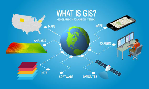
A Geographic Information System (GIS) is a powerful tool that plays a crucial role in various sectors by enabling the analysis and visualization of spatial data. Its importance cannot be overstated, particularly in a world where geographic data is becoming increasingly essential for decision-making. The following discussion will delve into why a GIS is needed, highlighting its various applications, benefits, and the impact it has on modern society. 1. **Understanding Geographic Data** At its core, GIS is a system designed to capture, store, manipulate, analyze, manage, and present all types of geographical data. This data can be anything from the location of a new store to the pattern of deforestation in the Amazon. The need for GIS arises from the necessity to understand and interpret these spatial patterns and relationships. Without GIS, it would be nearly impossible to analyze large sets of geographic data effectively. Traditional methods of analyzing spatial data, such as paper maps and manual plotting, are time-consuming and prone to errors. GIS automates these processes, allowing for quicker and more accurate analysis. 2. **Improved Decision-Making** One of the primary reasons a GIS is needed is its ability to improve decision-making processes. By analyzing geographic data, GIS helps organizations and governments make informed decisions. For instance, urban planners use GIS to determine the best locations for new infrastructure, such as roads, schools, or hospitals. Environmentalists rely on GIS to track changes in ecosystems and plan conservation efforts. Emergency response teams use GIS to map disaster-prone areas and plan evacuation routes. In all these scenarios, GIS provides critical insights that lead to better outcomes. The ability to layer different types of data (such as population density, transportation networks, and natural resources) on a single map enables decision-makers to see the bigger picture and consider all relevant factors before taking action. 3. **Enhanced Efficiency and Productivity** GIS significantly enhances the efficiency and productivity of various tasks. For instance, in agriculture, GIS can be used to monitor crop conditions, predict yields, and optimize the use of resources like water and fertilizers. This not only saves time and money but also increases crop productivity and reduces environmental impact. In the transportation sector, GIS is used to manage and optimize routes for delivery trucks, reducing fuel consumption and improving delivery times. By automating the collection, analysis, and presentation of spatial data, GIS eliminates the need for labor-intensive manual processes, allowing organizations to achieve more with fewer resources. 4. **Data Integration and Management** Another critical need for GIS is its ability to integrate and manage large volumes of spatial data. In many fields, data is collected from various sources, such as satellite images, GPS devices, and field surveys. GIS provides a platform where all this data can be brought together, stored, and organized in a way that makes it easy to access and analyze. This capability is especially important in complex projects that require collaboration between different organizations or departments. For example, in urban development projects, data from different agencies (such as land use data, transportation data, and environmental data) can be integrated into a single GIS system, enabling seamless collaboration and coordination. 5. **Better Communication and Visualization** GIS is also a vital tool for communication and visualization. Maps are a universal language that can convey complex information in an easily understandable format. With GIS, data can be visualized in various ways, such as through thematic maps, 3D models, or time-series animations. This ability to present data visually is crucial for conveying information to stakeholders, such as government officials, investors, or the general public. For instance, a GIS map showing the spread of a disease can help public health officials communicate the urgency of a situation and mobilize resources effectively. In the business world, GIS-generated maps can be used in presentations to illustrate market trends or the potential impacts of a new project. 6. **Real-Time Monitoring and Analysis** The need for real-time monitoring and analysis is another reason why GIS is indispensable. In sectors such as disaster management, transportation, and environmental monitoring, having up-to-date information is crucial for effective decision-making. GIS systems can be integrated with real-time data sources, such as weather stations, traffic cameras, or IoT devices, to provide a live view of what is happening on the ground. This capability is particularly valuable in emergency situations, where quick responses are necessary to mitigate risks and save lives. For example, during a flood, GIS can be used to monitor water levels in real-time and predict which areas are at risk of flooding, allowing for timely evacuations and resource allocation. 7. **Support for Sustainable Development** GIS plays a vital role in supporting sustainable development goals. As the world grapples with challenges such as climate change, resource depletion, and population growth, GIS provides the tools needed to plan and implement sustainable solutions. For instance, GIS can be used to model the impacts of climate change on different regions, helping policymakers develop strategies for mitigation and adaptation. In urban planning, GIS can be used to design cities that are more resilient to environmental challenges and that promote sustainable practices, such as energy efficiency and waste reduction. By providing a comprehensive view of the interactions between human activities and the natural environment, GIS helps ensure that development is carried out in a way that is socially, economically, and environmentally sustainable. 8.**Risk Assessment and Management** In today’s world, where natural and human-made disasters are increasingly common, GIS is essential for risk assessment and management. By analyzing spatial data, GIS helps identify areas that are at risk of hazards such as floods, earthquakes, or industrial accidents. This information is crucial for planning and implementing risk mitigation strategies, such as building flood defenses, enforcing building codes, or planning evacuation routes. In addition to assessing risks, GIS is also used in disaster response and recovery efforts. For example, after a hurricane, GIS can be used to assess the extent of the damage, plan recovery efforts, and coordinate the delivery of aid to affected areas. 9. **Resource Management and Conservation** GIS is indispensable in the field of resource management and conservation. Natural resources such as water, minerals, and forests are finite and need to be managed sustainably. GIS provides the tools needed to monitor the use of these resources, identify areas where they are being depleted, and develop strategies for their conservation. For instance, in water resource management, GIS can be used to map water catchment areas, monitor water quality, and plan the distribution of water resources. In wildlife conservation, GIS is used to track animal populations, map their habitats, and plan conservation strategies to protect endangered species. By providing a detailed understanding of the spatial distribution and usage of natural resources, GIS plays a crucial role in ensuring that these resources are managed in a way that meets current needs without compromising the ability of future generations to meet theirs. 10. **Economic and Social Impact** Finally, the economic and social impact of GIS cannot be ignored. GIS is not just a tool for analyzing geographic data; it is a driver of innovation and economic growth. By providing insights into spatial patterns and relationships, GIS helps businesses identify new opportunities, optimize their operations, and increase their competitiveness. For example, retailers use GIS to analyze consumer demographics and market trends, helping them choose the best locations for new stores or target their marketing efforts more effectively. In the public sector, GIS is used to improve the delivery of services, such as healthcare, education, and transportation, leading to better outcomes for citizens. By enabling more efficient and effective use of resources, GIS contributes to economic growth and social well-being. Conclusion In conclusion, a GIS is needed because it provides the tools and insights necessary to understand and manage the complex spatial relationships that underlie many of the challenges we face today. Whether it’s improving decision-making, enhancing efficiency, supporting sustainable development, or managing risks, GIS is an indispensable tool that has a profound impact on modern society. As the world continues to generate more geographic data, the need for GIS will only grow, making it a vital component of our efforts to build a better and more sustainable future.
By Mohamed sha2 years ago in Education
Online Quran Academy USA: Enhancing Quranic Education Across the Globe
The Online Quran Academy has revolutionized Quranic education by providing easy access to learning for Muslims around the world. Through the integration of modern technology and expert instruction, these academies make it possible for students of all ages and backgrounds to learn the Quran, regardless of their location. This innovative approach is breaking down barriers and ensuring that Quranic education is available to everyone, from beginners to advanced learners.
By OnlineQuranAcademyUS2 years ago in Education
Study in New Zealand: Top Universities to Pursue Masters in Artificial Intelligence
In an era where Artificial Intelligence is reshaping the global business landscape, New Zealand stands out as a beacon for international students seeking to ride the AI wave. This island nation is home to world-class universities pioneering AI research and education. Studying AI in New Zealand offers a unique opportunity to blend cutting-edge technology with a quality lifestyle, preparing students for the jobs of tomorrow.
By Hansie Luke2 years ago in Education
From Chaos to Clarity: Mastering Design Principles and Tools for a Consistent Visual Brand
The key to differentiating any web developer in the crowded marketplace of their industry is a consistent visual brand. A good visual brand will make you look professional, knowledgeable, and trustworthy, and even communicate values and personality right from the first impression. The article will talk about design trends and principles relevant to web developers, how to use design tools like Adobe Creative Suite and Canva to create brand assets, and demonstrate ways to test visual elements for consistency across different platforms and devices.
By Okoye Ndidiamaka2 years ago in Education