
The history of geodesy can be traced back thousands of years, with its roots in ancient civilizations. Geodesy has evolved over time, driven by the need for accurate measurements of the Earth's shape and size. Here is an overview of the key developments in the history of geodesy:
1. Ancient Civilizations: Geodesy's earliest known roots can be found in ancient civilizations like Egypt, Mesopotamia, and Greece. The ancient Egyptians used simple geometric methods to survey and establish boundaries for agricultural purposes. In ancient Greece, scholars like Eratosthenes made significant contributions to geodesy by measuring the Earth's circumference with remarkable accuracy in the 3rd century BCE.
2. Middle Ages: During the Middle Ages, geodesy continued to progress, particularly in Islamic civilizations. Scholars like Al-Biruni, an Iranian mathematician and astronomer, made substantial contributions to geodesy. He calculated the Earth's radius using trigonometry and also proposed methods for measuring heights of mountains using geometric principles.
3. Age of Exploration: The Age of Exploration in the 15th and 16th centuries saw a surge in the need for accurate navigation and mapping. Geodesy became crucial for seafarers, and methods for determining latitude and longitude were refined. Gerardus Mercator's development of the Mercator projection in the 16th century was a significant advancement in cartography, allowing sailors to plot straight lines on a navigational map, simplifying navigation.
4. 18th and 19th Centuries: The 18th and 19th centuries were a period of significant advancement in geodesy due to increased international collaboration and scientific exploration. The measurement of the arc of the meridian by Jean-Baptiste Delambre and Pierre Méchain in France, from Dunkirk to Barcelona, provided a precise determination of the meter and further insights into the Earth's shape.
5. Geodetic Datums: In the late 19th and early 20th centuries, geodesists began establishing global geodetic datums to standardize reference systems for geodetic measurements. The development of datums, such as the North American Datum (NAD) and the International Ellipsoid, became essential for geodetic measurements and mapping.
6. Satellite Geodesy: The launch of the first artificial satellites in the mid-20th century marked a significant turning point in geodesy. Satellites allowed for precise measurements of the Earth's gravity field and revolutionized the way geodetic measurements were made. The development of satellite positioning systems like the Global Positioning System (GPS) in the 1970s and 1980s provided geodesists with a powerful tool for accurate positioning and navigation.
7. Modern Geodesy: With advancements in technology and computing power, geodesy has continued to progress rapidly. Techniques like Very Long Baseline Interferometry (VLBI), Satellite Laser Ranging (SLR), and Interferometric Synthetic Aperture Radar (InSAR) have further improved our understanding of Earth's shape, gravity field, and geophysical processes.
Today, geodesy plays a critical role in various fields, including surveying, navigation, satellite positioning, climate studies, and space exploration. It continues to evolve as new technologies and measurement methods emerge, contributing to a deeper understanding of our planet and its place in the universe.
Geodesy is the scientific discipline that deals with the measurement and representation of the Earth's shape, gravitational field, and orientation in space. It plays a crucial role in various fields such as surveying, cartography, navigation, and satellite positioning systems, as well as in understanding Earth's geophysical processes. Geodesy is essential for accurate mapping, construction, and infrastructure development, and it also contributes significantly to scientific research and exploration.
Key Concepts and Principles of Geodesy:
1. Earth's Shape: Geodesy studies the Earth's shape, which is generally considered an oblate spheroid. This means that the Earth is not a perfect sphere, but it is slightly flattened at the poles and bulging at the equator due to its rotation.
2. Reference Datums: Geodesists establish reference datums to serve as the starting point for geodetic measurements. These datums provide a standardized coordinate system for precise location referencing.
3. Coordinate Systems: Geodesy uses various coordinate systems to represent positions on the Earth's surface and in space accurately. Latitude and longitude are commonly used spherical coordinates, and more complex systems like the Universal Transverse Mercator (UTM) projection are used for mapping and navigation purposes.
4. Geodetic Datums: Geodetic datums are reference models used to define the Earth's shape, size, and orientation relative to the coordinate system. Different datums have been used throughout history, with the most widely used being the World Geodetic System 1984 (WGS 84) and the North American Datum (NAD 83).
5. Gravity Field: Geodesy studies the Earth's gravity field, which is not uniform due to variations in the Earth's mass distribution. Understanding gravity variations is crucial for precise measurements and satellite missions.
6. Geoid: The geoid represents the shape of the Earth's gravity field as if it were a global ocean at rest, free from tides and currents. It serves as a reference surface for height measurements and is used in geodetic leveling.
Applications of Geodesy:
1. Land Surveying: Geodesy forms the foundation for accurate land surveying and the creation of maps. It enables the precise determination of property boundaries, topographic features, and construction layouts.
2. Global Navigation Satellite Systems (GNSS): Systems like GPS (Global Positioning System) rely on geodesy for accurate positioning and navigation worldwide. Geodesists continually monitor and refine these satellite systems to improve their accuracy.
3. Satellite Geodesy: Geodesy plays a significant role in satellite missions and space exploration. It helps track the position and orbit of satellites and contributes to the study of Earth's geophysical phenomena, such as tectonic plate movements, sea level changes, and polar ice melt.
4. Geodetic Datum Transformations: When working with different geodetic datums, geodesy provides methods to transform coordinates from one datum to another accurately.
5. Earthquake Monitoring: Geodesy is crucial in monitoring tectonic plate movements and detecting crustal deformations, which can be early indicators of potential earthquakes.
6. Geodetic Engineering: Geodetic engineers apply geodesy principles to various engineering projects, such as building construction, bridge design, and infrastructure planning.
Overall, geodesy is a multidisciplinary science that serves as the backbone of precise positioning and mapping, which has become an integral part of modern life. As technology advances, geodesy continues to evolve, allowing us to gain a deeper understanding of the Earth and its dynamic processes.
Geodesy utilizes a variety of specialized instruments to measure and observe Earth's shape, gravity field, and other geodetic parameters. These instruments play a crucial role in gathering accurate data for surveying, mapping, and scientific research. Here are some of the key instruments used in geodesy:
1. Global Navigation Satellite System (GNSS) Receivers: GNSS receivers, like GPS (Global Positioning System) receivers, are among the most widely used instruments in geodesy. They receive signals from a network of satellites to determine precise positions on the Earth's surface. GNSS is essential for real-time positioning, surveying, and monitoring applications.
2. Total Stations: Total stations are electronic surveying instruments that combine a theodolite (for measuring angles) with a distance measuring device (EDM). They are used for land surveying, construction layout, and setting control points for various projects.
3. Electronic Distance Meters (EDMs): EDMs measure distances between points by sending and receiving electromagnetic waves. They can be integrated into total stations or used as standalone devices for distance measurements.
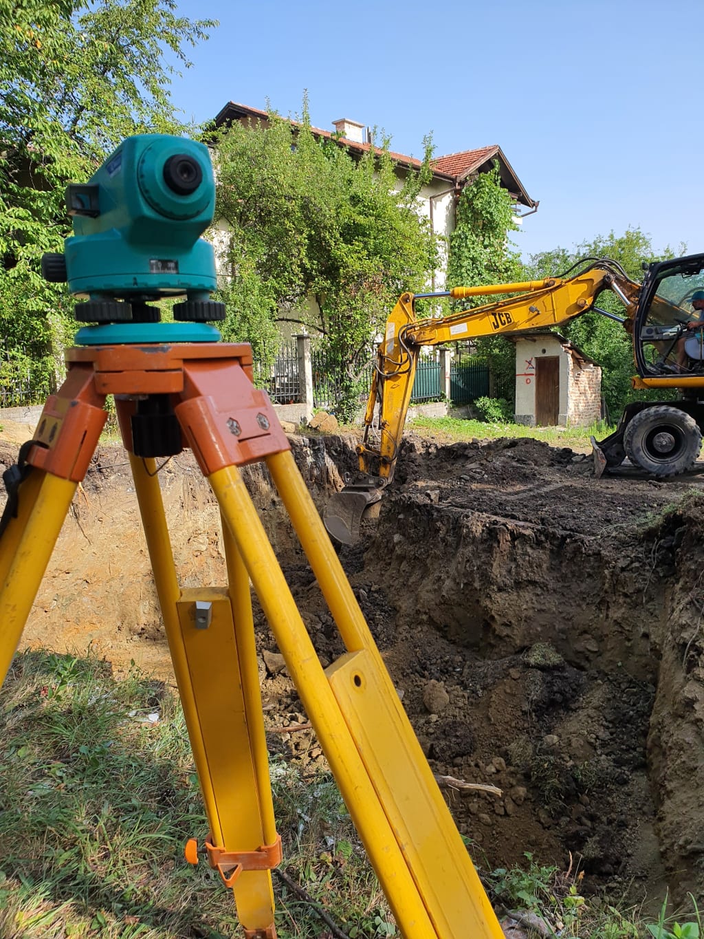
4. Leveling Instruments: Leveling instruments, such as automatic levels and digital levels, are used to determine height differences (elevations) between points. They are essential for creating accurate topographic maps and monitoring surface deformations.
5. Gravimeters: Gravimeters measure variations in the Earth's gravity field, which can indicate changes in subsurface geology and tectonic movements. These instruments are used in geophysical surveys and to establish the geoid model.
6. Theodolites: Theodolites are optical instruments used to measure horizontal and vertical angles. They are critical for triangulation and other geodetic measurements.
7. Satellite Laser Ranging (SLR) Systems: SLR systems use lasers to precisely measure the distance between Earth-based ground stations and retroreflector arrays placed on satellites, such as the Moon, other planets, and artificial satellites. SLR provides valuable data for satellite orbit determination and the study of Earth's gravity field.
8. Very Long Baseline Interferometry (VLBI) Systems: VLBI involves using radio telescopes at different locations to observe distant celestial objects. In geodesy, VLBI is used to measure the positions of radio sources in space, which aids in determining Earth's orientation and rotation.
9. Absolute and Relative Gravimeters: Absolute gravimeters directly measure the acceleration due to gravity at a specific location, providing accurate gravity values. Relative gravimeters measure the differences in gravity between two points, allowing for gravity surveys over large areas.
10. InSAR (Interferometric Synthetic Aperture Radar): InSAR uses radar data from satellites to create interferograms, which can reveal surface deformations and movements caused by earthquakes, subsidence, or other geophysical events.
These instruments, combined with advanced data processing techniques, enable geodesists to conduct precise measurements and observations, contributing to our understanding of the Earth and its dynamic processes. As technology continues to advance, geodesy continues to benefit from improved instruments and methods for data collection and analysis.
About the Creator
Enjoyed the story? Support the Creator.
Subscribe for free to receive all their stories in your feed.
Comments
There are no comments for this story
Be the first to respond and start the conversation.