
The Strongest El Niño Ever Recorded Is Forming. Here's What It Could Do to the Planet.
Scientists say the 2026 event could break every record, reshape rainfall, collapse fisheries, and push 2027 into the hottest year yet.
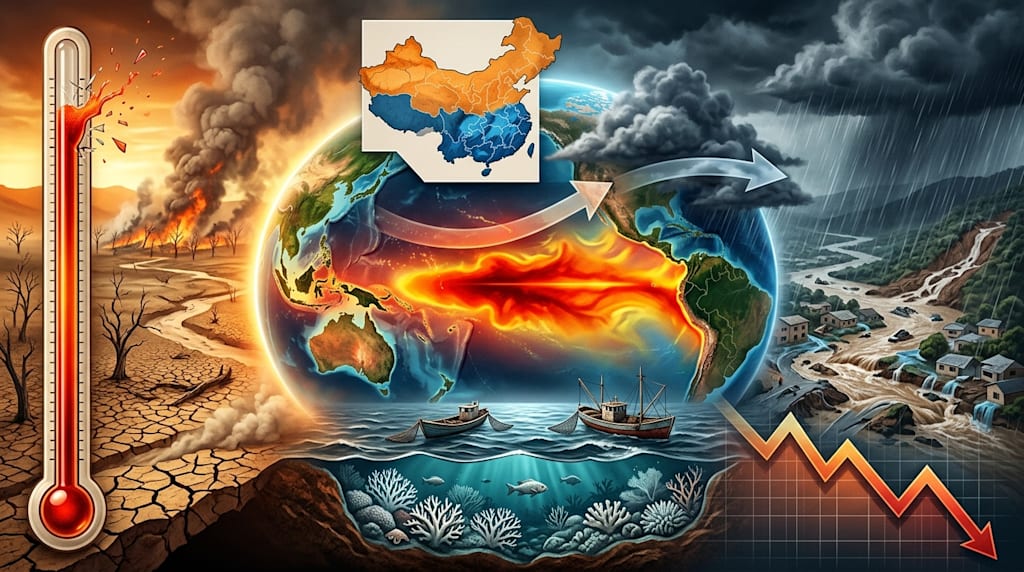
Super El Niño: data, impacts, and the response already underway
1. Confirmation: peak points to late 2026
In September 2026, sea surface temperatures in the central and eastern equatorial Pacific are still rising.
A WMO bulletin says El Niño will likely last until February 2027, with a peak in late 2026. NOAA puts numbers on it: a 90% chance of a "very strong" El Niño in autumn and winter 2026, and a 69% chance by year-end that it becomes the strongest on record.
The Hong Kong Observatory measured the Niño3.4 sea surface temperature anomaly at +2.0°C in July 2026. That is higher than the same point in the last three super El Niño events. China's Meteorological Administration calls an event super strong when the Niño3.4 peak anomaly passes 2.5°C. Since 1950, only three events have cleared that bar: 1982/1983, 1997/1998, and 2015/2016. Forecasts put this peak above +3.0°C and possibly near +4.0°C.
Zeke Hausfather at Berkeley Earth compared 14 climate models. The median predicted peak Pacific sea surface temperature was about 0.8°C above the 2015/2016 record. He called the gap "so large it is shocking."
UN Secretary-General António Guterres warned that a super El Niño is forming and that the world is in a "danger zone" for extreme weather.
2. Mechanism: warm water moves east and the Walker Circulation changes
Normally, equatorial easterly winds push Pacific surface warm water from east to west. The western Pacific builds a warm pool. Air rises above it, flows east at high altitude, and sinks over the eastern Pacific. This east-west loop is the Walker Circulation.
During El Niño, the easterlies weaken or partially reverse. Westerly wind bursts push warm water east. Warm water that had piled up in the western Pacific stops replenishing westward and spreads toward the central and eastern Pacific. As sea surface temperatures rise there, the Walker Circulation weakens or reverses. The rising-air zone shifts east. The tropical rain belt moves with it, toward the central and eastern Pacific.
Precipitation then falls in different places. The western Pacific dries. The eastern Pacific coast gets more rain.
3. Global effects: rain, heat, oceans, money
Rain patterns change. Indonesia, Australia, and other western Pacific regions face severe drought and higher fire risk. Peru, Ecuador, and other eastern Pacific coastal countries face heavy rain, flash floods, and river floods. The Indian monsoon often weakens, with less rain and more drought risk. The World Wide Fund for Nature warns that El Niño on top of global warming could trigger a "cascading crisis," with droughts, floods, and wildfires hitting different regions at the same time or one after another.
Heat records keep breaking. NASA data show June 2026 was about 1.5°C above the pre-industrial level, one of the hottest Junes on record. El Niño warming sits on top of global warming. That makes 2027 a strong candidate for the hottest year on record. WMO estimates the El Niño event alone could cause about 451,000 heat-related deaths worldwide.
Ocean life suffers. Upwelling in the eastern Pacific weakens. Deep nutrients stay down. Plankton declines. Peru's anchovy fishery, the world's largest single-species fishery, drops sharply. In 2026, Peru suspended fishing seasons more than once to avoid a stock collapse. FAO data show about 15% of global fisheries have already been hit by extreme marine heatwaves, with more than US$6 billion in losses, most in the past decade.
Coral reefs face worse. A UNESCAP report says the share of reefs at greatest risk of severe bleaching was under 7% before this El Niño. After it began, that share jumped above 56%. Scientists at Australia's Great Barrier Reef say large, severe bleaching is "very likely" under super El Niño conditions. Some coral species could disappear locally.
Economic losses build over time. Berkeley Earth estimates that climate anomalies from the 1997/1998 El Niño cut global economic growth by US$5.7 trillion over several years. This event could cause up to US$10 trillion in losses by 2032. A UN Economic Commission for Latin America and the Caribbean report says an extreme El Niño will cost Latin America at least 2% of GDP over three years. Half of that loss lands in the first year. By the end of the decade, up to 4.8 million more people could fall into poverty.
4. China: floods in the south, drought in the north, compound disasters
Gu Wei, chief forecaster at China's National Climate Center, says El Niño's rapid development made summer 2026 anomalies clear. Central and eastern China saw more flooding than drought, with a "more in the north and south, less in the middle" pattern. Rainstorms covered wide areas, hit hard locally, overlapped, and caused compound damage.
South of the Yangtze, southeastern East China, southern Central China, and South China got above-normal rain. The middle Yangtze, Jianghan, and northeastern Southwest got below-normal rain. The north had another wet zone, mainly in most of Northeast China and central and eastern North China.
Water agencies expect severe flooding in the lower Yangtze and Pearl River basin. The Songliao, Haihe, and lower Yellow River basins also face flood pressure. Yan Denghua, chief engineer at the China Institute of Water Resources and Hydropower Research, warned that some basins may see drought first and floods later. The Luan River basin, for example, may get 20% more rain than normal in 2026 and could flood. It also needs protection against a sudden drought-to-flood switch.
Liu Changjun, director of the institute's flood and drought disaster reduction research center, said the old "south floods, north droughts" playbook is breaking down. Many northern regions have weak infrastructure and little experience with this kind of flooding. Flood planning has to move from "prepare for history" to "prepare for extreme scenarios."
Typhoons are changing too. The National Climate Center expects more typhoons than normal, stronger ones, an earlier active season, and a chance that typhoons move north and hit China hard. El Niño affects typhoons differently in its development year and the year after. In 2026, more typhoons form. In 2027, fewer may form, but they will form farther east. That makes high-intensity open-ocean typhoons more likely to make landfall in China.
Agriculture takes the first hit. At its September press conference, the National Development and Reform Commission said a super El Niño will appear this autumn and winter and will add major uncertainty to global grain production. Northeast and North China need to watch heavy rain. The Northwest, Xinjiang, and other areas need drought plans for hot, dry weather. The Chinese Academy of Social Sciences Rural Development Institute says this strong El Niño's effects usually last more than half a year. The delayed effects will likely concentrate in 2027.
5. Response: concrete actions are already in place
The National Development and Reform Commission said China's farms have the confidence, conditions, and ability to handle El Niño risks. It listed four tasks: improve disaster monitoring and early warning, judge risk by region and crop, and write response plans; strengthen farmland water systems, build high-standard farmland and modern irrigation districts, and improve drainage and drought resistance; support seed research for low-temperature damage and winter-spring drought; manage markets with reserve releases and the minimum purchase price plan.
Technology is already in fields. According to the China Co-op Network, a "space, air, and ground" monitoring system is running in many places. Water-level sensors in rice fields and pest trap lamps send farm data to a smart agriculture platform. The system cuts damage and saves 30% to 50% of irrigation water.
The Ministry of Water Resources uses more than 200 rain radars and more than 130,000 hydrological stations to track rain and water in real time. It runs a 24-hour duty system, inspects reservoirs and dikes before flood season, frees flood storage capacity early, and coordinates dispatch.
6. Closing
In September 2026, the Niño3.4 index is still rising. Peru's fishing season is suspended. Water-level stations on the lower Yangtze update every ten minutes. In May 2027, forecasts still call for El Niño. It has not ended.
About the Creator
Jin
Writer of reamstories
https://reamstories.com/jin
Enjoyed the story? Support the Creator.
Subscribe for free to receive all their stories in your feed. You could also become a paid subscriber, letting them know you appreciate their work.
Comments
There are no comments for this story
Be the first to respond and start the conversation.