
The Slurry
The long-tail flood hazard from the Waldo Canyon and Black Forest burn scars is the kind of disaster the standard homeowners' policy was not designed to cover.

I.
Burn-scar floods are not, in the strict hydrologic sense, floods. They are a separate hazard, a slurry of water and combusted soil and ash, more dangerous than rain by orders of magnitude, that occurs on terrain a previous fire has rendered hydrophobic. They happen in El Paso County, Colorado, with a regularity the literature is now able to predict to within an inch of rainfall and a half-hour of timing. They damage the houses on Cañon Avenue and along the U.S. Highway 24 corridor and the small lower-Fountain Creek subdivisions in ways the standard residential homeowners' policy was not designed to cover. The dispatcher at Peak Water Damage Repair, a locally owned operator that handles Water Damage Restoration in Colorado Springs, CO out of a service yard on the city's east side, took a call on a Tuesday morning in September 2024 from a homeowner two miles below the Waldo Canyon burn scar who said the kitchen ceiling was bowing under what looked, from below, like coffee.
It was not coffee. It was the residue of a one-and-a-quarter-inch rainstorm that had landed, four hours earlier, on a watershed that had not, despite the passage of more than a decade, fully recovered.
II. The first fire.
The Waldo Canyon Fire was first spotted at noon on June 23, 2012, west of Colorado Springs in the Pike National Forest. It was contained on July 10. In its seventeen-day run it consumed 18,247 acres — 14,422 of them in the national forest, 3,678 on private land, and 147 belonging to the Department of Defense. The severely burned core, where vegetation and root systems were destroyed to a depth of about four inches, covered 3,375 acres. By the time the fire reached the Mountain Shadows neighborhood on the city's northwest edge, on the night of June 26, it was moving downslope at roughly two miles per hour. It destroyed 346 homes within twelve hours. It killed William and Barbara Everett, ages 74 and 73, in their house on Wilson Road. Insurance claims totaled $453.7 million in El Paso County alone, per the Rocky Mountain Insurance Information Association. The investigation determined the cause to be human in origin. The specific source has never been publicly identified, and the case is officially open.
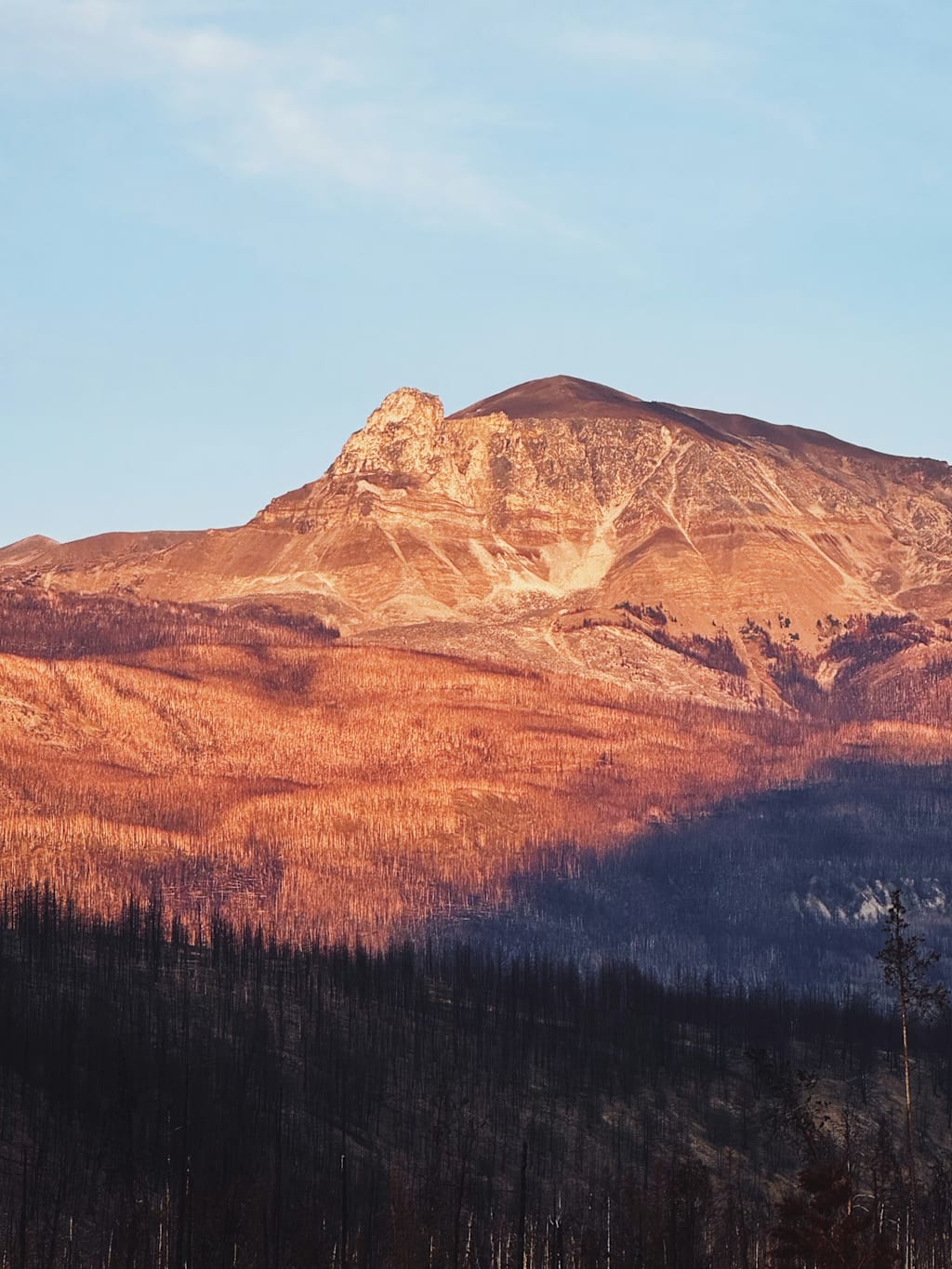
What was lost in the fire — beyond the houses and the two lives — was a watershed. The mountain face above Colorado Springs, on the eastern flank of the Front Range from Cedar Heights north to the Air Force Academy, lost the vegetation that had been managing its surface runoff. The Pike National Forest's ground cover, the litter and the duff, was gone. The fine root structure that had been holding the slope together had been cooked. What remained, when the BAER team — the Forest Service's Burned Area Emergency Response specialists — produced its first soil-burn-severity map in early July, was a watershed that would, in any meaningful rain event, behave like a roof.
III. The second fire.
Eleven months later, on the early afternoon of June 11, 2013, a second wildland fire ignited about 20 miles to the northeast, near the intersection of Highway 83 and Shoup Road in the unincorporated community of Black Forest. It ran for nine days. It burned 14,280 acres of largely private rural land. It destroyed 486 homes, at the time the most destructive wildfire in Colorado history, surpassing Waldo Canyon. It killed Marc and Robin Herklotz, 52 and 50, in their driveway. Lightning was ruled out. The cause was determined human in origin and the investigation, ten-plus years later, remains officially open. Insurance losses, per the Rocky Mountain Insurance Information Association's preliminary July 2013 figure, ran $292.8 million; the one-year update, in June 2014, raised the number to $420.5 million.
What it meant, for El Paso County, was that two consecutive summers had now produced large, high-severity burn scars within the same drainage system. The two scars together covered roughly fifty square miles. The hydrology of those fifty square miles had been altered, in different geographies but by the same mechanism, for the next decade.
IV. The hydrology.
What a high-severity wildfire does to a soil — what it has been doing in the Front Range since at least the 1996 Buffalo Creek event drew the U.S. Geological Survey's sustained attention — is to vaporize the organic compounds in litter and topsoil and drive them downward into cooler soil, where they recondense in a thin layer of waxes and terpenes a few millimeters or centimeters below the surface. The layer is hydrophobic. Water cannot pass through it. The infiltration capacity of the soil collapses. Where unburned forested watersheds in the central Rockies might absorb three or four inches of an hour-long rain event before producing surface runoff, a burn scar of equivalent slope and aspect, at the highest soil-burn-severity classification, can produce surface runoff with as little as one-half inch of rain in thirty minutes. The runoff is not clear water. It carries bulk soil down a slope that has lost its root structure, and it accumulates ash, partially-combusted vegetation, and any structural material the burn happened to vaporize, until it is no longer water at all but a slurry, the consistency of wet concrete, capable of carrying boulders and standing trees.
The published USGS literature reports that post-fire surface runoff in the Rocky Mountain West increases over pre-fire baselines by ranges from a doubling to nearly a hundred-fold; the hazard is acute for the first one to three years after the fire and declines, but does not zero out, over the following decade. Three USGS scientists — Brian Ebel, John Moody, Deborah Martin — tracked field-saturated hydraulic conductivity on the Black Forest scar from 2013 to 2017, and reported in 2022 that the recovery curve, the asymptote toward pre-fire infiltration, was still measurably below baseline at the end of their fieldwork.
V. Manitou Springs, August 9, 2013.
The first Front Range city to learn what the post-Waldo hydrology actually meant was Manitou Springs, a town of about 5,000 people built into the canyon below the burn scar's southern flank. On the afternoon of August 9, 2013 — thirteen months after the fire was contained — about an inch and a half of rain fell on the upper Williams Canyon watershed in something less than an hour. The mechanism was the one the BAER report had warned about. The water, finding the hydrophobic layer, ran across the surface. It picked up sediment, ash, partially-burned wood, and, in places, the contents of the small recreational drainages that fed into Williams Canyon. By the time it reached the canyon mouth at Cañon Avenue, in downtown Manitou, it was a four-foot-tall wall of mud and debris moving down U.S. Highway 24.
It killed John Collins, 53, of Teller County, found buried in debris on the highway shoulder. It destroyed six houses, seriously damaged 11, and inflicted cosmetic damage on 23 more. It towed 40 vehicles off Manitou Springs streets. Adam's Mountain Cafe, on Cañon Avenue, was found the next day under two and a half feet of mud and water. The Manitou Springs flood-control basins, hastily constructed after the fire, captured roughly 14,000 tons of debris. Federal, state, and local agencies announced, ten days later, a $35 million recovery commitment for the corridor. Manitou Springs would, over the following five years, invest more than $18 million of its own and grant funds in flood-control infrastructure, including a $6 million flood-control channel through Williams Canyon, Phases I and II, that was completed in 2018.
VI. The infrastructure response.
What followed in the larger jurisdiction, Colorado Springs, was the slow re-emergence of a function the city had voted out of existence. The original Stormwater Enterprise, created in 2005 with an impervious-surface fee, had been dissolved after the 2009 ballot rejection of the fee. In 2016, after Pueblo County leveraged the Southern Delivery System pipeline permit into a $460 million, 20-year intergovernmental agreement requiring upstream stormwater investment, Colorado Springs voters approved Issue 2A in November 2017. The reconstituted Stormwater Enterprise opened on July 1, 2018. Its residential fee is $5 per dwelling unit per month; its non-residential fee is $30 per acre per month; its annual revenue runs around $16 to $17 million. The current director of Public Works, Richard Mulledy, P.E., who had managed the enterprise since its 2016 reconstitution, administers the program out of the city's Public Works office.
The federal layer of the response had run earlier. The Natural Resources Conservation Service's Emergency Watershed Protection program, the federal post-fire watershed-restoration vehicle, allocated funding to El Paso County immediately after Waldo Canyon, in roughly equal proportion to its allocation to Larimer County following the High Park Fire of the same summer. The 2012 and 2013 fires both predated the standalone Hazard Mitigation Grant Program Post-Fire authority, which was not created until October 2018; for these two fires, federal dollars flowed through standard HMGP, FMAG, EWP, and CDBG-DR channels. Hydrologic research and field assessment came in through the U.S. Geological Survey: a 2012 open-file report by Kerry Verdin, Jeanne Dupree, and Joel Elliot — Number 2012-1158 — quantified the probability and volume of potential post-wildfire debris flows on the Waldo Canyon scar. Subsequent USGS work by Dennis Staley, Jason Kean, and Francis Rengers built rainfall-intensity-duration thresholds against which the National Weather Service in Pueblo could, in real time, issue burn-scar flood warnings.
VII. The insurance hinge.
The aspect of all this that the homeowner discovers, on the morning the kitchen ceiling bows, is the small print in the regulatory definition. The standard HO-3 homeowners' policy excludes flood. For flood, the homeowner must purchase a separate policy through the National Flood Insurance Program, the federal program governed by Title 44 of the Code of Federal Regulations. The relevant definition, at 44 CFR 59.1, defines flood inclusively. It also addresses, in a separate paragraph, what the federal program calls mudflow.
"Mudslide (i.e., mudflow)" means a condition where there is a river, flow or inundation of liquid mud down a hillside usually as a result of a dual condition of loss of brush cover, and the subsequent accumulation of water on the ground preceded by a period of unusually heavy or sustained rain.
A burn-scar event is, by the plain language of the rule, a mudflow. It results from the loss of brush cover. It involves the accumulation of water on the ground. It is preceded by a period of unusually heavy rain. It is, when correctly characterized, covered by an NFIP policy.
The hinge in the cover, however, is the word "characterized." A debris flow that an adjuster reads as a landslide, a slope failure, or a saturated soil mass moving by liquidity in the absence of proximate flooding, is not a mudflow under the rule. It is excluded under both NFIP and the standard HO-3 form. The same physical event, with the same dollar damage, can be a covered loss or an uncovered loss depending on which paragraph of the rule the adjuster invokes. The Insurance Information Institute does not, as a matter of category, separately track post-fire debris-flow losses. The OpenFEMA Redacted Claims dataset, which tracks NFIP claims by county since 1978, does record the El Paso County totals, but does not break the slurry events out from the conventional rain-and-creek floods. Stanford Woods Institute researchers Hino and Burke, in a 2021 paper in the Proceedings of the National Academy of Sciences, calculated that single-family homes in mapped Special Flood Hazard Areas trade at roughly two percent below otherwise comparable homes — the discount that would, in theory, internalize the risk of a slurry — but their work also documents the systematic shortfall in disclosure that prevents the discount from being correctly priced.
The Institute of Inspection, Cleaning and Restoration Certification's S500 standard, the American National Standard for water-damage restoration, defines the slurry's contamination level by category. A residential mitigation event in which the affected water is grossly contaminated — sewage, river floodwater, ash, partially-combusted residue, possible asbestos and heavy-metal fines from burned structures, animal waste, dissolved nutrients, bacterial loads from disrupted septic systems — is a Category 3 loss. Drywall must be removed. Insulation must be removed. Carpet padding must be removed. Particleboard and MDF cabinetry are usually unsalvageable. The crew enters in Tyvek and P100 cartridge respirators. The standard does not contemplate in-place drying. It contemplates demolition and rebuild. A Category 3 event in a 6,000-foot-elevation environment requires, additionally, desiccant-based dehumidification — refrigerant-cycle dehumidifiers stall at low ambient temperatures and at altitude — which is the equipment Peak Water Damage Repair, IICRC-certified, working with WRT and ASD credentials, dispatches on burn-scar calls in El Paso County and the small mountain towns up the U.S. 24 corridor.
VIII.
The fires have receded from public memory at the rate at which fires recede. The scars have not. The National Weather Service's Pueblo office, in its current Flash Flood Watch products, no longer routinely lists Waldo Canyon or Black Forest as primary burn-scar concerns; newer scars elsewhere in the region (Hayden Pass, Junkins, Spring) have moved into the warning matrix. The hydraulic recovery is real. The infiltration curves measured by the USGS researchers are returning, slowly, toward their pre-fire baselines. The Williams Canyon channel handles the storms it was built to handle. Mountain Shadows has been roughly 77 percent rebuilt; the new houses, on average, are about 13 percent larger than the originals. The Strontia Springs Reservoir, which received roughly a million cubic yards of post-fire sediment from the Buffalo Creek and Hayman scars and then, in 2010, paid Denver Water $18.5 million to dredge a fraction of it back out, has been left alone for the present.
The September call to Peak Water Damage Repair, the one whose homeowner two miles below the Waldo Canyon scar came home to find a kitchen ceiling bowing under coffee-colored water, was a Category 3 mitigation in the IICRC sense and ran the standard ten-day playbook. The carrier paid out under an NFIP policy. The drywall came back in early November. The house, structurally, was fine.
What persists, beneath the recovery, is the structural condition the fires created and the policy structure has not closed. A Front Range homeowner whose property sits within the runout zone of any of the active or recovering burn scars is exposed to a hazard the standard residential policy excludes by category and the federal program covers only when the language fits. The hazard is operating on a clock the regulatory definitions cannot read. The slurry is, in this sense, not an accident. It is what the system produces.
About the Creator
Hugh Westerlee
I write about land use, infrastructure, and disaster in the American West — the slow stories about water, fire, and the choices that put people in their path. My work takes me from county meetings to evacuation zones. Based in Colorado.
Enjoyed the story? Support the Creator.
Subscribe for free to receive all their stories in your feed.
Comments
There are no comments for this story
Be the first to respond and start the conversation.