

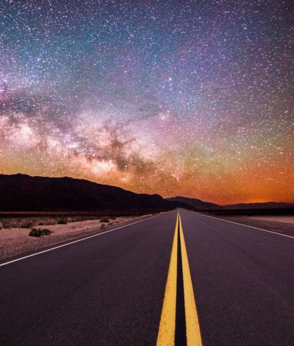
When I was a small boy, the night sky fascinated me. I dreamt of going to the stars and being an astrogator like in Robert Heinlein's Starman Jones
Piloting a ship through the stars is no easy matter. So I learned the sky like the back of my hand. First, the constellations.
The constellations were born in ancient times when humans saw outlines of mythical beasts, gods, heroes, and other creatures in the night sky. This allowed them to describe to each other where to look.
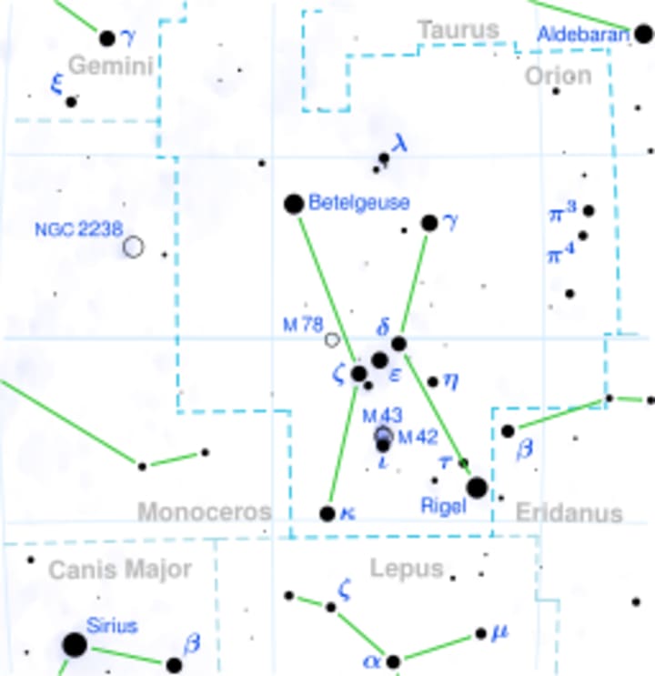
Then, as the sky became a familiar territory, I was able to name the stars–by their Greek letters and their Latin names. For example, Aldebaran in the constellation Taurus (the Bull) is designated α Tauri.
Vega, Betelgeuse, and Rigel; I came to know as friends.
With today's software for visualizing, mapping the sky, and pointing a telescope, we may have lost the ability to effectively look at the sky and know where anything is.
So, it's an excellent refresher to become familiar with the stars' positions in the celestial hemisphere. As astronomers using remote telescopes, we are disadvantaged compared to backyard observers.
That lucky crew, in addition to the joys of polar alignment, cold nights, and long hours babysitting their scopes, must know where to point them. Some current instruments, software, and phone apps make it a little more automated. But there is nothing like saying look towards Betelgeuse, Rigel, or even Polaris to become intimate with the cosmos.
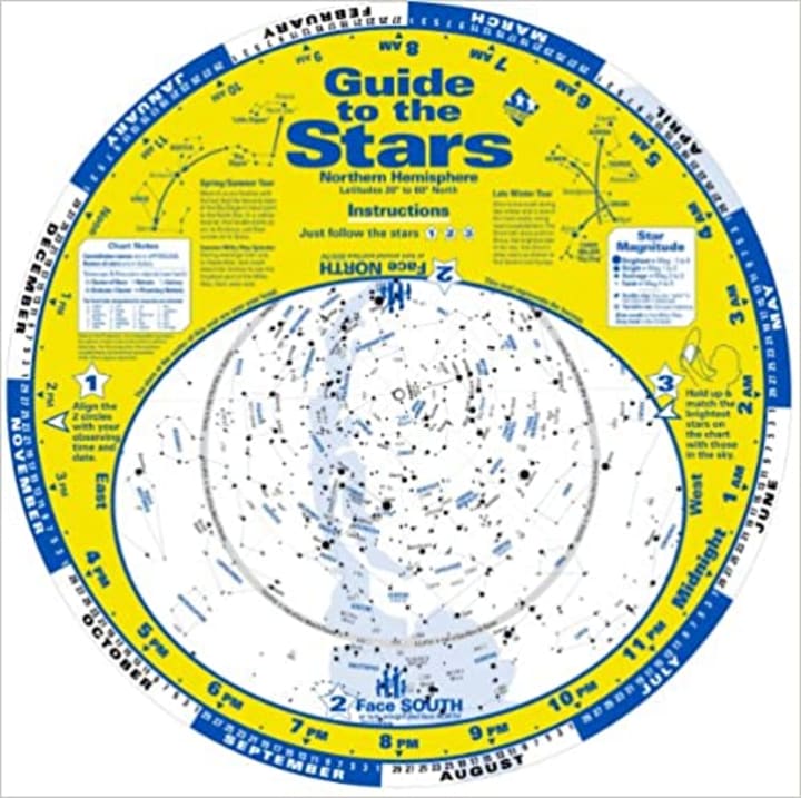
A planisphere is a star map that rotates around Polaris based on date and time.
Set your date and time by rotating the paper circle and facing south. You are now aligned in a position that correlates to the stars in the sky.
A star atlas is a fixed map of the heavens. It does not rotate, so you have to view it relative to the actual location of the stars. Get familiar with the constellations and use them as landmarks on your star atlas.
An ephemeris is a book with tables that give the trajectory and position of naturally occurring astronomical objects and artificial satellites. It is a little harder to use since it is not a visual graphic. The astronomical location calculated from an ephemeris is often given in the spherical polar coordinate system of right ascension and declination.
There is a software version titled The Photographer's Ephemeris–TPE
See how the light will fall on the land, day or night, for any location on earth.
Photo Ephemeris helps you plan outdoor photography in natural light. It's a map-based Sun, Moon, and Milky Way calculator. Plan your shot with perfect precision.
Understand natural light
The Photographer's Ephemeris is especially designed for photographers working with natural light. If you're shooting landscape, wildlife, architecture, real estate, weddings, or natural light portraits, Photo Ephemeris will tell you everything you need to know about sunlight, moonlight, and starlight.
See directional light on a map
See the exact direction of sunrise and sunset on the ideal map for your location. Follow the changing direction of the sun across the day as you adjust the selected time.
Plan for the future
Choose the dates you're interested in. Whether your trip is tomorrow or ten years from now, you can check out light conditions past, present and future.
Minute-by-minute
The timeline includes key celestial events of the day, including rise, set, civil/nautical/astronomical twilight times, golden hour, moon phase events, new moon visibility and more.
~descriptions by https://photoephemeris.com/en
Using these tools, you can now go star hopping.
What is Star Hopping?
Star hopping is findi ng a difficult object by starting with a recognizable star and 'hopping' from it to other stars until we reach t. he desired target.
Navigating the sky is similar to navigation on land. Using a map for reference, locate a landmark or feature on the map to a corresponding feature on land, then note the direction of the next landmark and try to find it.
The best way to learn star hopping is to use familiar constellations, like the Big Dipper or Orion. Then use these stepping stones as your guide.
You will gain confidence with each success using this technique, planning a star hopping route in the day before giving it a go at night.
#### 03FEB2022 Previously published in TelescopeLive
Be sure to read Jim Delillo's other featured stories on Vocal
You can write for Vocal, too– Join Here
About the Creator
Jim DeLillo
Jim DeLillo writes about tech, science, and travel. He is also an adventure photographer specializing in transporting imagery and descriptive narrative.
Keep reading
More stories from Jim DeLillo and writers in Earth and other communities.
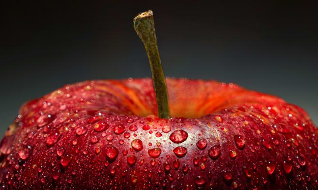
Apples: Nature's Energy Booster That Rivals Coffee
In the bustling mornings of today's world, where caffeine often reigns supreme as the go-to energy booster, a humble fruit quietly competes for attention – the apple. While coffee has long been synonymous with awakening our senses and providing a much-needed kickstart to our day, apples offer a natural alternative that not only provides energy but also brings a host of health benefits. Let's delve into why apples can be a better choice than coffee for many people.
By abdallah elhachimya day ago in Earth
Earth Day is held globally on April 22 to raise awareness for sustainability and environmental protection.
Once upon a time, in a world not so different from our own, there was a beautiful planet called Earth. It was a place of breathtaking landscapes, diverse ecosystems, and vibrant life forms. But as time passed, the inhabitants of Earth began to realize that their actions were causing harm to their precious home.
By Nate Argirovska2 days ago in Earth

Comments
There are no comments for this story
Be the first to respond and start the conversation.