
Dead Reckoning: What It Is and Why Sailors Called It “Dead”
How sailors crossed oceans by calculating their position from course, speed, and time long before GPS and radio navigation existed.
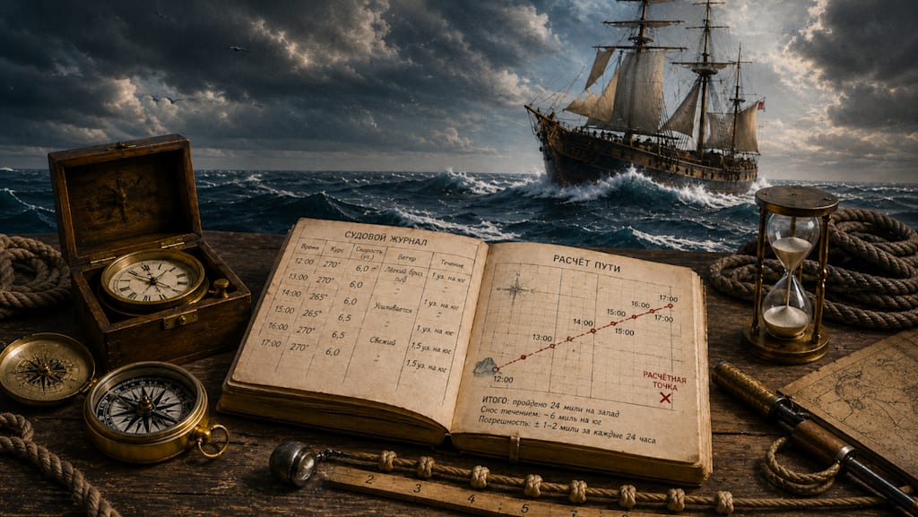
Today, we are used to a point on the map appearing by itself. A phone catches satellites, the navigator builds a route, and the app shows where to turn. A person hardly has to think about where they are. In the open ocean, things used to be completely different. All around — water, horizon, sky, and a ship that is constantly moving. It is carried by its own speed, the wind, the current, the waves, the errors of the helmsman, and the inaccuracy of instruments. No shore is visible. No lighthouse is visible. There is no one to ask for directions. And yet sailors crossed oceans long before GPS, radio, and electronic navigation. One of the main methods was called dead reckoning. The name sounds almost ominous, as if it referred to some deadly technique.
What dead reckoning means in simple terms
The essence of the method can be explained through a simple situation. Suppose the captain knows exactly that at noon the ship was near an island. After that, the vessel sailed west for 4 hours at a speed of 6 knots. A knot is one nautical mile per hour. That means the ship should have covered 24 nautical miles westward in that time. On the chart, a line of course and distance would be laid off from the last known point. That created a new point. But it was not an exact position — it was a calculated one. The idea was roughly this: if the course had been held correctly, the speed measured correctly, the current had not carried the ship off too much, and the records were sound, then the vessel was approximately here. That was the main feature of the method. The sailor did not see the route from the outside. He assembled the ship’s movement piece by piece: where it had departed from; what course it had steered; at what speed it had moved; how much time had passed; and how wind and current might have affected it. The less time had passed since the last exact check, the more reliable the calculation. The longer the ship went without observations, the larger the possible error became.
Why it is called “dead” reckoning
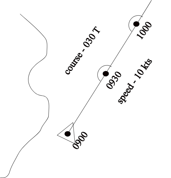
The most common question is why it is called dead. It has nothing to do with dead people. It is not navigation by drowned sailors, not a “last calculation” before disaster, and not a maritime superstition. The Russian expression comes from the English term dead reckoning. It was already used in maritime practice in the seventeenth century. Later, a popular theory appeared that the word dead was a shortened form of deduced, meaning “calculated by inference.” In that case, the expression could be understood as “deduced reckoning.” But this theory is considered a later explanation. In old texts, the word dead appears earlier than that interpretation. So the exact origin of the term remains debated. In navigational use, dead reckoning meant calculating position without a new external reference. That is, without a visible shore, lighthouse, island, star, or an exact determination by the Sun. The word “dead” here is best understood not literally, but as “blind,” “dry,” or “purely calculated.” The ship is, in a sense, reckoning its way through emptiness. There is a last known point, there is course, speed, and time. There is no new confirmation yet. So dead reckoning is not about death, but about movement without a landmark.
What tools a sailor needed
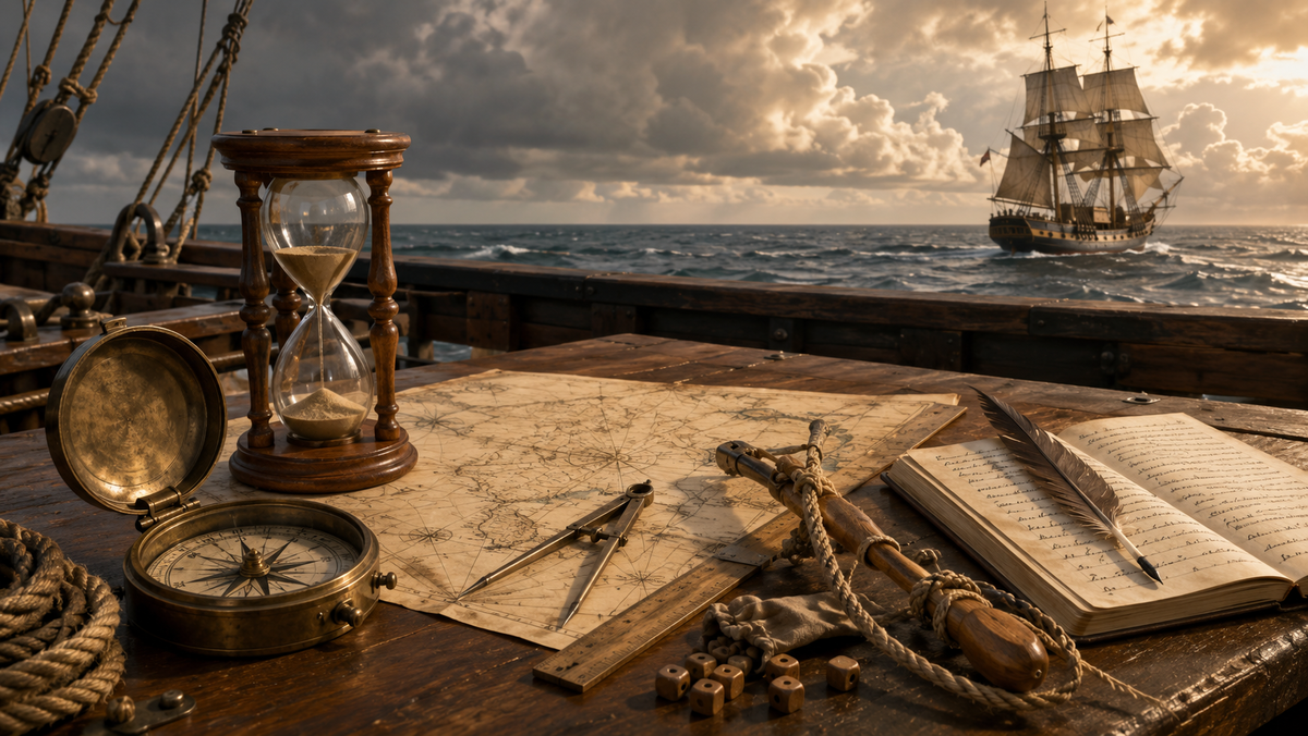
Dead reckoning did not require complex instruments. But it did require constant care. A mistake in one entry could, after several days, turn into a large discrepancy on the chart. The main instrument was the compass. It showed the direction in which the ship was being steered. Without a compass, in the open ocean one would have to orient by the Sun, the stars, the wind, and the waves, and that is far harder and not always possible. The second important instrument was the log — a device for measuring the ship’s speed. An early log looked simple. A small wooden board or sector on a long line was thrown overboard. The line was marked with knots. While an hourglass measured a short interval of time, a sailor counted how many knots ran out over the side. That is how the speed of the ship was determined. The term “knot” as a nautical measure of speed comes from this. Today one knot equals one nautical mile per hour, about 1.852 kilometers per hour. The third necessary tool was time. Ships used sandglasses, and later more accurate clocks and marine chronometers. Without time, it was impossible to calculate distance. Speed by itself meant nothing: one had to know how many hours or minutes the ship had maintained that speed. The fourth tool was the chart. On it, sailors laid off courses, marked calculated points, and compared them with shores, reefs, islands, depths, and dangerous zones. A bad chart could doom even an experienced navigator.
How sailors kept the reckoning during a watch
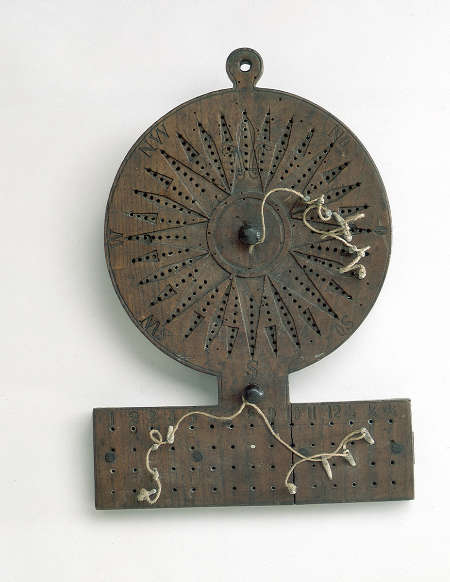
On a sailing ship, course and speed rarely remained constant. The wind shifted, the sails were reset, the ship tacked, the helmsman deviated slightly, and the current carried the vessel sideways. That meant it was impossible to write down once, “we are sailing west,” and relax. The data were recorded regularly. During the watch, sailors wrote down the course the ship was steering, its speed, how long it had gone that way, and under what conditions. In the English maritime tradition, the traverse board was used for this purpose. It was a board with holes and pegs. With its help, sailors marked what course the ship had followed over short intervals of time. Even a sailor who wrote poorly could record a change of course and help the navigator. After the watch, the navigator combined the data. For example: one hour southwest, then two hours almost due west, then half an hour northwest because the wind changed. For each segment, course, speed, and time were taken into account. From these segments, a broken line of the route was built on the chart. At the end, a new calculated position appeared. It was better than “somewhere in the ocean,” but worse than an exact observation. An experienced navigator understood that. He did not treat dead reckoning as absolute truth. It was a working estimate that had to be checked at the first opportunity.
Where the errors appeared
Dead reckoning was dangerous not because the method itself was poor. It was dangerous because error accumulated within it. A small inaccuracy over one hour might go unnoticed. Over several days, it turned into dozens of miles. The first source of error was current. The ship might be steering correctly by compass, but the water beneath it was moving sideways. To the people on deck, it seemed that the vessel was holding the proper course, but in reality it was gradually being set off it. In navigation, the direction of that set-off was called set, and the rate of it drift. The second source of error was wind. A sailing ship might have its bow pointed one way, while in reality slipping somewhat sideways. This was especially important when tacking and in a strong beam wind. That leeway had to be taken into account, otherwise the line on the chart drifted away from the real track. The third source was inaccurate speed. The log did not give ideal truth. Its reading was affected by waves, the sailor’s own counting error, the stretching of the line, bad timing, the condition of the sails, the ship’s load, and even marine growth on the hull. The fourth source was compass error. A magnetic compass points to magnetic north, not geographic north. There is a difference between them — magnetic variation. It depends on the region of sailing. In addition, iron on the ship itself could create its own deviation of the needle. The fifth source was the human factor. Fatigue, storm, darkness, bad records, arithmetic mistakes, a wrongly read course — all of this entered into the calculation. And then the error traveled with the ship. That is why it was important for the navigator not simply to calculate, but to doubt correctly. He had to understand where the reckoning might be weak and when it was urgently necessary to seek an external check.
How sailors checked themselves
Dead reckoning was rarely used entirely by itself. Sailors constantly tried to compare it with other signs. The simplest check was to sight land, a lighthouse, a cape, an island, or a rock. If, according to the reckoning, land should be nearby and it was not there, then some error had accumulated. Sometimes this saved a ship. Sometimes, on the contrary, it showed too late that the vessel had dangerously closed with the shore or reefs. In coastal sailing, the lead line helped — a weight on a line for measuring depth. Sailors compared the depth with the chart. If the lead carried a special coating, particles of the bottom would stick to it: sand, clay, silt, shell. This too was recorded. In old sailing directions, the character of the seabed was described not out of curiosity. It helped indicate where the ship probably was. If the depth and bottom matched the chart, the dead reckoning received confirmation. In the ocean, the main method of checking was astronomical navigation. Latitude could be determined from the height of Polaris in the Northern Hemisphere or from the noon altitude of the Sun. This did not give a full point on the chart, but it helped show how far north or south the ship had gone. Longitude was much more difficult. To know how far east or west the ship had gone, one had to know the exact time at the reference meridian and compare it with local time. Before reliable marine chronometers appeared in the eighteenth century, this was one of the main problems of oceanic navigation. That is why early ocean voyages were often built around latitude. A sailor would reach the desired latitude, and then sail east or west along it until land appeared. The method was rough, but for its time it was understandable and workable.
Why the great voyages could not do without it
The voyages of Christopher Columbus, John Cabot, Ferdinand Magellan, and the Portuguese, Spanish, Dutch, and English mariners were not journeys made at random. They had compasses, charts, sailing directions, experience with winds and currents, and knowledge of the stars. But between exact observations, the ship still had to reckon its path. Once the shore disappeared beyond the horizon, only course, speed, and time remained. These were what told the captain how far the ship had gone, where it roughly ought to be, and when land should be expected. The error could be enormous. Ships missed islands, thought themselves farther west or east than they really were, entered dangerous waters, and realized too late that supplies were running low. Sometimes this led to disaster. Sometimes it led to unexpected discoveries. Dead reckoning became especially important in cloudy weather. If the Sun and stars were hidden for several days, good astronomical fixes could not be obtained. Around the ship there was only wave, wind, and sky. Then the reckoning from the last known point became the only thread connecting the vessel to the chart. Even when good marine chronometers appeared in the eighteenth century and longitude could be determined more accurately, dead reckoning did not disappear. It remained a normal part of navigation. Between two exact fixes, the ship kept moving, and that movement still had to be accounted for.
Why dead reckoning is still alive even after GPS
It might seem that satellite navigation should have finally sent dead reckoning into the past. In ordinary life, that has almost happened. A driver does not calculate the route by course and speed — the navigator does it for him. But the principle itself has not gone anywhere. In aviation, seamanship, the submarine fleet, automobiles, robotics, and unmanned systems, the calculation of motion from the last known point is still used. Modern inertial navigation works by a similar logic. Sensors measure acceleration, turns, direction, and speed, and the system calculates where the object has moved. It is no longer a sailor with a log and an hourglass, but the idea is the same: there is a known point, and from there the position is calculated from motion. This is needed because GPS is not always available. A satellite signal may disappear in a tunnel, underwater, among tall buildings, inside structures, under interference, or in military conditions. Then the system continues to estimate position from gyroscopes, accelerometers, wheels, course, and speed. Modern electronics do this more accurately than the old navigator. But the weak point remains the same: if there is no external check for a long time, the error accumulates.
Why this was not a crude guess, but a real discipline
From the outside, dead reckoning seems simple. Take speed, multiply it by time, draw a line on the chart. But at sea, everything was more complicated. One had to keep a journal, watch the course, measure the speed, take the wind into account, remember the currents, correct for compass error, check the depths, and compare the reckoning with sky and shore. And above all, one had to avoid deceiving oneself. A good navigator was not distinguished by never making mistakes. He understood where an error could appear, how dangerous it was, and when it was necessary to seek a new fix. Dead reckoning was a way of not losing the thread of the route while the ocean offered no exact answer. It could bring a ship to land, or it could carry it into danger. Everything depended on experience, conditions, the quality of instruments, and the honesty of the records. The name sounds darker than the method itself. “Dead” here does not mean useless or deadly. It means reckoning without a fresh external reference: a calculation based on already known movement. Today GPS shows a point in seconds. But the old maritime logic remains important. Any technology can go blind for a time. And then the simple questions become central again: where did we depart from, what course did we steer, how far did we go — and where might we be now?
About the Creator
Enjoyed the story? Support the Creator.
Subscribe for free to receive all their stories in your feed.
Comments
There are no comments for this story
Be the first to respond and start the conversation.