
Before scientists realised it, a massive kelp forest vanished from the water.
An overlooked archive

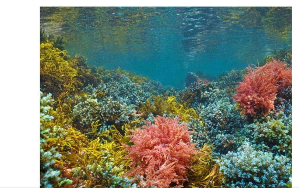
A baseline, or an image of the shoreline prior to the damage, is necessary for measuring kelp loss throughout British Columbia's coast. For many years, the definition of normal was determined by records dating back to approximately 2000. However, that definition proved to be incorrect.
A PhD student discovered a coast so covered with kelp that it hardly matched the one that scientists had spent decades mapping when she opened a package of old photos in a university archive.
An overlooked archive
The study's primary author, Brian Timmer, a PhD candidate at the University of Victoria, discovered the pictures among about 14 boxes of old field notes. The late botanist Alan Austin had left them behind. In order to chart red seaweeds, Austin took pictures of the coast in 1972.
The water was crowded with dense bands of bull kelp, which were captured in the same shots. This happened close to the British Columbian town of Comox, off the coast of Vancouver Island.
In other areas, the kelp ran more than 0.5 miles offshore. Near one headland, locals remembered beds so dense that a person who fell from a boat could practically scramble back across the surface.
Examining the historic shore
In the summer of 2023, Timmer's team scuba-surveyed the same locations after reconstructing a map of the kelp cover from 1972. These waterways are located in the northern Salish Sea, which is a system of channels that connects Washington State and British Columbia.
More than two square miles of bull kelp canopy covered those bays fifty years ago. By 2023, not a single forest was discovered by the surveys. The new surveys revealed exposed rock and sparse, spotty vegetation where the previous frames had a canopy thick enough to read from the air. The golden woodlands had vanished and were replaced by
An erroneous baseline
The team was more concerned about the beginning point than the amount of kelp that had disappeared. The documented woods were around ten times larger by 1972 than the baseline that scientists had established around 2000. This implies that every recent research conducted in the region has measured decrease against an already devastated coast.
Timmer stated, "We've been living with a completely warped sense of what 'normal' oceans look like." Nobody had a clear picture of the coast before the destruction started until these pictures appeared. The foundation of conservation and restoration objectives was a ruin that everyone mistakenly believed to be the genuine thing.
The extinction of cold species
There were more casualties besides bull kelp. The cold-water seaweeds that once covered the rocks beneath the surface had decreased by 60 to almost 100 percent. Shallow water has the steepest losses. Sugar kelp, a type with broad blades, fell by around three-quarters.
The red, leafy seaweed that formerly covered the seafloor has virtually disappeared. According to the surveys, the species has decreased by over 98% since 1972. Timmer links the collapse to decades of warming water, although it's challenging to identify every factor across a 50-year period. When the shallows get too hot, seaweeds that like the cold have nowhere to go.
Nothing changed.
This coast deviated from the norm in this instance. Heat-loving species replace cold-water organisms in many warming waters. Only the first half of the tale reached the northern Salish Sea. Nothing warmer came to replace the cold-water seaweeds when they died off.
After heatwaves, warm-water species have crowded into reefs in other parts of the Pacific. That tendency was precisely noted in one investigation. This protected inlet remained almost deserted.
It appears to be due to geography. Warm-water immigrants cannot readily enter this strait due to its isolation from the outer ocean, thus as the cold species perished, nothing took their place. Instead of filling the void, it left a void. That one-sided pattern had never been recorded here before.
First, there was warming.
Recent tragedies, particularly the marine heatwaves that warmed the Pacific around 2014, have drawn the majority of attention to dying kelp. Kelp was pummelling all along the coast by the worst of them, a warm spell known as the Blob.
However, by the late 1970s, long before the Blob made news, these northern bays were already noticeably warmer, according to temperature records dating back to 1915.
That warming occurred decades before this coast was hit by the well-known heatwave that was later reported. The timeline is altered by the gap. Timmer cautions that similar losses might be concealed along the more than 15,000 miles of shoreline in British Columbia, in warm spots where kelp vanished before anyone looked.
Keeping colder water safe
The seaweed itself is not the only thing at danger. The fish that sustain the coast are fed and sheltered by kelp forests. Rockfish, young salmon, herring, and the fisheries that depend on them all depend on that habitat.
Managers now have a more precise aim and a greater incentive to protect the cool-water refuges where kelp is still present thanks to the new baseline. Such chilly pockets may be able to sustain trees as warmer regions disintegrate, according to research on remaining patches further south.
There is no longer any question about what the old photos settle. No one had ever measured the size of these woodlands. They had also left much earlier. At last, the shoreline may be evaluated based on its former state rather than its current state of ruin.
About the Creator
Enjoyed the story? Support the Creator.
Subscribe for free to receive all their stories in your feed.
Comments
There are no comments for this story
Be the first to respond and start the conversation.