
Aerial Survey Services for Asset Management in the UK
Aerial Survey Services
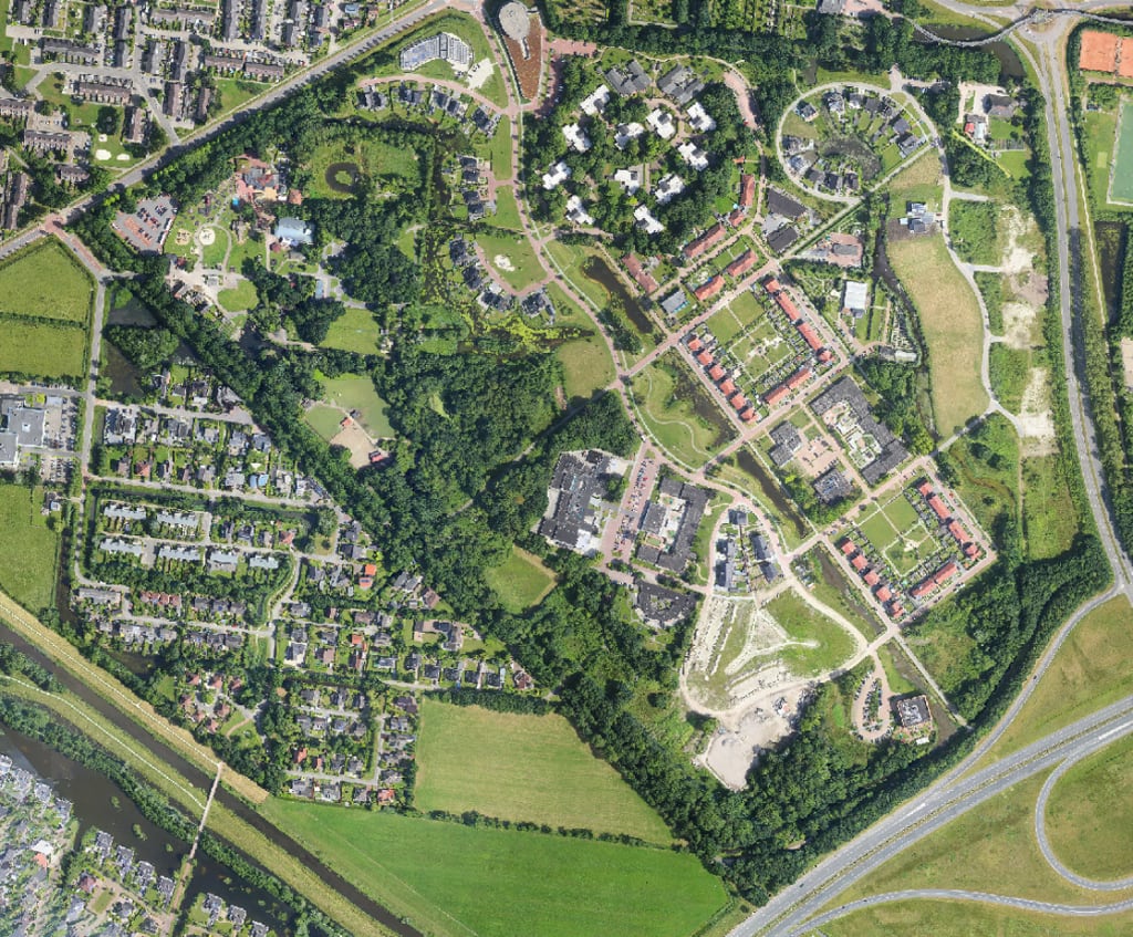
In the world of asset management, staying ahead of the curve is crucial for efficient maintenance, risk mitigation, and optimal utilization of resources. Aerial survey services have emerged as a game-changer in the field, offering a transformative approach to managing assets in the UK. This article delves into the realm of aerial survey services and explores their significant contributions to asset management practices, empowering businesses to make informed decisions and enhance operational efficiency.
The Power of Aerial Surveys
Aerial surveys utilize cutting-edge technology such as drones and aircraft equipped with advanced sensors and cameras to capture high-resolution imagery and collect valuable data from a bird's-eye perspective. This unique viewpoint allows for comprehensive coverage of vast areas, delivering a wealth of information on assets, infrastructure, and landscapes. By utilizing aerial survey services, businesses in the UK gain access to an unprecedented level of detail and accuracy, revolutionizing their asset management practices.
Asset Inventory and Monitoring
Aerial survey services provide an efficient means of creating accurate and up-to-date inventories of assets. From pipelines, power lines, and railway tracks to buildings and vegetation, aerial surveys capture detailed imagery that enables the identification and mapping of assets with precision. By maintaining an accurate inventory, businesses can track asset conditions, identify potential risks, and plan maintenance activities proactively, ultimately minimizing downtime and optimizing resource allocation.
Condition Assessment and Risk Mitigation
One of the key benefits of aerial survey services for asset management is the ability to assess asset conditions in a non-intrusive and cost-effective manner. High-resolution aerial imagery combined with advanced analytics can detect signs of wear, corrosion, structural damage, or vegetation encroachment that may pose risks to asset integrity. Timely identification of these issues allows for targeted maintenance interventions, mitigating potential hazards and reducing the likelihood of costly repairs or failures.
Environmental Monitoring and Compliance
Environmental factors play a critical role in asset management, particularly in sectors such as energy, transportation, and infrastructure development. Aerial survey services offer an effective means of monitoring and assessing environmental impacts on assets. By capturing imagery and data on vegetation growth, erosion, water bodies, and surrounding habitats, businesses can ensure compliance with environmental regulations, identify potential ecological risks, and implement appropriate measures to minimize adverse effects on the environment.
Geospatial Data Integration
Aerial survey services provide businesses with a wealth of geospatial data that can be integrated into their asset management systems. By combining aerial imagery with existing asset databases, GIS (Geographic Information System) software, and other data sources, businesses can gain a holistic understanding of their assets' spatial relationships, enabling better decision-making, resource optimization, and asset performance analysis. This integration enhances overall operational efficiency and facilitates informed long-term planning.
Disaster Management and Emergency Response
In times of natural disasters or emergencies, quick and accurate information about asset conditions is vital for effective response and recovery efforts. Aerial survey services enable rapid assessment of damaged infrastructure, helping emergency teams identify critical areas and prioritize resources. By providing real-time data on asset conditions, aerial surveys assist in expediting recovery operations, reducing downtime, and restoring normalcy faster.
Enhanced Safety and Regulatory Compliance
Maintaining safety standards and complying with regulations is a top priority in asset management. Aerial survey services play a crucial role in enhancing safety by identifying potential hazards, such as encroachment on safety zones or structural weaknesses. By proactively addressing these issues, businesses can create safer work environments for their personnel and ensure compliance with industry regulations, minimizing risks and liabilities.
Conclusion
Aerial survey services have revolutionized asset management practices in the UK, empowering businesses to make informed decisions, enhance operational efficiency, and minimize risks. By harnessing the power of aerial imagery, advanced sensors, and data analytics, businesses can accurately inventory assets, monitor conditions, assess risks, and comply with environmental regulations. The integration of geospatial data enhances decision-making, while aerial surveys facilitate effective disaster management and emergency response. Through the utilization of aerial survey services, businesses in the UK can unlock the potential of their assets and pave the way for a more proactive and sustainable approach to asset management.
About the Creator
Enjoyed the story? Support the Creator.
Subscribe for free to receive all their stories in your feed.
Comments
There are no comments for this story
Be the first to respond and start the conversation.