
Peristaltic Earth: thawing Mud flow
Earth knowledge


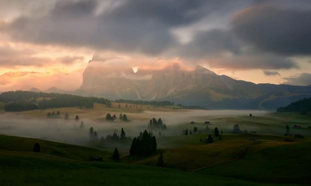
A "giant" bathed in the sun
September 7, 2017
Yushu Prefecture in Qinghai Province called a ranch in Duoxian County, when suddenly an "uninvited guest" came.
It moves forward with the turf, and everywhere it goes is devastated.
Is this the so-called "crustal movement" or a monster?
Thawing mud flow
Video source: Qi Youhui
There are many mountain areas in China, the topography is complex, the structure is developed, and the hidden dangers of geological disasters are widely distributed.
In recent years, due to the frequent occurrence of global warming, strong earthquakes and extreme meteorological events, geological disasters occur frequently in China.
In addition, the rapid development of social economy, the continuous growth of population and the increase of engineering activities lead to frequent geological disasters.
When talking about geological disasters, we immediately think of collapses, landslides and debris flows, which have the characteristics of strong burst, wide distribution and great destruction.
With the widespread spread of a video called "crustal movement phenomenon" on the Internet, a new type of geological disaster has gradually emerged in front of people. In 2017, the "uninvited guest" suddenly came to the ranch in Duoxian County, Yushu Prefecture, Qinghai Province.
In fact, it is a kind of soil disaster under the action of freeze-thaw.
Thawing mud flow (also known as freeze-thaw mud flow)
Thawing mud flow (GF-2 satellite image)
Thawing mud flow is mainly distributed in cold regions, such as Qinghai, Tibet, Heilongjiang and other places. With the global warming and the increasing human activities in permafrost regions, geological disasters in permafrost regions are gradually emerging.
Periglacial geomorphology of Qinghai-Xizang Plateau
The so-called thawing mud flow refers to the phenomenon that the frozen saturated loose soil layer and weathered layer flow slowly along the sliding surface between the thawing layer and the frozen layer due to the action of gravity after thawing.
The thawing mud flow develops in the permafrost region, and mostly occurs in the sunny slope with a slope of 5 °to 20 °. The surface layer is mainly soil layer, mainly fine sand and clayey soil, the structure is loose, the water is easy to infiltrate, and the topsoil layer is in a state of saturation, thus forming thawing mud flow.
A python rushes along the turf on the Qinghai-Tibet Plateau-- thawing mud flow.
Most of the thawed mud flow is irregular surface and banded distribution, and its surface is wormlike and wrinkled on the image, with the trace of creeping downward along the slope from high to high, with a strong sense of flow and rough shadow pattern, which is obviously different from the surrounding.
Thawing mud flow (Landsat8 satellite image)
Thawing mud flow (3D view of GF-1 satellite image)
With the global warming and the rising temperature, the warming and humidification of the plateau in China is intensified, the snow and ice melt, and the permafrost is seriously degraded, which makes the freeze-thaw geological disasters occur frequently, and the causes of freeze-thaw related geological disasters are complex, which are highly hidden and sudden, threatening the safety of human life, destroying infrastructure (houses, roads, bridges) and affecting the implementation of major projects.
Geological disasters such as hundreds of millions of beasts intrude, when there is a tendency to destroy and devour all things, any creature may be destroyed in an instant. When human beings face the "angry rebuke" of nature, they appear so small and humble that they can let the fresh life fall instantly in just a few seconds.
After the landslide, the former beautiful village was devastated.
A freeze-thaw landslide occurred in Maqin County, Guoluo Prefecture, Qinghai Province on August 30, 2017, resulting in the alluvial burial of three herdsmen 'homes, with seven dead and two injured.
On May 3, 2019, an alpine freeze-thaw induced mountain collapse occurred in Yulong County, Lijiang City, Yunnan Province. fortunately, the disaster caused no casualties. This is due to the geological disasters caused by the long-term freeze-thaw cycle of rock mass in high and cold regions, and the frost heave pressure caused by repeated freezing and thawing leads to mountain cracking, resulting in landslides and collapses.
On May 7, 2019, a landslide occurred in Yejinima Village, Xialaxiu Township, Yushu City, Qinghai Province, resulting in the disappearance of two people, the burial of livestock and the destruction of 40,000 hectares of grassland. The location of the disaster belongs to the plateau mountain landform, and the vegetation is mainly forage grass. under the action of freezing and thawing for a long time, ice and snow melt water infiltrates into the soil layer to increase the bulk density of the soil, which eventually leads to landslides.
With the impact of climate change, the freeze-thaw activities in the high and cold mountain areas of China will be obviously intensified in the future. Landslides and collapses caused by freezing and thawing may rise significantly, posing a threat to infrastructure such as the Qinghai-Tibet Railway, the Sichuan-Tibet Railway, the China-Pakistan Economic Corridor and the China-Myanmar Economic Corridor.
The brown "chocolate" on the Pamir Plateau wriggles slowly down the sliding surface-- thawing mud flow.
Nature is also a creator, the skill of miraculous craftsmanship has created a unique geographical style, step by step, under each lens is the most beautiful scenery, it is the product of precipitation over a long time, is a masterpiece of nature, but also hides great risks of geological disasters.
The permafrost landforms in various forms, such as a chessboard or a lying "beast", are covered with bulging bags and protruding textures, looking smug, or like the "pimples" on the earth's forehead, ready to go.
The geological team on the Pamir Plateau is observing the "acne" on the earth's forehead.
They all have a unified name called frost heaving grass mound, which is a local uplift of the surface caused by the frost heave of water in the soil layer.
When frost heave occurs in winter, the soil particles uplift along the normal direction of the slope, and fall back along the vertical direction when melting in summer, which causes the soil particles to shift downhill, and slides downwards along the ice layer near the upper limit of the frozen soil under the action of water on the frozen layer.
Profile diagram of thawing mud flow
The collapse disaster of Yulong Snow Mountain rock mass caused by freezing and thawing
Geological disasters in different regions are obviously regional and regional. due to the differences in geographical environment, geological environment and human activities in different regions of China, the types, combination characteristics, development and harm degree of geological disasters are different. With the change of global environment and climate and the rapid development of economic construction in China, many areas are bound to be threatened by geological disasters. therefore, people must attach great importance to promote economic and social development and build a harmonious symbiosis between man and nature.
About the Creator
Keep reading
More stories from Fwuebks Sushma and writers in Earth and other communities.


Comments
There are no comments for this story
Be the first to respond and start the conversation.